

Project
The Unstoppable Ocean
This project explores the impacts of sea level rise on everything from sandy beaches to working...
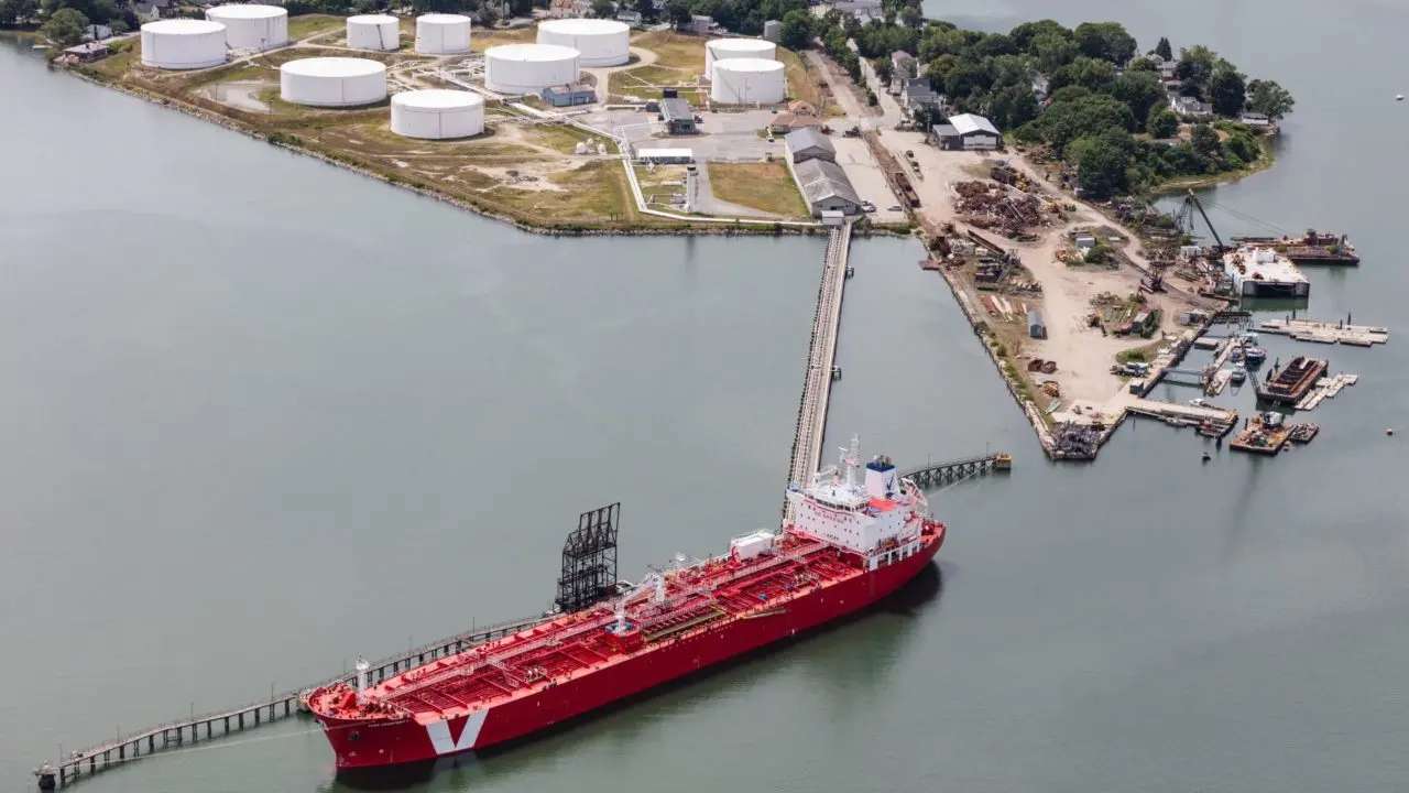
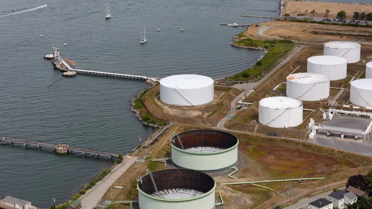
The city's terminals are crucial to Maine's energy needs, but the storage tanks, roads, and rail lines are all at risk as the ocean rises.
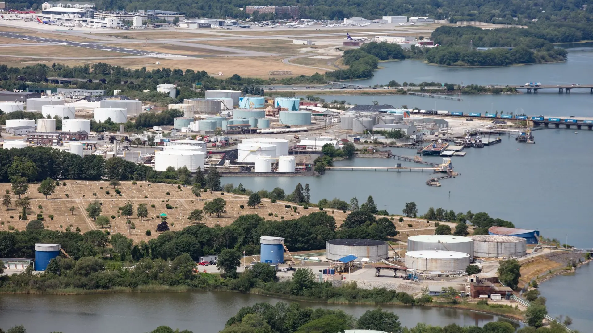
Today’s visitors to South Portland are more likely to find craft breweries in converted auto garages and restaurants serving steamed tamales than to come across the tanneries, shipyards or metal foundries of old. But among the gentrifying waterfront neighborhoods linger vestiges of the city’s industrial past, a past perhaps most visible in the form of the hulking white aboveground petroleum storage tanks that dot the shoreline.

As a nonprofit journalism organization, we depend on your support to fund our nationwide Connected Coastlines climate reporting. Donate any amount today to become a Pulitzer Center Champion and receive exclusive benefits!
A century after it was first established as a petroleum hub, South Portland and its sister city across the bay play a major role in Maine’s crude-oil supply chain. In 2016, around half of the petroleum consumed statewide entered the state through the port of Portland, according to a climate change vulnerability assessment commissioned by the two cities in 2019. South Portland, for its part, is home to seven terminals, with storage capacity for 8.6 million barrels of oil. It’s also the start of a 124-mile pipeline carrying refined products such as gasoline and diesel north to Bangor, as well as a World War II-era crude oil pipeline to Canada.
Much of that infrastructure was built as close to the water as possible, an arrangement that makes for easy on- and off-loading of the gargantuan tankers pulling into port. But it also leaves those storage tanks, and the roads and rail lines that serve them, vulnerable to an encroaching ocean.
There are roughly 100 tanks along the Fore River, according to a 2019 vulnerability assessment conducted as part of One Climate Future, a joint venture by Portland and South Portland to manage and mitigate the effects of climate change. Assessing the vulnerability of any infrastructure is difficult because scientists are uncertain just when and how much sea levels will rise, but the Maine Geological Survey’s Sea Level Rise/Storm Surge mapper shows that under a mid-range scenario of 6.1 feet, 37 of the tanks are in low-lying areas predicted to be underwater during the highest tides.
In a more conservative 3.9 feet scenario (the mapper includes scenarios ranging from 1.2 to 10.9 feet), more than half of the 13 large tanks near Bug Light Park would be at risk, wrote the researchers. Although berms would likely protect them from waves and corrosion on a regular basis, the areas “could be inundated if backup pumps were to fail.” With a violent storm or flooding, “these tanks would be the first to be subjected to damage or dislodgement by forceful wave action, or hydrostatic pressures should they be submerged.”
The storage tanks are not the only concern. Rising seas could also submerge hazardous waste sites along the shore, including petroleum waste sludge buried on Turner Island. The sludge is likely contained by clay at the moment, but even 1.6 feet of sea level rise would allow water to permeate the clay layer, wrote the researchers, “and the buried petroleum waste sludge may become vulnerable to migration.” Flooding and storm surge could exacerbate the problem, washing the soil and the petroleum-laden sludge into the bay.
Beyond the environmental hazards, there’s also the potential for stronger storms and rising seas to damage infrastructure on which the state is still heavily dependent. As of 2016, petroleum accounted for half of the energy consumed in Maine, where it’s used for heating homes and getting around. And there’s little backup: that same year, there was only enough stored to meet between two and four weeks of demand.
The problem is complicated by the fact that much of that oil is distributed by truck, which means the supply chain is dependent not only on clear roads and decent driving conditions but on petroleum to run those delivery trucks. Any disruption to that chain, warned researchers, would have “immediate implications for the state.”
South Portland is still in the early stages of planning for sea level rise, said Julie Rosenbach, who serves as the city’s sustainability director, and is working with the Army Corps of Engineers on a model that will predict when, where and how much parts of the city might flood under various conditions and sea-level-rise scenarios.
Data gathering has to happen before any detailed policies can be put in place or a public engagement process can start, said Rosenbach, meaning no concrete plans have been made for any of the storage tanks or other vulnerable infrastructure. “I think it’s challenging. These are decisions we should be making now, looking out into the future.”
That shift in thinking is often a difficult one for municipalities to make, said Abbie Sherwin, senior planner and coastal resilience coordinator with the Southern Maine Planning and Development Coalition, which has worked with a number of towns, including South Portland, on planning for the effects of sea level rise.
“Land use regulations are largely historically rooted and don’t reflect current conditions or future conditions,” said Sherwin. “Communities are making decisions based on historical data and conditions of the past, which are not reflective of what conditions of the future are going to be and not even necessarily reflective of current conditions.”
Decision-making is particularly difficult in the face of sea level rise. Predictions of how high the water will rise depend on how quickly we can cut down on gases that are warming the atmosphere and accelerating the damage, which is itself dependent on local, state and federal governments.
In Maine, a home-rule state, “municipalities have a lot of opportunities to take small or large adaptation measures,” said Sherwin, to guide new development away from areas at risk and make sure it is designed with climate change in mind.
“It can be done in small incremental measures, but they do have a lot of opportunities to try to reshape what their communities look like, to make them more resilient.”