


Project
The Unstoppable Ocean
This project explores the impacts of sea level rise on everything from sandy beaches to working...
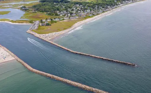
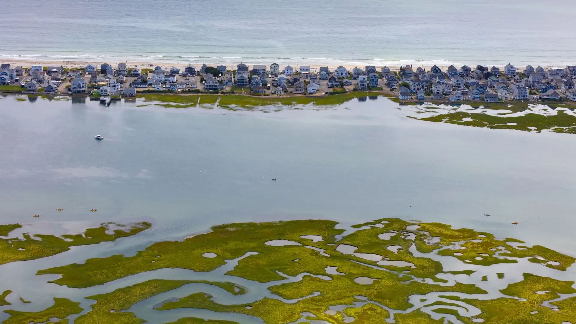
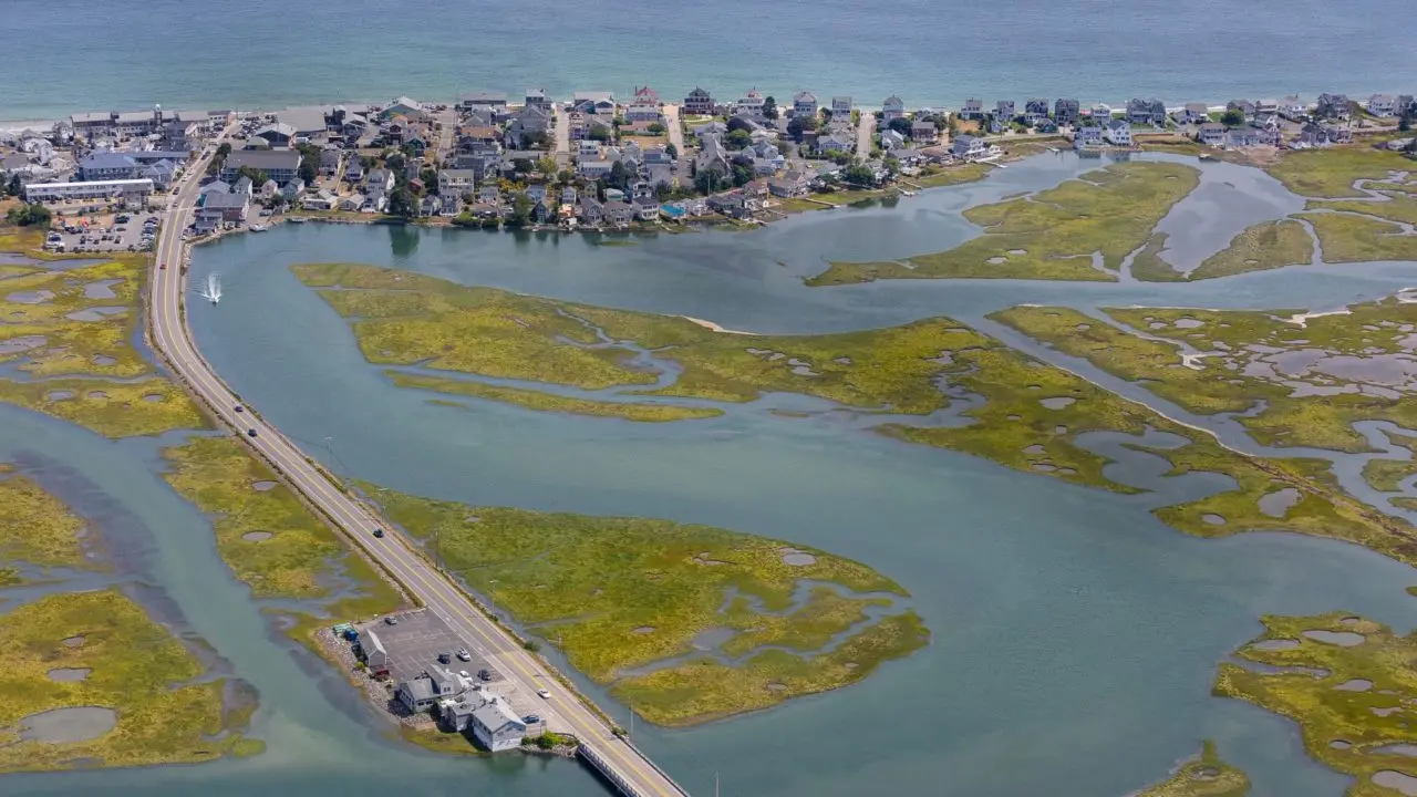
Wedged between sandy ocean beaches and an estuary, nearly 1,500 buildings in Wells could be inundated by 2050.
The Wells beaches are not like the rest of the Maine coast. They’re sandy, for one thing, and the water is mostly swimmable, not the stupefying cold of the rocky stretches farther east. There are lifeguards and surf shops, and colorful shanties with steps that lead, at high tide, directly to the sea.
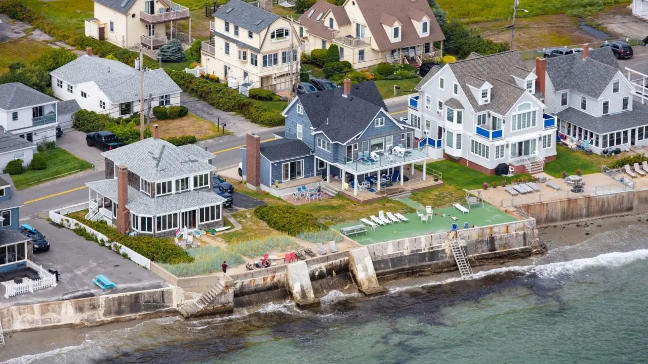
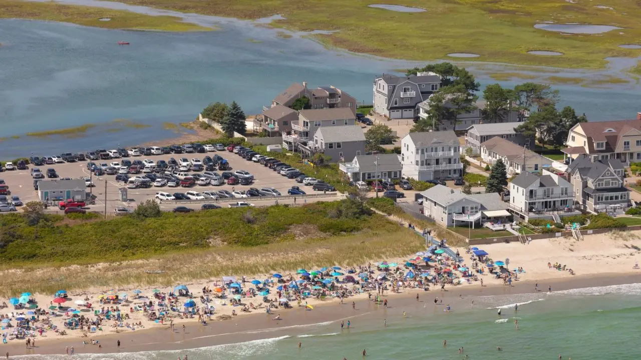
It’s little wonder, then, that those beaches attract millions of visitors each year, who come for the scenery and the sand dunes, and who leave salted and sun-baked. And it’s little wonder that the cottages and businesses catering to those visitors have been built, over the years, as close to the surf as possible. The cure for everything is salt water, and the closer you get, the better off you’ll be.

As a nonprofit journalism organization, we depend on your support to fund our nationwide Connected Coastlines climate reporting. Donate any amount today to become a Pulitzer Center Champion and receive exclusive benefits!
But as it turns out, you can be too close: Even under the most conservative scenarios, nearly 1,500 buildings in Wells will be inundated by rising seas by 2050. With more than a few feet of sea-level rise, entire stretches of Wells Beach will wash into the ocean before the end of the century; already, increasingly intense, wet storms are battering houses and eroding seawalls. The state has predicted that a mere 1.6 feet of sea level rise, which scientists say is almost inevitable, will reduce Maine’s dry beach area by more than 40 percent, possibly within 30 years.
“The pace is speeding up,” said Nik Charov, president of Laudholm Trust, which supports the Wells Reserve. “Sea level rise — it’s analogous to being in fire country out in the West. There are communities that never thought they were in any fire danger. Now they’re not there anymore.”
What people should ask, Charov continued, is “What is important to us? What do we want to protect? What are we willing to give up?”
These are not easy questions to answer. There are the houses, of course, and the roads that are at risk; about six miles in the Wells area would be submerged under the conservative 1.6-foot scenario. The Southern Maine Planning and Development Commission recently estimated that $860 million worth of residential property in Wells — the tax revenue accounted for 38% of the town’s most recent budget — is in inundation zones.
More-intense storms, flooding and higher tides are already costing Wells residents: Since 1978, property owners have filed the greatest number of flood insurance claims of any municipality in the state, according to a draft of the town’s 2022 comprehensive plan, nearly double that of York County, which had the second-highest claim number. Roughly 450 homes were damaged in flooding during the 100-year storm event of 1991, which washed over the shorefront roads of Ocean and Atlantic avenues.
Sea level rise is also expected to fully submerge the Wells Reserve estuarine lands by the end of the century and force marshy areas of the Rachel Carson National Wildlife Refuge to migrate inland. Other coastal marsh systems may not have the space to migrate, because houses, roads and businesses block their way.
That’s a problem because marshes and wetlands not only provide valuable habitat but also protect against floods by acting as natural sponges, absorbing water from rain, snowmelt and floods, and then slowly releasing it back. Sea level rise, as the town’s comprehensive plan points out, will “drown salt marshes, convert salt marshes into mudflats, and convert mudflats into subtidal zones.” Shellfish beds will be smothered, and freshwater wetlands will turn brackish.
“Anybody who looks outside, who has a memory, sees the change now,” said Charov. “This is a slow-moving catastrophe.”