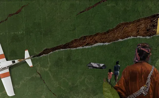

Three regions of the Peruvian Amazon—Huánuco, Pasco and Ucayali—have become the epicenter of a wave of violence that targets a critical problem: drug trafficking. Who is resisting in this scenario that forms a sort of triangle of death? The indigenous communities that live in the middle of the drug trafficking routes that are articulated from at least 67 clandestine airstrips that serve this illicit activity.
Mongabay Latam, in alliance with Earth Genome—an organization based in California, United States, specialized in satellite analysis of the territory—developed a search tool that uses Artificial Intelligence (AI) to detect clandestine airstrips in three Amazonian regions of Peru. This project revealed that 30 of the 67 illegal airstrips identified are within indigenous territories and 26 around them. In addition, all of them are used to transport drug shipments to countries such as Bolivia or Colombia.
Each of the leads was carefully verified with local sources, officials and field testimonies. The most important cases, moreover, were then investigated by a journalistic team that traveled to four points in the Peruvian Amazon to tell the stories behind these open scars in the middle of the forest.
The investigation took more than a year and involved a team of Mongabay Latam journalists, photographers, geographers and programmers. The names of the sources interviewed in the territory have been protected for security reasons, as have the names of the entire team.
How long does it take to reopen a destroyed clandestine airstrip? How are the airstrips used and how do the organized crime groups that profit from them operate? What is the role of the Peruvian state in this illegal dynamic?