Story
![]() October 28, 2021
October 28, 2021
A Unique Marsh Could Vanish on SC-GA Border. ‘Nobody Is Going To Hold Back the Tide.’
Country:

Project
Rising Tides, Sinking Future
Tidal marshes are slices of the coastal landscape that many people find hard to forget, and are...


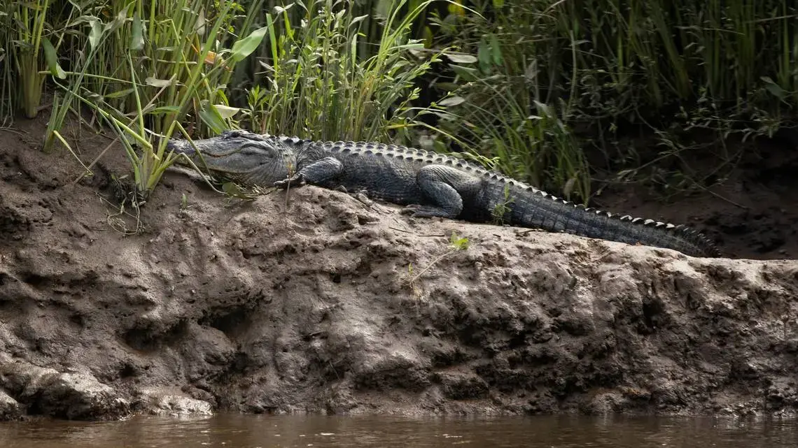


Five alligators slid from a muddy bank into the lower Savannah River, disappearing beneath the black water that flows through the Georgia-Carolina lowcountry.
Several yards away, herons and swallow-tailed kites soared over the river and above the prairie of tall marsh grass along the bank.
This peaceful scene, which took place on a warm evening in June, was one biologists at the Savannah National Wildlife Refuge know better than anyone.

As a nonprofit journalism organization, we depend on your support to fund our nationwide Connected Coastlines climate reporting. Donate any amount today to become a Pulitzer Center Champion and receive exclusive benefits!
But they also know the refuge’s freshwater marshes, among the most unusual and wildlife-rich wetlands in the Southeast, face a threat from sea-level rise.
Rising seas are advancing on the South Atlantic coast, flooding cities and menacing most everything in their path, including the freshwater marsh system at the Savannah refuge.
Saltwater that is deadly to some plants and animals threatens to move farther into rivers like the Savannah, the mighty waterway separating Georgia and South Carolina.
If that happens, the tidally influenced freshwater marsh system — already a remnant of what it once was — could shrink, or in the most extreme case, disappear.
That’s a concern because the Savannah’s tidal freshwater marshes hold an abundance of plants, birds, fish and mammals not often found in salt marshes of the South Atlantic coast.
Tidal freshwater marshes, expanses of tall grasses that line narrow creeks, also act as pollution filters, cleansing the water that pulses and recedes through them daily.
“I grew up around here, enjoying the river,’’ said Russ Webb, who manages the Savannah National Wildlife Refuge for the U.S. Fish and Wildlife Service.
“But it wasn’t until after I went off to college and came back that I realized how important this is for a lot of different reasons. The marshes act like a liver, cleaning up runoff pollution. And, along with salt marshes, they’re like shock absorbers during hurricanes. It’s also a nursery for our resources.’’
The Savannah’s tidally influenced freshwater marshes, some of which actually float on the water, are considered by many scientists as the “highest priority wetland resource in the Savannah River Basin,’’ a monitoring report for the U.S. Army Corps of Engineers says.
A 2020 study by a Clemson University graduate student identified 31 floating marshes within the Savannah National Wildlife Refuge.
Despite the significance of these tidal freshwater marshes, they have dwindled since the late 1800s as dredging in Savannah Harbor has deepened the port’s shipping channel and pushed salty water farther upstream.
Tidal freshwater wetlands once covered about 12,000 acres of the lower Savannah River, well beyond a wedge of saltwater that extended 10 miles upriver from the ocean.
In recent years, after multiple dredging projects, salt water extended about 20 miles upriver. Little more than 3,000 acres of tidal freshwater marsh remain in the Savannah National Wildlife Refuge, which straddles the South Carolina-Georgia line near the port, according to the U.S. Fish and Wildlife Service.
The U.S. Army Corps of Engineers has taken steps in recent years to block the salt migration from the most recent dredging project, a huge operation that is nearing completion. The effort has included damming up a creek that was draining freshwater away.
So far, federal officials say results are promising.
Still, sea level rise could be an insurmountable foe. It could be hard to control the advance of saltwater into freshwater parts of rivers like the Savannah, regardless of how hard the Corps tries.
“Nobody is going to hold back the tide,’’ said Jamie Duberstein, a Clemson University scientist who is monitoring the Corps efforts to keep salt water from expanding up river because of the most recent dredging project. “The Corps can’t be responsible for sea-level rise.’’


The effect of rising seas will be worse during times of drought, when less freshwater flows down the Savannah River from the interior of South Carolina and Georgia, several experts said.
In the past 100 years, sea levels have risen at Fort Pulaski, Ga., near Savannah, by more than 1 foot — and the annual rate of sea-level rise is increasing as polar ice melts, the ocean warms and greenhouse gases build up in the atmosphere.
By 2100, the ocean could rise 4 feet along the South Carolina-Georgia coast, according to a moderate sea-level rise scenario provided to the McClatchy company by National Oceanic and Atmospheric Administration scientists in Charleston. But some scenarios show the rise could be more than 6 feet, according to NOAA.
At the same time, there is evidence that parts of the Georgia and Carolina coasts are sinking, including around Charleston, Wilmington and Savannah. Land has sunk, on average, 1.4 millimeters per year since 1935 at Fort Pulaski, according to data in a 2013 NOAA report on vertical land motion.
Tonya Bonitatibus, the Savannah Riverkeeper, said the rise of saltwater is no abstract concept to her.
“You are talking about an already distressed system, where a lot of what was traditional marsh is gone,’’ Bonitatibus said, noting that with advancing seawater, “You would lose the last bit of that, the nursery for many of the creatures living there.’’
A unique marsh in the Southeast
While tidal freshwater marshes aren’t unique to the lower Savannah River, they are less common than salt marshes in parts of the southeastern United States.
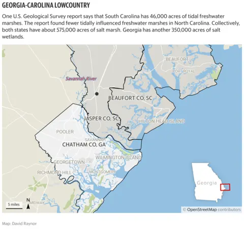
One U.S. Geological Survey report says that South Carolina has 46,000 acres of tidal freshwater marshes. The report found fewer tidally influenced freshwater marshes in North Carolina. Collectively, both states have about 575,000 acres of salt marsh. Georgia has another 350,000 acres of salt wetlands.
Some of those existing salt marshes are expected to perish by the end of the century as seas rise. But some salt marshes are expected to re-emerge and replace them, farther up rivers that historically have been fresh, like the Savannah.
What makes a tidal freshwater marsh unique is its location, where river and sea compete for influence.
Freshwater marshes are located in and along the rivers, but close enough to the ocean that the tides push water up through them. The water is saltier than upstream but not as salty as the ocean, a brackish zone that is delicately balanced to support freshwater marshes.
Daily surges of freshwater supply sediment and nutrients to the Savannah River tidal marsh, causing denser, more diverse grasslands to grow than in salt marshes.
Tidal marshes with higher concentrations of freshwater had nearly 10 times the number of plants as those found in marshes where saltier water was prevalent on the Savannah refuge, according to one 2003 study by researchers from University of Florida.
Another study found 26 species of birds associated exclusively with tidal freshwater wetlands on the lower Savannah, compared to 4 species in salt marshes.
The National Audubon Society calls the diverse habitat on the Savannah refuge, and its freshwater marshes, a “significant wild place’’ for birds and other wildlife. Rare species, such as the wood stork, forage on the refuge, while others nest there.
Species that are dwindling, but not yet considered endangered, include rails, mottled ducks and swallow-tailed kites, Audubon says. In the spring and fall, the refuge is a stopover for migrating birds, according to Audubon.
As far back as 2001, scientists were predicting a major impact on birds if saltwater continued to move up the Savannah River.
“An increase in salinity in tidal wetlands at Savannah NWR would lead to a significant loss of avian diversity,’’ a Fish and Wildlife Service study said.
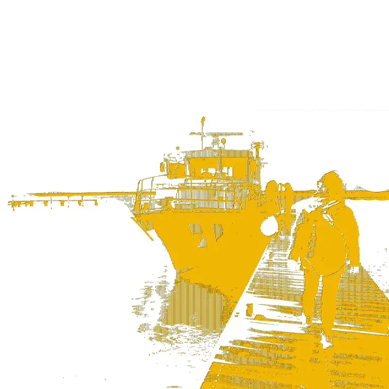
Webb, a native of the area who speaks in the strong southern drawl of the Georgia coast, pointed out many of the refuge’s natural features during a boat ride up the lower Savannah River this past summer.
“It would be a travesty’’ if the marsh system were degraded or lost, Webb said, noting that “anybody who appreciates the wild’’ would feel the same way.
A river cruise in Savannah
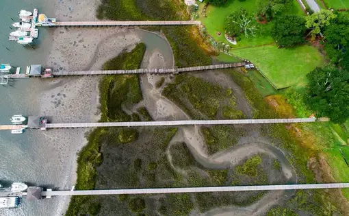
Under a late afternoon sky, the water shimmered like glass, reflecting the clouds above, as Webb eased his boat to a stop at a narrow creek that sliced through the tall marsh plants.
The creek is one of the most studied parts of the refuge, a place where scientists spend days at a time examining the elevation of the mud, how the tide changes, the height of marsh grasses and how wildlife interacts in the environment.
It’s also a place with a rare feature, not seen in salt marshes or many other wetlands. The tidal freshwater marsh appears anchored in the mud, but some of the wetland actually floats atop a sheen of water.
A University of Florida research professor once watched helplessly as he stepped too hard on the marsh floor, causing his foot to tear a hole in the wetland bottom and his leg to sink deep into the water below.
Webb said he’s seen manatees, wild hogs, herons, deer — plenty of alligators — and striped bass in the refuge, attracted by the freshwater marsh.
Manatees, big aquatic mammals that move north from Florida during the summer, prefer freshwater to salt water — and they’re always impressive when they arrive in the refuge’s freshwater marsh system, he said. “We had six of them come in here one time while we were doing research,’’ Webb said, pointing at a narrow creek lined by tall grass. “They are so big, they just displace the water.’’
He’s also seen scores of brightly colored birds that migrate through the Savannah refuge. Among those are prothonotary warblers, known for their brilliant yellow feathers.
“Some people call them river canaries because they are associated with water,’’ Webb said. “They come here in the summertime, they breed and lay eggs. It’s a very important area for them. Beautiful birds.’’
As he pushed the power boat farther upstream, flocks of startled birds raced across the sky, seemingly upset that they had been disturbed. The grassy wet plains became more forested, with dense thickets of cypress, tupelo and wild Palmetto trees.
At the intersection of the Back River and the Middle River, two stems of the lower Savannah, was the former site of Argyle Plantation, a massive 19th-century rice-growing operation. The property is now heavily forested and flooded.
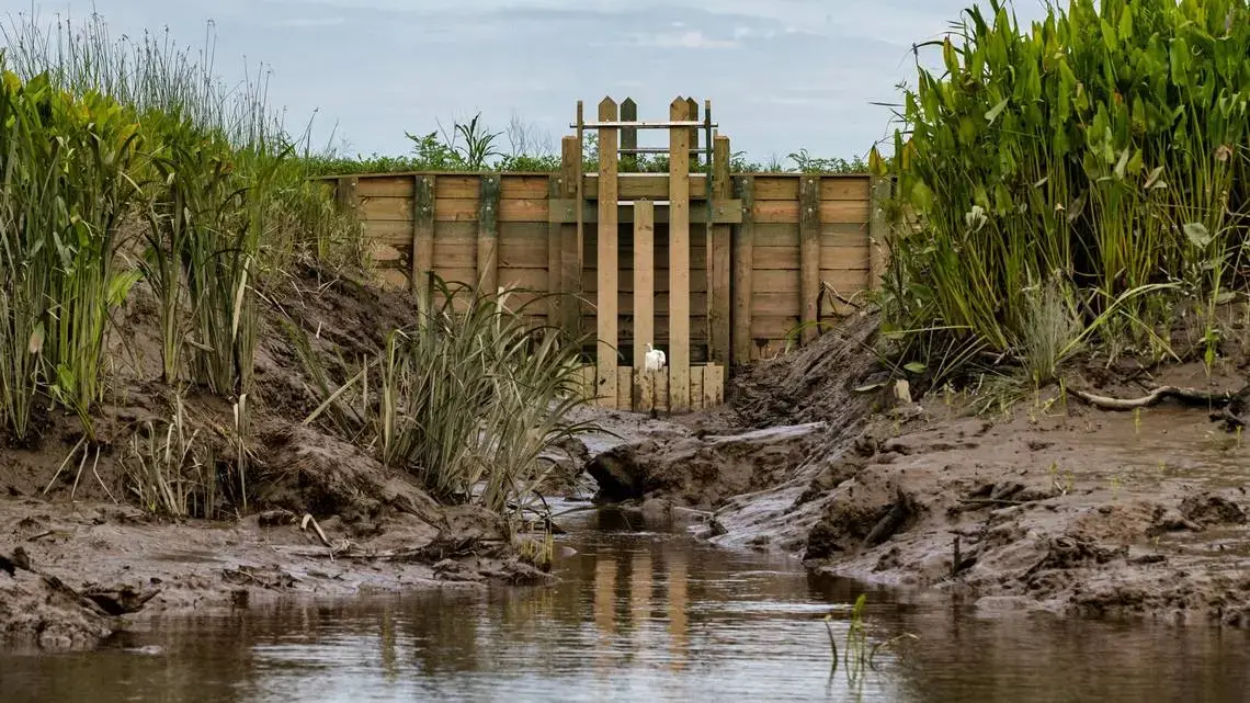
Just upriver, lay the McCoy’s Cut area. A creek there is blamed for channeling freshwater away from the marshes.
Officials with the U.S. Army Corps of Engineers have taken an array of steps to hold encroaching salt water at bay, including blocking off the creek.
The Corps also installed an underwater structure to help direct the flow of water from upstream into the lower Savannah, where its tidal freshwater marshes are found.
In addition, the Corps has turned over an additional 2,245 acres of wetlands to the Fish and Wildlife Service to compensate for the dredging, according to an email from Billy Birdwell, a Corps spokesman.
Webb pointed out some of the work that’s been done as he neared the river’s main section.
Not 50 yards from his boat was the blocked creek channel. It was filled with debris. Plants had begun to grow in the blockage. A small beach had formed and there was little sign water was draining away from the main channel into the creek.
Early reports indicate that the engineering effort to offset the harbor deepening has been successful, he said. The question now is whether that will be enough, Webb said. “The unknown is sea-level rise and drought that comes with climate change,’’ Webb said.