Government dam building projects since the 1970s have transformed the Euphrates, seen here in Turkey, and its sister river, the Tigris. Benefits have come at a high cost to local communities, to the environment, and to the region's cultural heritage. Image by Murat Yazar.
This story is part of journalist Paul Salopek’s multiyear, 38,000-kilometer walk across the world in the footsteps of our forebears. Learn More.
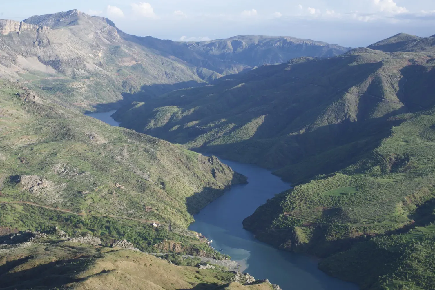
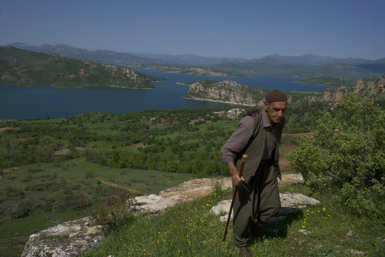
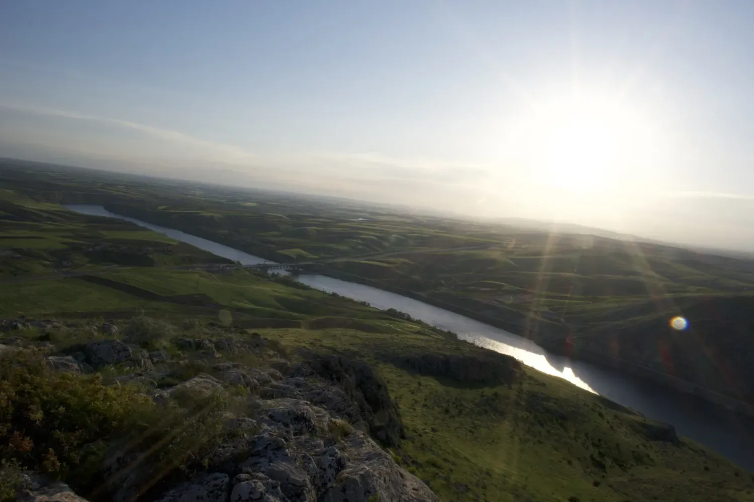
In my childhood, I fished and swam in the Euphrates River. I even drank its fresh, clean water. Many streams originating in Turkey's eastern provinces—the Ağrı, Erzincan, Sivas, Tunceli, Malatya, and others—feed the Euphrates, which flows 2,700 kilometers from its source in the Anatolian highlands through Syria and Iraq before emptying into the Persian Gulf. Its fluvial companion, the Tigris, makes a similar, but shorter, journey from eastern Turkey to the gulf.
The lands along the Tigris and Euphrates were the center of the ancient world, the so-called cradle of civilization, where humans developed writing and agriculture. For thousands of years, the rivers ran freely, their fertile valleys sustaining farming communities and a bounty of animal and plant life.
Not anymore.
Government initiatives have transformed the region. Turkey’s Southeast Anatolia Project, begun in 1977, involved constructing 22 dams and 19 hydroelectric power plants in the Euphrates and Tigris basins. The Keban, Karakaya, Atatürk, Birecik, and Karkamış dams have gone up on the Euphrates; on the Tigris, Turkey has built the Devegeçidi, Ilısu, Batman, Dicle, Kralkızı, and Garzan dams, and Iraq, a dam at Mosul.
Hundreds of settlements, natural areas, and archaeological remains have been submerged. Pollution has fouled the waters. People who for generations have farmed lands now flooded by reservoirs were compelled to leave their homes and move to crowded cities. The dam barriers prevent fish from migrating and reproducing and interrupt the flow of life-giving nutrients. Plant communities have vanished beneath the reservoirs; wild animals and birds have been displaced.
These engineering projects on the rivers that imprinted me with childhood memories have shaped my geography physically, culturally and spiritually. As a photojournalist, I felt it was essential to document the transformation that has occurred. I began shooting this March, but the work ended prematurely five months later. Authorities in Iraq detained me for eight days in a Kurdish security forces prison, and after my release, I crossed back into Turkey.
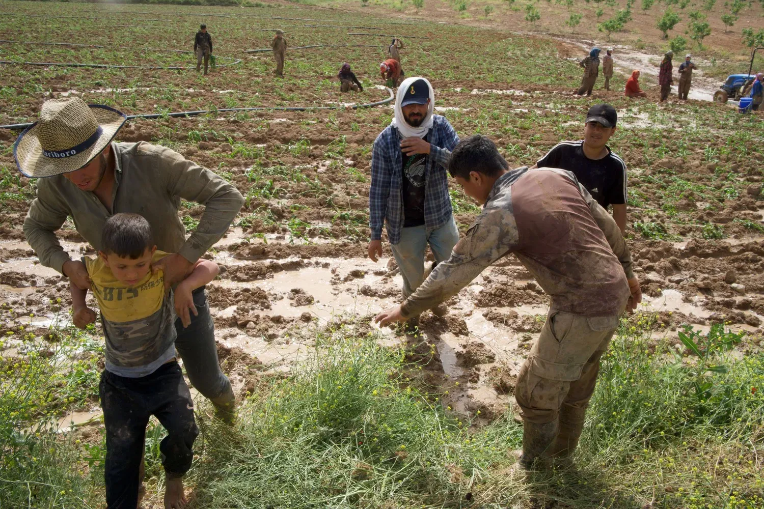
A major goal of the dam building was to irrigate some 1.8 million hectares of farmland. This has caused irreversible effects. With river waters diverted to farm fields in Turkey, downstream communities in Iraq and Syria are starved of water—a crisis exacerbated by decreases in winter snowfall, in part because of climate change, that have reduced the flow of the Tigris and Euphrates, especially during the summer and autumn months. In those regions, higher temperatures—climate change again—have increased evaporation from reservoirs and irrigated areas, raising humidity levels and intensifying rainstorms. Last year, severe flooding in the Turkish cities of Adıyaman and Şanlıurfa killed 21 people and damaged more than 3,000 houses and shops.
Meanwhile, pollution fouls the waters. Some of it is waste seeping from mines that use toxic chemicals in their extraction process. A landslide on February 13, 2024, at a gold mine operated by Anagold Mining in the İliç district of Erzincan, killed nine workers trapped underground. Some 10 million cubic meters of soil laced with cyanide and sulfuric acid spilled into the Euphrates basin.
In Turkey, much of the visible legacy of our forebears whose innovations gave us civilization’s cradle, has been wiped out. Millennia-old archaeological sites—such as Nevali Çori (early Neolithic) and the cities of Hasankeyf (8000 BC), Commagene-Samsat (3000 BC), and Zeugma (third century BC)—have been drowned. When conditions are exceptionally dry and water levels in the reservoirs drop, vestiges of these ancient wonders can be seen.
All this damage in the Euphrates and Tigris basins—to people’s lives, to natural systems, to irreplaceable cultural patrimony—seems impossible to repair. But some of it could be if the governments of Turkey, Syria, and Iraq were to collaborate in a spirit of goodwill on environmental and scientific initiatives to help prevent further degradation.
Photo Gallery
Mehmet Emin Çelik, 57, a farmer near the city of Elazig, says that in the years since the Karakaya dam was built on the Euphrates, there has been less winter snow and less available groundwater. Image by Murat Yazar. Turkey.
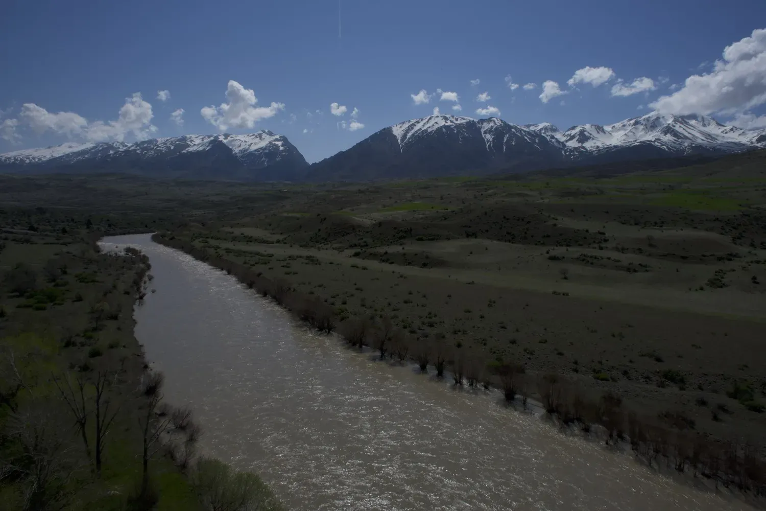
Snow in the mountains of eastern Turkey feeds the Euphrates, seen here near the city of Erzincan. Image by Murat Yazar.
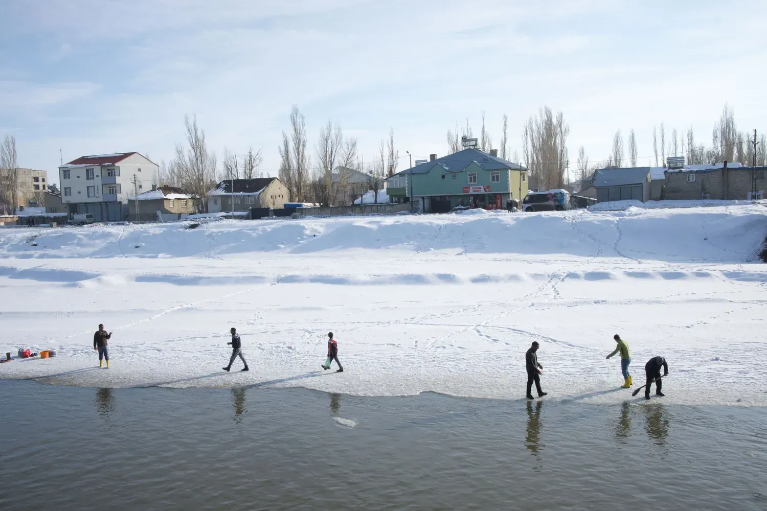
People fish in winter on the partially frozen Murat river, a tributary of the Euphrates that rises in the mountains near Ağrı. Image by Murat Yazar. Turkey.
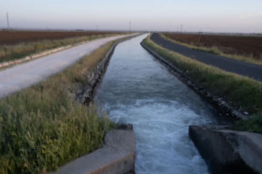
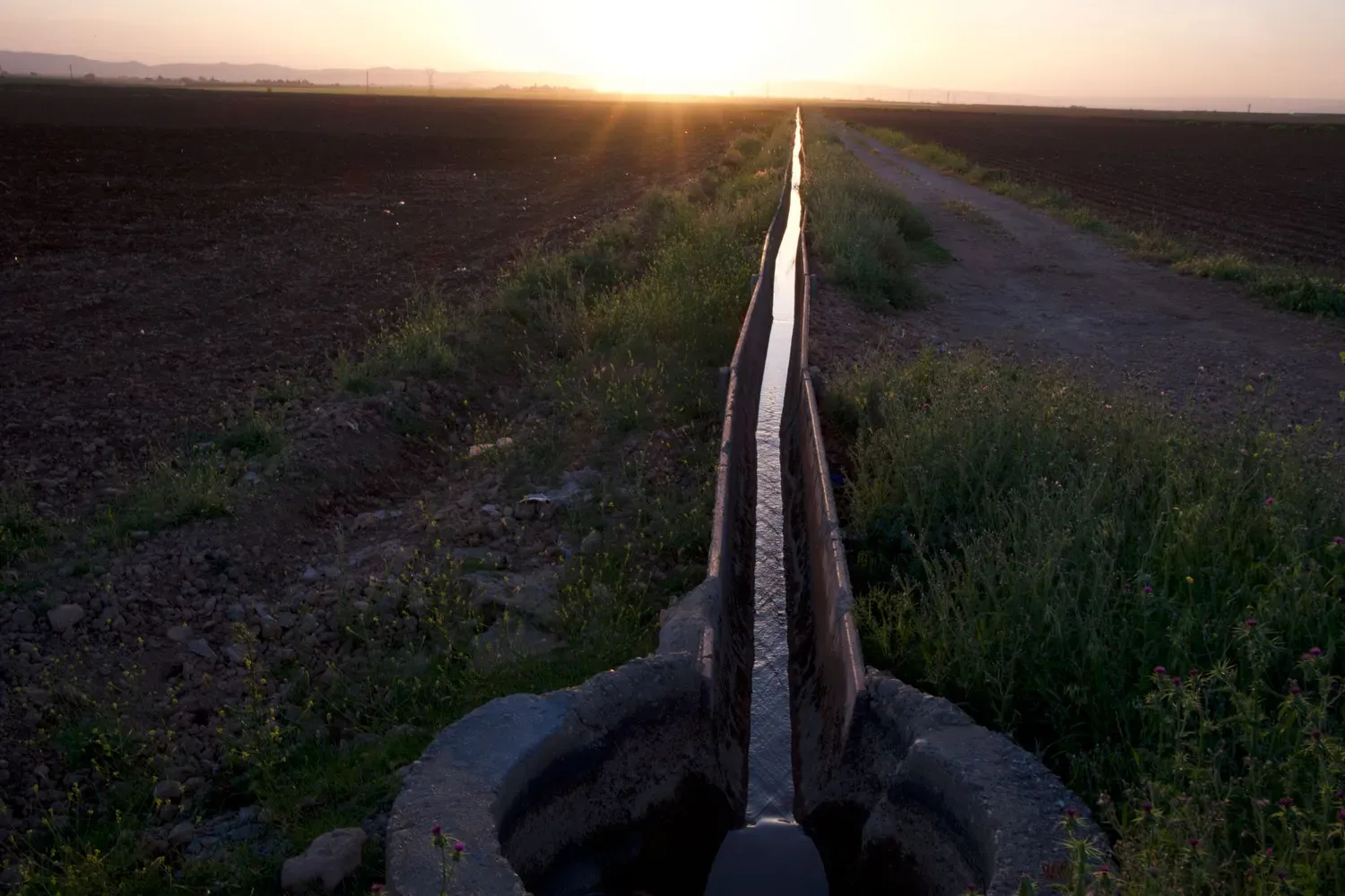
Channels and tunnels bring water to Kiziltepe from the reservoir formed by the Atatürk dam. Irrigation for agriculture in the Harran region draws heavily on the Euphrates. Image by Murat Yazar. Turkey.
In Harran, Euphrates water runs from large canals into networks of smaller channels to irrigate crops. Image by Murat Yazar. Turkey.
In springtime, farmers plant mint near the Euphrates in the Birecik region. Image by Murat Yazar. Turkey. Image by Murat Yazar.
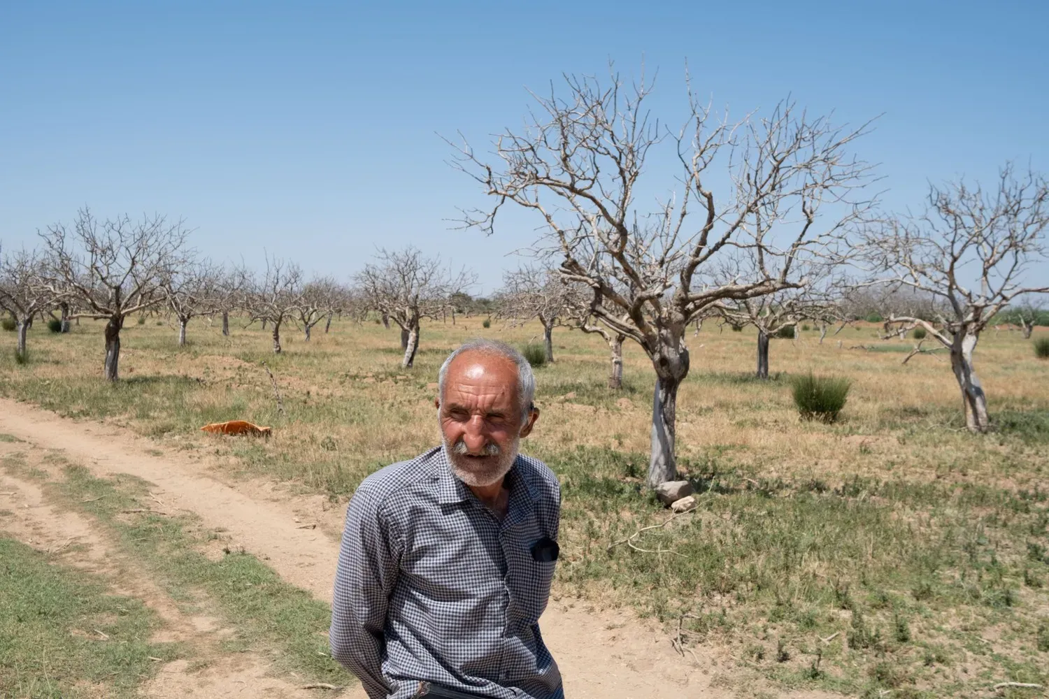
Yilmaz, 64, says water diverted for irrigation from the Atatürk dam reservoir dried up his 450-tree pistachio plantation. Image by Murat Yazar. Turkey.
Flooding upstream of the Kralkizi dam on the Euphrates flooded Hanefi's village. It submerged our best farmland and pasture, says the 76-year-old. Image by Murat Yazar. Turkey.
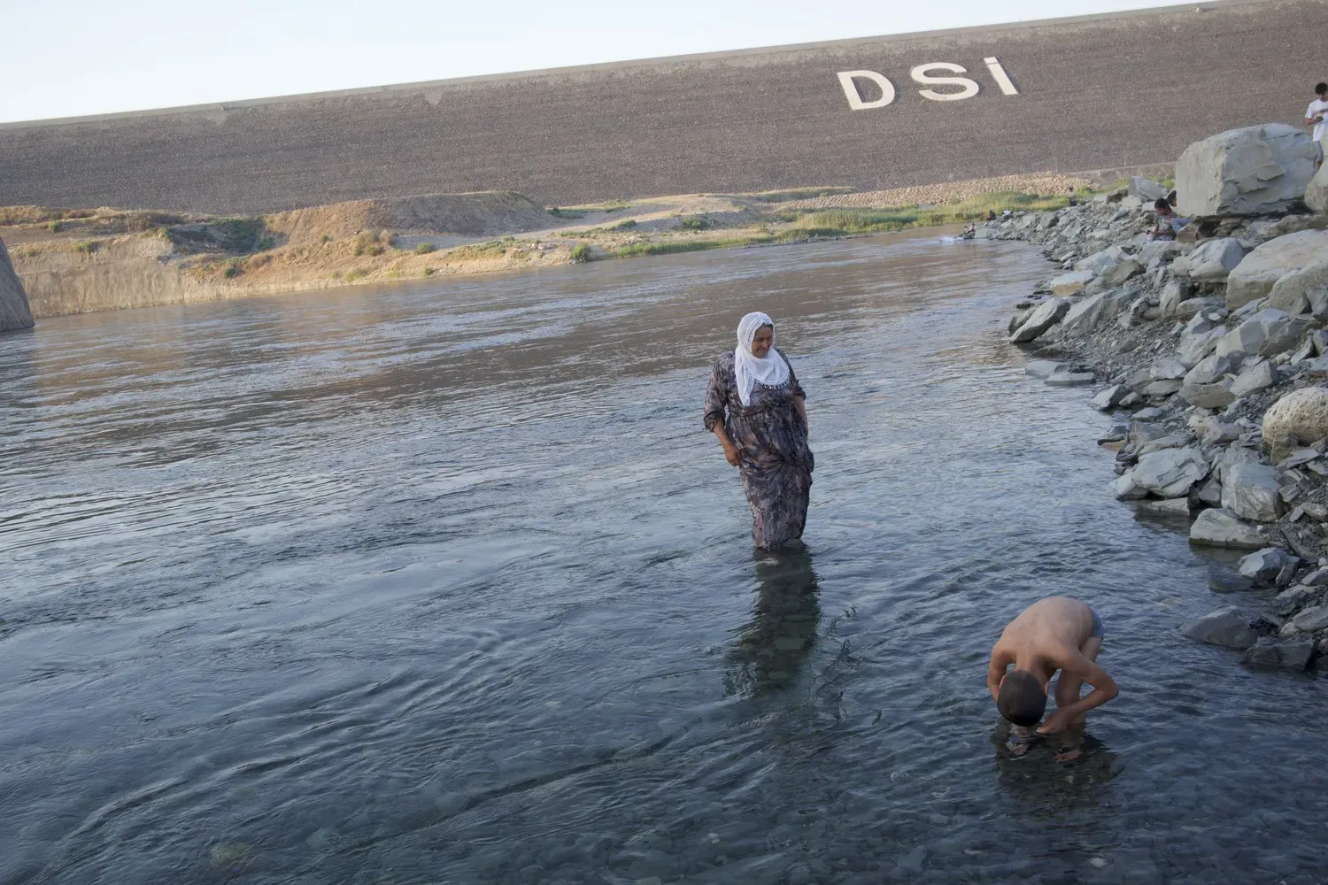
Cooling off downstream of Ilisu dam, the largest on the Tigris in Turkey. Image by Murat Yazar.
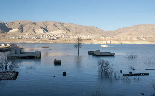
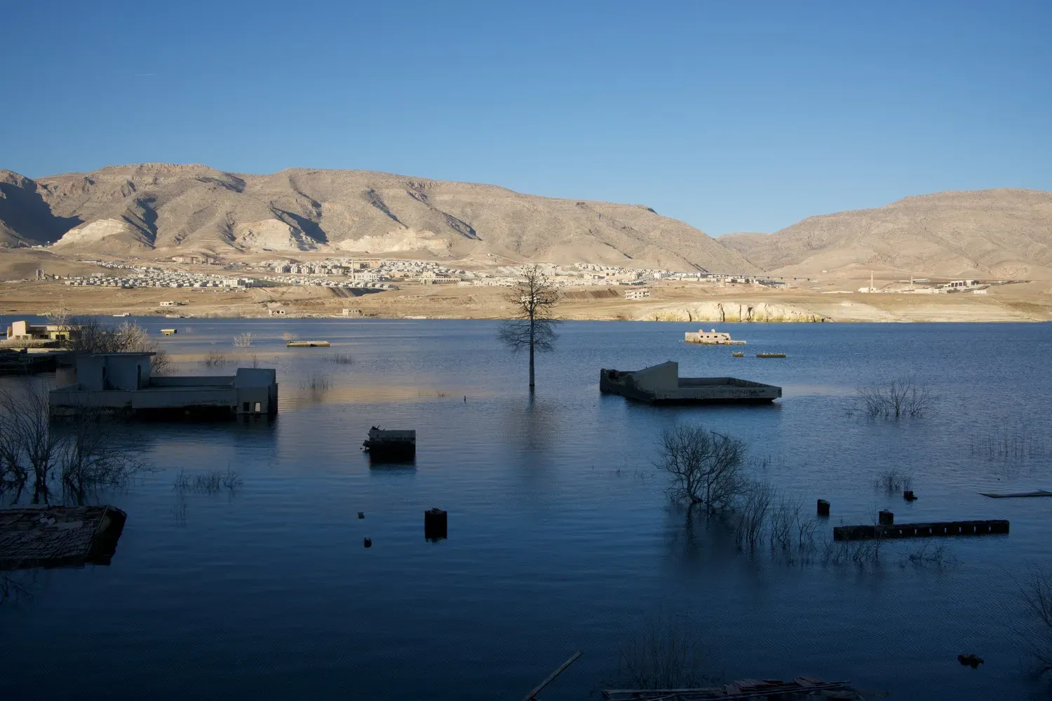
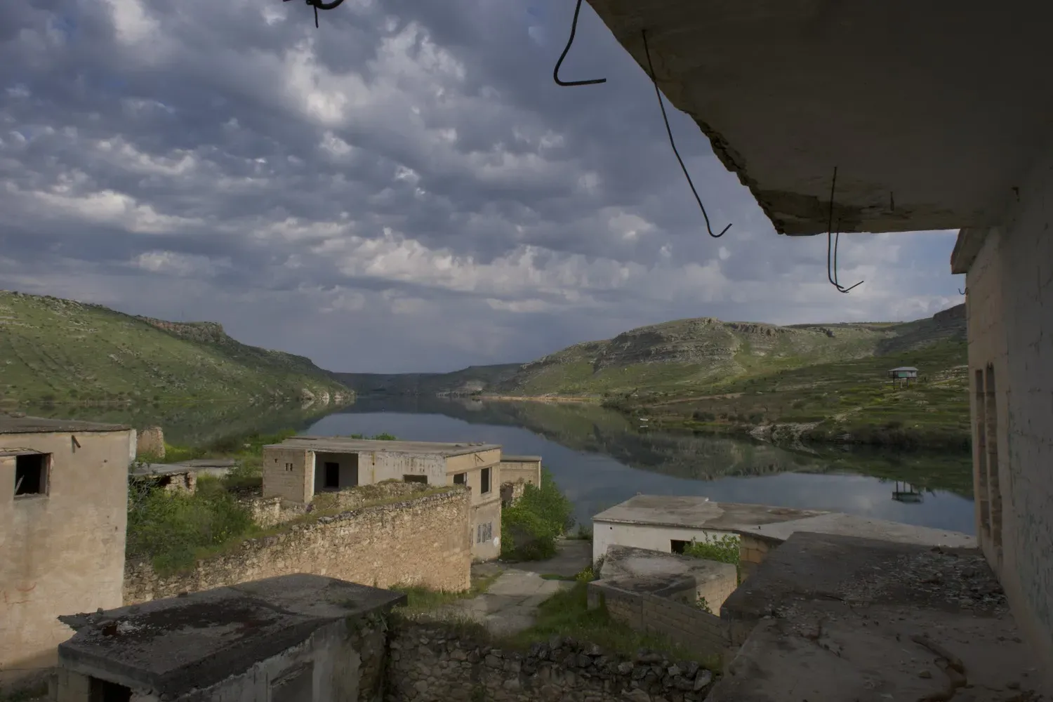
Ancient Hasankeyf, a city spanning 12,000 years of history, lies submerged beneath the waters behind Ilisu dam on the Tigris. Image by Murat Yazar. Turkey.
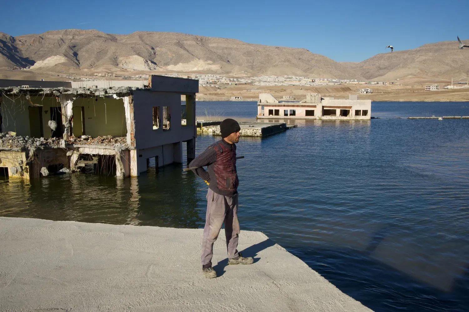
A former resident of Hasankeyf gazes over the Ilisu reservoir that flooded his home. Image by Murat Yazar. Turkey.
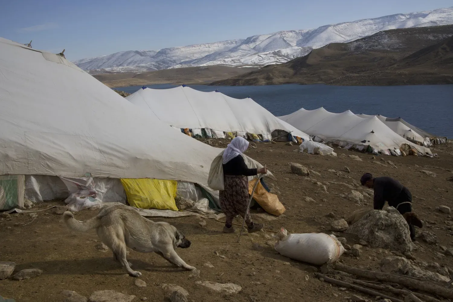
Nomads camp near Hasankeyf. The Ilisu dam flooded much of this area in the Tigris River valley. Image by Murat Yazar. Turkey.
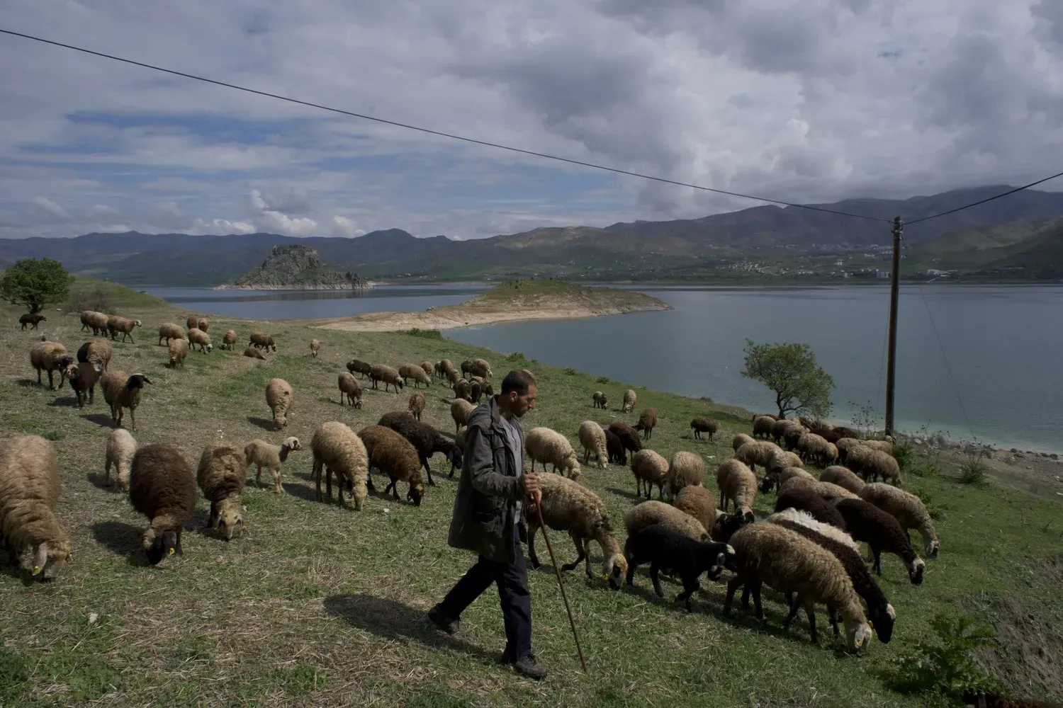
Cihan Çal, 32, a shepherd from Meselik village, grazes his flock beside the Keban dam. "There used to be much more pasture here, but now it's all under water," he says. "I’m having trouble finding places to graze my animals. Since the dam was built, the weather has become milder, and it doesn’t snow as much as it used to. Our underground drinking water has also decreased significantly." Image by Murat Yazar. Turkey.
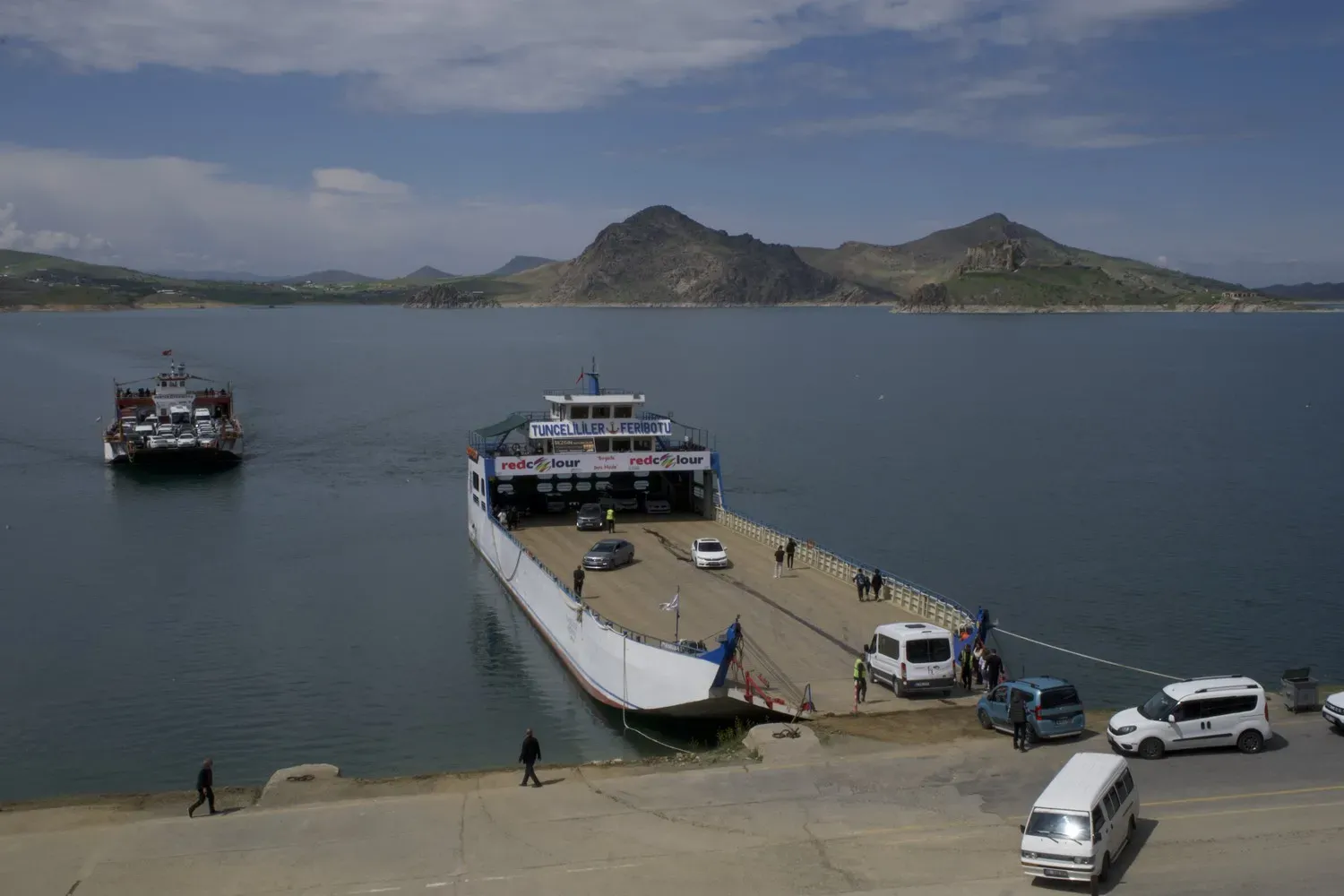
Keban dam across the Euphrates flooded area roads. Now, a ferry connects the cities of Elazığ and Tunceli. Image by Murat Yazar. Turkey.
The lake behind Birecik dam on the Euphrates submerged parts of Çekem village and its roads, forcing residents to leave their homes. Image by Murat Yazar. Turkey.
The residents of Savaşan, a village submerged by the Birecik reservoir on the Euphrates, had to move to a newly built settlement in the hills. Today, a cafe in the old village caters to tourists. Image by Murat Yazar. Turkey.
The Euphrates near the city of Sanliurfa. Image by Murat Yazar. Turkey.
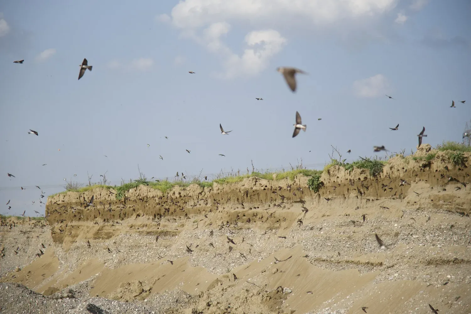
Sand martins nesting in the banks of the Tigris. Image by Murat Yazar.
Cyanide from a waste pool at Çöpler Gold Mine, located on two active faults 500 meters from the Euphrates in Erzincan province, leached into the soil in 2022. This year, cyanide-laden soil slid into the riverbed, burying nine workers. The collapse of the waste pool in an earthquake could be catastrophic for the environment. Image by Murat Yazar. Turkey.
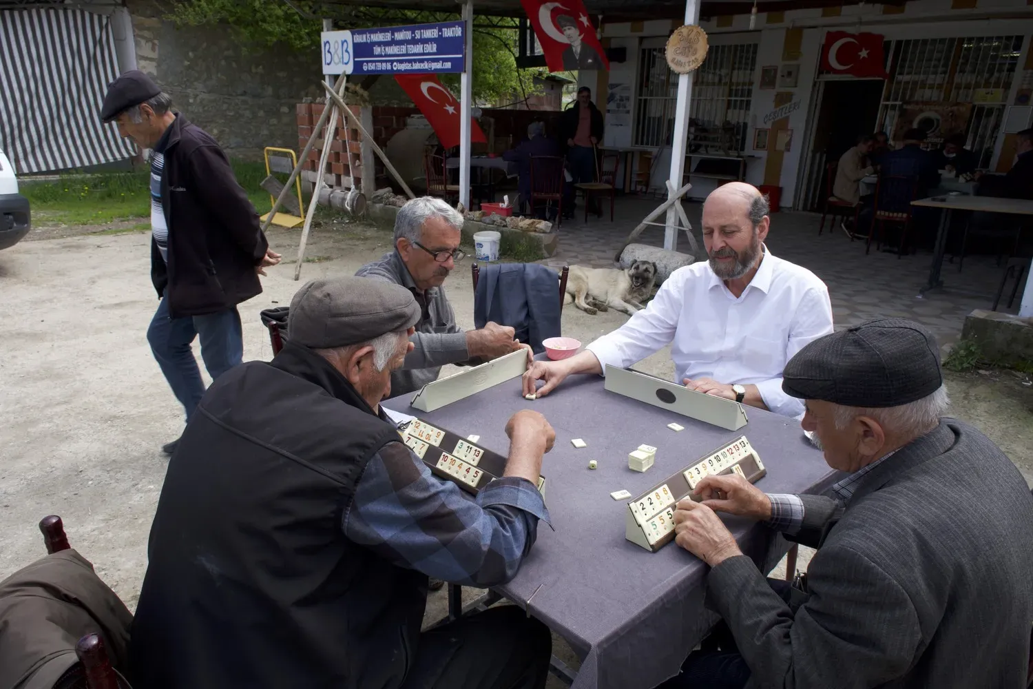
Farmers from the village of Bağıştaş, on the banks of the Euphrates 12 kilometers downstream from the Çöpler Gold Mine, enjoy a game in a local coffeehouse. One of the four men, Ünal Ertürk, says they saw dead fish in the river after an accident at the mine. The villagers are skeptical of the authorities' assurances that the water is clean. Image by Murat Yazar. Turkey.
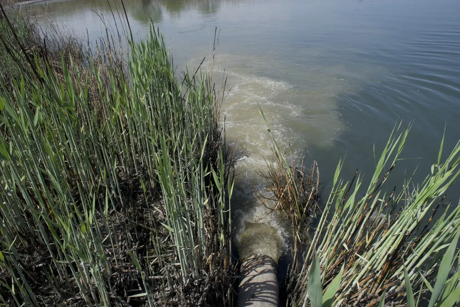
Sewage water in the Birecik district discharges into the Euphrates. Image by Murat Yazar. Turkey.
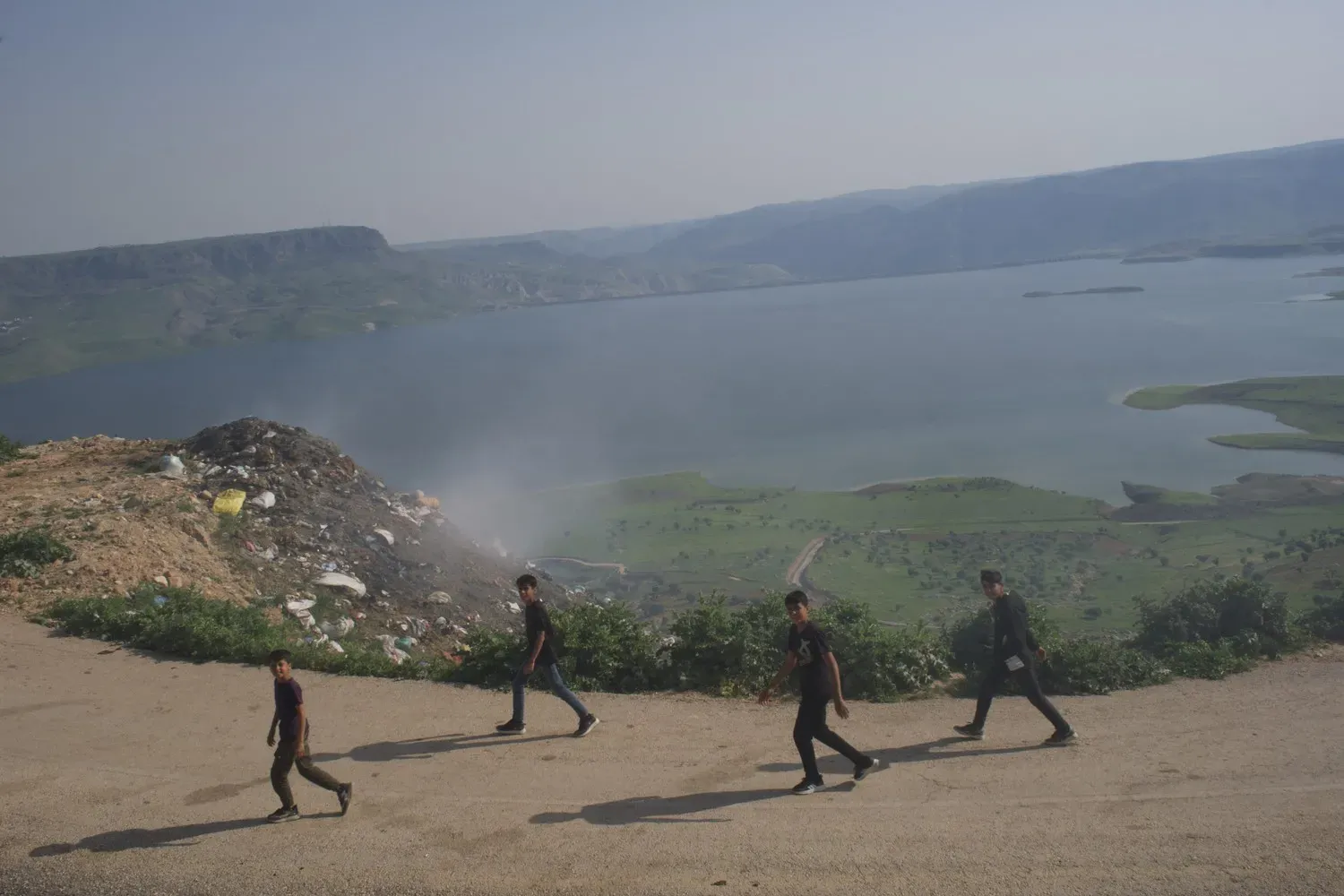
Garbage from the village of Temelli piles up near the reservoir behind Ilisu dam, on the Tigris. Image by Murat Yazar. Turkey.
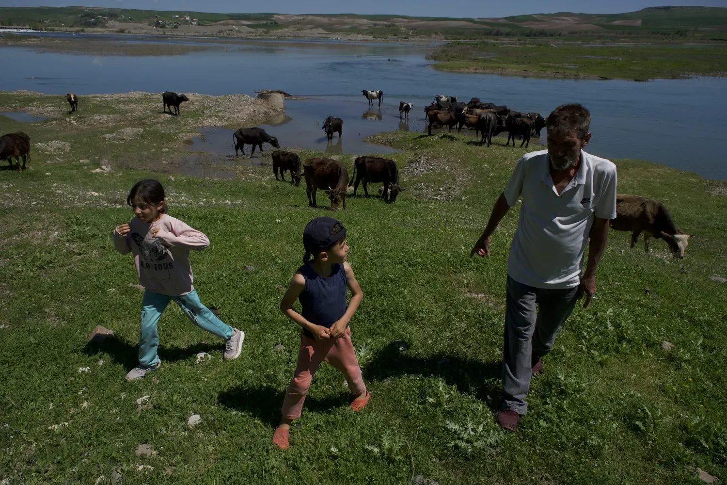
Mustafa Ates grazes his buffalo cows on the Tigris with his two kids. "This river is so important for us," he says. "Some people say this river is a piece of heaven." Image by Murat Yazar.
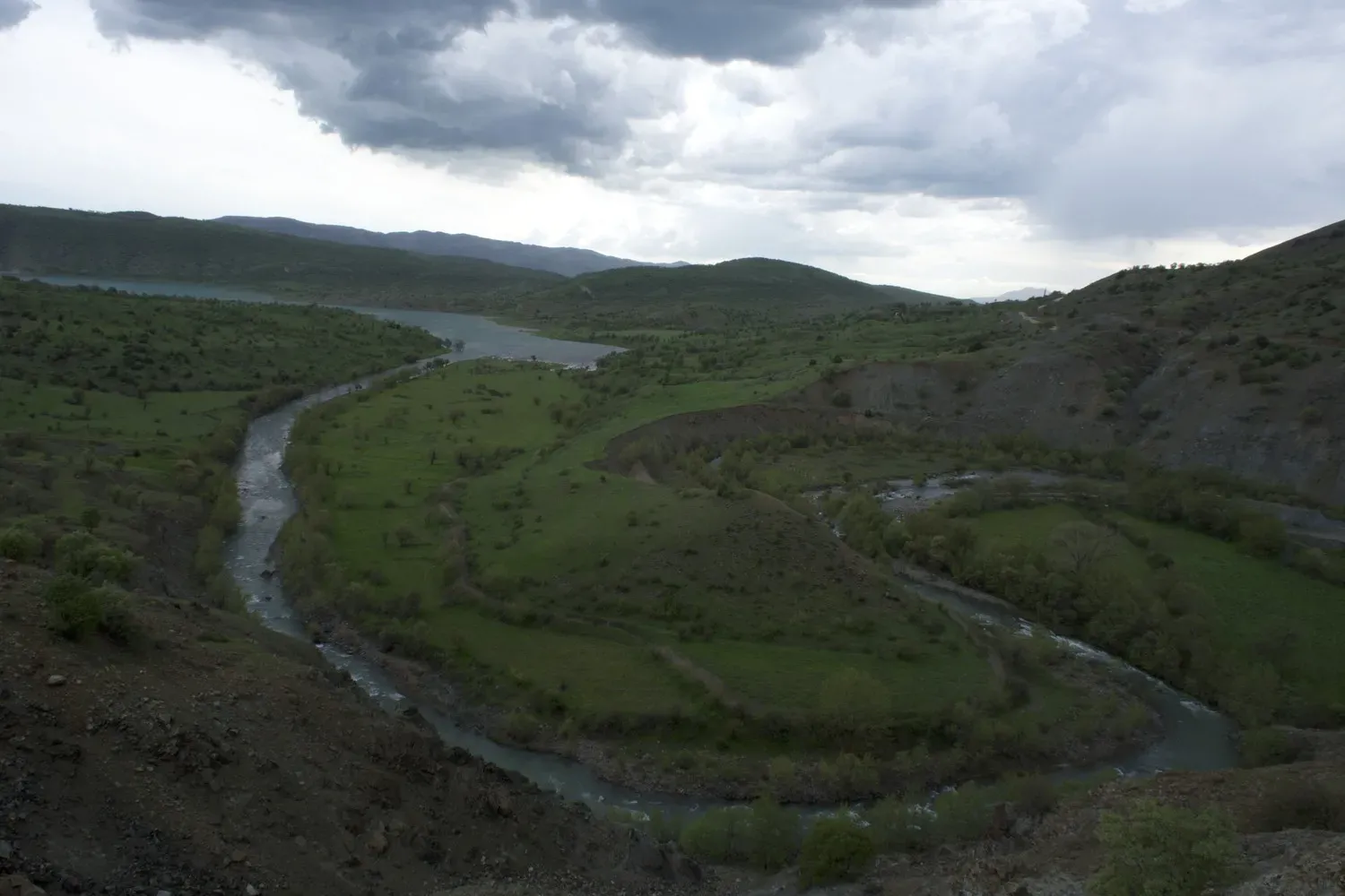
The meandering Köşkar is one of the source streams of the Tigris. Image by Murat Yazar.
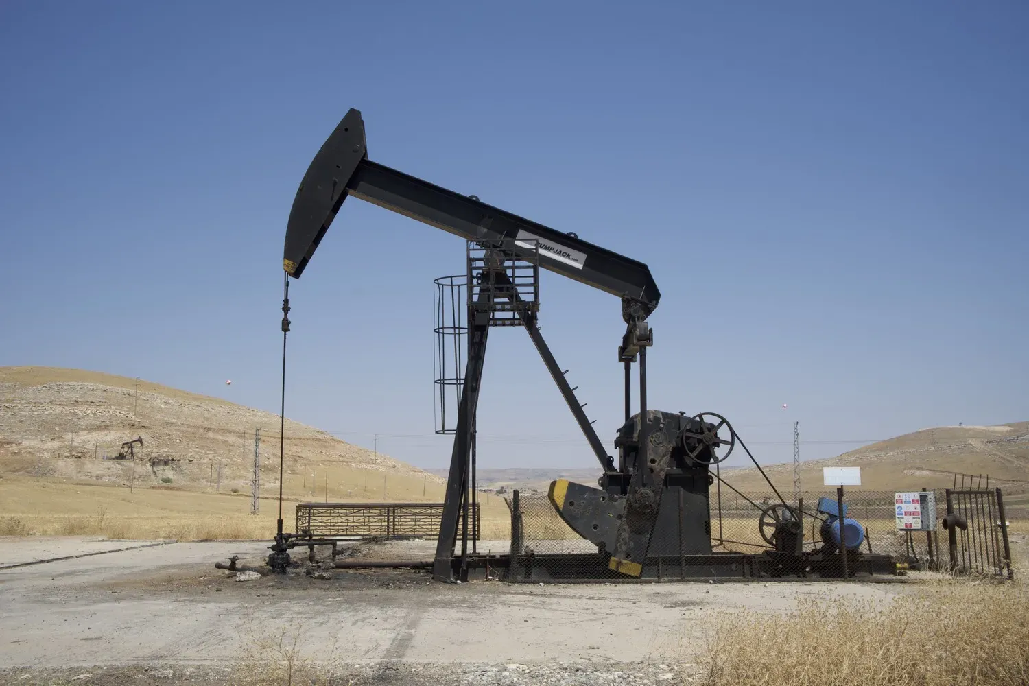
Control of oil fields in the Tigris-Euphrates region has caused contention in Turkey, Syria, and Iraq. Image by Murat Yazar.
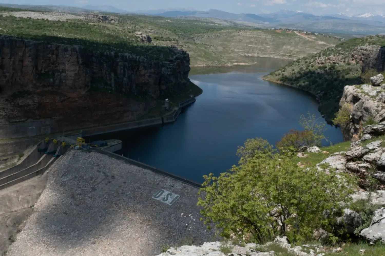
Egil dam on the Tigris. Image by Murat Yazar. Turkey.
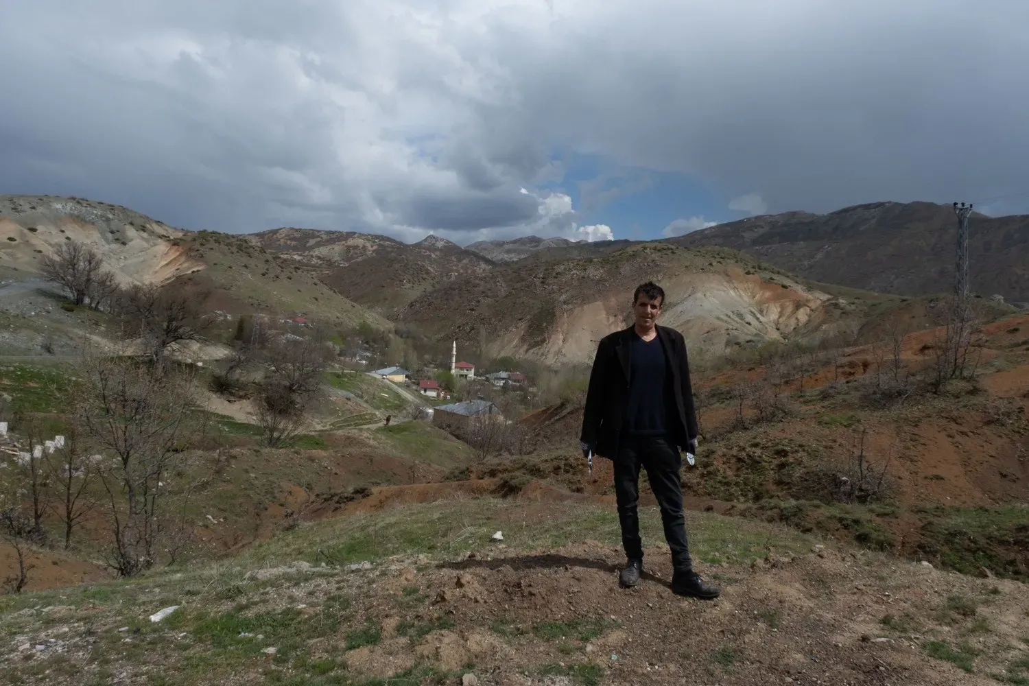
"For the past 20 years, it rarely snowed here," says Sabri Şahinoglu, who lives near the Tengilla, a stream that feeds the Tigris. "Before there was more snow here. The water levels of the local springs have also decreased. In some summers, the water source completely dries up." Image by Murat Yazar. Turkey.
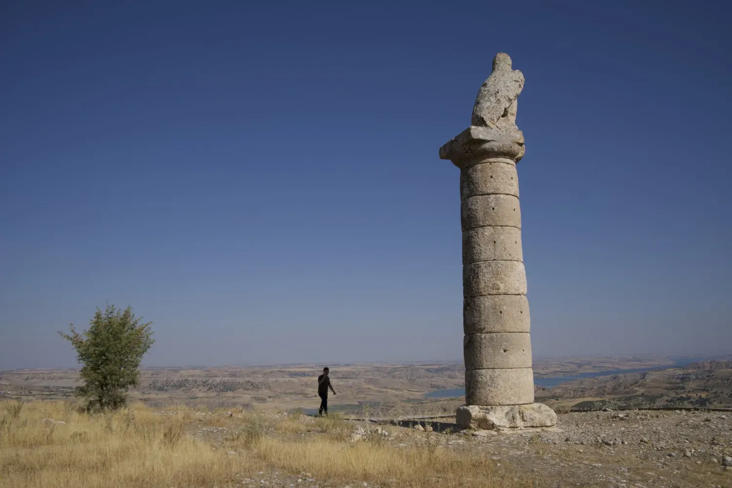
Karakuş Tumulus is a monumental tomb dedicated to the women of the Commagene royal family in Samosota, the capital of a kingdom more than two millennia ago. Samosota has vanished beneath the Atatürk lake. Image by Murat Yazar. Turkey.
A refreshing break from the heat in the Euphrates for the Out of Eden Walk team trekking through Turkey. Image by Murat Yazar.
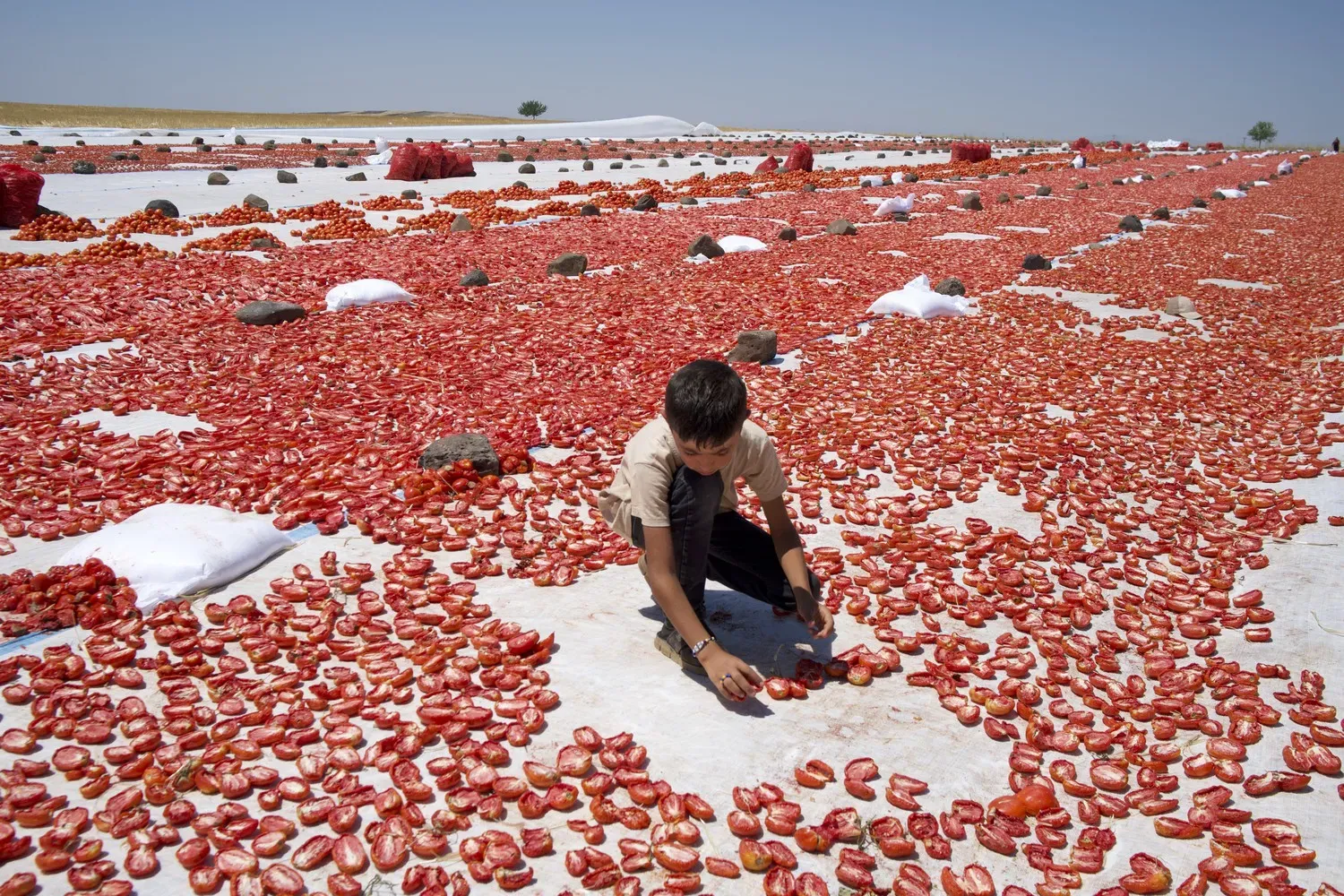
Red gold: Tomatoes spread out to dry in a field in Turkey. Image by Murat Yazar.
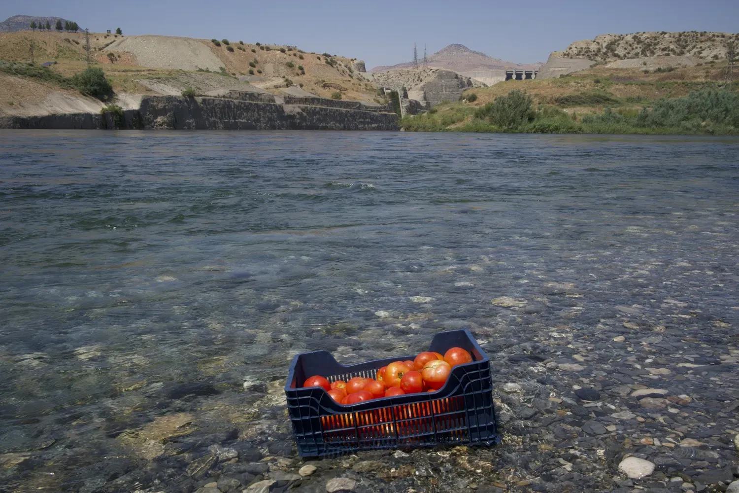
Picnickers let the Tigris do the work of cleaning and cooling tomatoes. Image by Murat Yazar.
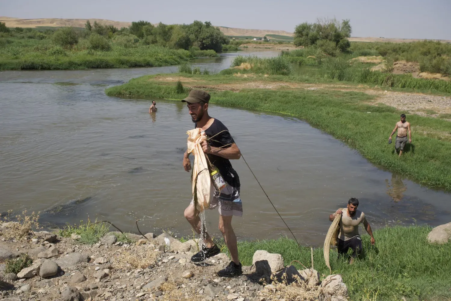
Villagers from Diyarbakir catch fish in the Tigris. Image by Murat Yazar.
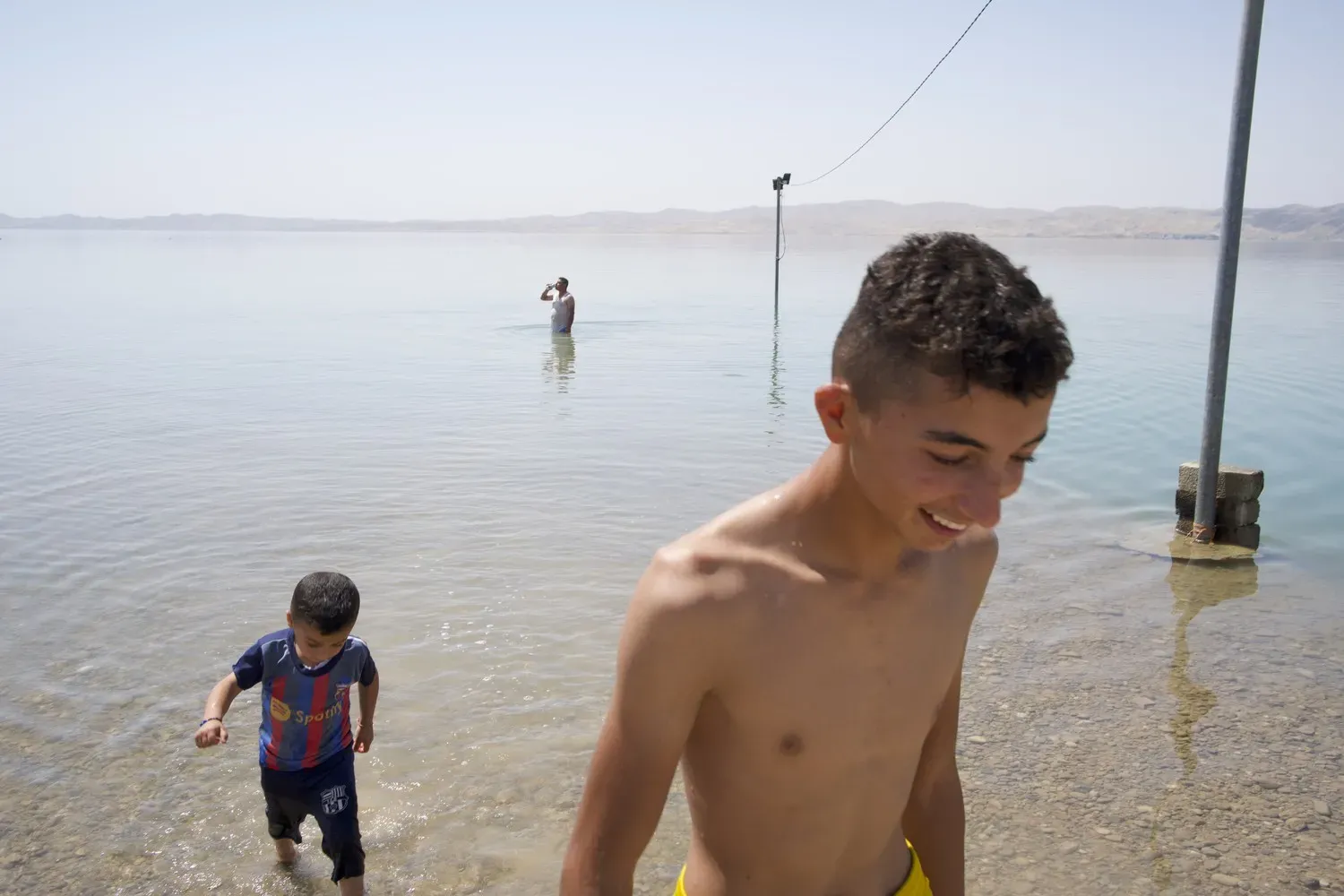
Kids from the town of Heweriya, in Iraq, get relief from the July heat in the Tigris. Image by Murat Yazar.
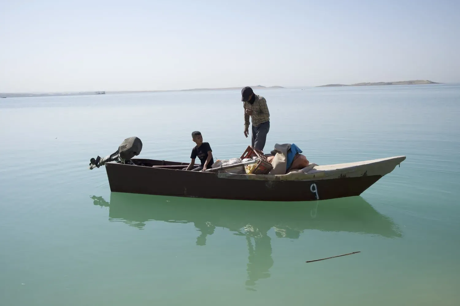
Muhammet Nemrik, 35, has fished in the Mosul reservoir, in Iraq, for 12 years. In April, the governments of Iraq and Turkey signed a "framework agreement on cooperation in the field of water." Image by Murat Yazar.
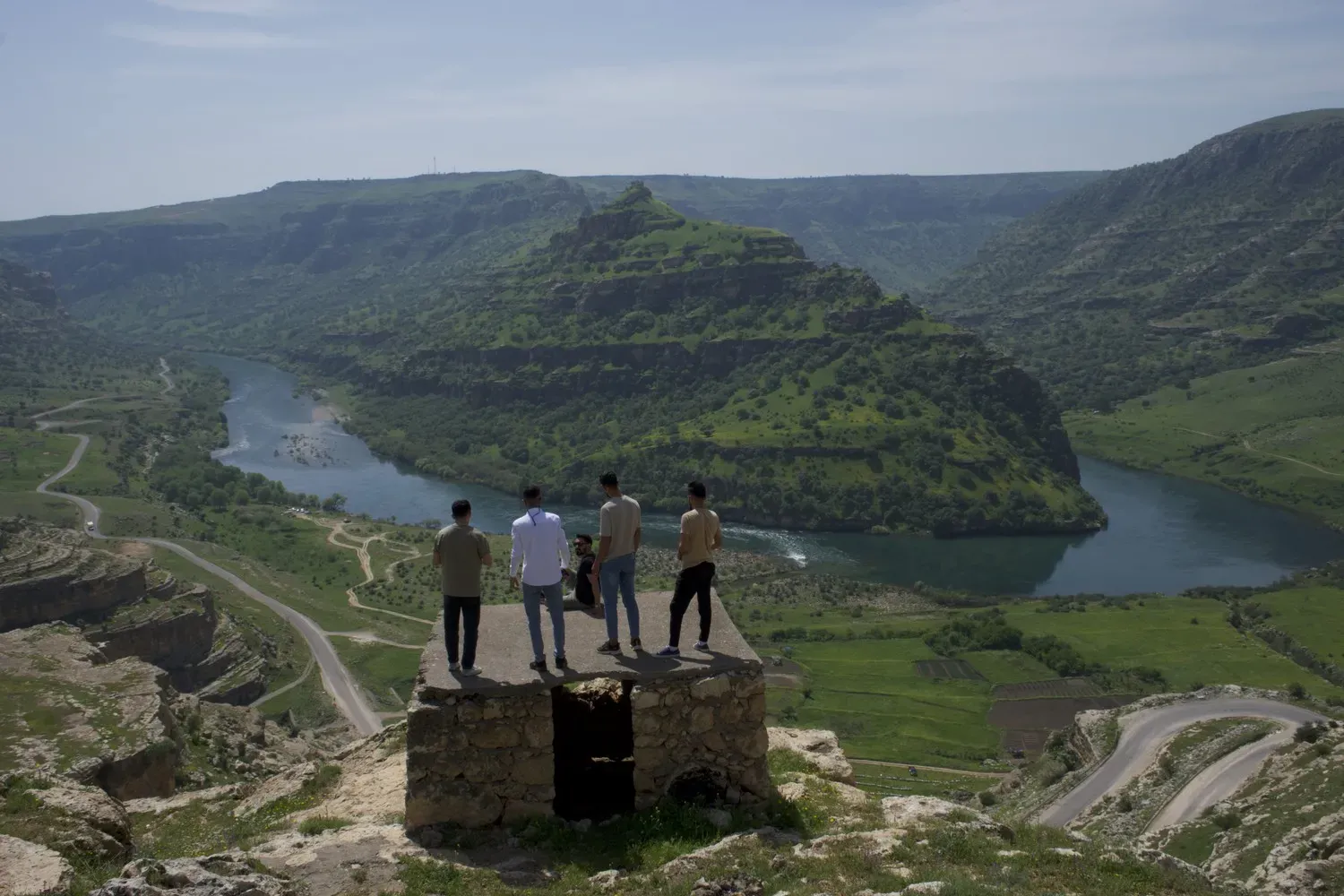
In ancient times, the Tigris was an important trade thoroughfare from Diyarbakir to Mosul and Baghdad. In the 1500s, Turkish local leader Elo Dino had a dispute with the provincial boss, so he put a chain across the river here at Qesra Elo Dîno and charged merchants for passage. Image by Murat Yazar.
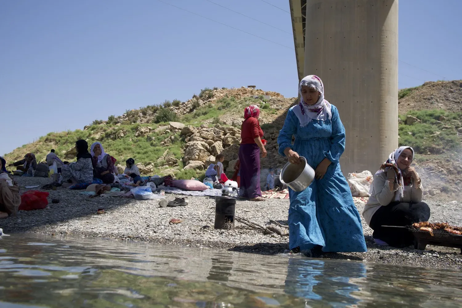
People from the Dargeçit and Güçlükonak have a picnic on the Tigris, collecting drinking water from the river. Image by Murat Yazar.
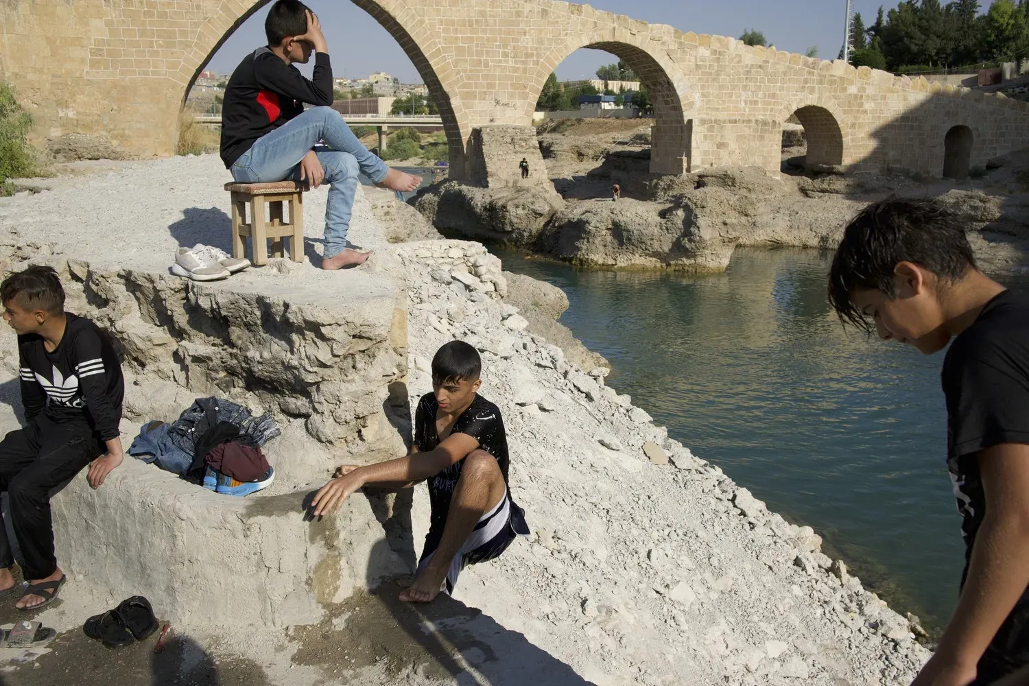
Iraqi children play and swim near the historic Delal Bridge on the Xebir, a tributary of the Tigris. Image by Murat Yazar. Turkey.
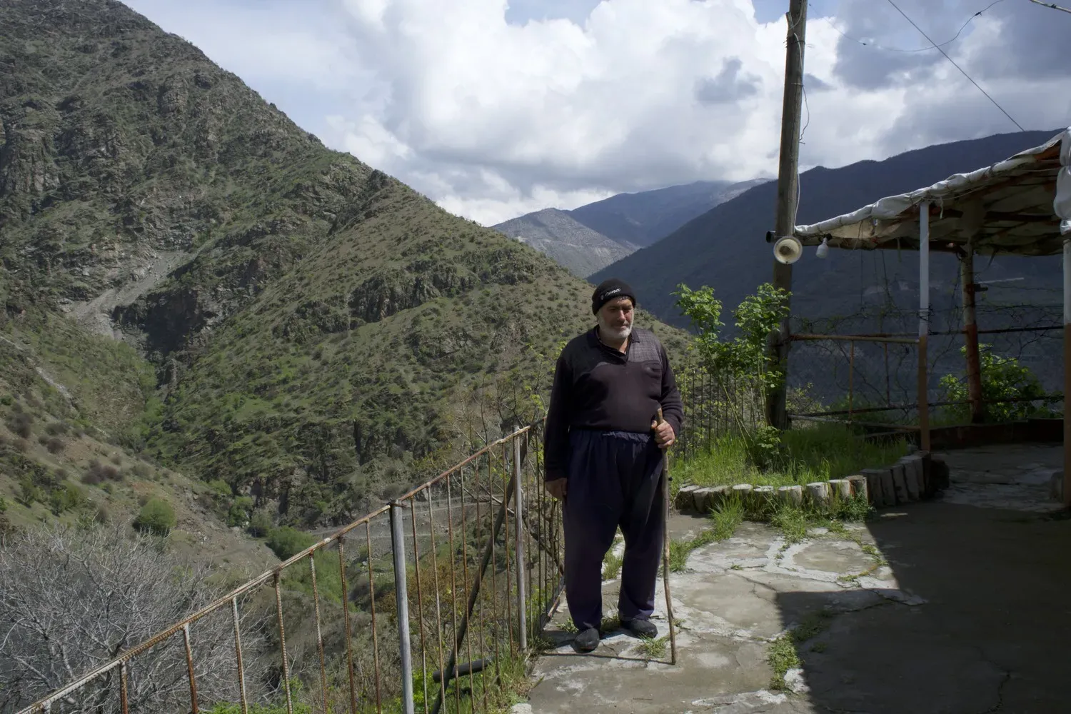
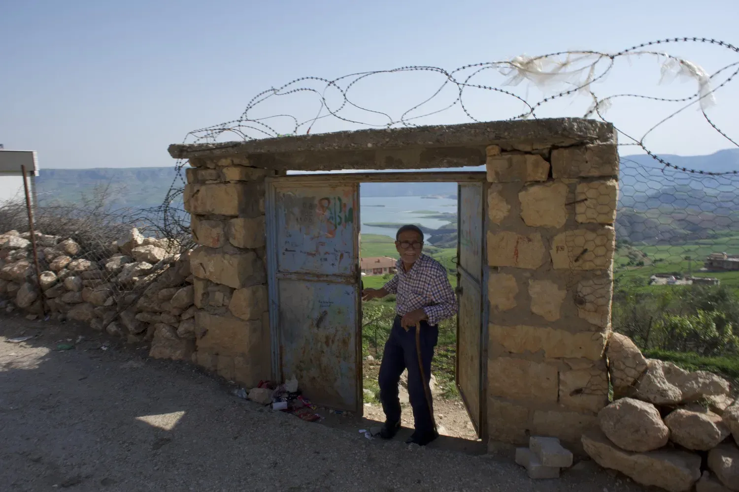
Abdurrahman, 72, lives in Temelli village, on a hill near the Tigris. He says the Illisu reservoir flooded the fields and pastures where villagers grazed their animals, causing despair and an increase in unemployment. Image by Murat Yazar. Turkey.
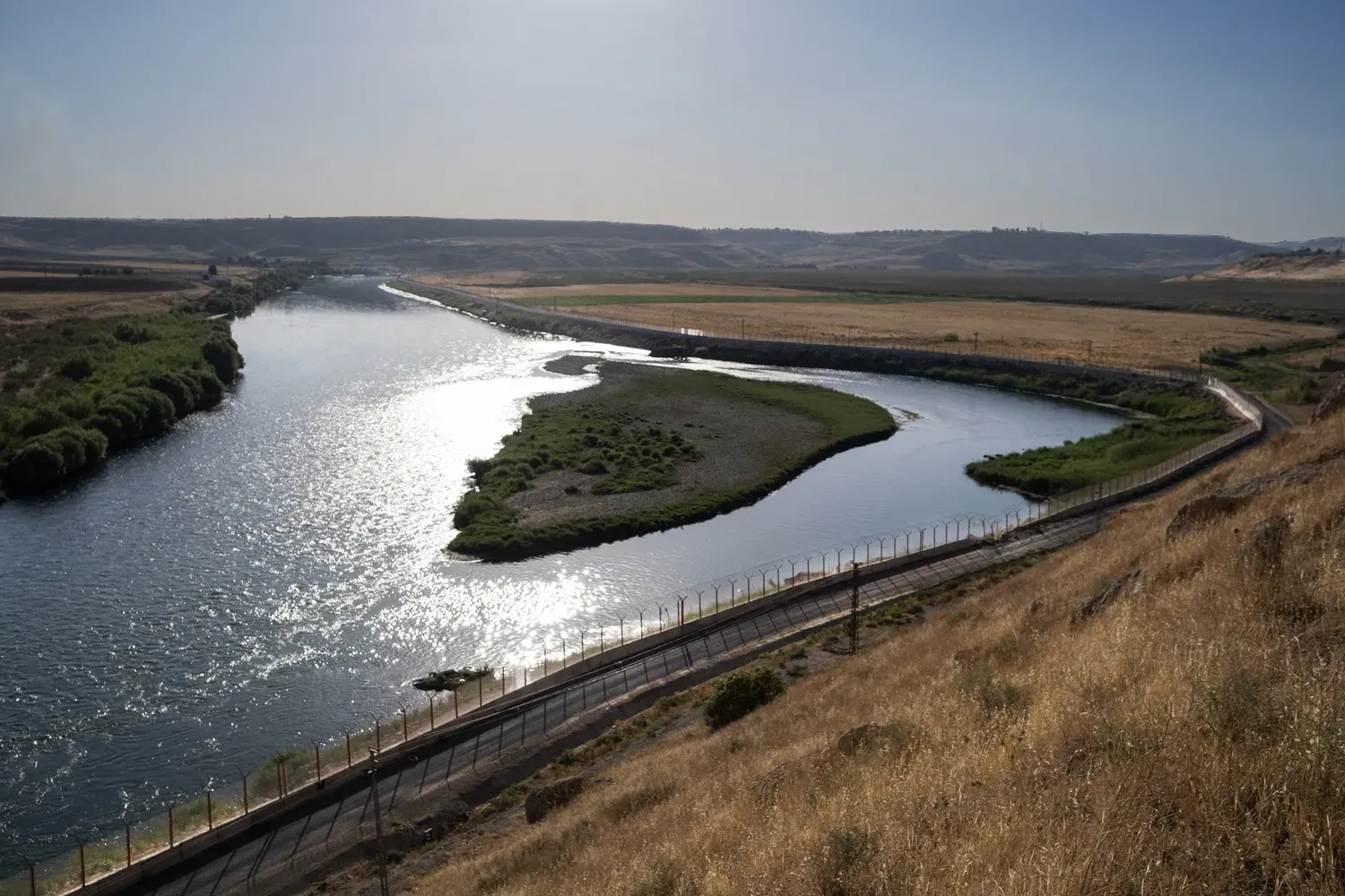
Turkey has built a nearly 900-kilometer wall along its border with Syria to address security concerns relating to Kurdish groups. Part of the barrier follows the Tigris. Image by Murat Yazar.