

The Kuikuro have no chance of survival unless they adapt, and the answers to how to do so can come...
A 3-decade partnership between archaeologists and the Kuikuro people offers a model of collaboration—and documents the complexity of early Amazonian societies.
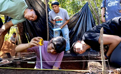
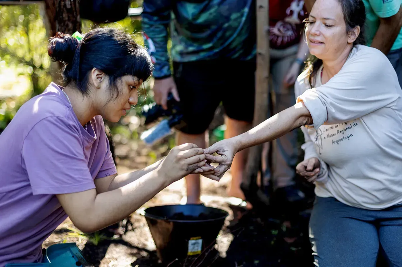
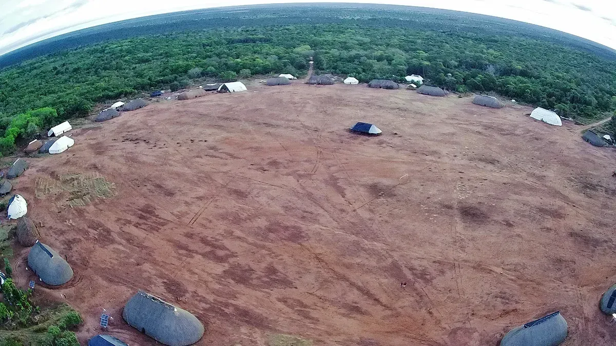
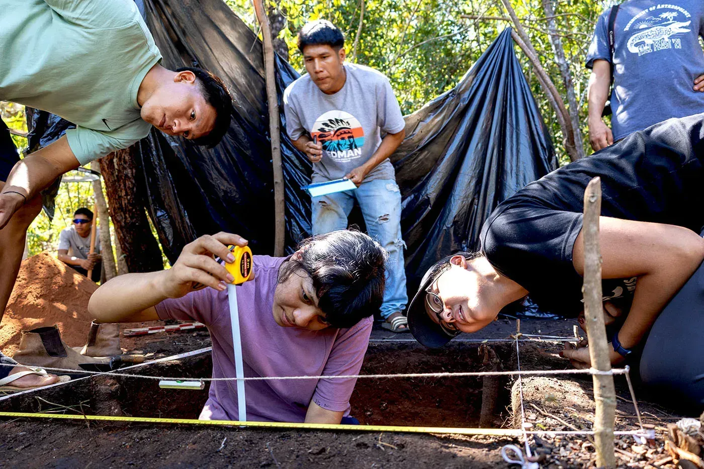
Xingu Indigenous Territory, Brazil—Yamána Kuikuro, 14, kneels barefoot beside a shallow, half-meter-square pit in the forest. The site, a few kilometers from her own hut in Ipatsé, a Kuikuro village in the Xingu Indigenous territory, was once the backyard of her great-grandparents’ house. As she scrapes the brown earth with a trowel, she soon spots a black ceramic shard. It is only about the size of her palm, and this is her first day ever on an archaeological excavation. But she immediately recognizes what the object once was.
“It’s an alato,” she says, showing the piece to a group of archaeologists and other Kuikuro who have gathered to watch the excavation in the village of Anitahagu. An alato, Yamána explains, is a large pan used to cook beiju, a white flatbread made with yucca flour that’s eaten almost every day in her village. Her grandmother still has one in the backyard fire pit where she prepares most meals, just as countless Kuikuro women did before her. This alato likely belonged to her great-grandmother on her mother’s side.
“Everything here has a history and a name,” says archaeologist Helena Lima, who is looking on. “We just have to listen to the Kuikuro and then guide the research based on that.”

As a nonprofit journalism organization, we depend on your support to fund more than 170 reporting projects every year on critical global and local issues. Donate any amount today to become a Pulitzer Center Champion and receive exclusive benefits!
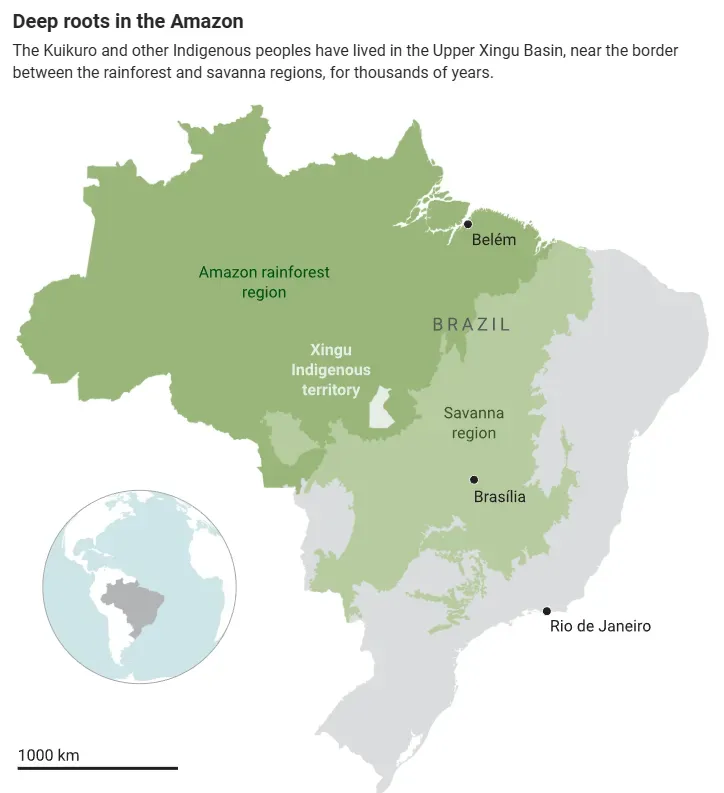
Lima, who works more than 2000 kilometers and up to three travel days away at the Emílio Goeldi Museum of Pará, in Belém, is leading a 2-week scientific expedition here in the southeastern Brazilian Amazon, as part of a partnership between archaeologists and the Kuikuro people. The project began to take shape in the 1990s, when archaeologist Michael Heckenberger of the University of Florida started to work—and publish with—the Kuikuro, a rarity at the time. Together, they have been exploring the history of Indigenous occupation in the Upper Xingu region of the Amazon, a transition zone between the savanna and the rainforest, and home to many Indigenous groups (see map, below).
The project has helped rewrite a common Western narrative around the Indigenous presence in the Amazon. The archaeologists and the Kuikuro have documented the long history of a large and sophisticated civilization that prospered here for at least 1500 years—up to the arrival of Europeans in the Americas. In half a dozen papers—mostly in top journals such as Science and Nature—they have traced the outlines and activities of a cluster of ancient cities that were laid out following the same structure of modern Kuikuro villages, but far larger.
The pioneering collaboration has inspired other researchers, says Eduardo Neves, an archaeologist at the University of São Paulo who is leading a mapping project elsewhere in the Brazilian Amazon. Neves now also engages local communities in his studies. “People are starting to talk about involving local communities now, but Heckenberger and the Kuikuro were already doing it decades ago,” Neves says. “This is a wonderful case that was only possible because of a relationship of trust, and it serves as a reference for us all.”
In 2019, Heckenberger prepared to retire and Lima took over. Her team has deepened the collaboration, involving the Kuikuro in every step of research, from planning to publication. Villagers of all ages guide the work, formulate questions, and receive training in archaeological methods including remote sensing technology.
For the researchers, the partnership allows access to otherwise unknown sites and offers crucial context for ancient lives. For the Kuikuro, who live in a green oasis surrounded by encroaching deforestation, archaeology has helped show the world what they have long believed: Their ancestors lived in the Upper Xingu for many centuries. “It’s really touching,” Yamána says, putting the ceramic piece into one of many small bowls containing every artifact recovered. “We’re digging the earth and seeing our history.”
Throughout the 20th century, many Western scholars thought that before European contact, the harsh jungle environment and poor soil of the Amazon Basin could only have supported small populations of nomadic hunter-gatherers. But all over the rainforest, researchers began to find mysterious patches of dark earth, or terra preta, a fertile soil rich in organic matter and ancient ceramics. Deforestation uncovered monumental geometric earthworks, with ditches and embankments. Researchers began to wonder whether these might be the signature of large, settled, complex ancient societies across the Amazon.
Heckenberger took up the question while working on his Ph.D. at the University of Pittsburgh in the 1990s. He sought a region where current Indigenous peoples were likely direct descendants of ancient populations, so he could see whether they had always maintained small-scale settlements of fewer than 100 residents, as seen today, or they once lived in larger communities—cities.
The Kuikuro in Upper Xingu appeared to be a good candidate. Heckenberger’s adviser, archaeologist Robert Carneiro, had lived with the Kuikuro in the 1950s, and, based on oral history and artifacts, suggested the group had been there for at least 500 years. He had noted large circular ditches—possible signs of ancient occupation—near the Kuikuro’s main village.
In 1991, Heckenberger traveled to Brazil to make contact with the Kuikuro. In Rio de Janeiro, he met chief Afukaká Kuikuro, who was in the city to create an organization to represent his people and other Upper Xingu tribes in Brazilian politics. Heckenberger and Afukaká lived together in town for 6 months and formed a close friendship.
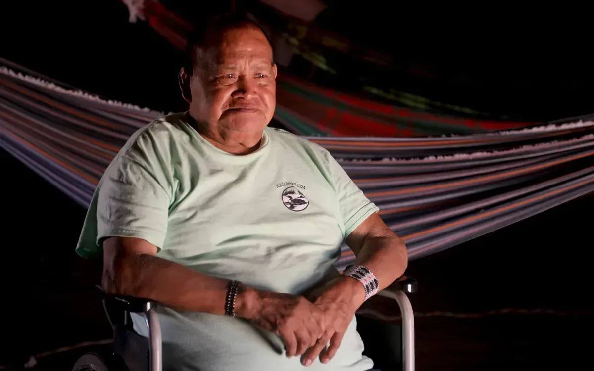
A year later, with Afukaká’s permission, Heckenberger visited the Kuikuro territory, which had been delineated by the Brazilian government in 1961, to do archaeological work. By then, the men were calling each other brother. “I said yes because I believed in his work,” recalls Afukaká, now 74.
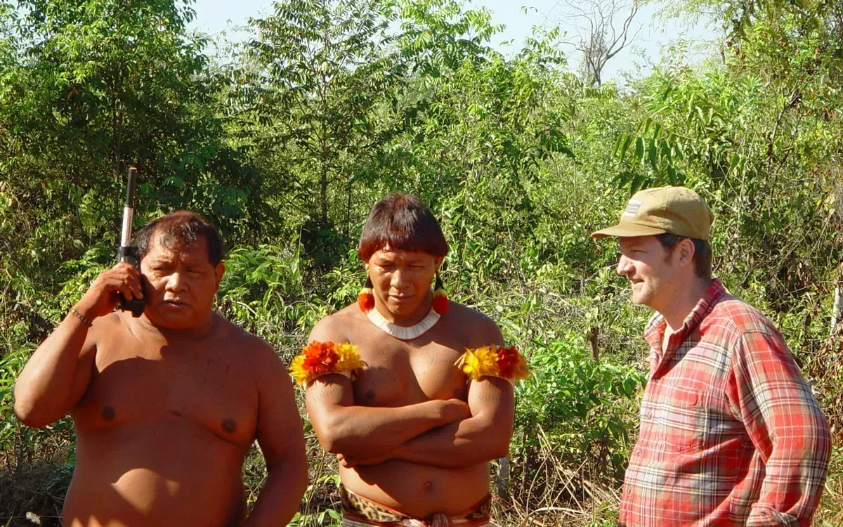
Heckenberger relied on the Kuikuro to guide him to the ancient earthworks—which they already knew about—and help him dig and map them. “We built a relationship of trust,” he recalls. “They taught me about their culture, and I taught them how to do archaeology.”
The first Kuikuro to join Heckenberger in the fieldwork were the chief’s brothers and sons-in-law. In teams of up to 20 men, they set out on foot on forays lasting for days, using knives and electric saws to clear a path through the dense forest and rods to mark straight-line transects extending for kilometers. It took them 3 months to map the first sites, and some courage to go against the popular Kuikuro belief that handling ceramic shards from the ngiholo, or ancestors, would give them diarrhea.
The group’s positive interactions with earlier Western researchers may have eased the way for Heckenberger, says anthropologist Carlos Fausto of the National Museum of Brazil. The Kuikuro’s early contact with white people, likely explorers for gold in the 18th century, may have been violent. But later contacts included peaceful visits from the German traveler and ethnographer Karl von den Steinen in 1880. In the 1950s, Carneiro and his wife, Gertrude Dole, visited, followed in the ’70s by Brazilian linguist Bruna Franchetto, who created the first written version of their language, Carib, and recently, the first dictionary. “Unlike many other Indigenous peoples in Brazil, the Kuikuro and other Xinguans became more familiar with researchers and their notebooks than with missionaries and their Bibles,” Fausto says.
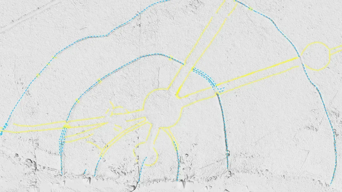
Over the next 3 decades, Heckenberger returned almost every year. He trained three generations of Kuikuro in excavating and mapping sites using GPS, and later brought in more researchers. Together, they uncovered an archaeological complex comprising 28 clusters of earthworks, each including kilometers-long circles of rammed earth, ditches, and embankments, connected by straight pathways up to 40 meters wide and stretching several kilometers. The entire complex spread across 1200 square kilometers of forest.
“I didn’t ‘discover’ anything,” Heckenberger says. “I wouldn’t have found a single pot if it weren’t for [the Kuikuro]. They took me to every site and helped me map every single one.”
The Kuikuro traditionally believed the earthworks were the footprints of Hitsi-Hitsi, a mythical hero whose legs were transformed into a sharp spear that scored the ground as he wandered the land. But to Heckenberger, the marks were remnants of forest cities, with plazas, defensive trenches, and a vast system of interconnecting roads. Today, the Kuikuro think both explanations hold some truth. For Afukaká, his people’s tales and Western scientific explanations are complementary, rather than conflicting. “The researchers believed my stories and I believed theirs,” he says.
Radiocarbon dating showed the settlements were inhabited from 500 C.E. to 1770 C.E. Like modern villages, the ancient cities were organized with pole-and-thatch huts around circular plazas, but they were more than 10 times larger. Based on the distribution of ceramics, researchers estimate that at their peak 800 years ago, at least 50,000 people lived in all the towns of the Upper Xingu Basin.
The results showed that the long-standing Western view of an Amazon hosting only small, “primitive” societies reflected conditions after Europeans arrived, unleashing violence and epidemics that diminished Indigenous populations and weakened their culture. “These sites revealed the existence of ancient societies that were much more complex and densely populated than previously imagined,” says Fausto, who for decades has documented the Kuikuro culture and has collaborated with Heckenberger.
The devastation wrought by epidemics continued for centuries: Anitahagu, the village now being excavated, was founded in 1961 after a measles outbreak reduced the Kuikuro to about 100 people. The survivors moved to the new location to be closer to a medical station inside their newly created reserve. Today, the Kuikuro number approximately 700 and live alongside 6000 other Indigenous people in the Xingu Indigenous territory.
At first, many Kuikuro and members of neighboring Indigenous groups were skeptical of Heckenberger’s intentions. Rumors circulated that he was digging for gold or gemstones. “They saw the holes in the ground and thought he was a foreigner who came here to exploit our resources,” recalls Sepé Kuikuro, a local teacher and elderly political leader at Ipatsé. “But then the results started to come out and people began believing him.”
A turning point came in 2003, when Heckenberger’s team published a Science paper describing the evidence that the Upper Xingu was once home to dense, complex human societies—and included Afukaká and his brother as co-authors. The study attracted international media attention, and the visibility led more Kuikuro people to recognize the value of the archaeological work.
“Research has made the white men believe us,” Afukaká says. “It showed the world, in a language that the white men understand, that we have been here in this territory for a long time.”
“[The research] showed the world, in a language that the white men understand, that we have been here in this territory for a long time.”
Afukaká Kuikuro, Kuikuro chief
The collaboration grew ever stronger over the years. In their latest study, published in Science Advances in 2023, seven Kuikuro and 22 Western researchers, including Heckenberger, offered new evidence that ancient Indigenous peoples intentionally created dark earth, or eegepe in their language. The work, led by archaeologist Morgan Schmidt at the Federal University of Santa Catarina, included interviews with modern-day Kuikuro at Ipatsé, who explained that they intentionally compost their organic waste in small mounds in their backyards to fertilize the ground for later planting. They added that the practice was likely handed down from their ancestors. “We make eegepe to plant, so the yucca, the mango tree, and all plants grow strong,” says Kanu Kuikuro, an elderly villager. “We throw the remains of food, coal, ashes, all that outside in a pile so we can plant there [later].”
For Afukaká, the eegepe offer another example of how Indigenous knowledge and scientific explanations can work together to preserve Kuikuro heritage and history. “For us, archaeology is an important tool,” he says. “I tell my grandkids they have to study and learn more about the white man’s science to keep our culture alive in the future when I am gone.”
Heckenberger says the partnership has given him much more than academic accomplishment. “[The Kuikuro] are not only my research partners,” he says. “They are my family.” In 2003, the chief gave Heckenberger a Kuikuro name: Maikedjana.
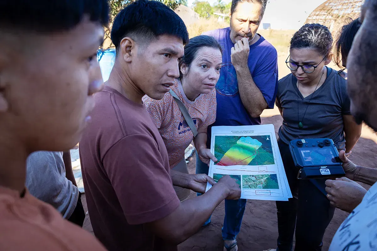
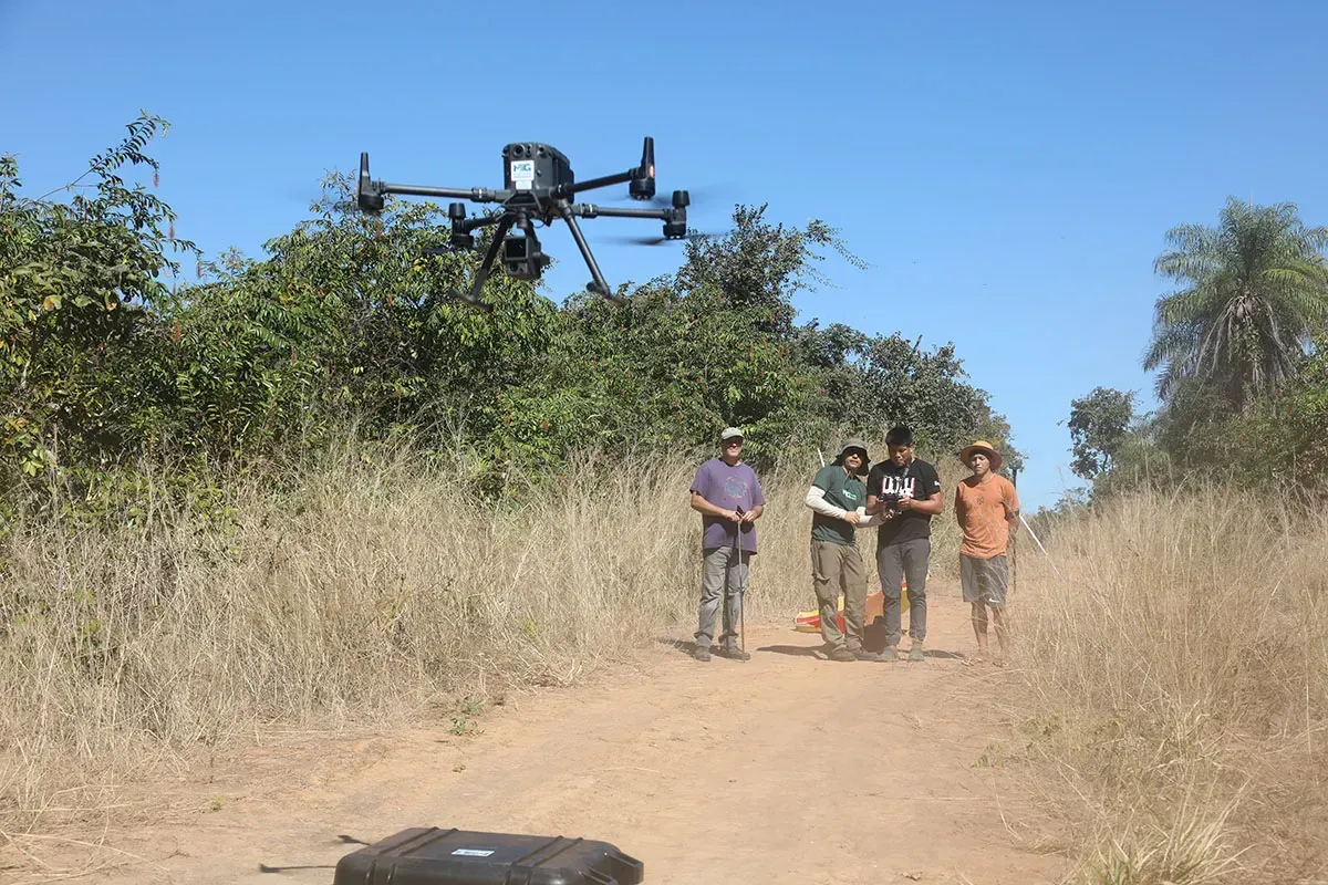
A few meters away from the excavation site in Anitahagu, Viola Kuikuro, a young man just out of high school, keeps his eye fixed on the sky while steadily holding a drone controller. He is working with Lima’s team, which has taught him and other villagers how to map their land using a Lidar sensor mounted on a drone. Lidar, an acronym for light detection and ranging, uses laser beams that can scan Earth’s surface to create precise 3D maps of topographic features even when covered by vegetation, and it is revolutionizing archaeology in the dense forests of the tropics. One recent discovery includes a network of settlements in the Upano Valley of Ecuador, featuring more than 6000 rectangular earthworks connected by straight roads and footpaths, dating back about 2500 years.
Flying the drone over the trees, Viola checks its radio signal while watching the camera feed on the screen, taking into account both wind speed and vultures angry at the intrusion. His goal is to map the excavation site and two other former villages. With these data, they hope to compare the marks left on the ground by recent occupations with the signatures left by ancient towns. Next, the team hopes to use Lidar to look for undiscovered sites mentioned in Kuikuro oral histories.
The Kuikuro will make the ultimate decision on where to fly. “We decide together where to look and what to map,” says Lima, who has spent her career doing archaeology in various parts of the Amazon. In the Xingu region, she’s particularly interested in a site preliminarily dated to about 5000 years ago. But she puts the Kuikuro’s needs first, she says. “Our goal is to share these technologies and give them control over them.”
All geolocated data produced by the collaboration, including Lidar and satellite imagery, are stored in a portal hosted on the Goeldi Museum’s servers and co-managed by the Kuikuro Indigenous Association. Access requires their permission. The portal was created as part of an effort to repatriate research data to the Kuikuro, which started in 2016 when Heckenberger transferred copyright and digital copies of his research materials to them.
For the Kuikuro and other Indigenous peoples, controlling research data is crucial, especially given recent cases of unauthorized data collection on their land. For example, a 2023 study by Brazil’s National Institute for Space Research and international researchers, published in Science, used Lidar scans from around the Amazon, including of Kuikuro territory, to estimate that up to 10,000 pre-Columbian earthworks could be hidden beneath the canopy. But the researchers conducted the survey without consulting the Kuikuro or other Indigenous peoples and the findings were released without their involvement.
Daniel Kalutata Kuikuro, Afukaká’s grandson and president of the Kuikuro association, was shocked when he saw the study’s results on national TV, accompanied by Lidar images of one of their most sacred sites, considered the birthplace of their people. “We were very sad,” he says. “We want to safeguard and protect this place, and then it was on TV for everyone to see it, and maybe go there and do something bad.”
He has good reason to be wary. In 2018, unknown criminals vandalized several ancient engravings in a cave the Kuikuro consider sacred, located just outside their reservation. And in May, a contest promoted by the company OpenAI challenged citizen researchers worldwide to use the technology to find ancient cities in the Amazon. Once again, Indigenous communities from the region were not consulted. “New technologies are transforming archaeology, revealing all these big Indigenous cities in the forest, but how much are the communities truly involved?” Lima asks. “Here, we are making sure that the Kuikuro are in charge.”
On a sunny afternoon, Lima and some members of her team, including young Kuikuro drone pilots, load heavy Lidar and drone equipment into a pickup and drive 30 kilometers from Ipatsé to the village of Lahatua. They hope to involve these villagers in the research project. But whether the chief here, Akulu Kuikuro, will support archaeology as much as Afukaká does is uncertain.
Inside the school building, researchers, local teachers, and Akulu sit in a circle of student chairs. Speaking in Portuguese, which the teachers and leaders all understand, Lima and her team introduce themselves and describe the work they’ve done and the projects they plan. These include continuing to map sites with Lidar, collecting pollen from lake bottoms to reveal what plants thrived in the ancient landscape, and scraping tiny particles of starch from ancient pots to identify the grains the Kuikuro ancestors cultivated and ate.
“Our main mission is to establish an open dialogue with you,” Lima says. “We want to work together as long as you wish and as long as our lifetime allows us.”
After the explanations, Akulu breaks the silence. “Many people don’t understand your work,” he tells the researchers. “But I have been explaining it to them. My dream is to see you conducting research and mapping here, too. That is what I want for my children and grandchildren.” Akulu says the archaeological work will help the villagers understand their past and preserve their culture.
Later that day, teachers and local leaders discuss with Lima and her colleagues where to fly the drone. Together, they decide to scan a small area missing from previous maps, just outside the defensive trenches of Kuhikugo, a major 1000-year-old site first mapped by Heckenberger’s team. “We may find new things there,” says Bruno Moraes, an archaeologist and geospatial analyst with the Goeldi Museum.
One day, the collaboration with Lahatua may look like the one at Ipatsé. There, on the last day of the expedition, the researchers and about 50 Kuikuro men gather in the “men’s house,” a large oval-shaped hut in the center of the village plaza. The researchers summarize their activities and promise to return next year. They also invite the community to suggest topics for future archaeological research.
The Kuikuro raise a worry that seems far removed from archaeology: the state of their rivers. “A big concern for our people is to take care of the river headwaters,” Sepé Kuikuro says. The upper headwaters that form the Xingu River and its tributaries lie outside their official territory. As more and more land is deforested to make space for large soy plantations, the Kuikuro fear their rivers may be polluted with pesticides and could eventually dry up because of the combination of climate change and intense water use by surrounding farms.
Lima listens. Then she suggests using Lidar to map areas on the border of the reservation. If they find ancient sites there, the Kuikuro could use this information to strengthen their claim to have those lands recognized by the federal government as their ancestral territory. Additionally, under Brazilian law, archaeological sites are considered property of the state, which can add another layer of protection against private development such as agribusiness.
For Lima, the boundaries between research and social causes are fluid. “We are together with the Kuikuro, defending their way of living,” she says. “We’re not here just to make holes and learn history.”
After years of collaboration, the Kuikuro themselves see archaeology as a political tool. “Archaeology is a weapon for us,” says Kumessi Waurá Kuikuro, a nurse technician in the village who participated in excavations with Heckenberger in 2018. “If anyone tries to invade our lands or undermine our presence, we can show that we have been here for centuries and that this place belongs to us.”
During the meeting, Mutuá Mehinaku, the first villager to get a master’s degree, in linguistics, stands up to speak. He encourages other Kuikuro to study and attend college, while also pushing the Western researchers to provide more academic opportunities. “We need to get real training in archaeology so that one day we are not just assistants, but the ones leading the research,” he says.
Over the years, a handful of Kuikuro have pursued college degrees in the city. But it’s a hard path. The closest universities are several hundred kilometers away, and enrolling means leaving the village and its family-centered Indigenous way of life. Students must leave their support network behind while finding the money to pay for city life. But at the end of the meeting, the researchers have good news.
Through partnerships with universities and research institutions, Lima says she and her colleagues have arranged grant opportunities for Kuikuro villagers to participate in research and pursue college degrees. After a round of applause and tribal shouts, the community decides who will receive the scholarships. Viola, the drone pilot, is one of the chosen. He will participate in a 6-month training to prepare him to enter a new bachelor’s program in Indigenous archaeology, set to launch next year at the University of Brasília.
“Little by little,” Viola says with a shy smile. Perhaps one day, he will lead the research.