Journalist Resource
 November 4, 2025
How To Track Ships Like a Pro Using OSINT (Part II)

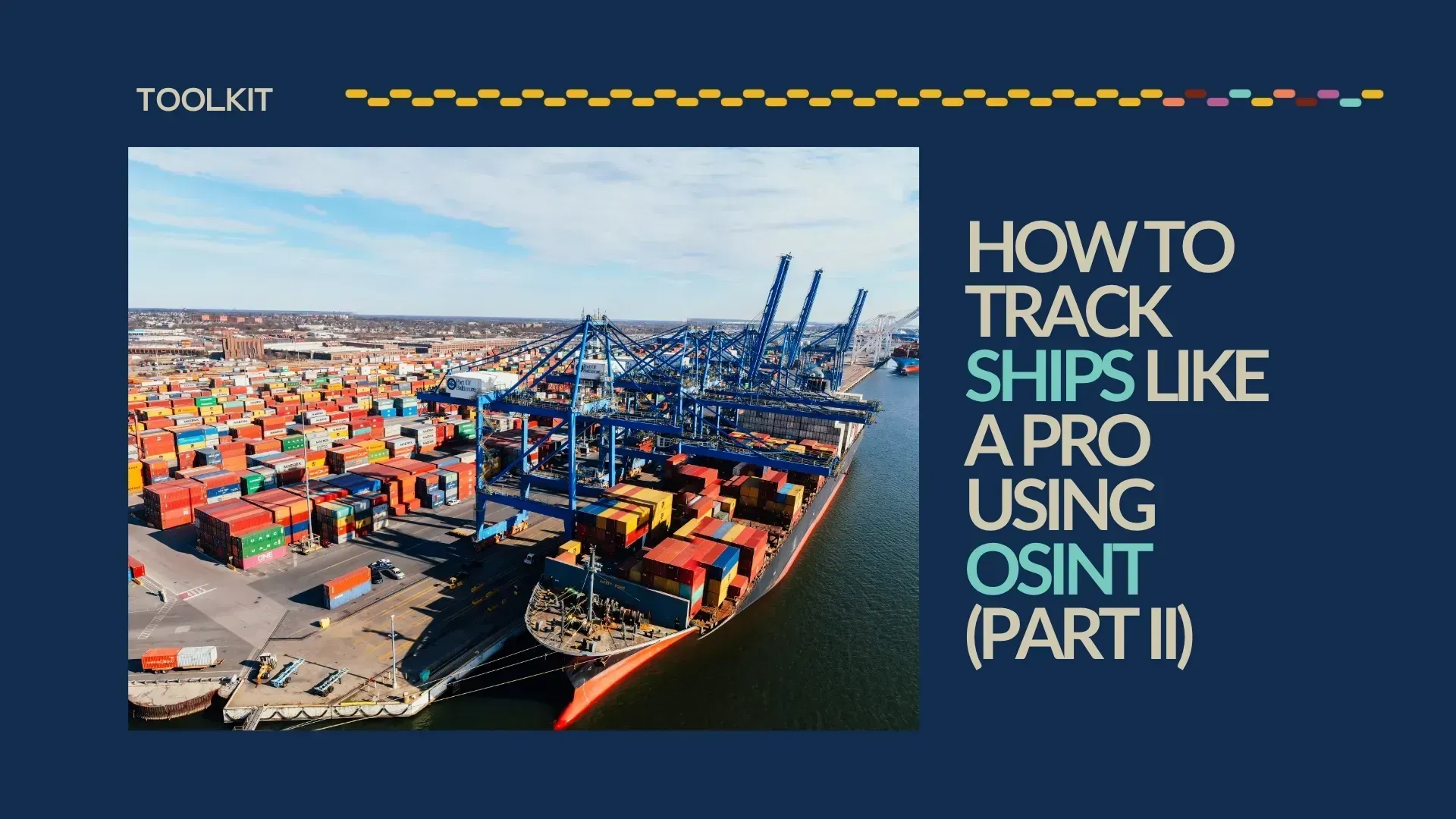
We’re back! This toolkit is a continuation of How To Track Ships Like a Pro Using OSINT (Part I). As promised, in the second part of this toolkit, we will cover tracking tools, historical Automatic Identification System (AIS) data, satellite imagery, port records, and ship registries to find a vessel’s whereabouts and activities.
It’s time to choose a protagonist. The first thing I’ll do is open VesselFinder, then use the filter icon (the second on the upper left side) to select what type of vessel I’m interested in. This time, I looked up “fishing ships.” Then, I went around Guinea-Bissau and spotted Yuan Yu 892. Perfect, it rhymes!
As a nonprofit journalism organization, we depend on your support to fund more than 170 reporting projects every year on critical global and local issues. Donate any amount today to become a Pulitzer Center Champion and receive exclusive benefits!
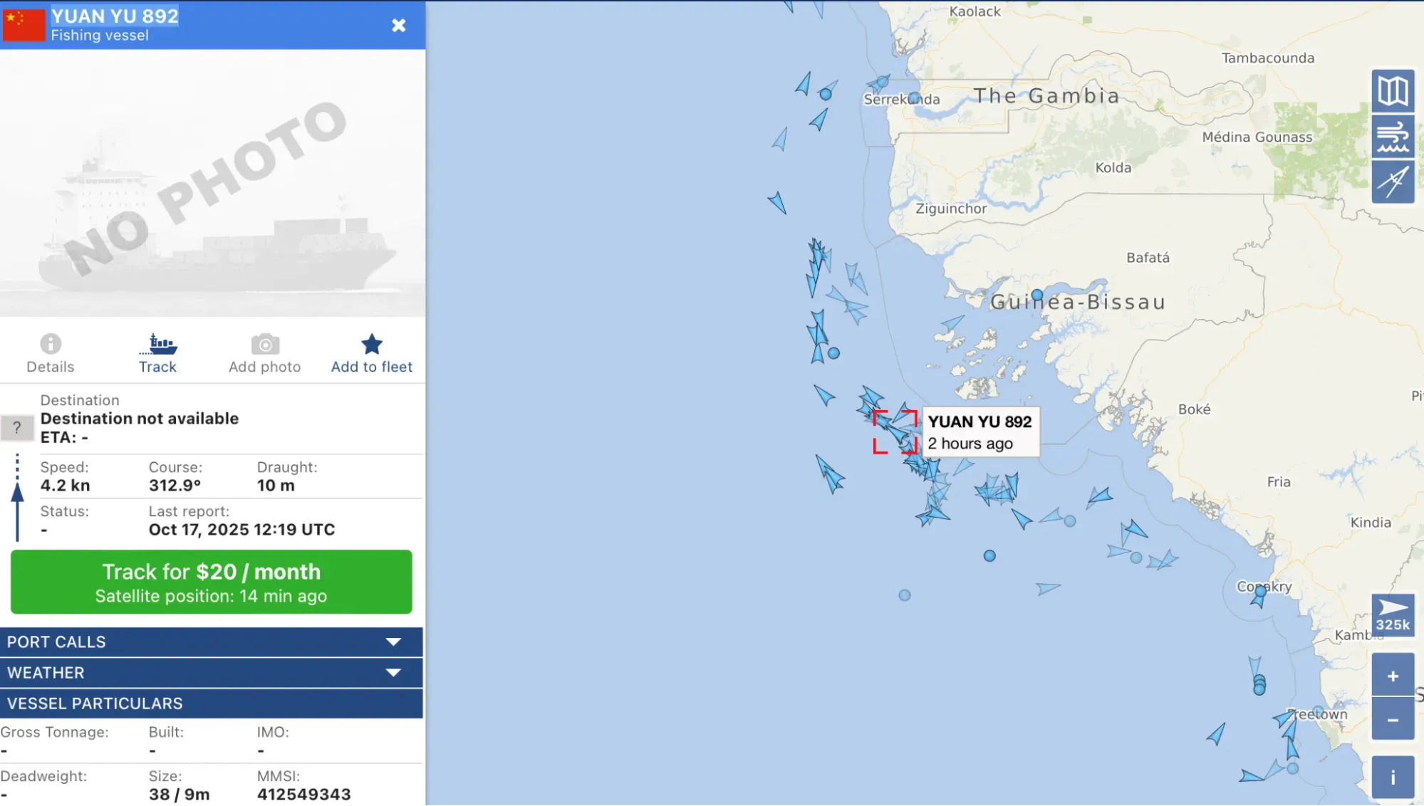
As you can see from the screenshot, the IMO (Remember? That’s the International Maritime Organization’s unique ID number for each vessel) is not listed and we have no photos of the ship. Sounds like a fun challenge.
My next step was to open Global Fishing Watch and type its name. I found it, and its IMO is 9922172. With the IMO, I went to Equasis and found out that the company responsible for our Chinese ship is called Zhongyu Global Seafood Corp and it has 45 vessels in its fleet. They have a similar profile to Yuan Yu 892; most are fishing vessels, but there are some refrigerated cargo ships and fish factory ships too.
Automatic Identification System (AIS)
Now that we know a bit more about Yuan Yu 892, how can we learn about its activities and past? The Automatic Identification System (AIS) will help us with that. The AIS is a communications system by which ships continuously broadcast their position using VHS radio signals. It was developed in the 1990s, with the primary purpose of increasing safety at sea—if vessels could spot each other, they would avoid collisions.
Little did the people responsible for creating the AIS know that they were providing a valuable resource for journalists. Because of it, we are now able to monitor a ship's identity, position, speed, course, and navigational status. And when the AIS goes dark, or stops emitting its signals, it normally raises a yellow flag about the vessel's intentions of wanting to navigate “under the radar.” This doesn’t mean that there’s always a problem, but it should definitely raise an eyebrow.
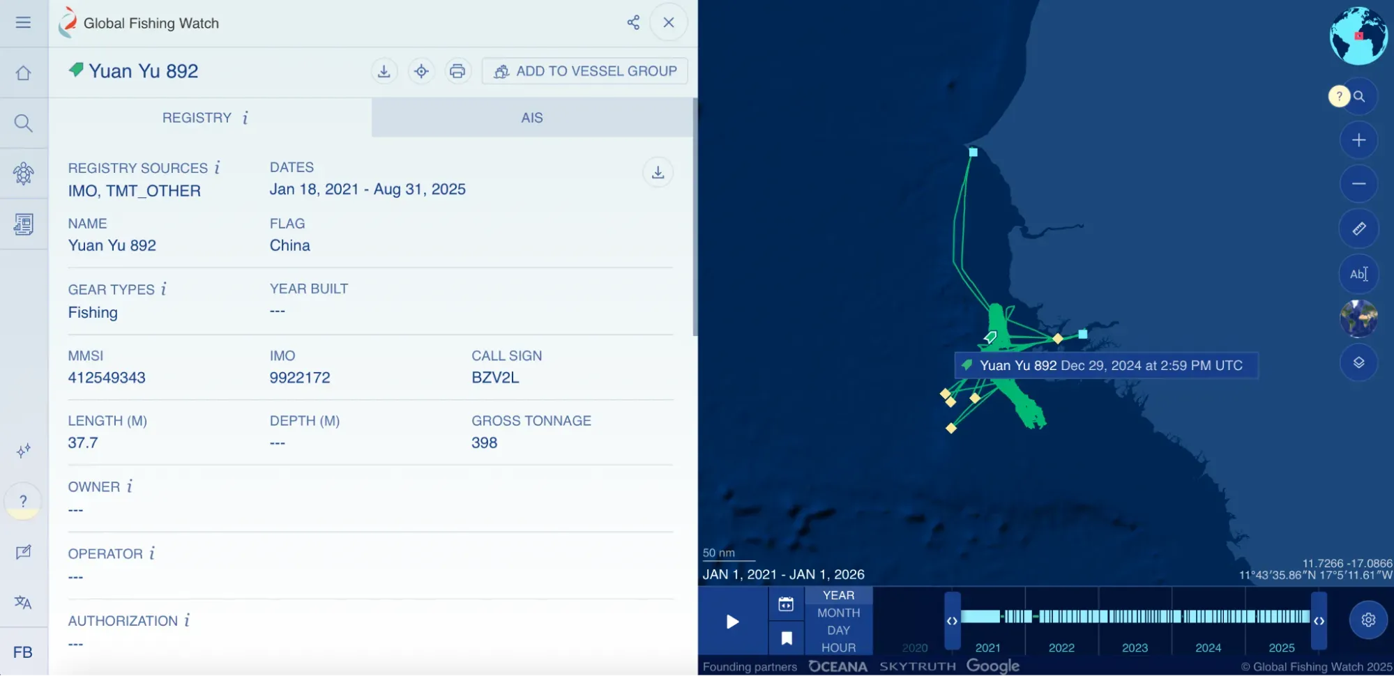
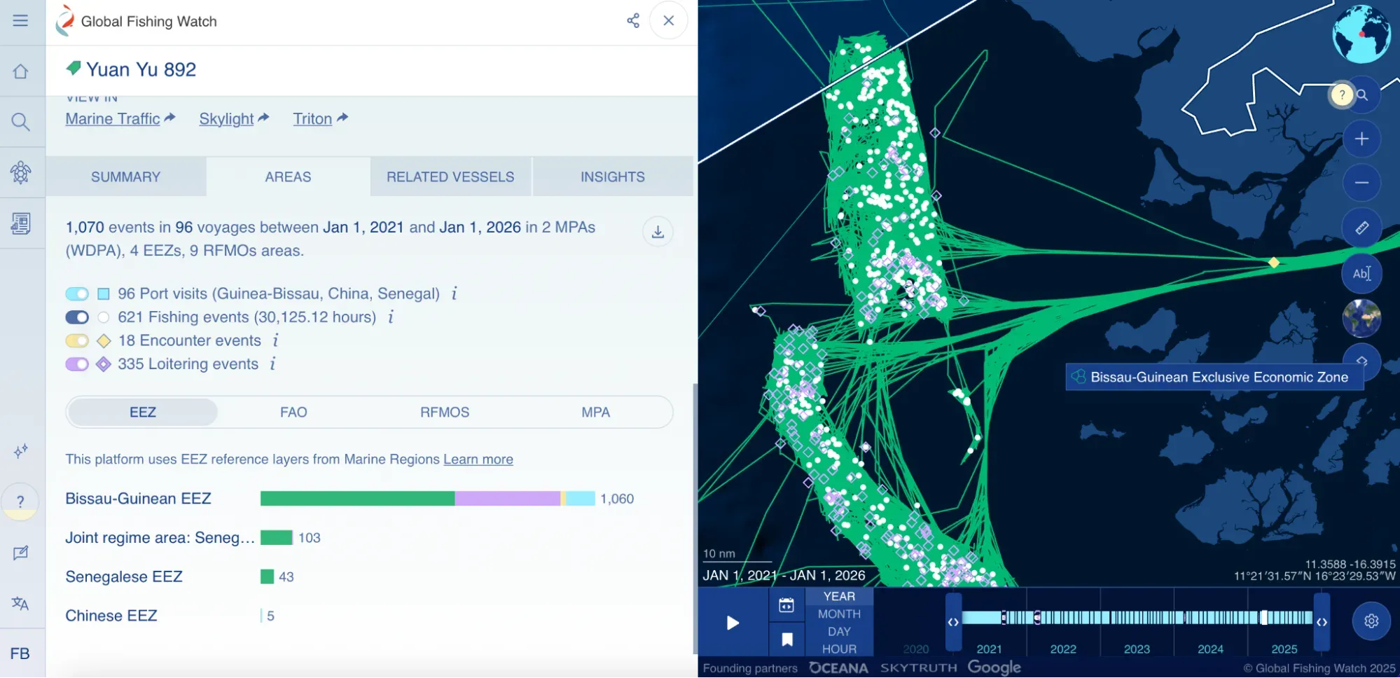
In the screenshot above, we can see the journey that Yuan Yu 892 conducted from 2021 to 2025. If you scroll down, you will find more information. I always like to look at the “Areas” tab because besides giving us the summary of activities (fishing, encounters, and loitering), it also tells us which Exclusive Economic Zones (EEZ) the vessel spent most of its time in and what Regional Fisheries Management Organization (RFMO) oversees that area. Before we continue, I realize I'm using terms that don’t belong to daily vocabulary, so let’s define them:
- Loitering is an indicative of a potential encounter with another ship. It happens when the vessel travels at average speed of less than two knots, while at least an average of 20 nautical miles from shore.
- EEZ is an area of the ocean, typically extending up to 200 nautical miles from a country's coast, where that country has sovereign rights over its marine resources.
- RFMO is an international body composed of countries that share an interest in managing and conserving fish stocks in a particular region.
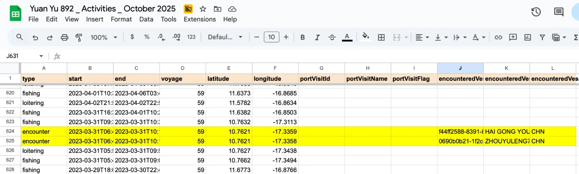
In this spreadsheet, I uploaded all of the 1070 events that the Yuan Yu 892 experienced in the last four years. This is helpful, because it gives you a panoramic view of the ship and its activities. Going through the data, you can see that Yuan Yu 892 encountered Hai Gong You 302 and Zhouyuleng7 (in Equasis, this last one is spelled “Zhou Yu Leng 7,” so please also keep that in mind while looking up ships—their name may be spelled differently according to each platform). Zhouyuleng7 is a refrigerated cargo ship owned by Zhoushan Haibao Transport Co. Because of its vessel type, and because Yuan Yu 892 had been fishing in the area just before the encounter, it is very likely that transshipment occurred.
In fishing, transshipment is the transfer of catch from a fishing vessel to another vessel, either at sea or in port. This practice is common in the industry, but it is also associated with illegal, unreported, and unregulated (IUU) fishing due to a lack of transparency and monitoring. So it’s important to keep this in mind.
Satellite imagery
This is where things get tricky. I asked the Pulitzer Center’s Data team to help me analyze the ships’ interaction using satellite imagery. They explained that most satellites monitoring the ocean are built to collect oceanographic or atmospheric data rather than capture high-resolution optical imagery, which is typically focused on land areas.
In Copernicus Browser—a free platform that offers imagery at 10m per pixel and supports several satellites such as Sentinel 1, 2, 3, and 5—I could see an encounter (based on the coordinates and timestamp) of two ships that might be our targets.
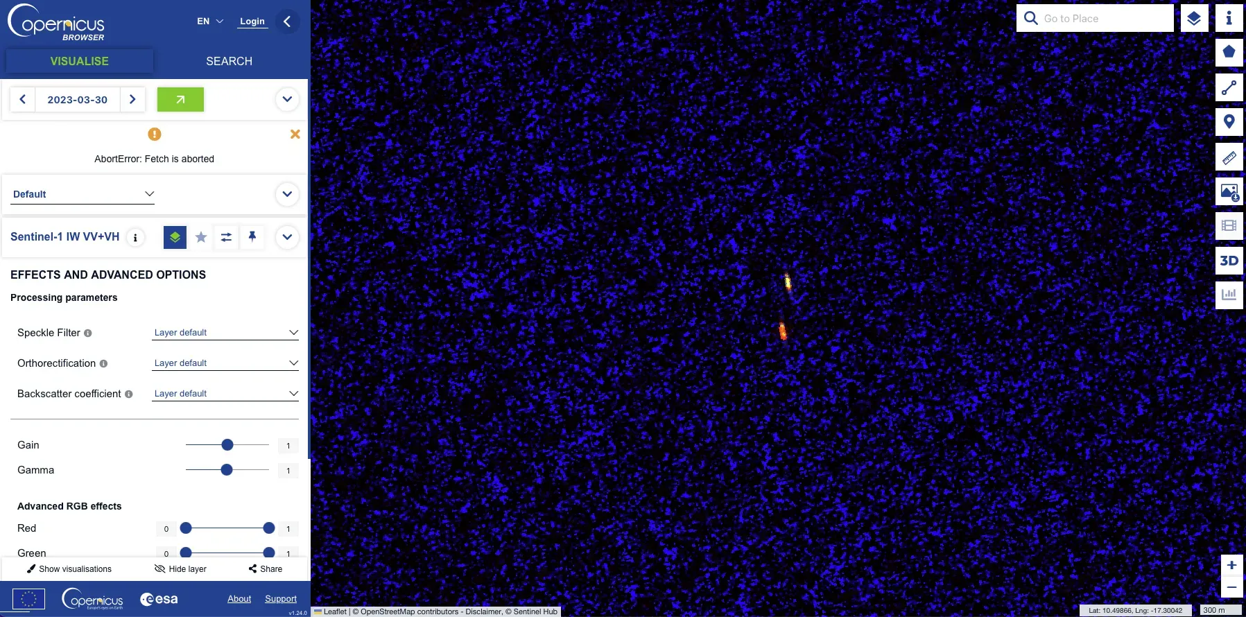
Even when imagery is available, detecting vessels is difficult. Ships are constantly moving, and many satellites revisit a given location only every few days—or even less frequently over remote oceanic regions. On top of that, standard commercial optical imagery (e.g., ~3m resolution offered by Planet’s PlanetScope) is usually too coarse to reliably identify individual vessels unless you purchase satellite tasking from high-resolution commercial providers. While instruments such as Visible Infrared Imaging Radiometer Suite (VIIRS) collect global data over international waters, they are designed for atmosphere, cryosphere, and ocean-color monitoring rather than detailed optical ship-detection.
Other platforms such as Skylight (free platform) also work with satellite imagery and maintain the data for 18 months. And here is where Global Fishing Watch comes to the rescue again because they explain exactly how they collect satellite imagery so you can back up the data on your investigations.
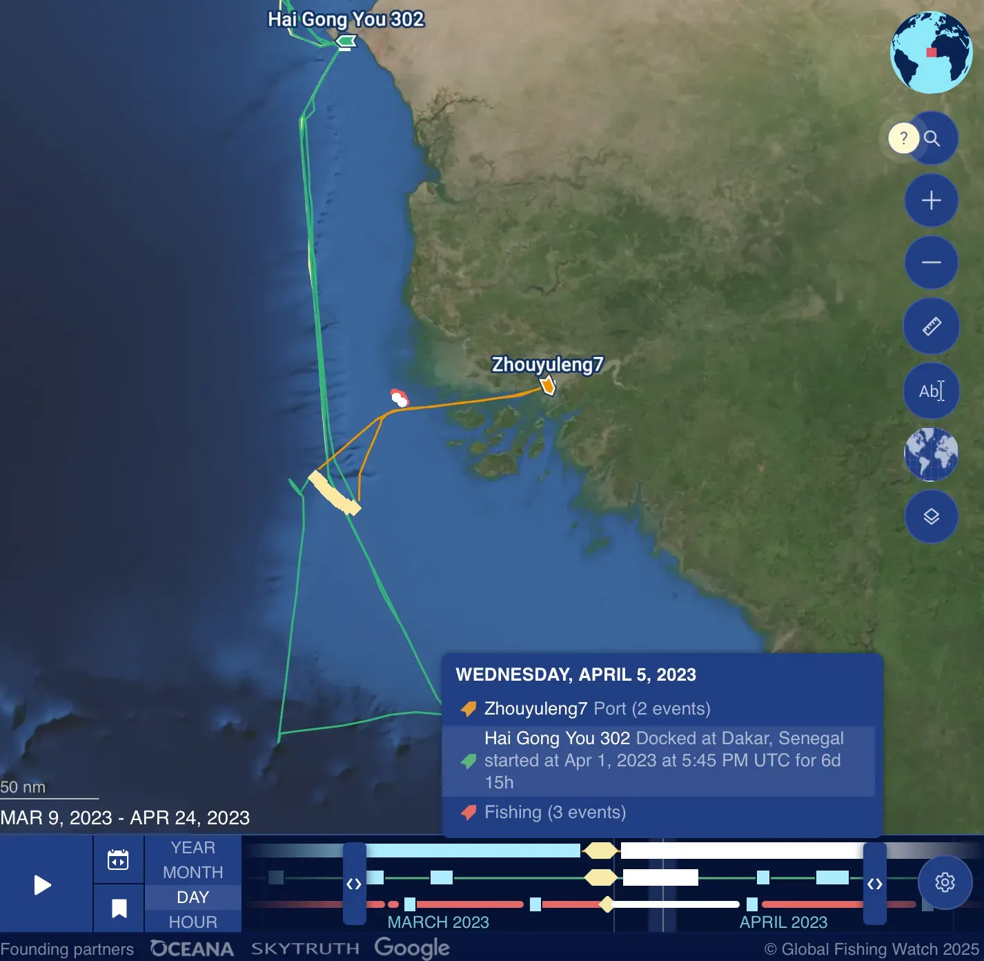
Looking at the track of the two vessels that came across our protagonist, it’s also interesting to see that one docked in Dakar, Senegal, while the other went to Bissau, Guinea-Bissau.
Port records
Port records (such as shipping manifests, customs declarations, or AIS vessel logs) reveal what cargo is entering and leaving countries. By analyzing them, journalists can identify where commodities come from and where they are heading, expose discrepancies, and verify trade routes in depth. Journalists can also get a better understanding of a country or a certain context.
That’s why we’re now shifting the focus of the toolkit. As a Brazilian, I find it deeply frustrating that the federal government (through its environmental agency, Ibama) has recently approved exploratory oil drilling by Petrobras, the majority state-owned petroleum company, near the mouth of the Amazon River.
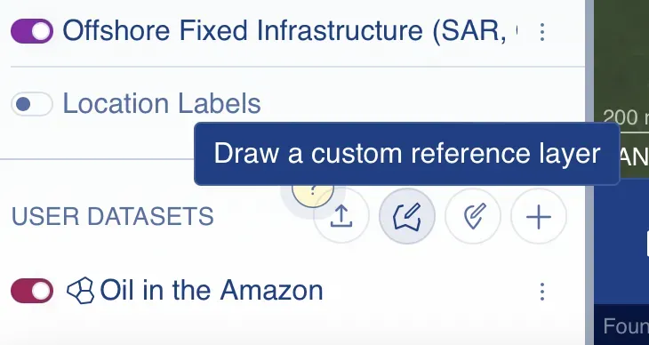
To see the vessel activity around the area and understand it better, I went to Global Fishing Watch, scrolled all the way to the bottom and created my own polygon to monitor. It’s under the “User Datasets” section, then you click “Draw a custom reference layer.” See below:
After I had created my polygon, I wanted to understand the busiest ports in the area, so I filtered by that:
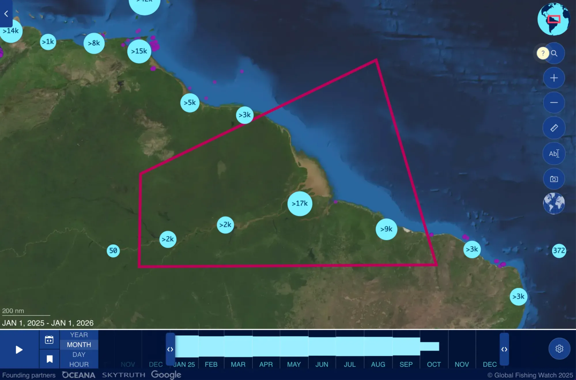
Ironically enough, Belem, the city chosen to be the host of COP30 (the UN's annual climate summit where member countries negotiate climate change agreements) has one of the busiest ports of the area.
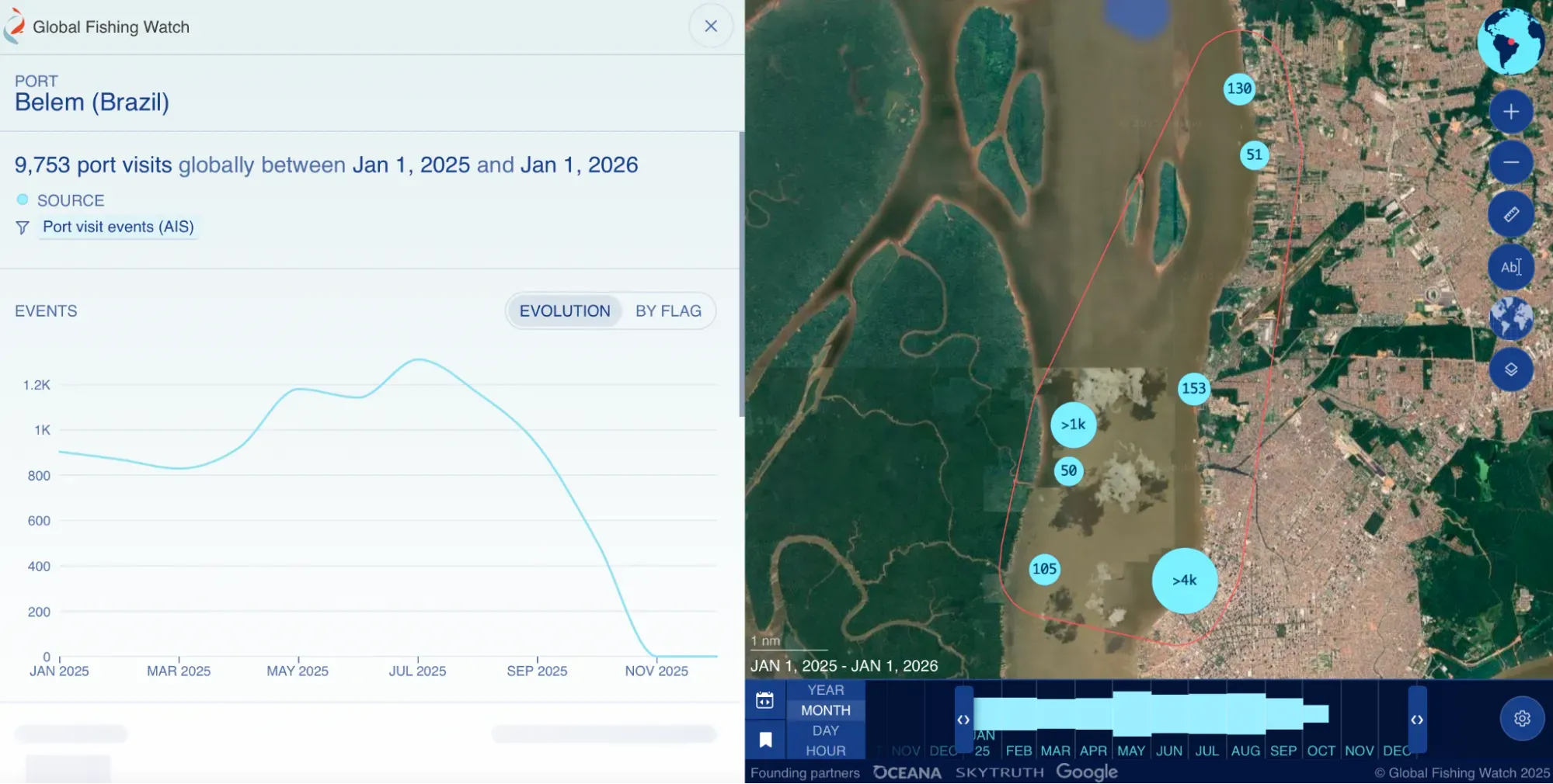
Now, what else can we find out about the port? The first thing to figure out is: Who is the port authority? In this case, it’s a government entity called Companhia Docas do Pará. This is important because now we can do some Google search operators (dorking) to find documents related to them.
Here you can find all of their public procurement data. This is a document outlining their whole operation and last updated in 2024. This document shows the main ports of the state of Pará.
And there’s more: If you scroll down, you will see that they give specific information about the type of trade that each port is responsible for. They say: “The port units complement each other in meeting the needs of exporters and importers, with each port having its own specialization.
- Port of Belém: For general cargo, containers, and solid bulk (wheat);
- Miramar Terminal: For liquid bulk (petroleum derivatives);
- Outeiro Terminal: For solid agricultural bulk and goods that use coastal shipping;
- Port of Vila do Conde: For serving the aluminum hub, solid mineral bulk, liquid bulk, containers, live cargo, and goods that use coastal shipping;
- Port of Santarém: For solid agricultural bulk, general cargo, containers, and liquid bulk.
This is gold for journalists. Let’s say you want to investigate soy that is being exported from the Brazilian Amazon. You will know that, at least in the state of Pará, the Outeiro Terminal and Port of Santarém are your go-to places to investigate further. With this information, you can calculate the soybean harvest date and monitor the ships that pass through these ports at certain times of the year. You can also track their final destination.
With all of this information handy, let’s see what else we can find with Google search operators:
- site:cdp.com.br filetype:pdf "Belém" - helped me find the Development and Zoning Plan; the Emergency Action Plan; and the port Environmental Assessment.
- site:dados.gov.br "porto" "Belém" filetype:csv - helped me to look for government-published datasets related to the local port authority.
- Looking up information about CDP, I realized that all of their uploads followed the same URL: https://www.cdp.com.br/wp-content/uploads/YEAR. So I wanted to check out 2025 and that’s why I typed: site:cdp.com.br inurl:"/wp-content/uploads/2025/" filetype:pdf. As always, interesting information popped up:
- The complete list of almost 600 people that work for CDP.
- The 2025 list of tender processes.
- The products exported from Vila do Conde, another port area that is also administered by CDP.
Ship registries
Tracking registries is just as critical as monitoring port records, because they reveal who owns, operates, and controls the world’s ships.
When looking into a specific country, the first thing you need to ask yourself as a journalist is whether the country’s register is open or closed. When a country has an open registry, they allow foreign-owned vessels to use their flag. Most countries have closed registries, which means they require vessels to be owned locally to keep profits within the country and make it easier to enforce fishing regulations.
Another interesting question to ask: How does fishing legislation work there? For that, The Outlaw Ocean has a great database where you can filter by country to learn more about their marine policies. If you want to dive specifically into registries, the International Maritime Organization's Global Integrated Shipping Information System (free) provides official shipping records.
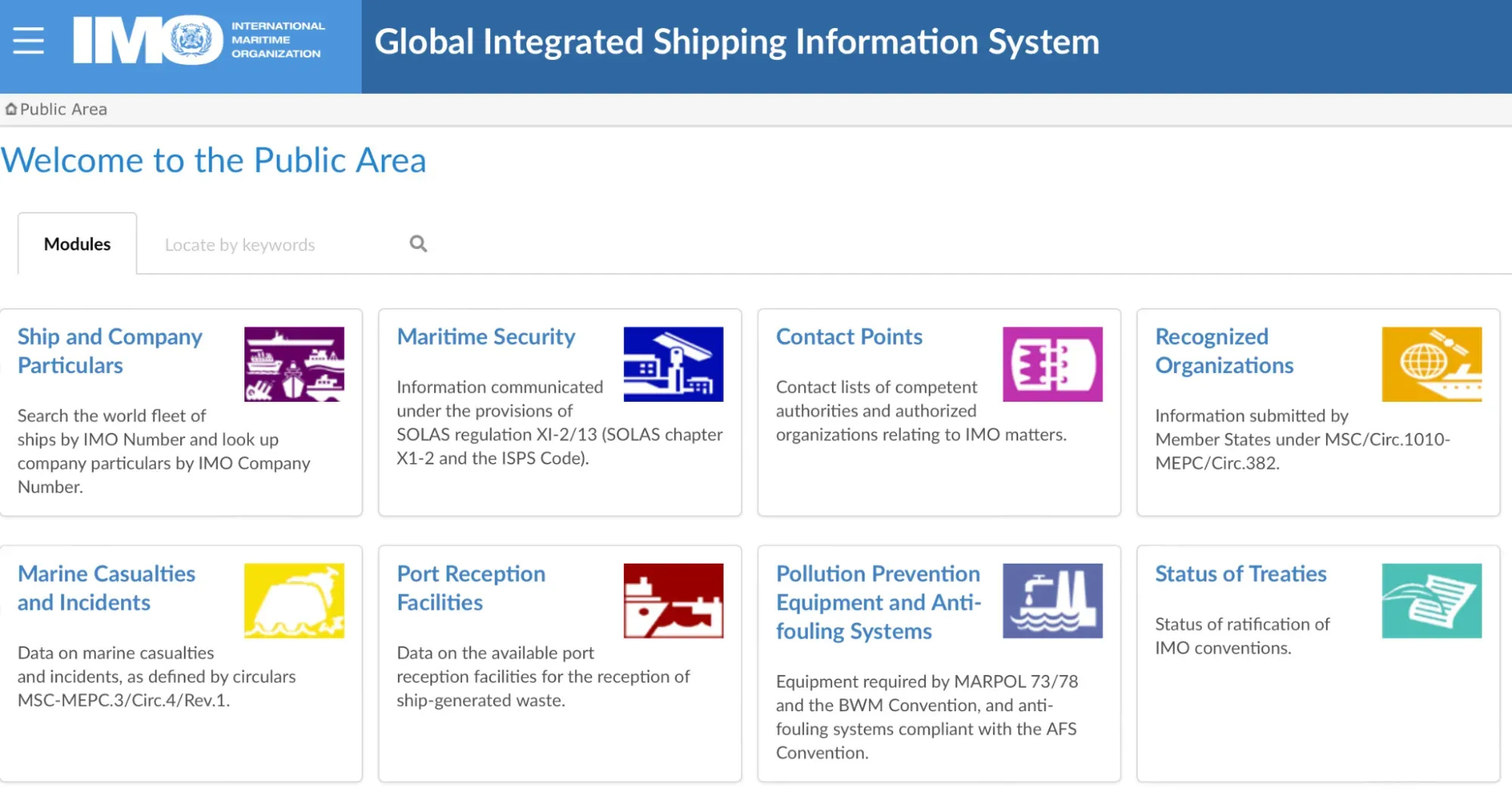
Brazil has two registry systems: the Ownership Registry (for Brazilian-flagged vessels) and the Special Brazilian Registry (REB—for certain foreign vessels). Luckily, Brazil is a very transparent country, so we have open information about its ships. You just need to look at the “Open Data” platform and download the dataset that says “Marinha do Brasil - Embarcações” which translates to 'vessels.'
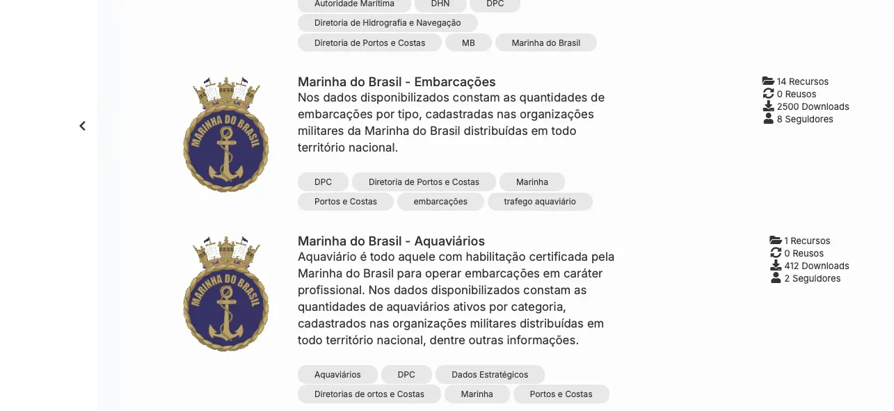
Knowing what websites contain the data that we need and how to use Google dorks to extract the best information from them is always the best way to go.
- site:marinha.mil.br/dpc filetype:pdf : Here you can see a list of all vessel accidents reported to the Brazilian navy in the year of 2025.
- site:marinha.mil.br/dpc filetype:pdf intext:"proprietário" OR intext:"armador" OR intext:"navio" OR intext:"embarcação" : will tell us how foreign vessels should behave in Brazilian waters.
Again, this toolkit is running long! If you use a platform or technique that I did not cover in this second part, please send it my way! I’m always happy to learn new research methods. You can reach me at [email protected].