Story
 July 6, 2021
The Water’s 'Coming In’: How Grand Isle Residents Are Coping As Their Home Washes Into The Sea
Country:


Since the 1930s, Louisiana has lost approximately 2,000 square miles of land along its coastline...
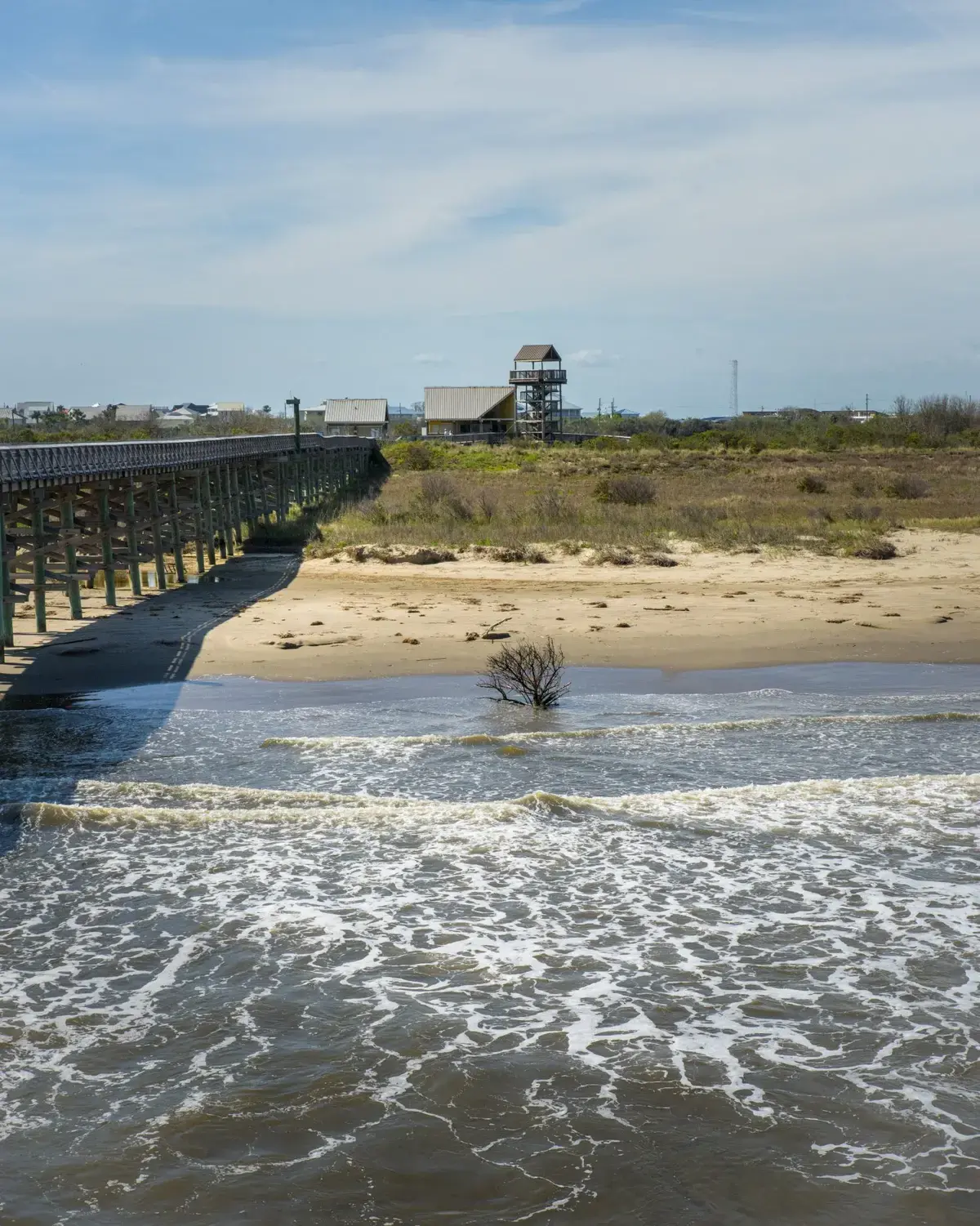
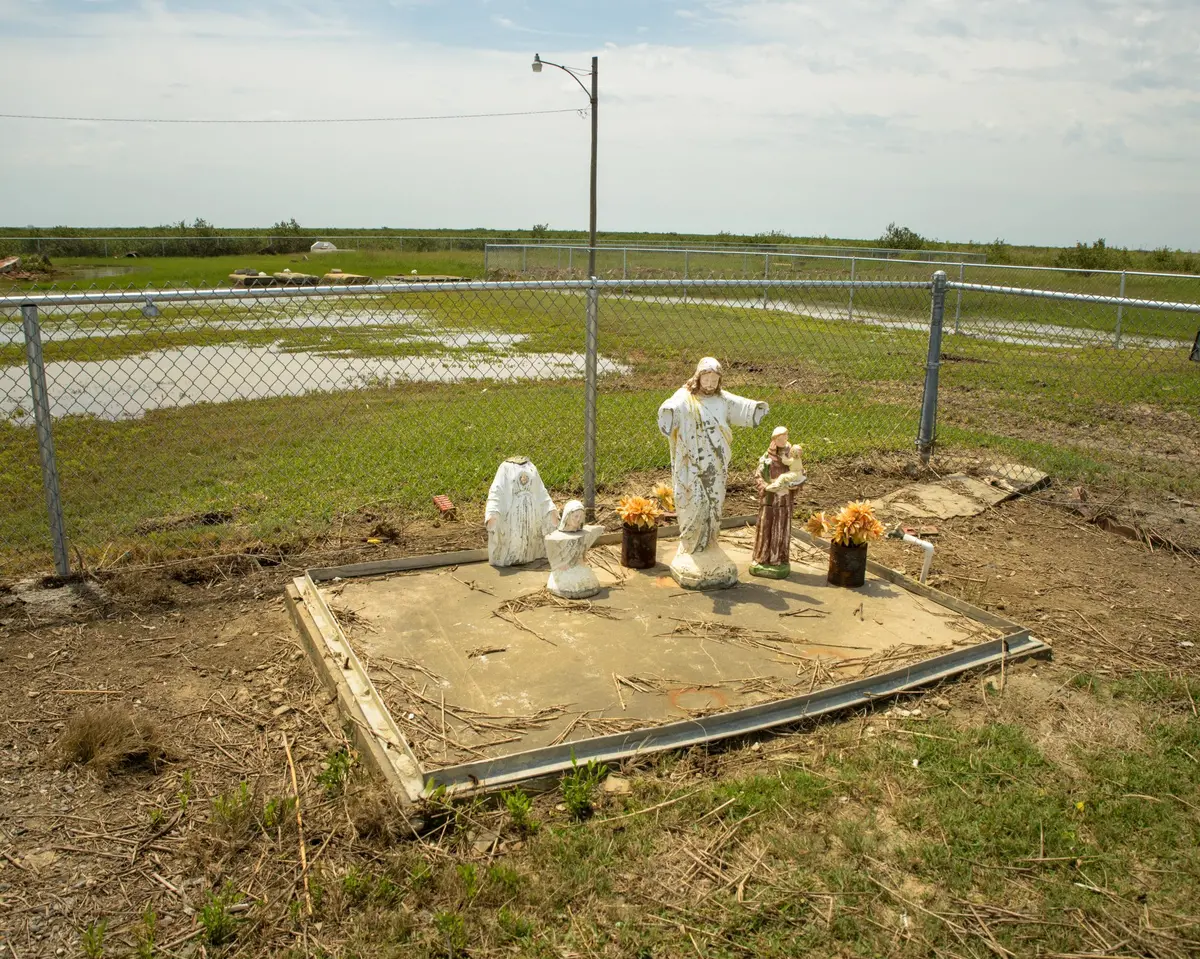


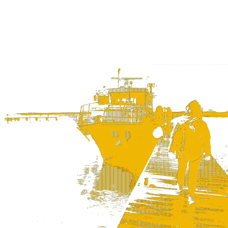
Jean Landry sits on her covered porch, 16 feet above ground. Hummingbirds hover just below her face as she sips her morning coffee. Half a mile away, the Gulf of Mexico laps against Grand Isle’s shores. On most days, the slow pace of life on Louisiana’s last inhabited barrier island fills Landry, 74, with peace. There’s only one road in and one road out, a remote paradise to the community of fewer than 1,500. Like the rest of Grand Isle’s full-time residents, Landry lives on “island time.”
But that carefree phrase has taken on a grimmer cast as hurricanes and rain storms have intensified and the land sinks into the rising sea. Landry and some of her neighbors consider: How much time do Grand Isle and Louisiana’s 20 other disappearing barrier islands have?
“What used to be 100-year storms became 50-year storms. Now, they’re 10-year storms, and sometimes, they don’t even give us 10 years in between,” said Landry, a conservationist. After Louisiana faced six tropical storms and hurricanes in 2020, she knows it’s related to climate change. “It’s here, and it’s a real thing. We’re seeing it; we’re living it.”
Across the Gulf Coast, humans live and recreate on dozens of barrier islands, from Mississippi’s Ship Island to Florida’s Santa Rosa Island, home to Pensacola Beach. These narrow, sandy spits are the first line of defense against storm surge for ecosystems and inland coastal communities such as New Orleans.
But compared to those protecting Mississippi, Alabama and Florida, the barrier islands of Louisiana are unstable, disappearing at a faster rate and becoming more costly to maintain.
This is largely because levees built in the first half of the 20th century to tame the Mississippi River cut off the Barataria Basin from the once-wandering river’s periodic dispersal of sediment. Wetlands in the bay began disappearing, accelerating erosion and subsidence on the islands.
Since 1947, when Landry was born, relative sea level at Grand Isle has risen by more than 2 feet, according to the National Oceanic and Atmospheric Administration, or NOAA. As the climate warms, the Army Corps of Engineers projects the water will rise faster, another 1 to 2 feet by 2050.

As a nonprofit journalism organization, we depend on your support to fund more than 170 reporting projects every year on critical global and local issues. Donate any amount today to become a Pulitzer Center Champion and receive exclusive benefits!
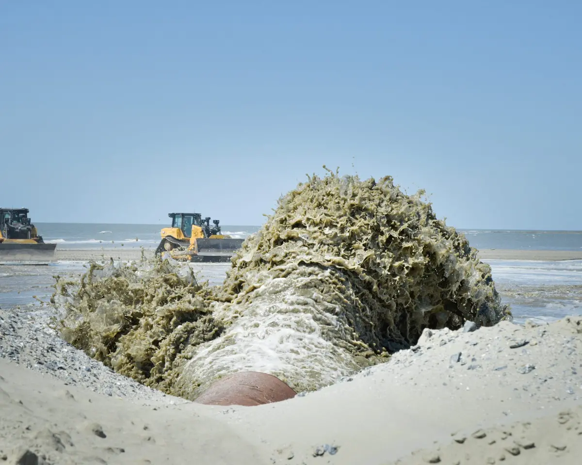
Since the 1990s, the state and federal government have spent hundreds of millions of dollars on the temporary salvation of Louisiana’s barrier islands, restoring them with sand pumped from offshore. It’s a monumental effort that aims to help not only the people living on or near them, but those living in the more populated coastal parishes they protect—similar to how speed bumps slow traffic headed into residential areas.
It can seem futile at times, but what choice is there? Adam Ledet, construction manager for the Louisiana Coastal Protection and Restoration Authority, or CPRA, considered it as he stood on land built by the state on Trinity-East Island in Terrebonne Parish. “These islands are expensive, but they’re cheaper than the alternative,” he said.
Without them, Louisiana would lose its shield against the Gulf of Mexico’s powerful forces that would push and pull against interior wetlands until they disappear.
“Once you lose barrier islands, you have increased erosion on the inside, you have flood damage in coastal towns and even moving into larger cities along the coast. … You’d have to shut down some of these inland ports that can no longer protect or sustain themselves,” he said. “Once you add all the effects of not having these islands here, it’s suddenly feasible to restore these even though they have high price tags.”
On Grand Isle, last names such as Chighizola, Lefante and Cheramie go back more than two centuries. Landry’s children are the ninth generation in her husband’s line to grow up there. These families sailed with Jean Lafitte in the early 1800s after he settled on Grand Isle and on Grand Terre, to the east. Indigenous tribes were transient residents before European settlers’ arrival. For decades, Grand Isle’s economy centered on fishing and agriculture, especially cucumbers. At one time, the island was known as the “cucumber capital,” as the vegetable drew the highest profit and was grown en masse by Grand Isle island farmers and sold in New Orleans’ French Market.
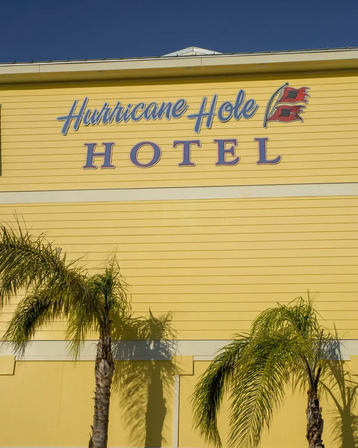
The community evolved to support more recreation and tourism; large farmhouses transformed into hotels. With World War II came jobs in oil and gas exploration, an industry that has since migrated to Port Fourchon, about 15 miles to the west. Today, tourism and hospitality serve as the island’s economic engines, as thousands flock there during the summer.
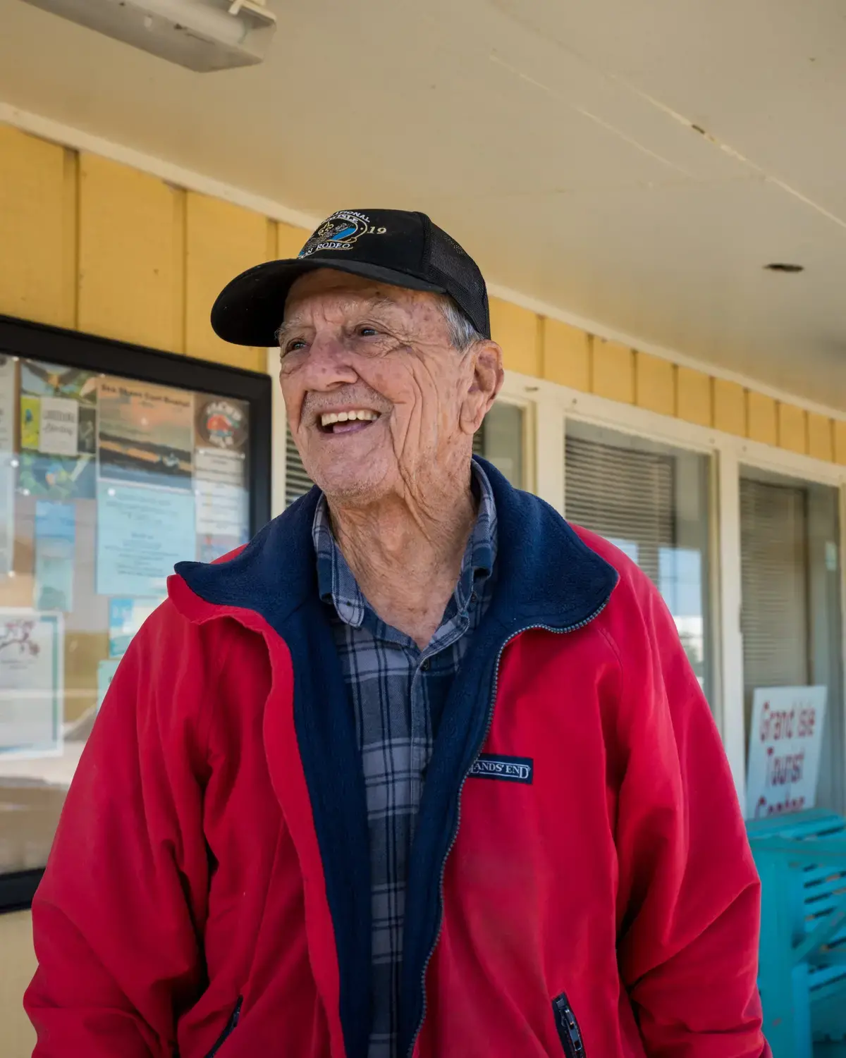
Through all those changes, Grand Isle residents faced fearsome gales and hurricanes head-on, staying in place as the wind kicked up. “We were storm riders,” said Ambrose Besson, one of the island’s oldest residents at 88. “When we had a hurricane, no one would leave; we would just ride it out.”
The community has outlasted its neighboring settlements. Hundreds of people stayed on nearby Isle Derniere, or Last Island, with wealthy Louisianans treating it as a resort. Almost 2,000 people lived on the Cheniere Caminada headland, just northwest of Grand Isle. Villages dotted Barataria Bay’s marshes and the southern tip of what would become Plaquemines Parish. Powerful storms wiped each of them off the map.
Grand Isle nearly suffered a similar fate when a 1909 storm killed more than 300 people, according to Louisiana State University research. But those who survived returned to rebuild.
Subsequent generations continued to defy the odds, but it’s gotten harder and harder. Though Hurricane Betsy in 1965 leveled many of Grand Isle’s homes and businesses, Besson said it was far more expensive to rebuild after Katrina in 2005 after the price of materials increased and building codes changed.
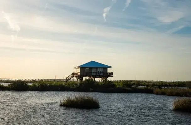
At one time, Besson’s house was elevated 4 feet off the ground. Now he uses an elevator to get to his living quarters, which, like Landry’s, are 16 feet up.
Storms aren’t the only challenge. Few jobs on the island remain, and those available often don’t pay enough to cover the cost of living, where hefty insurance premiums make it expensive to rent or own a residence. More and more young people move away, settling farther up Bayou Lafourche. They can’t afford to stay.
Between the 2000 and 2010 censuses, the population declined by 230 people, a drop of about 16%. Of the 143 students who attended Grand Isle School in October 2019, nearly two-thirds were considered economically disadvantaged.
With a tourism-dependent economy, tensions sometimes arise between newcomers—wealthy retirees living in gated communities or along the beachfront —and island natives living more modestly near the bay side.
“They come to try to change things with us, you know, it’s like somebody come telling you how to live in your house,” said Grand Isle Mayor David Camardelle.
Despite the struggles, Besson, Landry and other longtimers have hope. “I think this island will be here for a long time,” Besson said, eyes shining.
“It was here when I was a kid. I’m 87 years old, and it’s still here, and I’ll be here another 20 years for sure,” he said before his 88th birthday in April.
Barrier islands don’t always last, though. A few miles to the west of Grand Isle, south of Cocodrie, wooden pilings covered in algae poke above the water’s surface where Pelto Island once existed. Erosion and the lack of new sediment drove the island under, according to geologist Alex Kolker. The wetlands surrounding Lake Pelto converted to open water.
“This is an area that used to have more land than water 100 years ago,” Kolker said.
Globally, barrier islands form in a variety of ways. They’re often in chains, separated from the mainland by tidal creeks, bays, and lagoons. In Louisiana, Grand Isle and its neighbors represent a river delta in decline. As the Mississippi River flailed back and forth across what is now south Louisiana, it sprayed sediment like a firehose, creating land and wetlands in the process. Each time the river changed course, it left behind a stretch of land that would recede without consistent sediment nourishment. Those areas became barrier islands—lonely strips that slowed the ocean’s waves and allowed wildlife to thrive in the calmer, brackish bays behind them.
The lifespan of a barrier island depends on its surrounding conditions. Storms push up water that weakens their mass and creates breaches. Eventually, they become a submerged pile of sand, or a giant shoal, but geologists say the timeline is difficult to predict. As subsidence and erosion erase land, the loss accelerates. Louisiana islands tend to retreat inland as wind blows sand into the sea and narrows them, according to Kolker.
“There’s not a particular hourglass that you can put on a barrier island. It just depends,” said Greg Grandy, the state coastal authority’s deputy director. “They’re very site-specific: where it is and the processes that are working on it and the geological forms that are out there.”
Despite several geologists advocating for barrier island restoration in the 1980s, it wasn’t until the passage of the federal Coastal Wetlands Planning, Protection and Restoration Act in 1990 that a plan was put in place. Money started to flow into rebuilding the islands protecting Louisiana’s coast about four years later. Still, the program didn’t get significant funding until BP began making payments for its 2010 Deepwater Horizon oil disaster, a windfall that allowed the state to pump sand from miles away onto some of the islands to widen and elevate them. Without those projects, many of the coast’s islands would be a few active hurricane seasons away from drowning.
April Newman, a CPRA project manager, said these restoration projects aim to extend barrier islands’ lives by 10 to 20 years. She compares island nourishment to caring for a garden amid a drought.
“It hasn’t ‘rained’ in a really long time, so we have to continue to water it every so often so that the garden doesn’t die,” she said. “If you wait too long in between waterings, you may not have a garden to water anymore.”
Grand Isle saw federal investment in its protection well before any other Louisiana island, receiving help as early as 1976, when the Army Corps of Engineers built a levee along the island’s length to protect residents from the Gulf side. The Corps spent $25 million to upgrade it in 2009.
Battered regularly by storms, the levee often requires repair. Last year, Tropical Storm Cristobal’s surge punched a hole in the levee on Grand Isle’s western end and left the community especially vulnerable in the middle of hurricane season. The CPRA spent more than $7 million to widen the beach to its 1980 footprint after the weather settled, but that will last only about 13 years before it needs more nourishment, Grandy said.
Restoring barrier islands the next time might be more difficult. With all of the restoration going on along the coast to protect it from sea level rise, Grandy said Louisiana is depleting its sources of high-quality sand, driving up construction costs.
“The next big challenge is finding amounts of sand that are nearshore that are available to use for projects,” he said.
Efforts to place sand and fix portions of the levee damaged by 2020’s storms will continue in the near term, Grandy said, adding that there hasn’t been talk of moving people off the island. The CPRA is working with the Army Corps to expedite the process for making repairs in the future after significant delays last year.
To Grand Isle residents living on the frontlines, the idea of retreat is unfathomable. The mayor’s focus remains on maintaining the island’s width and ensuring residents have an escape route from major storms.
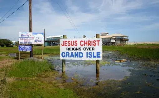
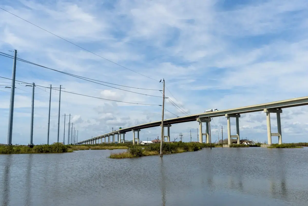
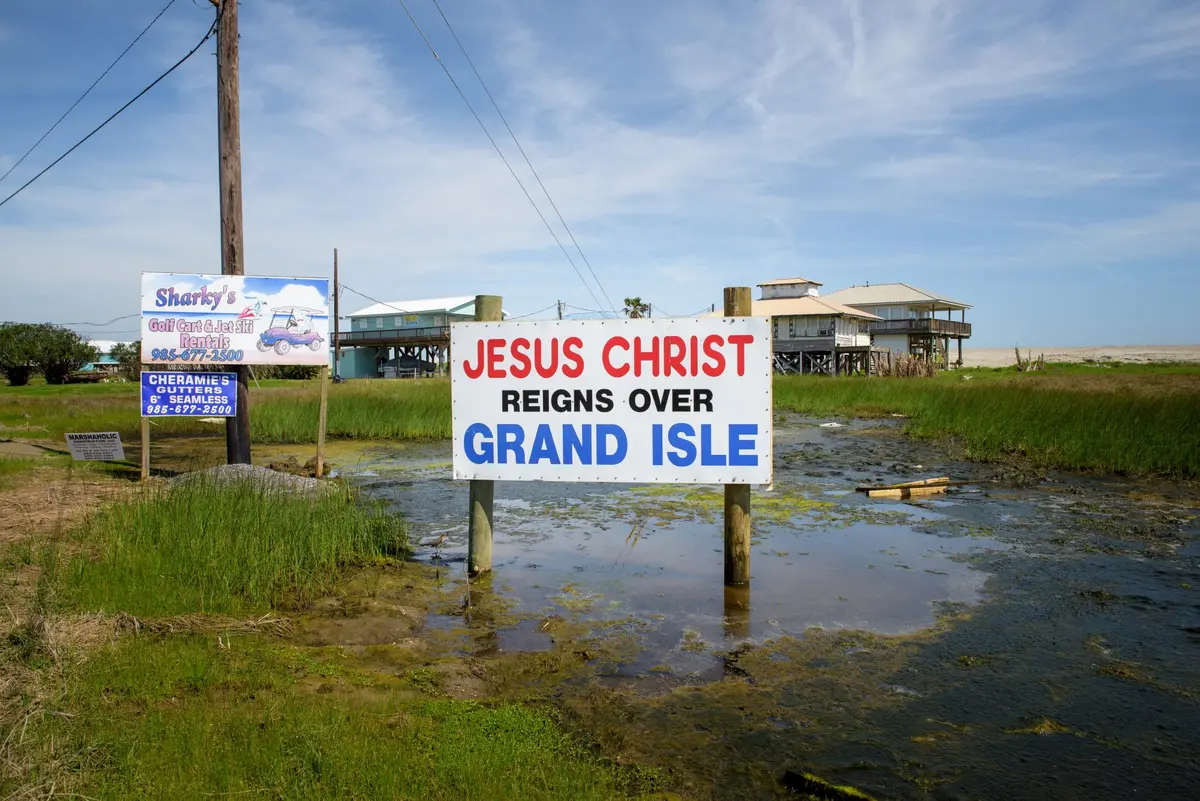
“We’re finding that there’s more water coming in. No matter what, the high tides are getting worse,” Camardelle said. He wants to add breakwater rocks to slow waves and allow sand to build up, and to see La. Hwy. 1 elevated to give residents more time to evacuate. The highway is the only road, and it floods often with storms. Strong winds can flood the access road, cutting the island off.
Lan Tivet hopes a long-term solution is found—and soon. She’s 30 and serves on the town council. She wants to secure the island’s future for at least another five decades. Her family moved to the island when she was in third grade, and she doesn’t plan on leaving.
“I am very concerned that Grand Isle will not be here in 50 years,” at least not in its current state, she said. “I don’t know how we can sustain what we’re doing if we don’t get the help we need in order to make sure that you can have a road to actually get to Grand Isle.”
Halle Parker is an environment reporter for the Times-Picayune | The New Orleans Advocate in Louisiana.
Virginia Hanusik is a photographer whose work focuses on architecture, landscape, and climate change. She is based in New Orleans, Louisiana.
 View this story on NOLA.com | The Times-Picayune | The Advocate