Project November 14, 2025
The Coming Floods: Predicting Climate Hazards in the Himalayas
Country:

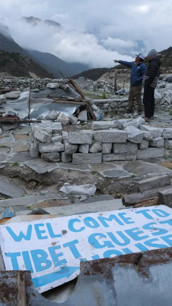
On August 16, 2024, just after noon, a wall of water careened down a mountain slope and slammed into the Sherpa village of Thame, in Nepal’s Solokhumbu district, damaging five lodges, a school, a health clinic and at least a dozen homes. Fortunately, nobody died. The last time a flood poured through Thame, nearly 40 years earlier, the community wasn’t as lucky. Twelve people died then as they were swept away along with livestock, several homes, trails and a nearly-completed hydroelectric power facility.
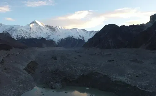
Thame's floods came without warning because they were triggered not by rainfall, but by the unexpected release of meltwater stored inside glacier lakes perched high above the village. It a flood hazard that is becoming increasingly common across the Himalaya as soaring temperatures are melting glaciers down into massive, unstable lakes.
For this reporting project, freelance photojournalist Jason Gulley works with The New York Times to follow an international team of glaciologists as they trek through Nepal’s Mt. Everest region to catalog and map lakes that are forming on glaciers as they melt – and to measure how soon they might violently drain and flood. Along the way, he documents the stories of people in remote communities like Thame who have lived through these terrifying floods, making the human stakes of this research clear.