Story
 November 12, 2025
‘Street Is Lake, Urgent!’ Mapping Reveals Flooding Blind Spots in South Florida
Country:


Project
Floods of Trouble
There is a culture of secrecy behind property-level flooding information in Florida, the state with...
When the rain comes in South Florida, the frantic flooding complaints quickly follow to mayors, commissioners, public works departments, just about whoever will listen:
Like this: “How is it possible that every time it rains a little more than normal this street gets flooded this way?!? Is there nothing the city can do to help this particular street?????”
Or this: “During the last heavy rain, many houses and cars were completely flooded, resulting in total loss of property such as cars, motorcycles, furniture, clothes … This is an unsustainable and unfair situation for the residents of the area, who pay their taxes on time and expect quality basic services in return.”
Or this: “Streets are flooding! Turn on the storm drain pumps!”
Or this: “Street is lake, urgent!”
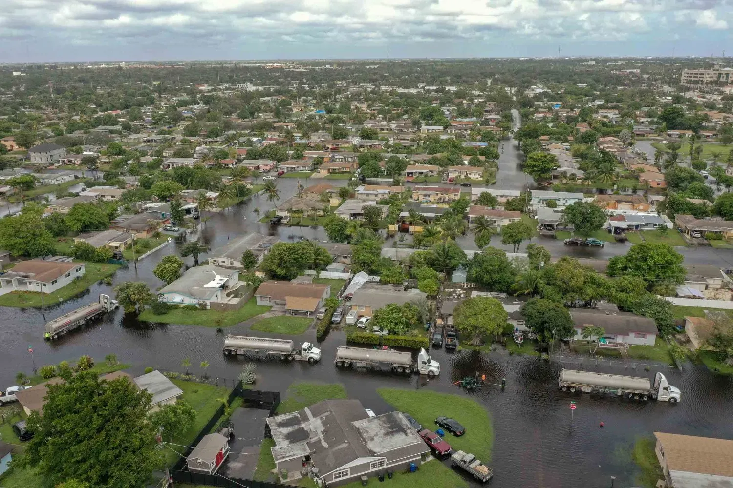
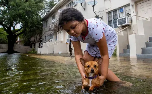
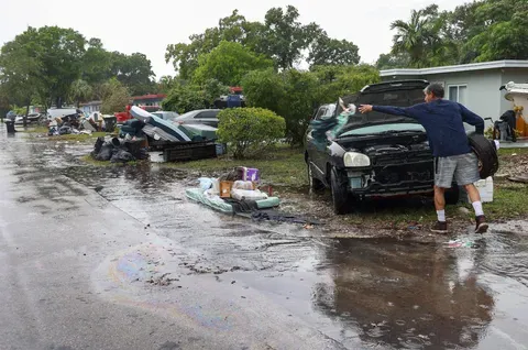
Those actual complaints are just a sampling of the thousands filed by residents who have found themselves with swamped and stalled cars, soggy and moldy homes or driving down a street so deep underwater they’re uncertain if it’s safe to cross.
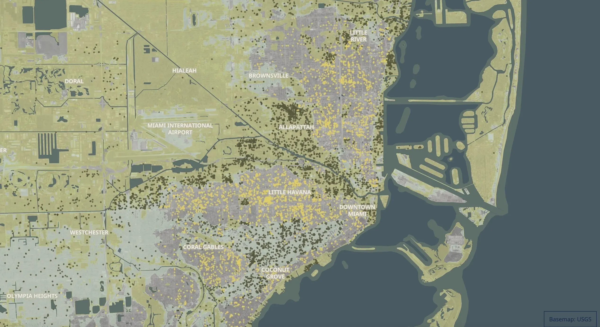
Nearly a decade of records examined by the Miami Herald show flooding is far more widespread than previously known across South Florida, revealing clusters of complaints in areas that federal flood insurance zones classify as at little to no risk of flooding. The record points to problem areas that are largely untracked and unknown, except to the residents who must deal with it.
But no city, county or state agency publicly documents residential flood complaints, a Miami Herald investigation found, or provides the public with mapping of neighborhoods with reported flooding histories. The Herald, using the best available data — 16,569 flood complaints from more than 12,000 locations in Miami-Dade and Broward over the last 11 years — has put together the most comprehensive maps of documented flooding to date.

As a nonprofit journalism organization, we depend on your support to fund more than 170 reporting projects every year on critical global and local issues. Donate any amount today to become a Pulitzer Center Champion and receive exclusive benefits!
But these, too, admittedly provide only a partial picture and almost certainly underestimate the problem.

That’s because lots of flooding is never reported to any agency. And to further muddy the waters, The Herald found, there are no standards for flood complaints, so it can be difficult to separate dangerously impassable streets from typical ponding after heavy rains. Some listed flood complaints are serious, like when waters breach a structure. Others might count a clogged drain on a street as neighborhood flooding.
And some communities don’t even document flood complaints — Monroe County, which covers the entire Florida Keys, and the village of Miami Shores, for instance. That means there are big data gaps not only on where flooding happens but also on how bad it is.
But, The Herald found, one thing is clear: Standard government-created maps often offer an incomplete — and potentially misleading — picture of the risk of flooding and damage that runs into the millions of dollars in South Florida every year, often without a tropical storm or hurricane. That means communities planning development and flood-protection projects may be underestimating risks, which will only rise with climate change, and home buyers making what is, for many, the biggest investment in their lives may be wading into a future flood of trouble.
“If you do not report your flooding, your community cannot deliver the solutions you need,” said Julia Kumari Drapkin, founder of ISeeChange, a company that crowdsources flood complaints and delivers them to city and county governments to help identify problem areas.
Anybody who has ever taken out a mortgage in South Florida has learned about flood maps. The maps, created by the Federal Emergency Management Agency in consultation with counties, are considered the gold standard of flood threat assessment, and really the primary source for home buyers, although third-party offerings like First Street Foundation’s Flood Factor tool are gaining ground.
Are you in a flood zone? You’ll need flood insurance, and you might flood. If you’re out, the thinking goes, you’re safe.
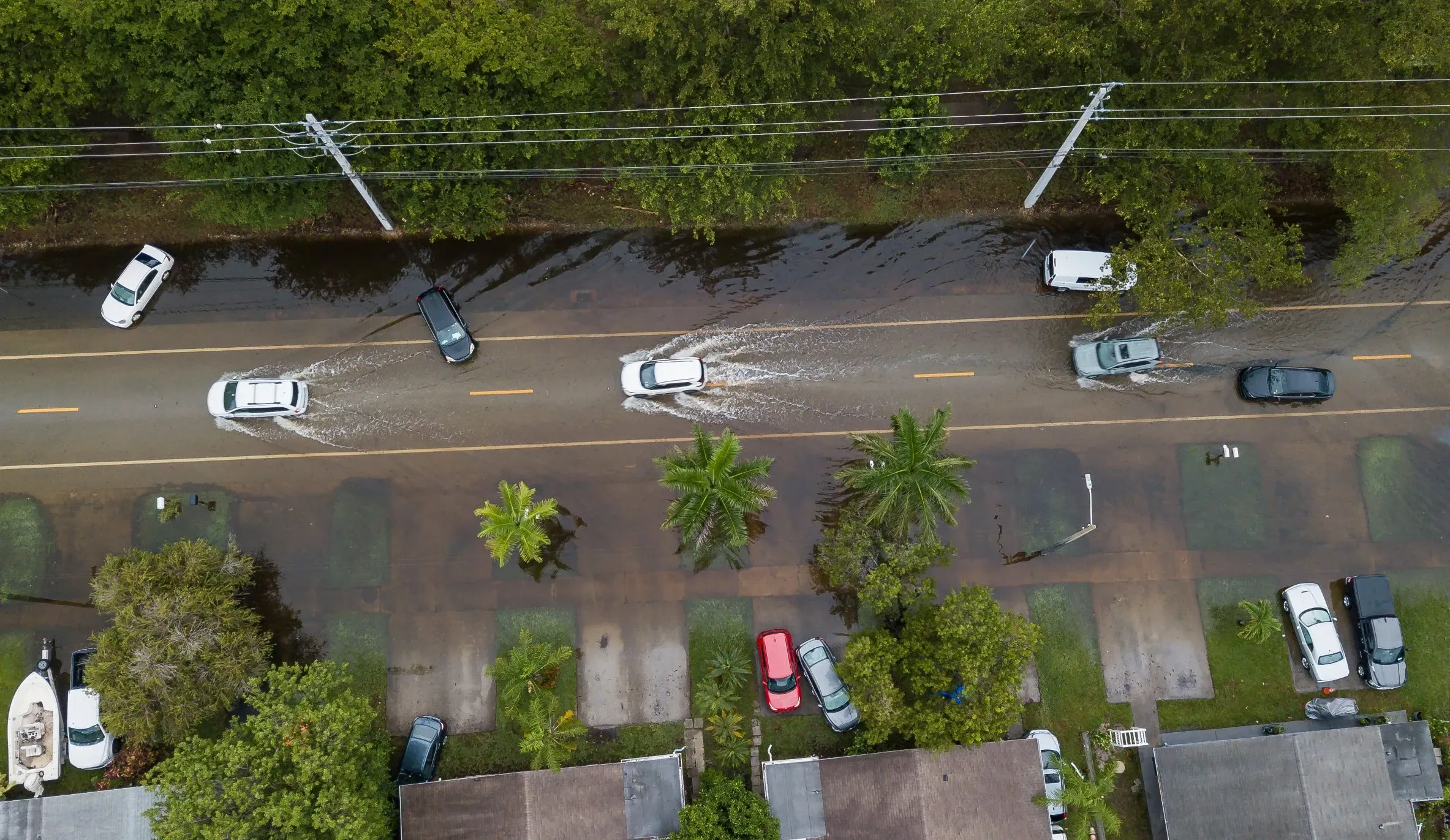
But the Herald analysis of records shows that a massive number of flood complaints in Broward and Miami-Dade happen outside of those lines.
These are the FEMA maps that most people are familiar with when it comes to buying or building in Florida. The 100-year maps indicate spots with 1% chance of flooding per year, considered at high risk. The 500-year maps indicate spots with a .2% chance of seeing a flood in a year, considered at moderate risk.
There were 14,155 reports of flooding in the data provided to the Herald from inside Miami-Dade County covering from February 2015 to February 2024. A vast majority were within the City of Miami.
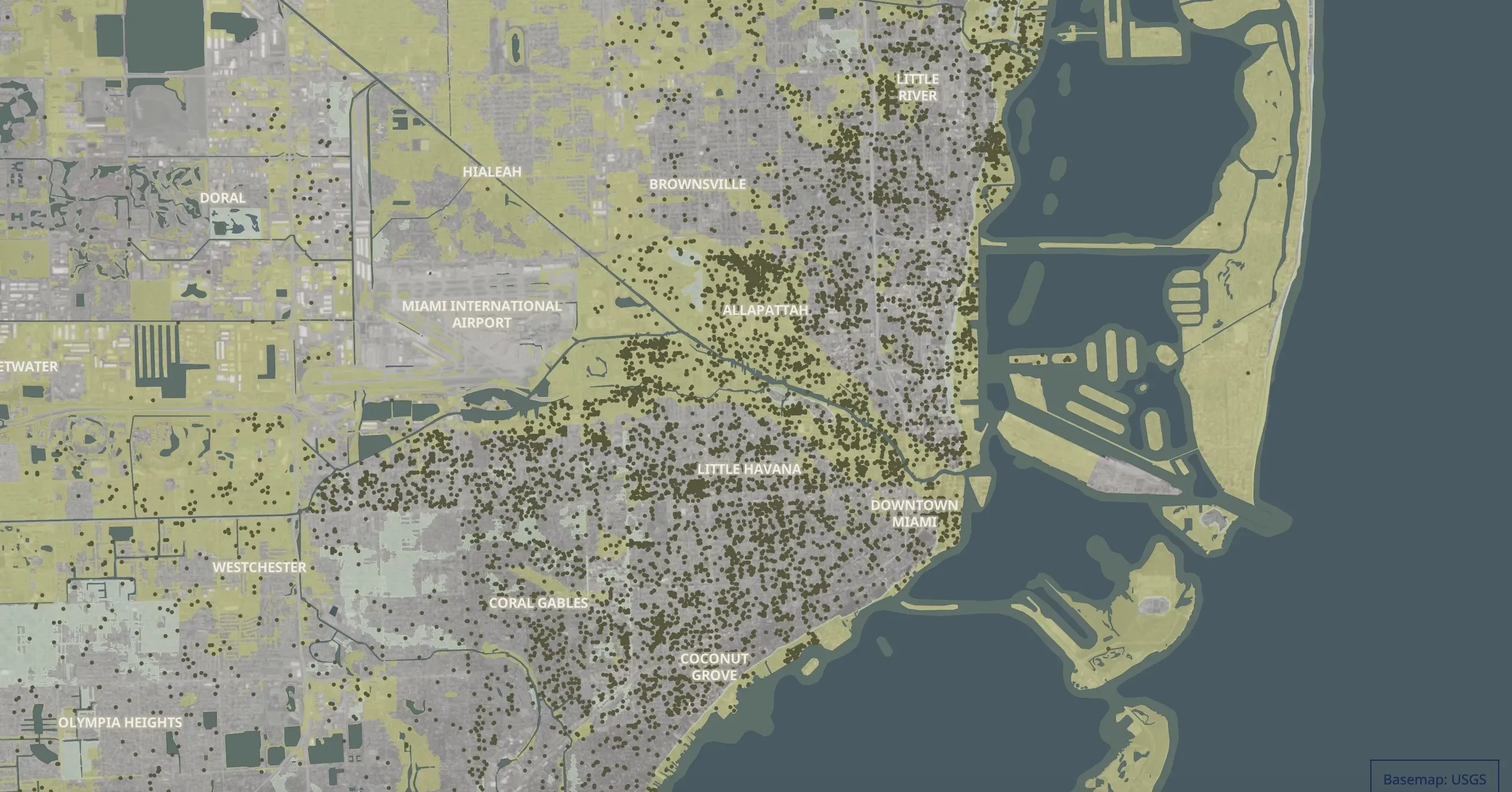
Staggeringly, nearly 60% of the reports were outside the FEMA-designated flood zones. That's over 8,000 flood complaints that were not located in the current flood zones in just a decade. (See the graphic "Reports in Flood Zones.")
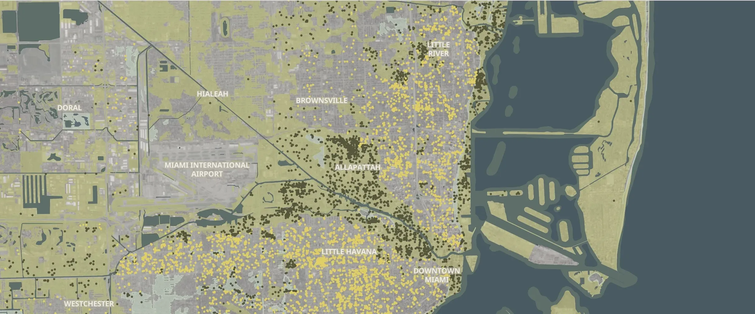
But even with the soon-to-be expanded flood zones highlighted here, the Herald still found regions with a large number of flood complaints outside of any formal flood zones. In those areas, residents could still face flooding but largely aren't required to buy flood insurance. (See the graphic "Reports in Preliminary Flood Zones.")
Miami-Dade has been updating those new FEMA maps for four years, and they could go into effect as soon as next year.
The new maps show more communities in flood zones, particularly in the Coral Way and Little River neighborhoods. More than 40,000 homes in Miami-Dade alone will be added to a high-risk flood zone, according to FEMA.
But, the Herald found, that still leaves thousands of people in spots that flood — even though they’re outside of formal flood zones.
Dangers outside of a flood zone
FEMA flood maps are most people’s main reference for the danger their home faces from future flooding. But plenty of people live in flood-prone spots that aren’t marked on even the most up-to-date maps — leaving them mostly in the dark when it comes to the risk of water seeping under their front door.
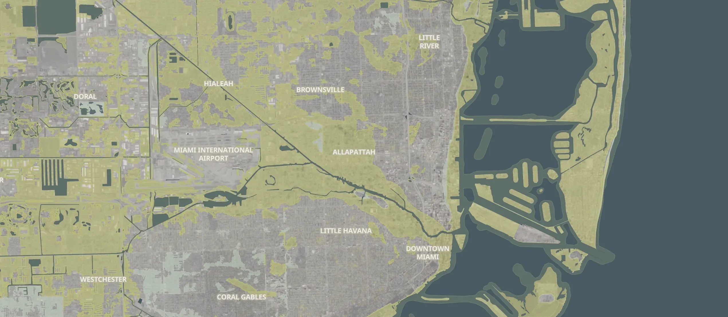
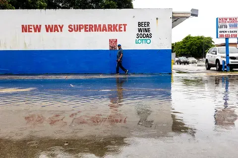
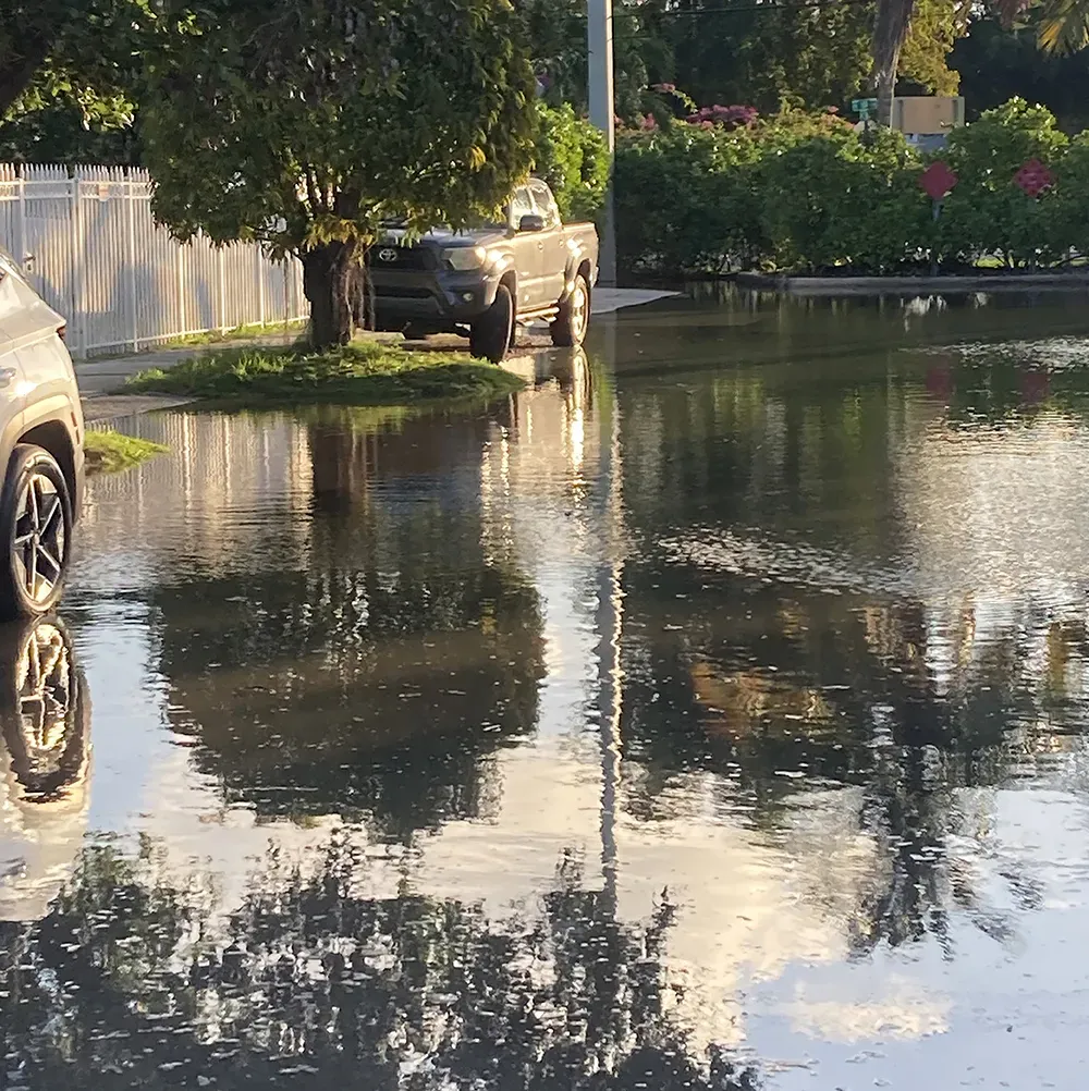
One such spot is Allapattah, where rainstorms can send several feet of water into low-lying houses and apartments, even outside an official flood zone.
As recently as early October, a few inches of heavy rain was enough to inundate streets and encroach on local businesses.
Allapattah
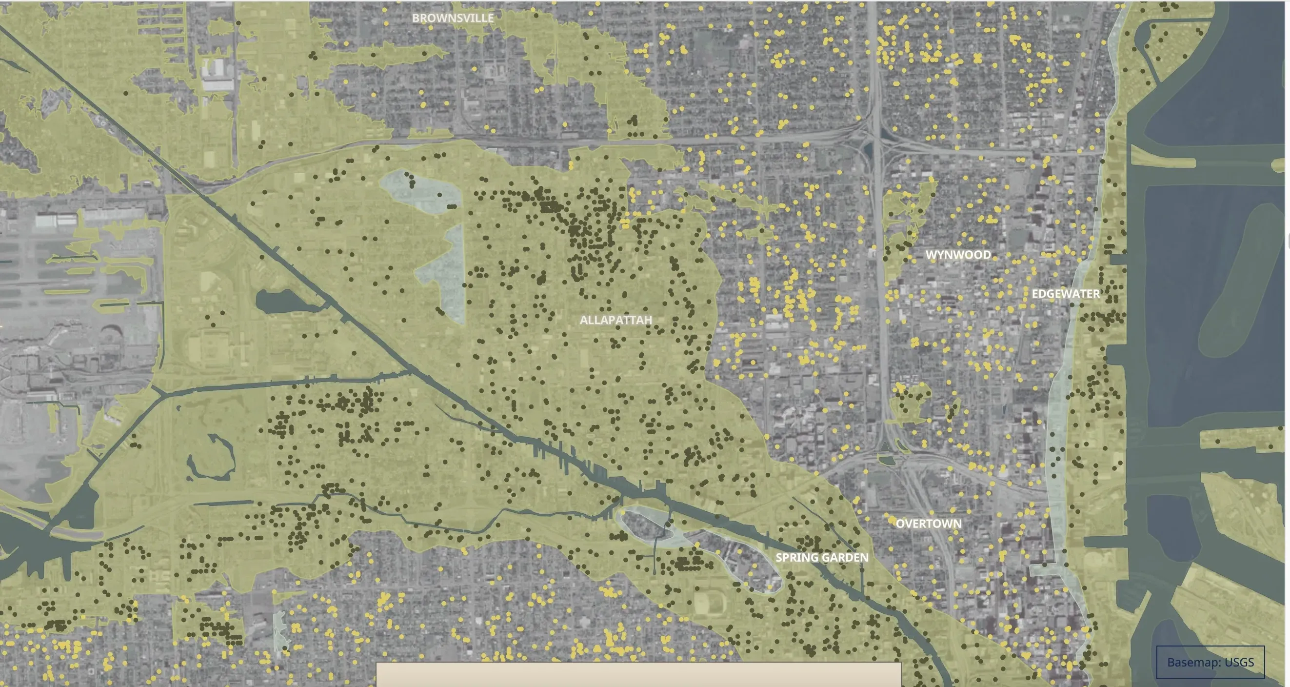
FEMA doesn’t consider some parts of Allapattah flood zones, but that doesn’t mean there aren’t regular floods.
“I put sandbags by the door, but water comes through anyway,” said Juan Benzant, a 40-year resident of Allapattah who has watched floodwaters get higher and higher in his inland neighborhood.
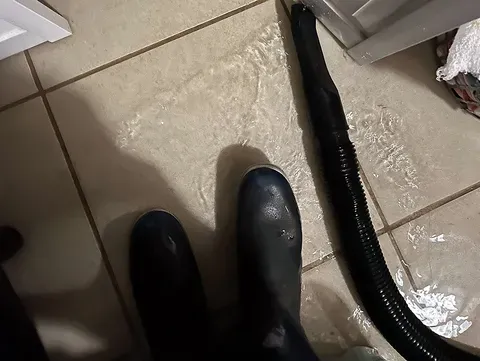
Benzant and his wife have lost a fridge and his cabinets to the frequent invasions of water, which happen whenever rainwater backs up on his street. “I’ve been thinking about buying a house somewhere else, but I like it right here,” he said. “I can walk to work.”
Benzant said he’s complained about his floods for years, but he’s not on the city of Miami’s list for places with flood complaints, and he isn’t in a FEMA flood zone. He wasn’t even on the city’s radar until a contractor, ISeeChange, noted his home as a potential flood hot spot with their AI-assisted technology.
Stories like Benzant’s aren’t public, so would-be home buyers or renters in his neighborhood would have no clear picture of the flood risk potentially awaiting them.
After years of pressure, Florida recently changed its laws, requiring sellers — for the first time — to warn buyers and renters if their property has flooded in the past. But some legal experts worry that it won’t be enforced, leaving potential buyers still in the dark.
FEMA keeps a list of all properties that have flooded repeatedly, at least those reported to the government through its flood insurance arm, the National Flood Insurance Program. But, as The Herald reported in the first installment of this series, it keeps that information secret. And the flood maps it produces using that information have long been dogged with complaints that they’re inaccurate and backwards-looking, not taking into account the increased flooding issues climate change is bringing.
Mike Sukop, a professor at Florida International University who researches flooding in South Florida, called it “depressing” that even scientists — much less homebuyers — can’t access this information.
“We don’t have the information. You can’t make our models reliable without that groundtruthing. That’s what we need,” he said. “This whole recognition that it’s being kept secret from us is devastating.”
Unmapped, out of sight
FEMA maps aren’t the only way to track where it has and hasn’t flooded. Some local governments track flood complaints and map them, like the city of Miami and Miami-Dade County, but that information is not made easily accessible to the public. For instance, those flood complaints may help form a city’s stormwater masterplan, which helps identify where new drainage needs to be installed, but not in a way where a would-be homeowner could find out if their potential new home is on a street with a bevy of complaints.
This map of South Florida flood complaints is incomplete for many reasons, namely because some local governments simply don’t keep track of which spots flood. And sometimes, neighboring cities have different policies for tracking flood complaints, leading to a patchwork map of flood problems.
El Portal and Miami Shores
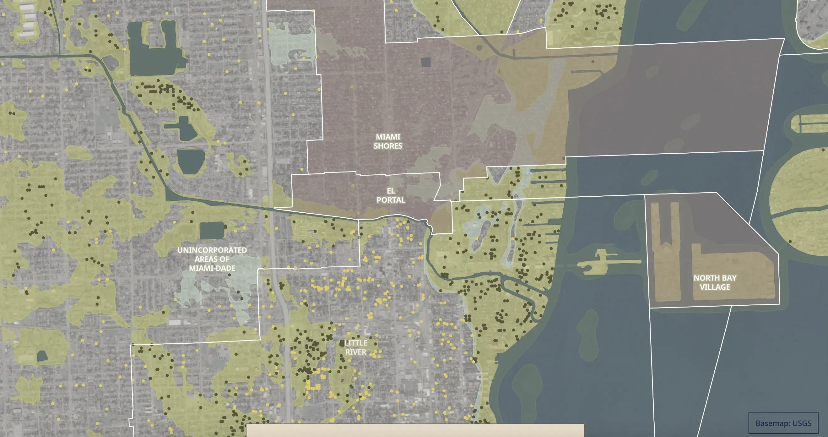
El Portal told the Herald it does not collect resident flood reports, despite “chronic flooding.” It's not the only municipality that doesn't track flood complaints. Miami Shores, the site of a massive drainage project, did not respond to multiple requests for flood complaints.
And yet, these spots clearly flood. This photo from ISeeChange reflects a swamped street in El Portal after King Tide flooding in November 2024.
Omarr Nickerson, the mayor of El Portal, said his residents regularly complain about flooding in the city. When king tides rise and heavy rains fall, some septic tanks back up into homes, creating a foul fountain. “Every year, they have to come out of their pocket thousands of dollars to fix their septic tanks from the damage,” he said.
Nickerson stockpiles sandbags for his residents and applies for every grant he can find to stave off flooding, but he says there’s a lot of work to be done still. “Their garages are flooded, their crawl spaces are flooded, their homes are flooded. It's not good,” he told the Herald.
Miami Shores also has its own problems with encroaching flood waters, an issue that led to federal funding for a multimillion-dollar project to help protect canalfront homes.
A rare window into bad floods
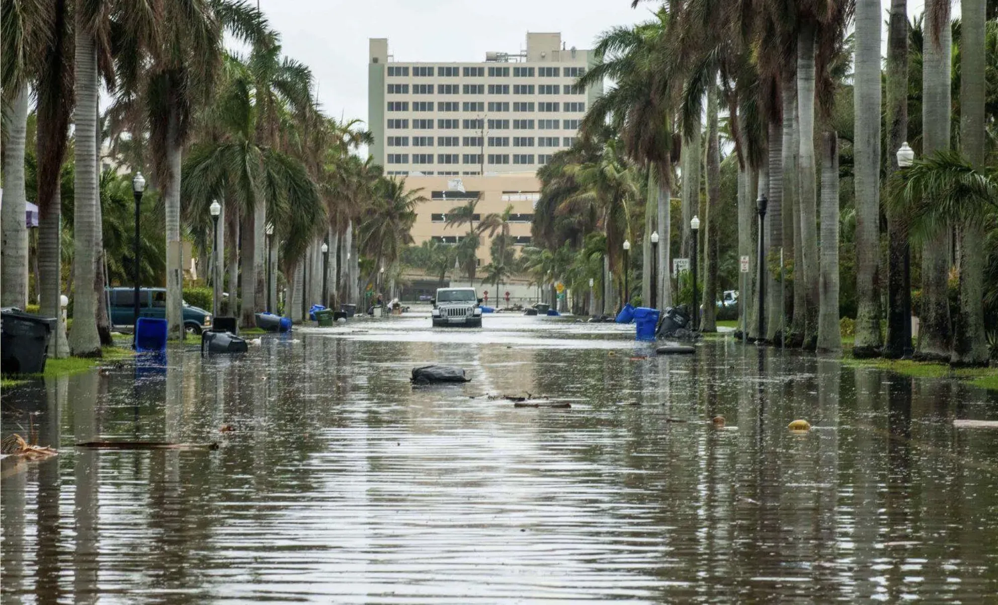
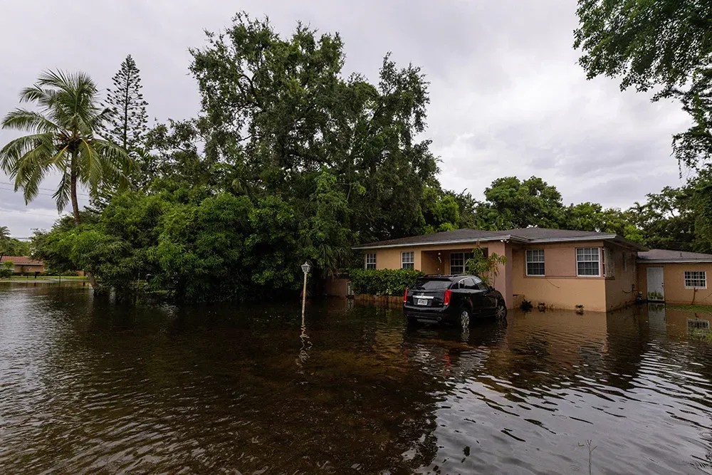
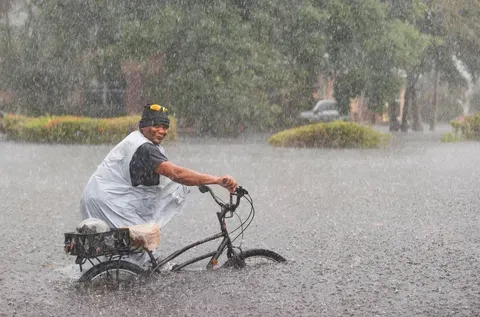
Incomplete mapping makes it difficult to get a sense of how common flooding actually is in any one neighborhood. But an extreme event in Fort Lauderdale in 2023 offers a window into how bad a single, terrible flood can be.
When 25 inches of rain fell in 24 hours in Fort Lauderdale, it swamped runways at the airport, inundated roads, cars and houses. Lots of houses.
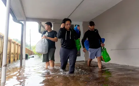
In a bid to get FEMA to reimburse them for some of the damages, the city committed to a meticulous count of every flooded house in one neighborhood. It posted the details of these flooded properties in a publicly accessible database in a rare case of transparency. It revealed widespread damage.
Within city limits, Fort Lauderdale found more than 1,100 homes with “severe damage” — more than 18 inches of water inside a home, and more than 300 with minor damage. The city later revoked public access to that map of ruined homes.
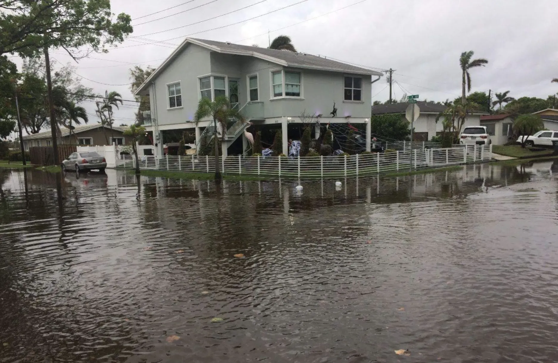
Edgewood
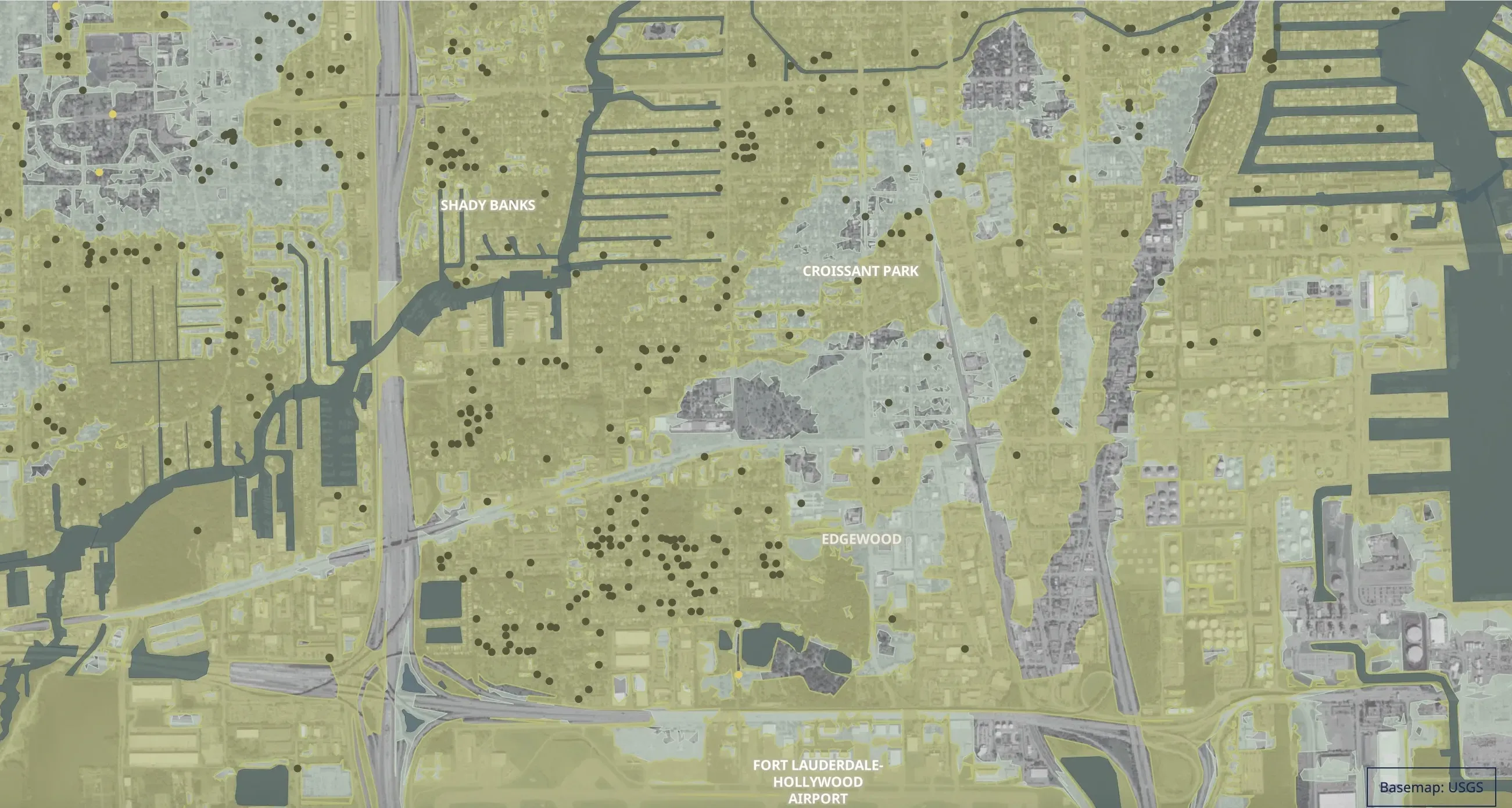
In the particularly hard-hit neighborhood of Edgewood, floodwater crested three feet in some homes. In this small area alone, the city counted 118 flooded properties.
Residents in Edgewood have submitted complaints — and pictures — of how the extreme flood affected them. “I never saw nothing like that, inside my house is flooding about 5 in of water.. Really bad…, ” one person reported.
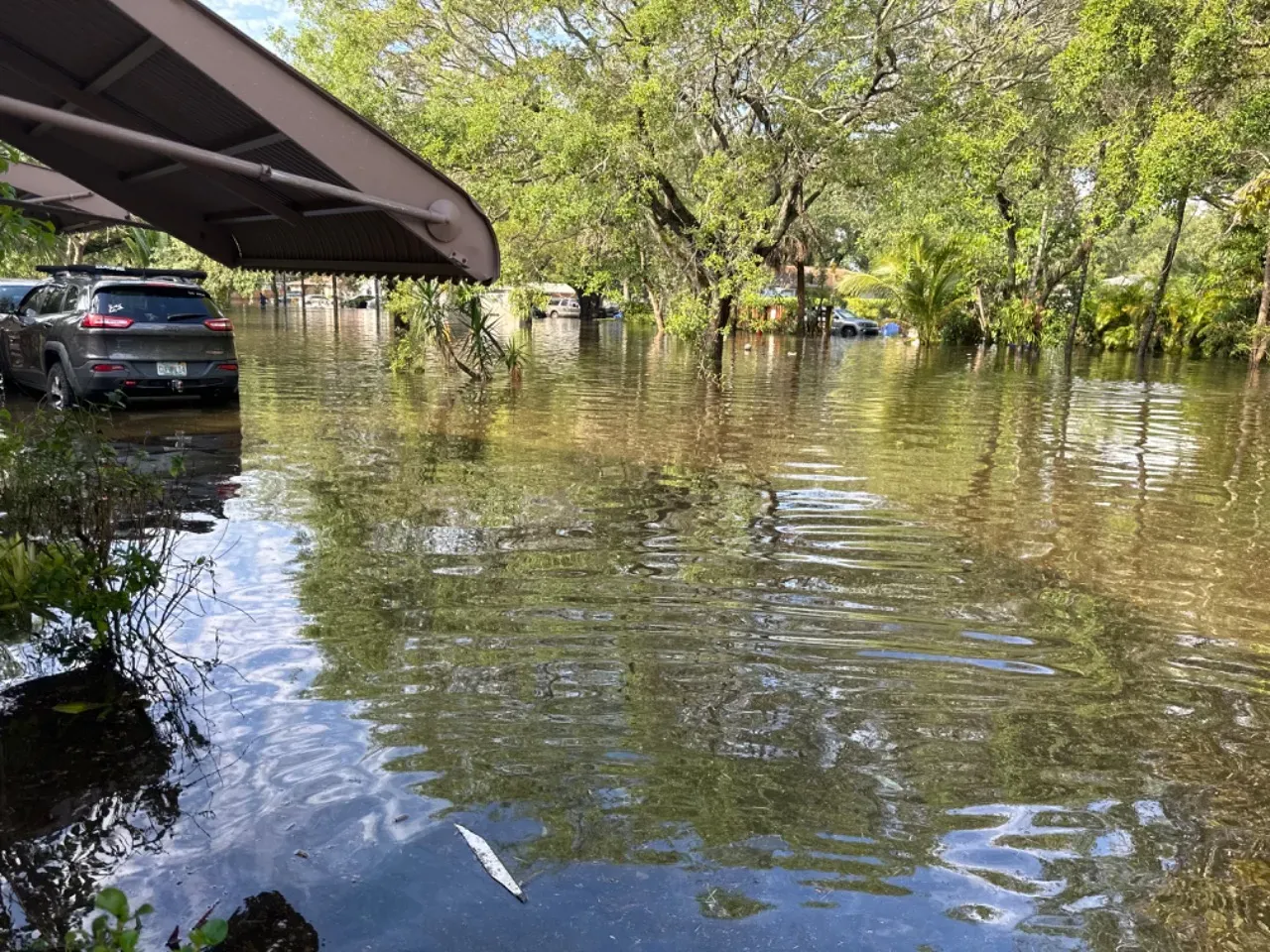
The water rose so high that some neighbors in nearby Tarpon River posted handmade ‘no wake’ zones to encourage drivers to stop pushing waves of water into their homes. One resident said: “Sewer drains toilets won’t flush/drain. Elderly people stuck in homes without functioning bathrooms.”
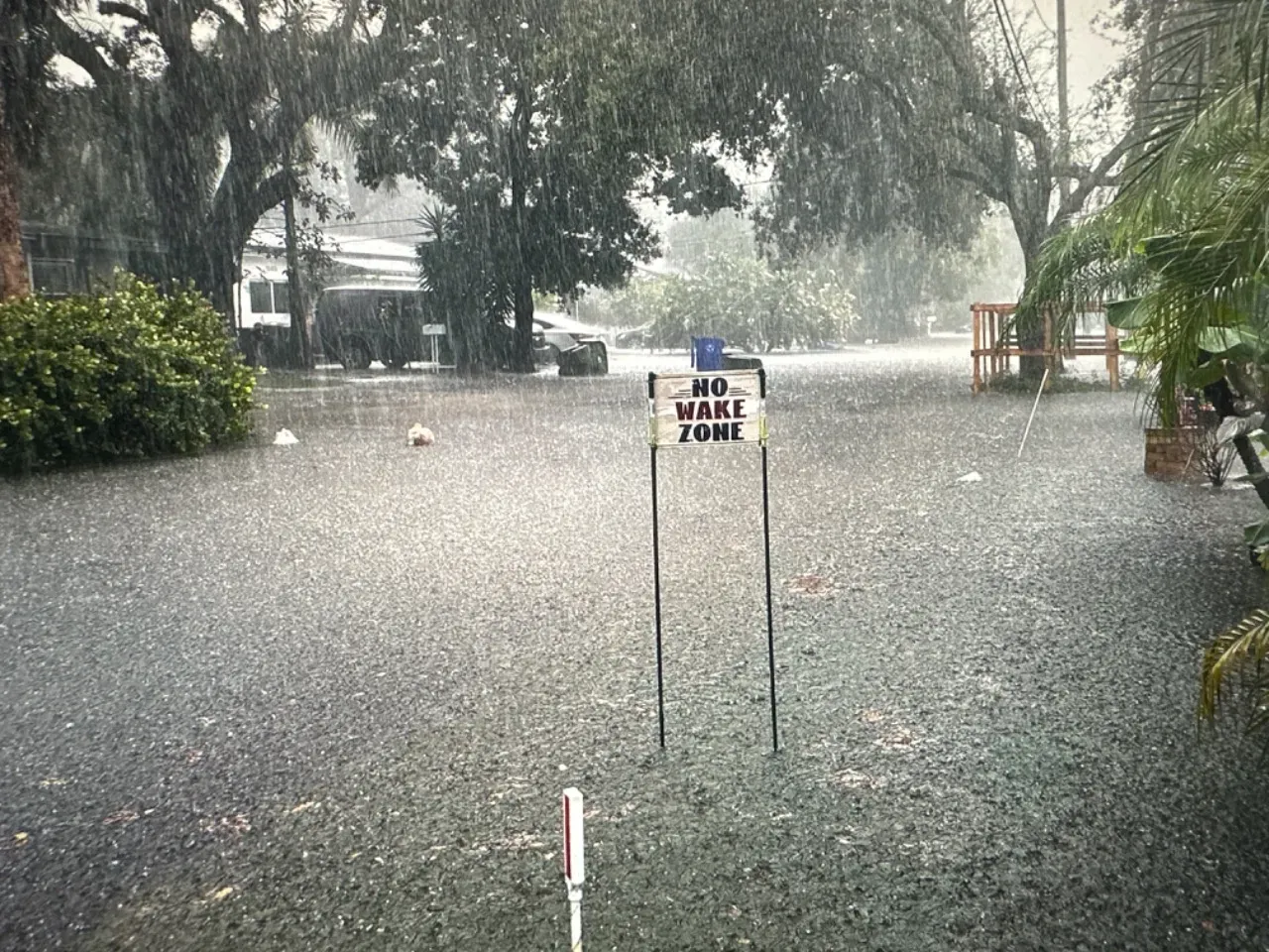
The 2023 flood was so severe that some residents gathered for annual memorials of the event. Two years later, some people are still waiting for repairs.

Scientists say flooding could worsen
Experts classified the massive flood in Fort Lauderdale a “1-in-1,000 year event” and city officials said building drainage abilities to be able to handle that much rain was unrealistic. But a growing body of research suggests that climate change is likely to make floods like that more common.
Sukop, the FIU flood researcher, said it’s already playing out in coastal spots in Miami-Dade and Broward Counties. That’s thanks to a quirk of South Florida’s geology, where the entire region is perched on holey rock that does little to stop the rise of groundwater, which Sukop’s research has shown is rising on pace with sea level.
“In areas where the sea level rise is raising the groundwater table, which could be pretty far inland in Miami, we don’t know what the limits are on that,” he said. “It can rise pretty freely, basically.”
The conclusion, he said, is that without further investment in elevating and protecting homes and roads and businesses in South Florida, flooding is likely to get more common and worse.
“It’s getting worse with sea level rise,” he said. “We can say that.”
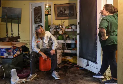
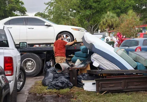
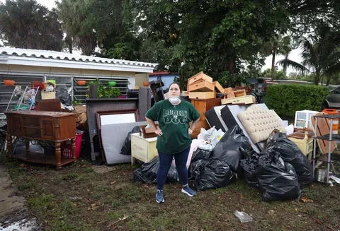
Image by Carl Juste/Miami Herald. United States.
Credits
Susan Merriam | Data Journalist
Alex Harris | Environmental Reporter
Matias J. Ocner | Photography
Ashley Miznazi | Photography
Daniel A. Varela | Photography
Carl Juste | Photography
Curtis Morgan | Editor
Carolina Zamora | Audience Engagement
Adrian Ruhi | Audience Engagement