

This project explores both the innovative and traditional strategies farmers in southern Zambia are...
Read "When the River Runs Dry in Lusitu, Zambia" in the January, 2023 edition of The Commons, published by the Nelson Institute for Environmental Studies at the University of Wisconsin, Madison.
Their parents were forcibly displaced by a colonial dam project in 1958. Now, the residents of Lusitu, Zambia, rely on traditional knowledge to grow food in the face of climate change.
Twenty years ago, the village of Lusitu was much like other towns in southern Zambia. It baked in the bright, cloudless skies that dominate the dry summer months from August to October and found relief in the rains that consistently fell between late November and early April. The Lusitu River flowed year-round and served as a lifeline for agriculturalists and pastoralists alike.
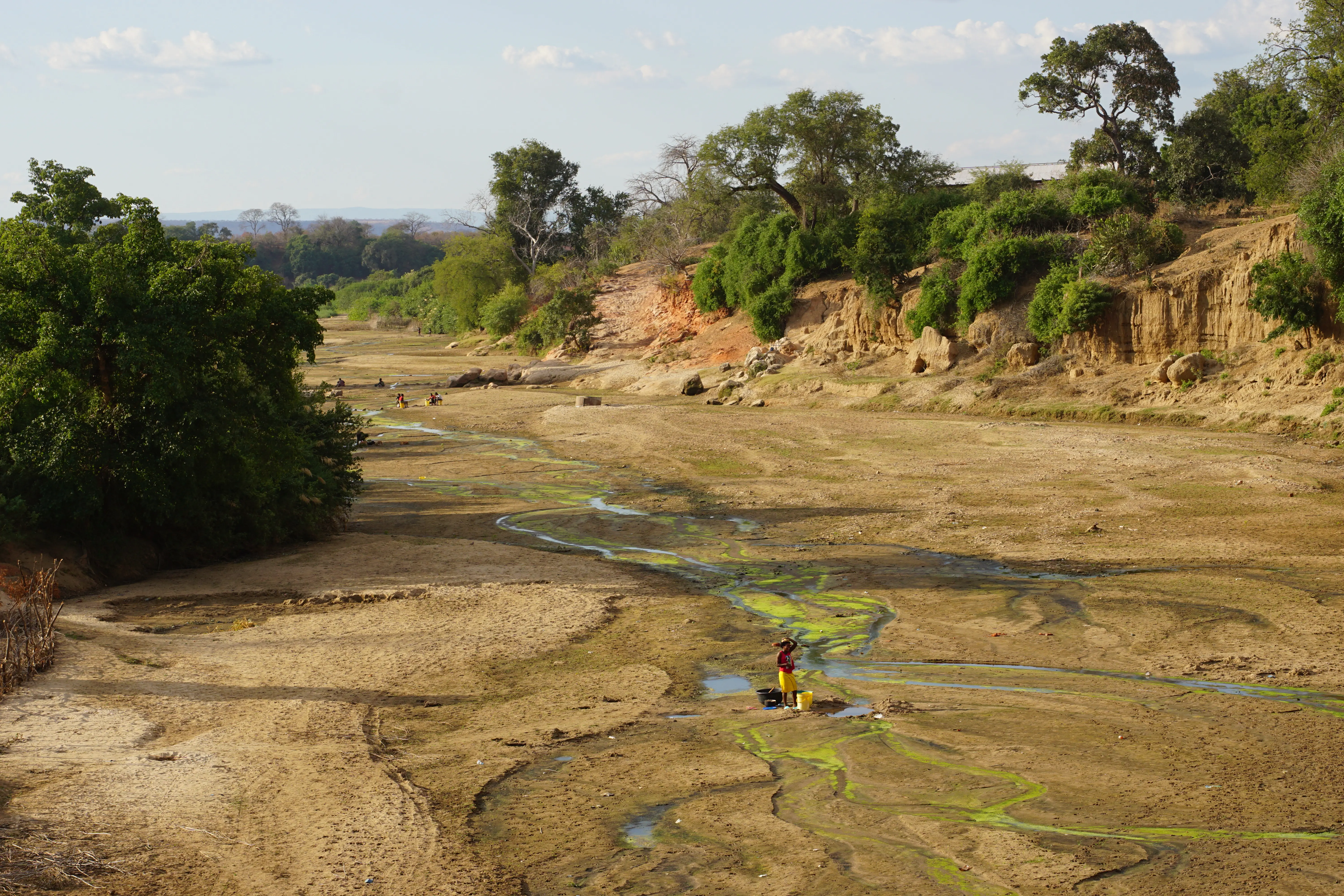
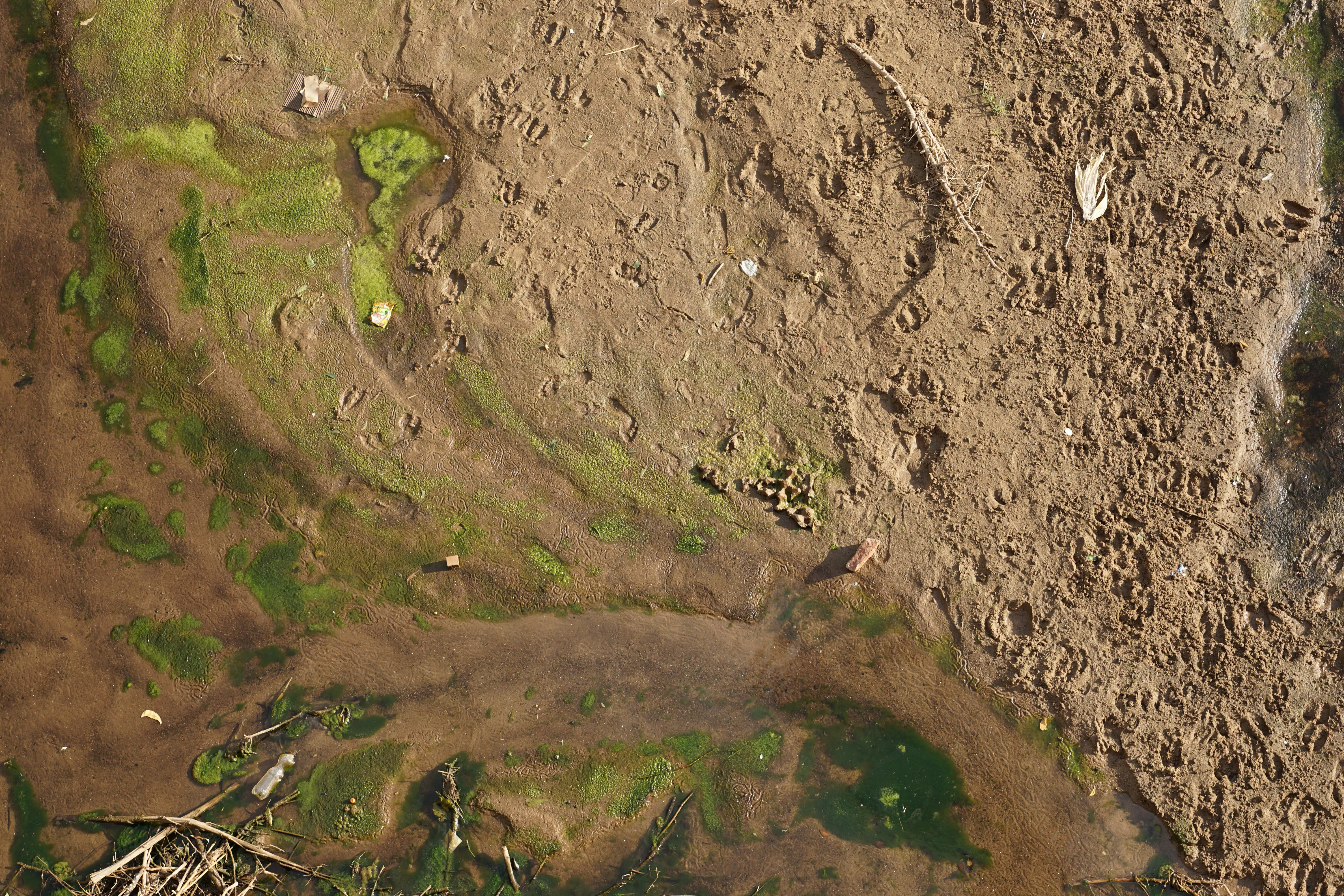
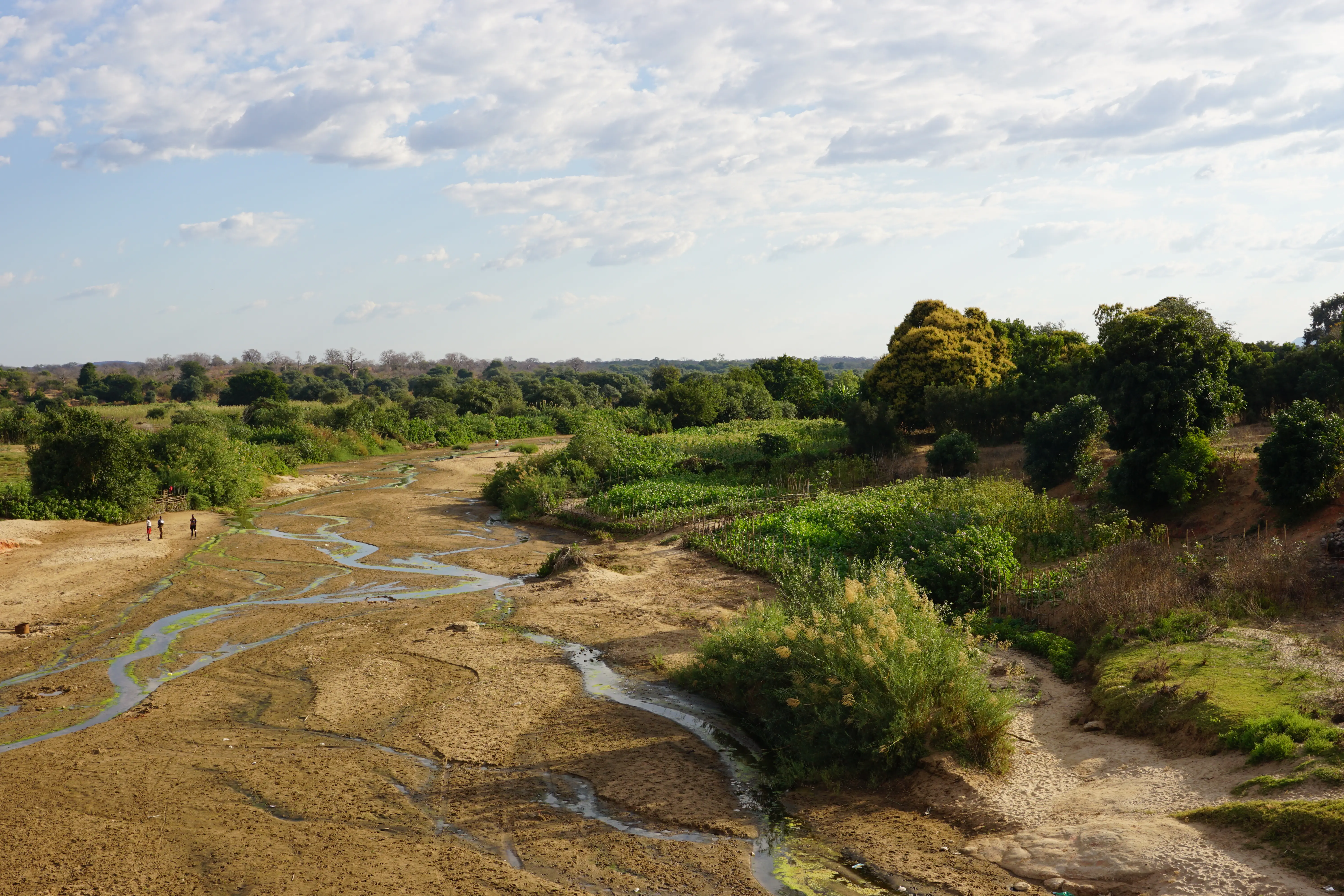
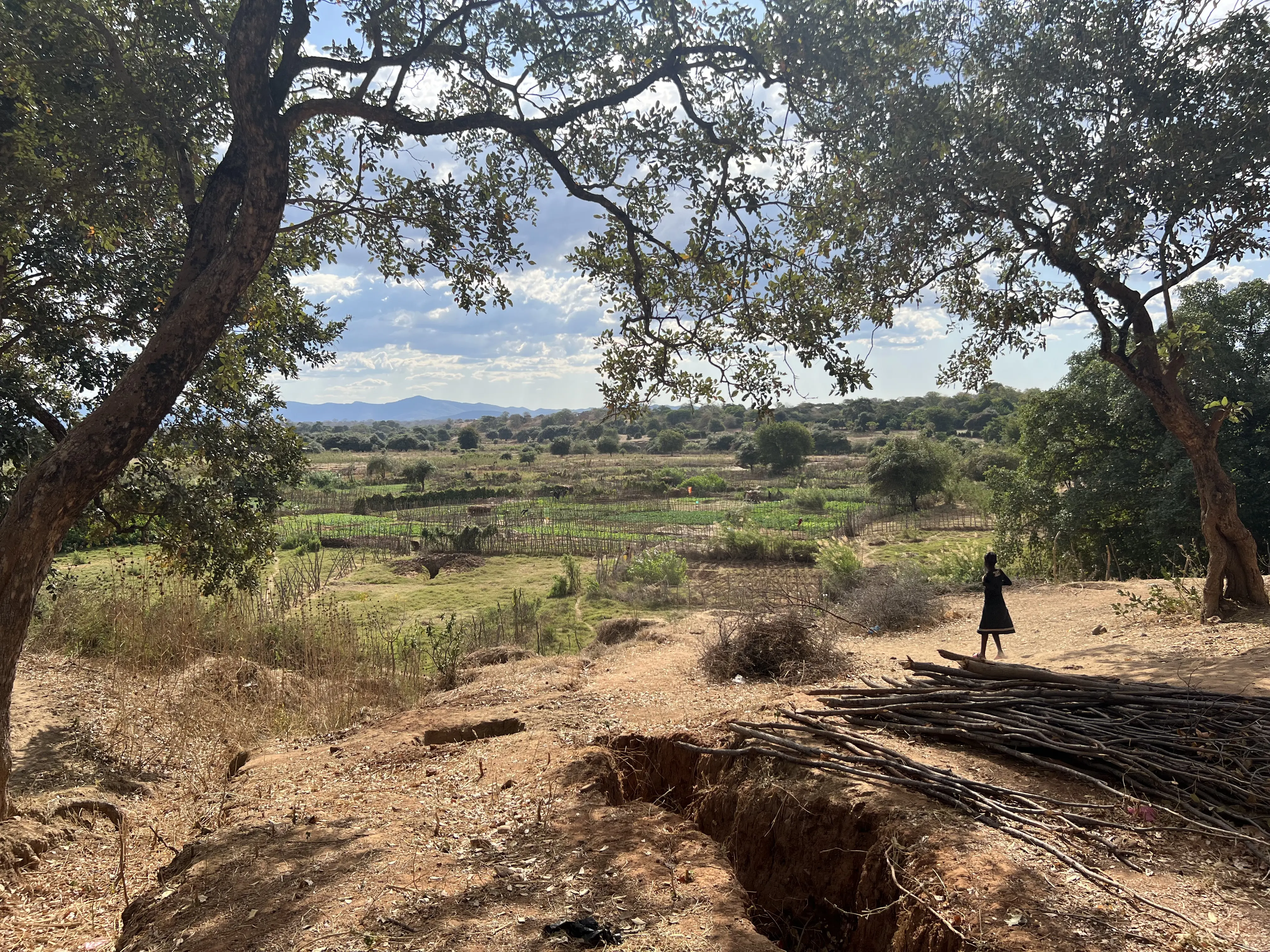
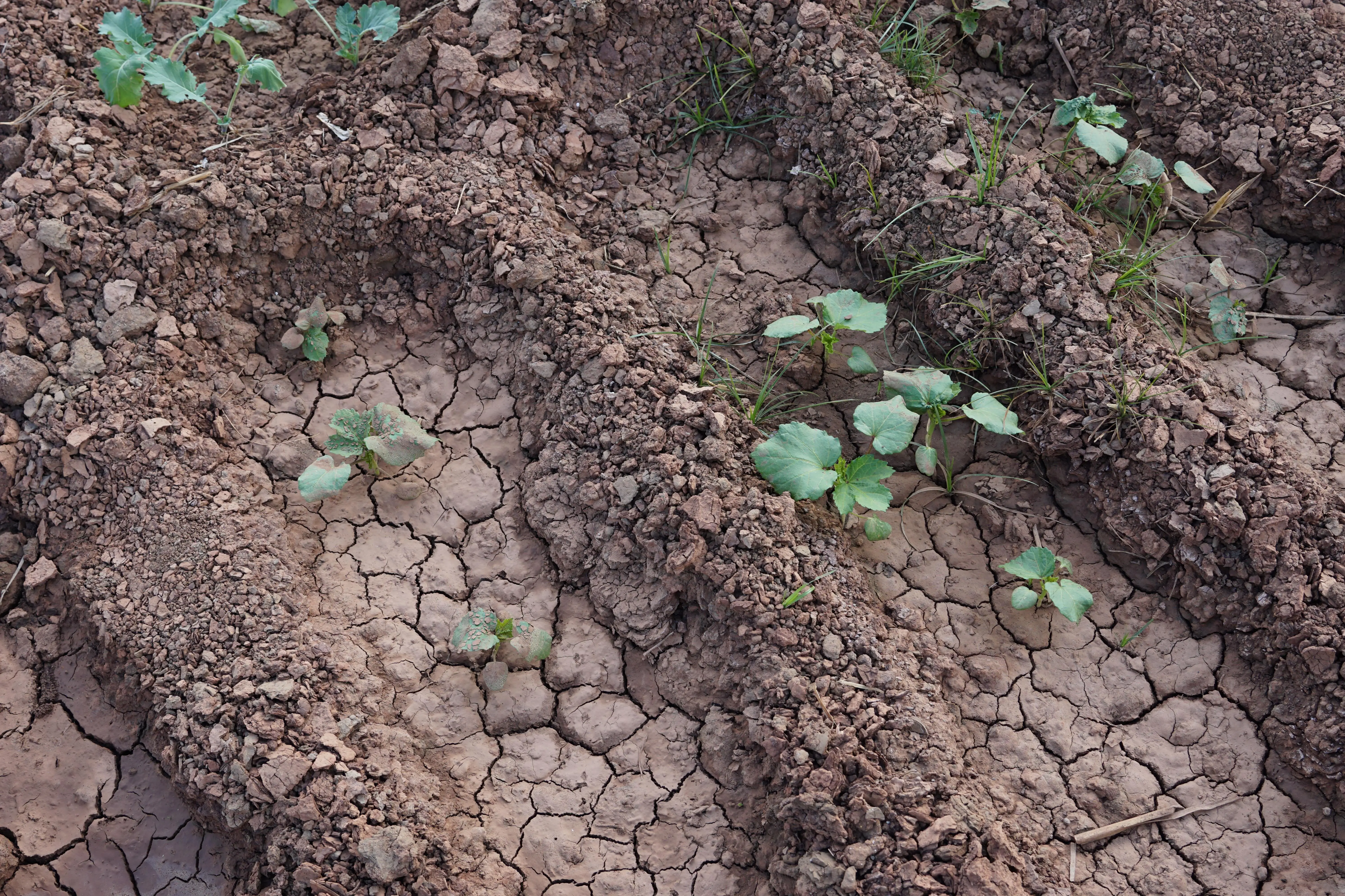
Now, Lusitu is transforming into a desert. Cacti and other succulents are replacing the shrubby woodlands, many of which were cut down to meet the growing demand for charcoal in nearby urban areas. In the fields that overlook the Lusitu River, wispy stalks of maize from the last growing season rattle in the unseasonably warm breezes that now arrive in late July. The river no longer flows from August to November. The only evidence of its presence are a few isolated, algae-filled puddles that dot the bottom of the river basin. These small pools are a refuge for both humans and their livestock, which travel there daily in search for water, leaving footprints behind in the soft clay.
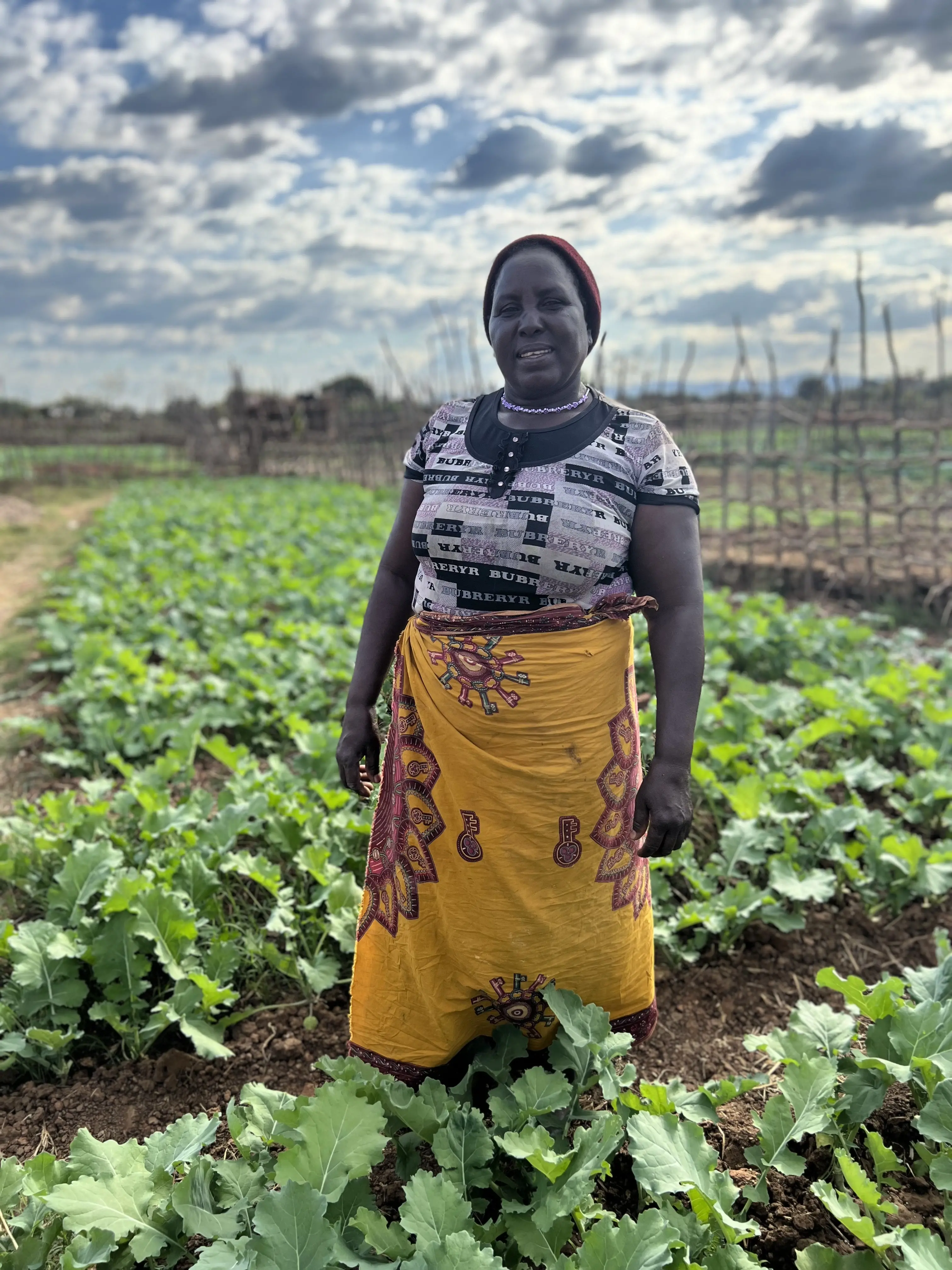
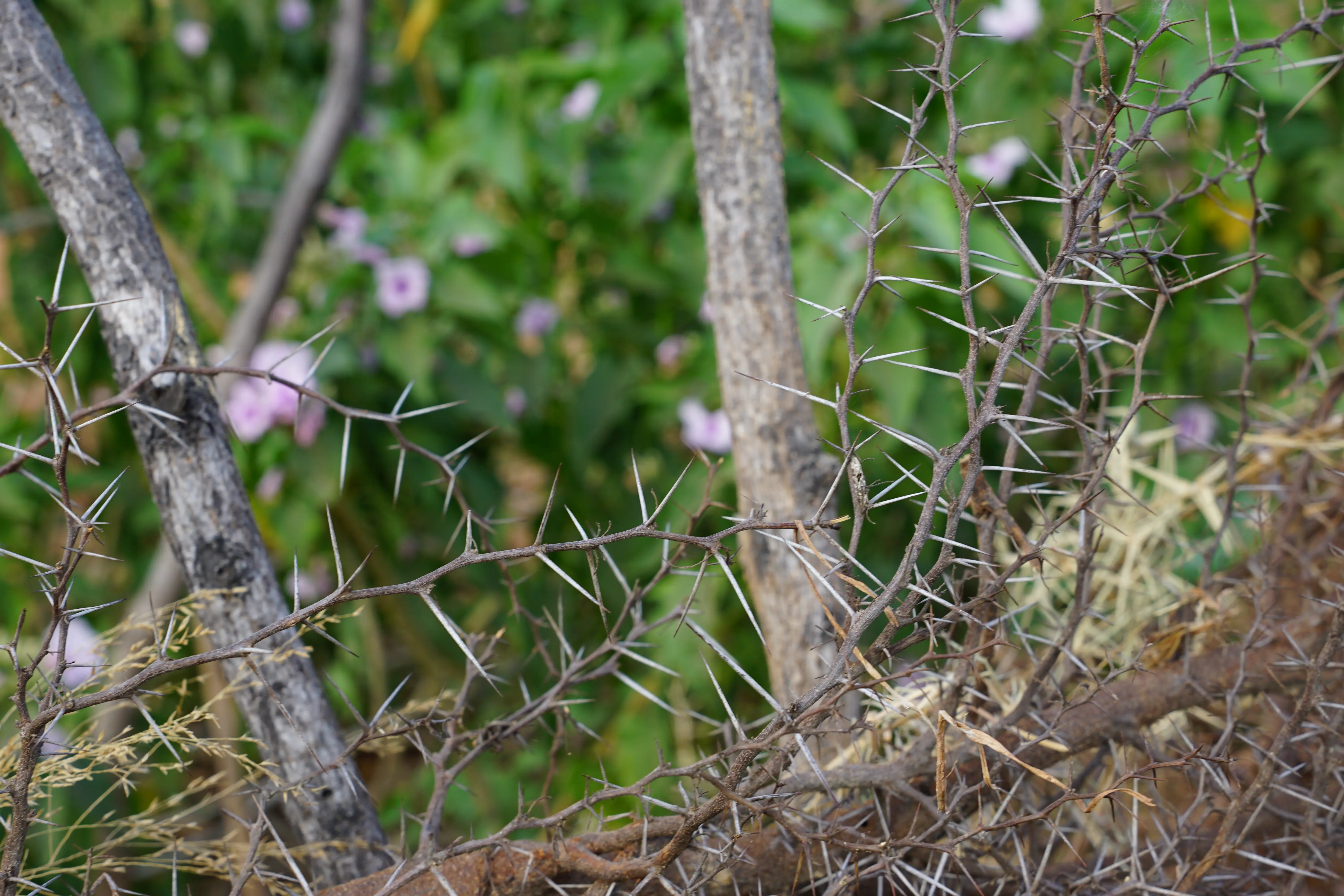
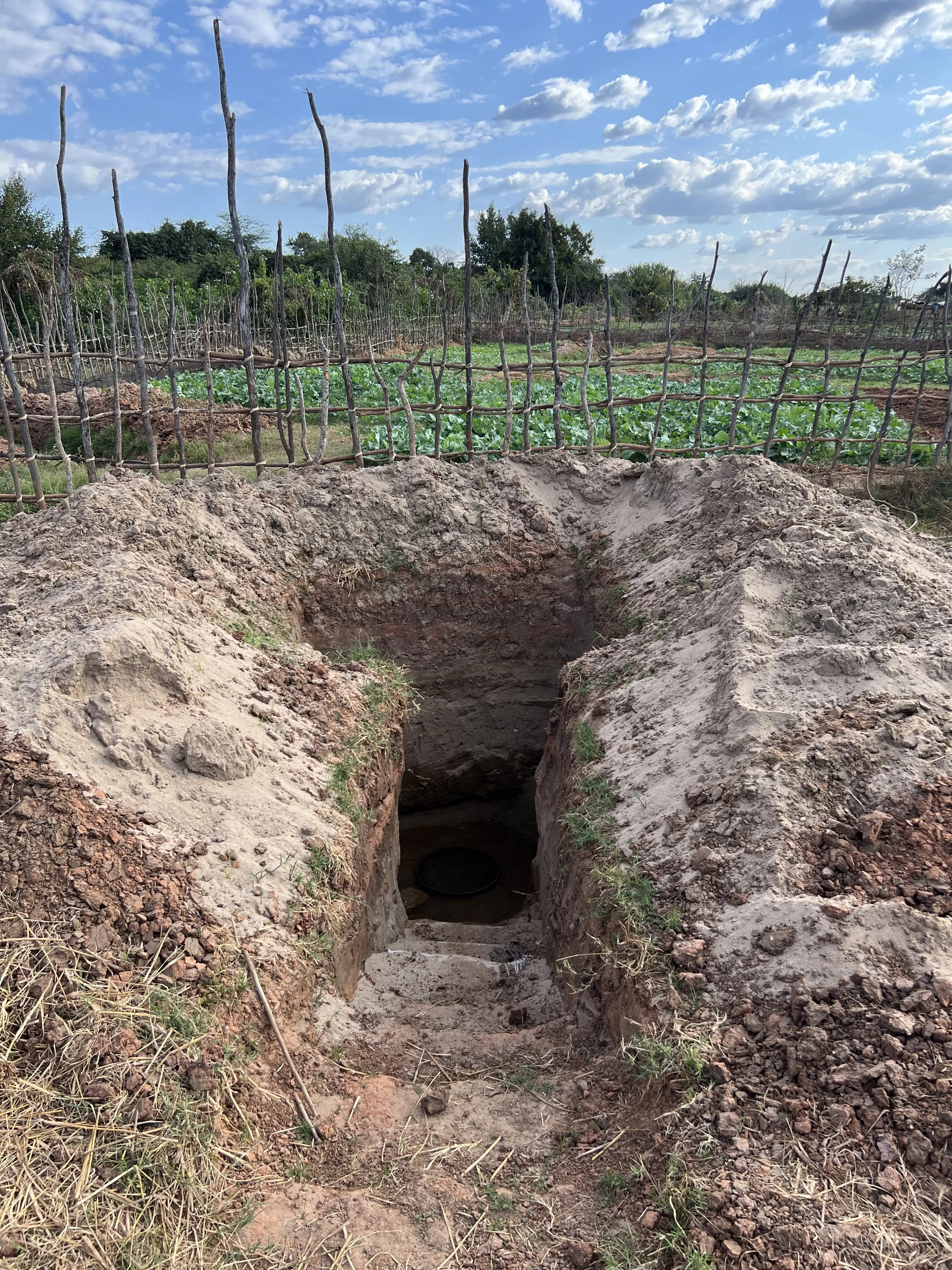
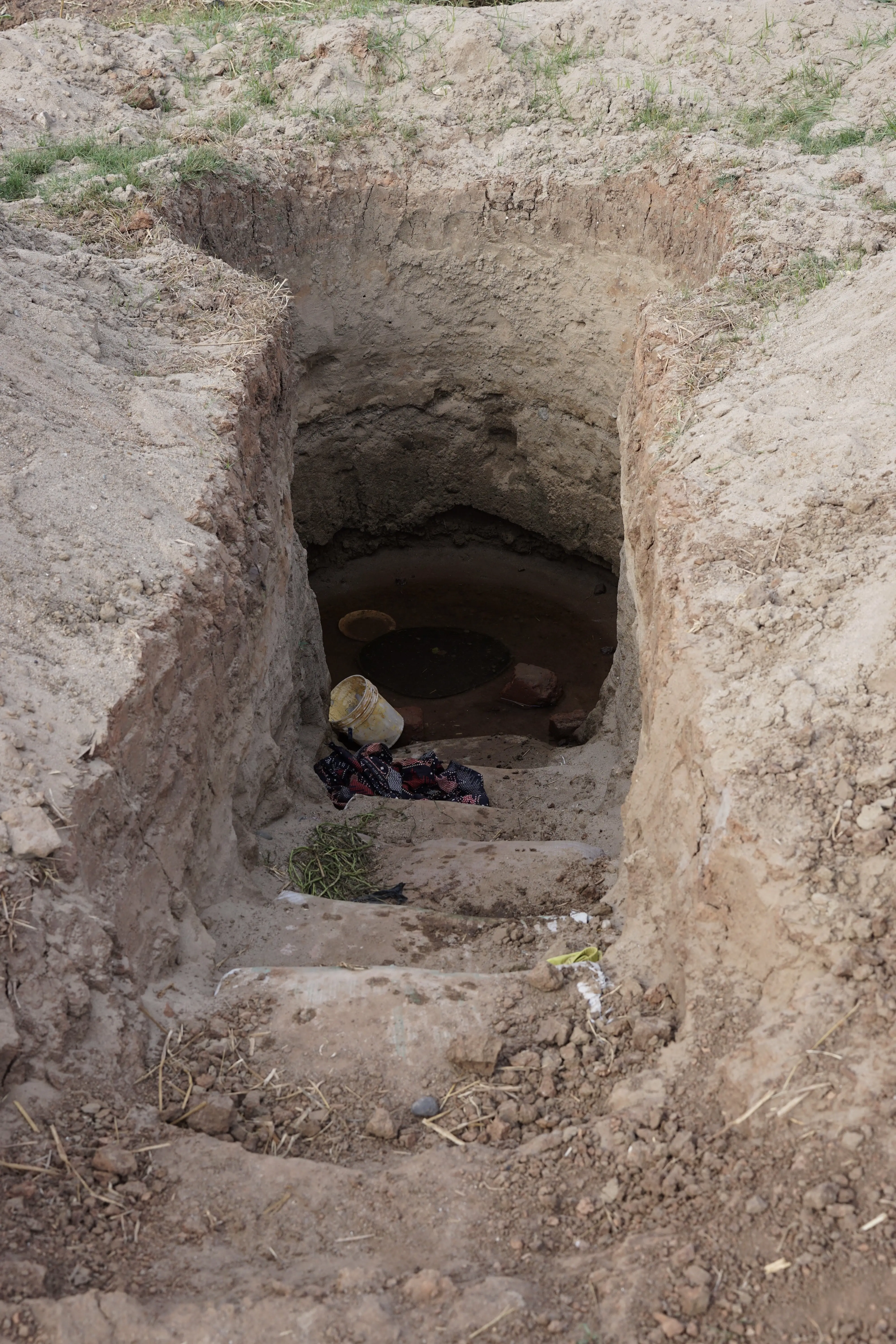
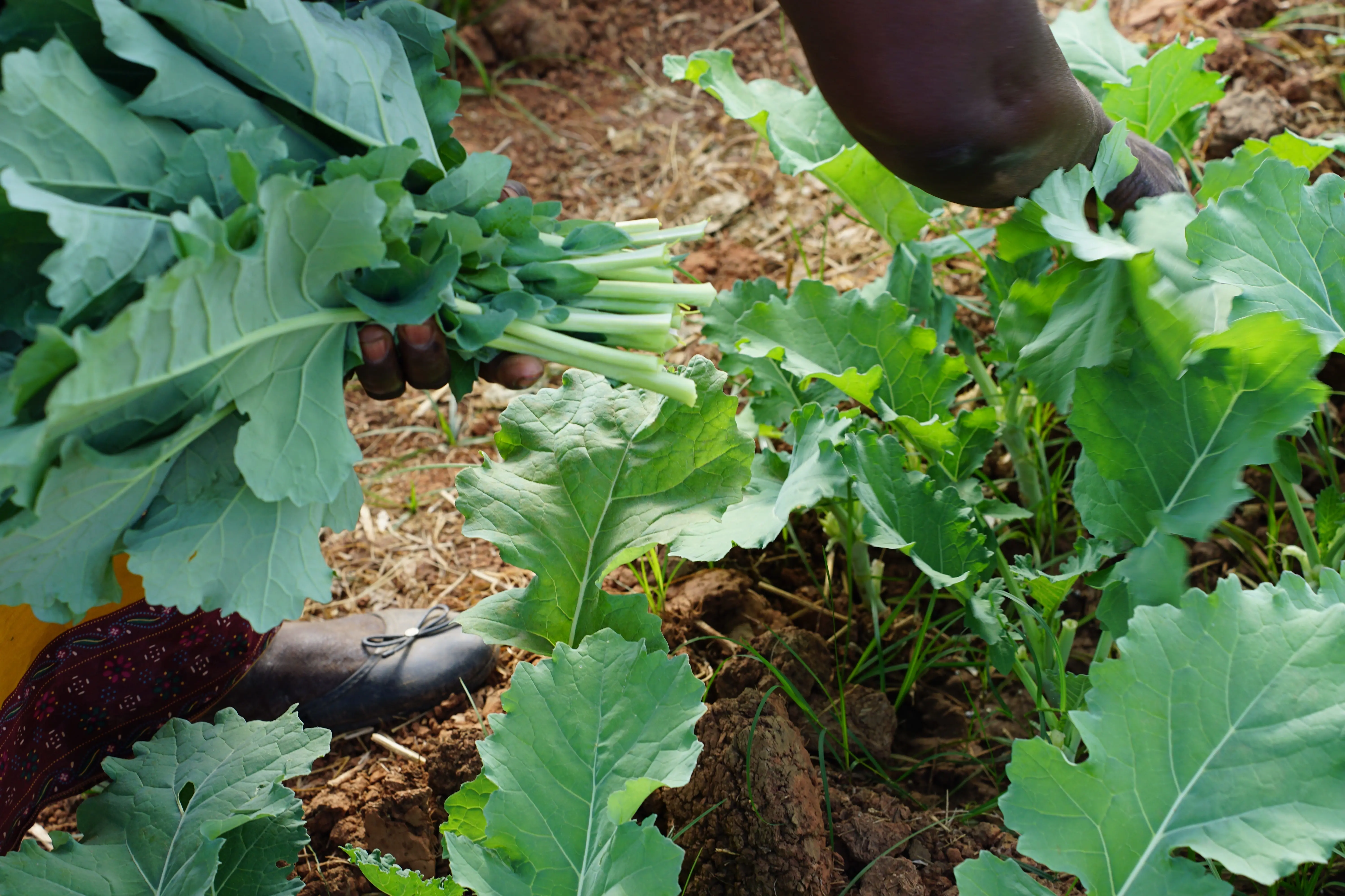
Eneless Chipenzi, a 62-year-old farmer and lifelong resident of Lusitu, is concerned with the climatic changes she has witnessed throughout her life. “The two biggest challenges here are soil and water,” she says. “The ground has become dry and rocky. When the river is not here, we must dig pits, sometimes 7-8 steps deep, to find water underground,” she says, pointing to the tomb-like well carved from dirt and stone at the end of her garden plot, which is demarcated with acacia branches and topped with inch-long white thorns to discourage scavengers.
“I am getting too old to carry much water from the pit to my garden,” she explains, while smiling and gently shaking her head. “I am blessed with grandchildren who help me with my garden,” she says as she gestures to a small band of boys and girls playing on the other side of the fence in the next field, “even if it does not look like it!” She says this last line just loud enough to jolt the children out of their game. They run to her garden, shimmying through the fence as they giggle and fall to the ground to catch their breath.
Chipenzi and her family are members of the Tonga tribe. Their ancestors lived along the middle portion of the Zambezi River for centuries. This area, known locally as the Gwembwe River Valley, remained relatively isolated from the British colonial forces until the mid-1900s, due to its allegedly “harsh and inhospitable climate,” as described by Jesuit missionary J. Torrend in a letter sent to his monastery in November 1931. Since that time, average temperatures in the region have increased about 1°C, and now range from 92°F (33°C) to 95° F (35°C) from September to November, sometimes even reaching 110°F (43°C).
Despite the challenging climate, people once thrived in the Gwembwe River Valley by relying on traditional ecological knowledge accumulated over generations. According to Given Kwapu, the Council Chairman for the nearby city of Siavonga and a member of the Tonga tribe, life along the Zambezi River was idyllic. “The Tonga in the valley had many animals because grazing areas were abundant,” Kwapu explains, while leaning back on a leather chair in his sunlit office that overlooks Lake Kariba, “Even today people remember that place because it was so bountiful.”
Although Kwapu never lived along the Zambezi, his mother often shared stories about what it was like to grow up with the river. She told him that “[the Tonga] paid attention to the signs nature provided to prepare for the changing seasons,” like the movements of birds and the calls of insects. Certain plants responded to shifts in rainfall, including the musiika, or tamarind tree, which would “produce more fruit right before a drought…as a gift from God or the ancestors.” While describing these traditions, Kwapu takes out his phone to enthusiastically show images of these native plants. He recounts that “the leaves of the chibase plant fall right before the rains arrive…so the Tonga only plant seeds after the tree has lost all signs of life.”

The people of the valley also built strong social and familial networks on both sides of the Zambezi River. “We were one people,” Kwapu describes, “not separated by the river, but connected to each other through it.” The Tonga seasonally migrated in and out of the alluvial floodplain, which allowed them to grow food year-round. When one family in the community ran out of food for the season, their neighbors who fared better provided for them, regardless of which side of the river they were on.
The traditional way of life for the Tonga changed dramatically in the late 1950s, when the Federation of Rhodesia and Nyasaland (the colonial governments of present-day Zambia, Zimbabwe, and Malawi) started to build the Kariba Dam in the Zambezi River. Although construction began in 1956, most residents of the river valley were not told that their homes would soon be underwater. According to Dr. Christopher H. D. Magadza, a researcher with the University of Zimbabwe, there was an international outcry when the world realized how the dam would impact wildlife in the valley, but there was little concern or fundraising over the plight of local people. Operation Noah, a nonprofit created using international donations, spent approximately £968 to rescue each animal from the flood zone, while the Federation spent approximately £50 relocating each person.
In 1958, the year before the dam was completed, British colonial forces evicted approximately 80,000 people from their homes. “Most people objected to the move, and for many reasons,” Kwapu explains. “Their ancestors lived there for thousands of years. Although the Chiefs took what ceremonial tools they could carry, the people had to leave the shrines for their dead, or malende, which were used in rituals to pray for rain.”
Armed conflicts broke out during the relocation. Several people were killed. Their bodies were quickly buried in mass graves within the abandoned villages. Homes were burnt to the ground. The survivors were forced to walk to small villages in present-day Zambia and Zimbabwe, some of which were over 45 miles (73 kilometers) away. The tight-knit social structure of their community began to unravel. “The Tongas across the river were forced to belong to a different country, even if they didn’t want to be,” Kwapu recounts, “The British brought a sea between our people, separating our families as they fled from the rising water.”
Ecologically, these new villages were a different world. Most relocated Tonga found themselves in semi-arid regions with no surface water, marginal soil, and a high risk of crop failure. The vegetation was unfamiliar. They did not know how to forage for food in the shrubby forests of their new homes. The wildlife was protected for conservation and tourism, so they could not hunt wild game. Over the course of a few years, the Tonga went from an isolated, self-sufficient ethnic group to a “food-deficit people,” living on two sides of the largest reservoir in the world.
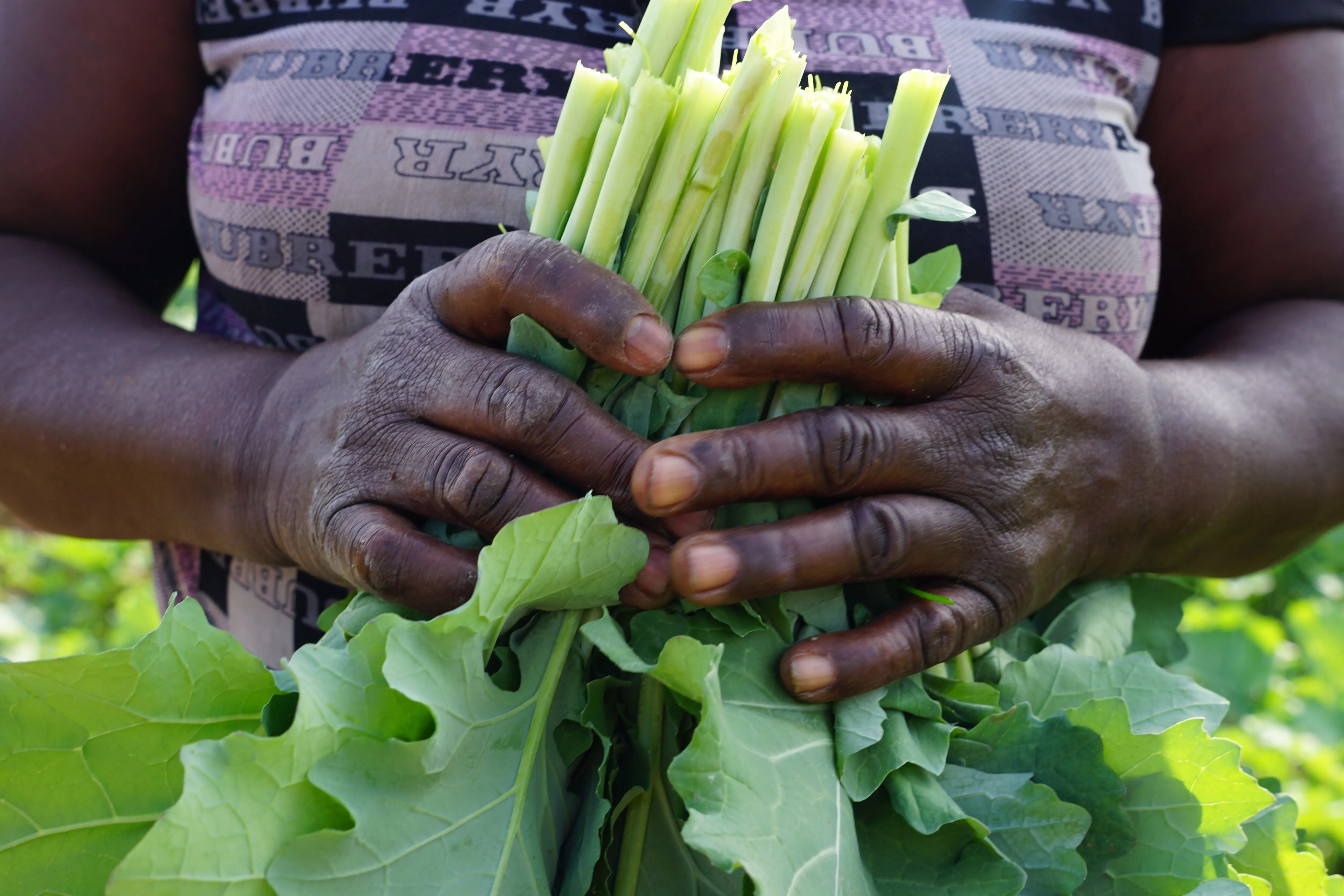
Lusitu was one of the relocation sites for the displaced Tonga. Chipenzi’s parents arrived there in 1959 and gave birth to her a year later. Their family was luckier than most, as their new village had access to the Lusitu River. “I grew up with dirt on my hands,” Chipenzi explains, “Our family was always farming. In the dry season we farmed along the riverbed. When the rains came and the river rose, we would farm above it. We grew food all year round. My parents taught me all I know.”
The agricultural technique that Chipenzi refers to is known as flood recession farming. Kwapu’s mother, whose family was evicted from the valley when she was eight years old, also taught her children this style of farming. According to Kwapu, “The Tonga would grow crops throughout the year by planting twice along the banks of the Zambezi River. As the water moved outward in the rainy season, people planted on higher ground and relied on rainfall to sustain their crops. When the rains stopped, water in the river retreated, leaving rich soil behind for people to grow food in again.”
Flood recession farming is common in semi-arid regions around the world, but free-flowing water sources are necessary to continue the practice. The presence of the Lusitu River allowed Chipenzi’s parents to pass on this small piece of ancestral knowledge to their children, despite their forced relocation. But now climate change threatens the continuation of this tradition for future generations.
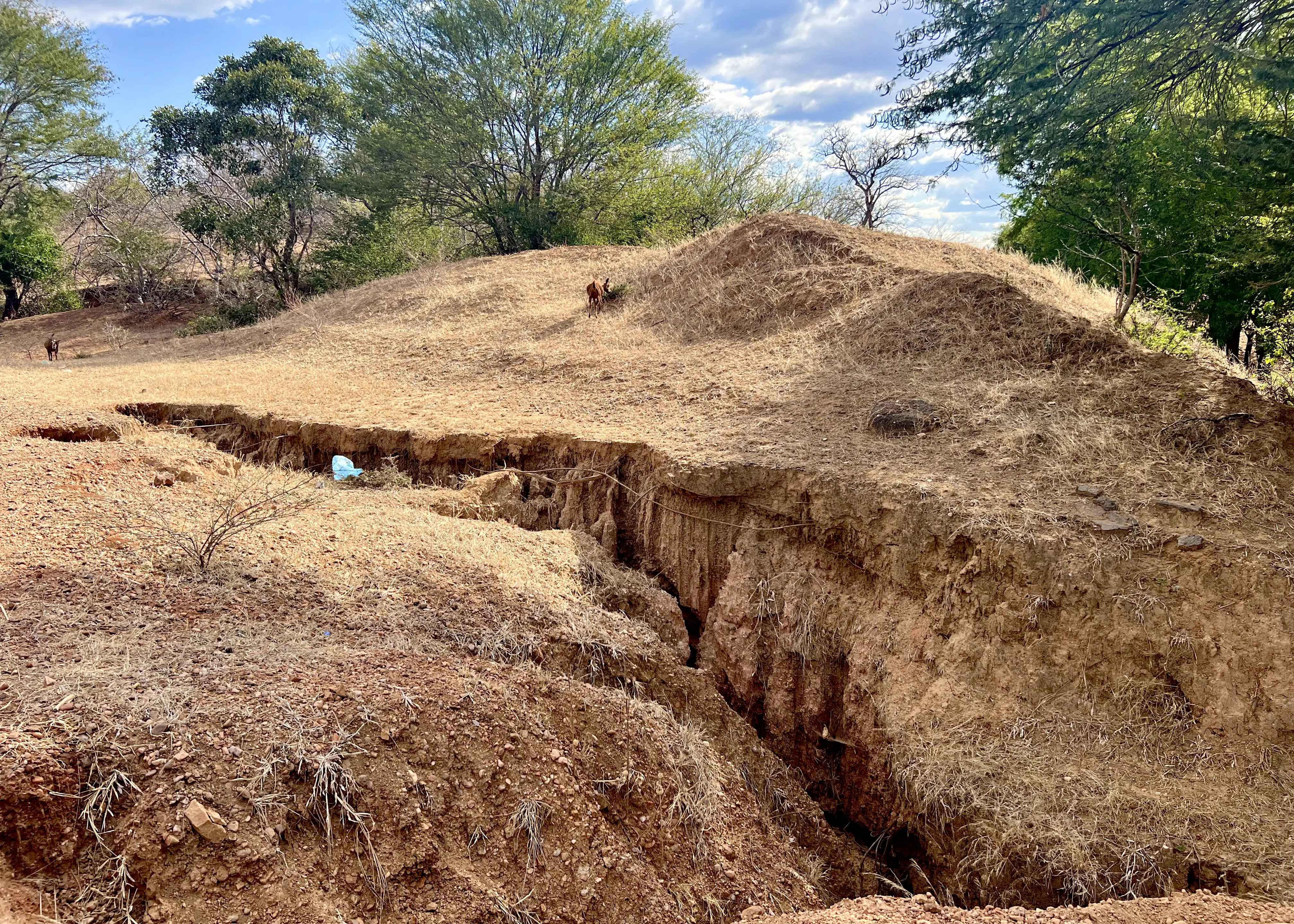
According to Geofrey Siulemba, a senior research scientist at the Zambia Agricultural Research Institute, “Lusitu is a climate change hotspot…many trees in the area were cut down for charcoal, which has allowed the topsoil to erode.” Without the trees, the remaining soil is hit with direct sunlight. This, paired with the increase in local temperatures, creates a feedback loop that ends in desertification. Siulemba notes that “the groundwater in Lusitu is very deep—often too expensive for local people to access—and is sometimes too salty to be used for irrigation or human consumption.”
In addition, the Lusitu River has less water than it used to. The river flowed year-round when Oscar Mulamfu, an agricultural supervisor for the Zambian Ministry of Agriculture, first moved to Lusitu 22 years ago. According to Mulamfu, “The volume of water flowing through the river began to decrease in 2006. This trend continued through 2016, which is the first year that the river ran completely dry. It has now become a seasonal river.” How could such a big change happen so quickly? “Climate change has led to more erratic rainfall in areas that feed into the Lusitu River. This is happening across Zambia, leading to the decline of our larger rivers, including the Zambezi and Lake Kariba.”
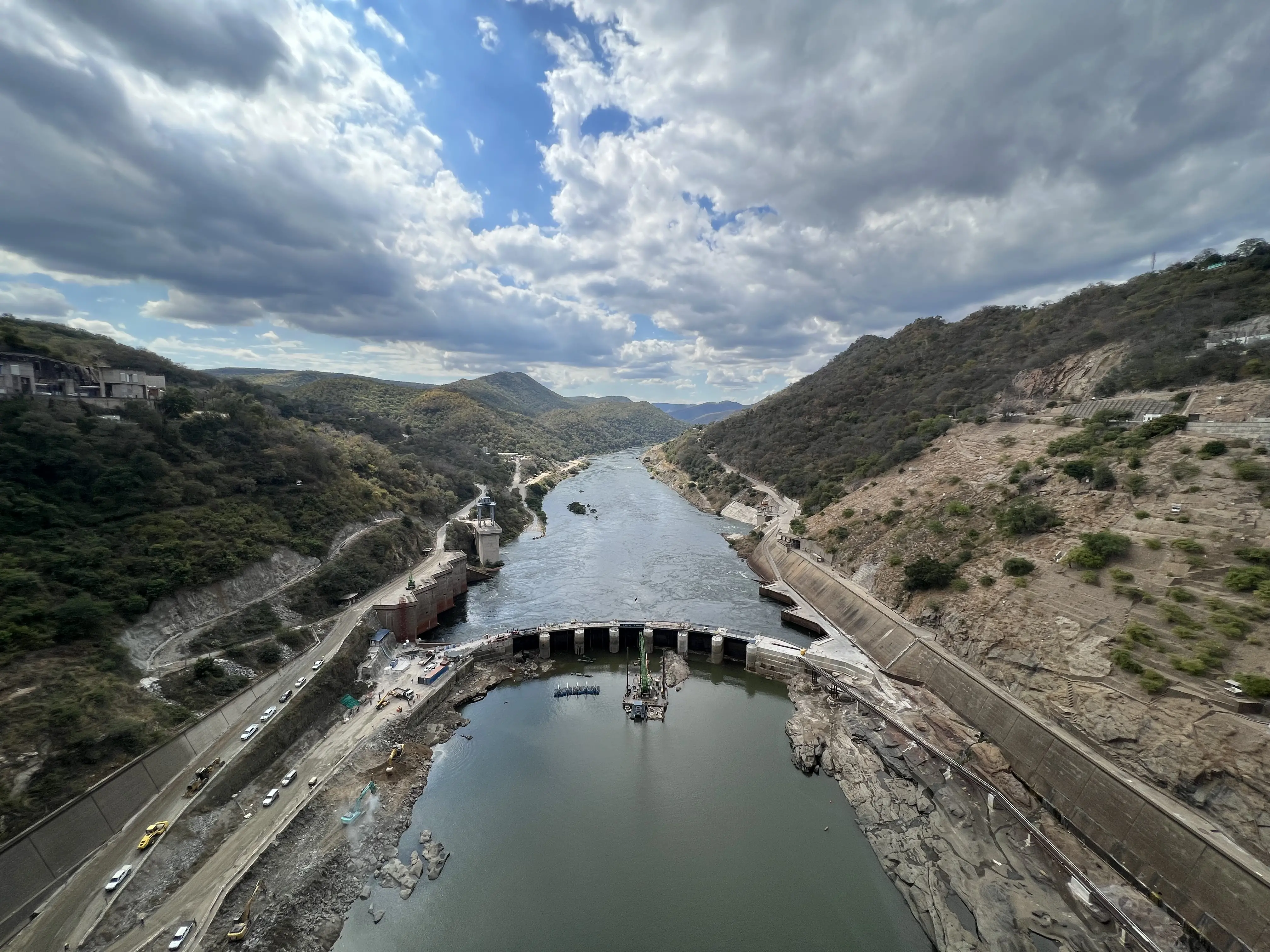
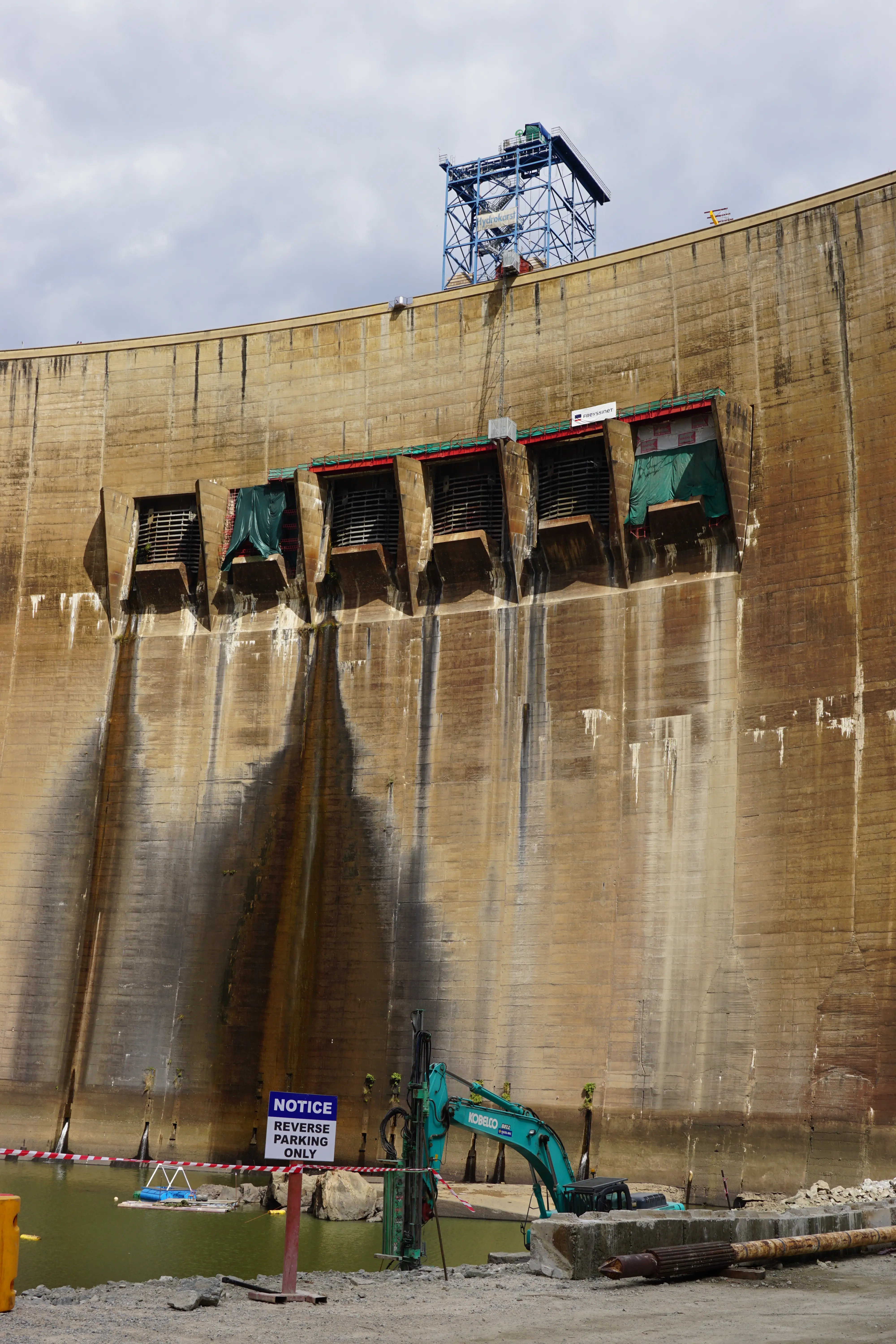
The decline of water volume in Lake Kariba is a major concern. The dam provides 60% of the electricity needed for both Zambia and Zimbabwe, and the reservoir has not been at full capacity since 2011. According to the Zambezi River Authority, the lake was at 23% of its capacity as of August 31, 2022, a decline of 20% from the same date in 2021. In the drought of 2019, that number fell to the single digits, leading to blackouts across both nations. Many of these lasted up to 18 hours, increasing the demand for charcoal and leading to deforestation in places like Lusitu. Also, the dam is 60 years old. Its overflow gates and plunge pool have been under repair for 10 years and are far from complete.
This change in rainfall is reflected in the lived experiences of farmers in Lusitu. In Chipezi’s words, “The rain pattern has changed. It delays more often and doesn’t come when we expect it to come. This change affects everyone, even those that do not farm. When I was young, we needed to plant our [rainy season] crops the first week of December or earlier, but now we need to plant after Christmas. If we plant too early, the rains come and go, and we lose our crops.”
In addition, the native plants that the Tonga use to interpret seasonal rainfall patterns are acting strangely. “The chibase tree still loses its leaves before the first rainfall, but now it regrows them after a week or so without rain…almost as if it thinks the rains are done,” Kwapu explains, “then it sheds the leaves again when the rains restart.” Some Tonga have noticed this phenological shift in the chibase tree, but other pieces of ecological knowledge have likely been lost in the aftermath of their forced relocation.
The ancestral knowledge that was passed on from her parents helped Chipenzi provide for her family in Lusitu, but many other relocated families were not as lucky. “I rent this land from the descendants of the original settlers here,” Chipenzi explains, “but others cannot afford the monthly fees and must find work elsewhere until the rains return.” But what will happen if the rains don’t come when they are expected? Can people continue to live in these climate change hotspots, or will more forced migrations be necessary?
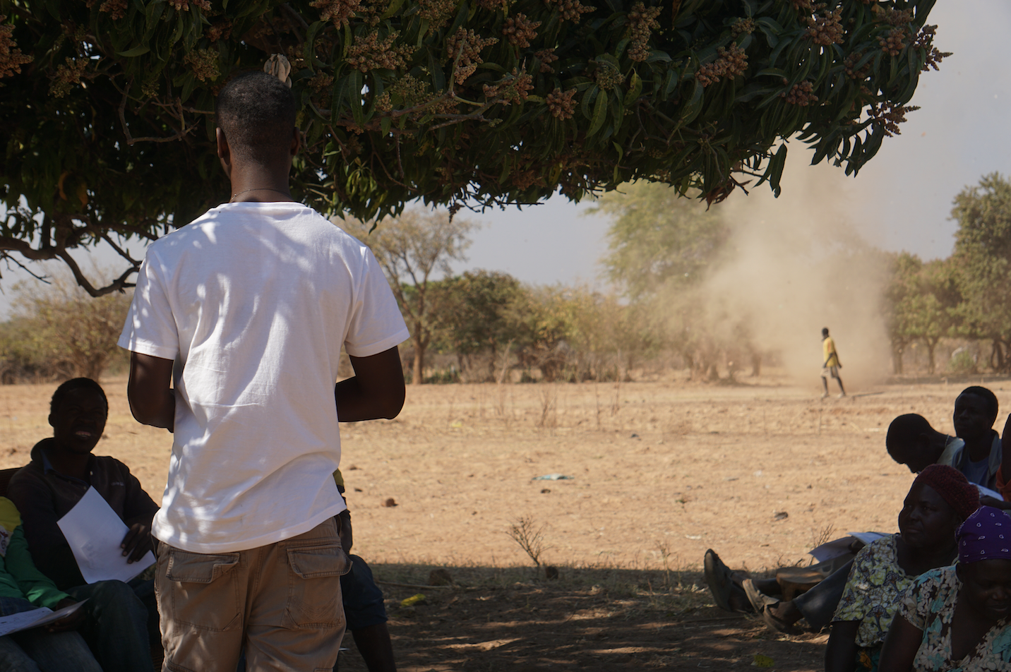
While farmers, researchers, and government officials are far from having answers to these questions, the open exchange of knowledge among these groups is essential. According to Helen Shelin, a Ministry of Agriculture official based in Siavonga, agricultural extension agents are “being trained in semi-arid farming techniques, which are sometimes gathered from local communities.” It is difficult for these agents to be effective, however, as they are each responsible for about 1,000 farmers. Shelin overcame this challenge by purchasing a motorbike, which helps her travel efficiently between farms. “People know me as ‘that woman on a motorbike,’” she explains with a laugh, “but it helps me reach our farm leaders quickly, since most roads here are bumpy and unpaved…they then share advice and instructions with their neighbors and other community members.”
Despite the challenges she faces, Chipenzi hopes to continue farming in Lusitu. “This is my home. It is where I raised my children…the bones of my parents are here,” she explains while packing up her belongings to walk home with her grandchildren in the setting sun. “The rains and the river are changing. We can only learn from it, help each other, and adapt where we can.”