


Amid climate shifts, the Labrador Inuit are taking matters into their own hands.
Arctic sea ice routes are a vital connector for Labrador Inuit peoples. As the ice begins to melt, old traditions fuse with innovation to fight climate change
This is the first of a two-part series on how Inuit communities are adapting to climate change, which is disproportionately affecting coastlines in Canada’s Far North. Click here to read the original report in The Globe and Mail.
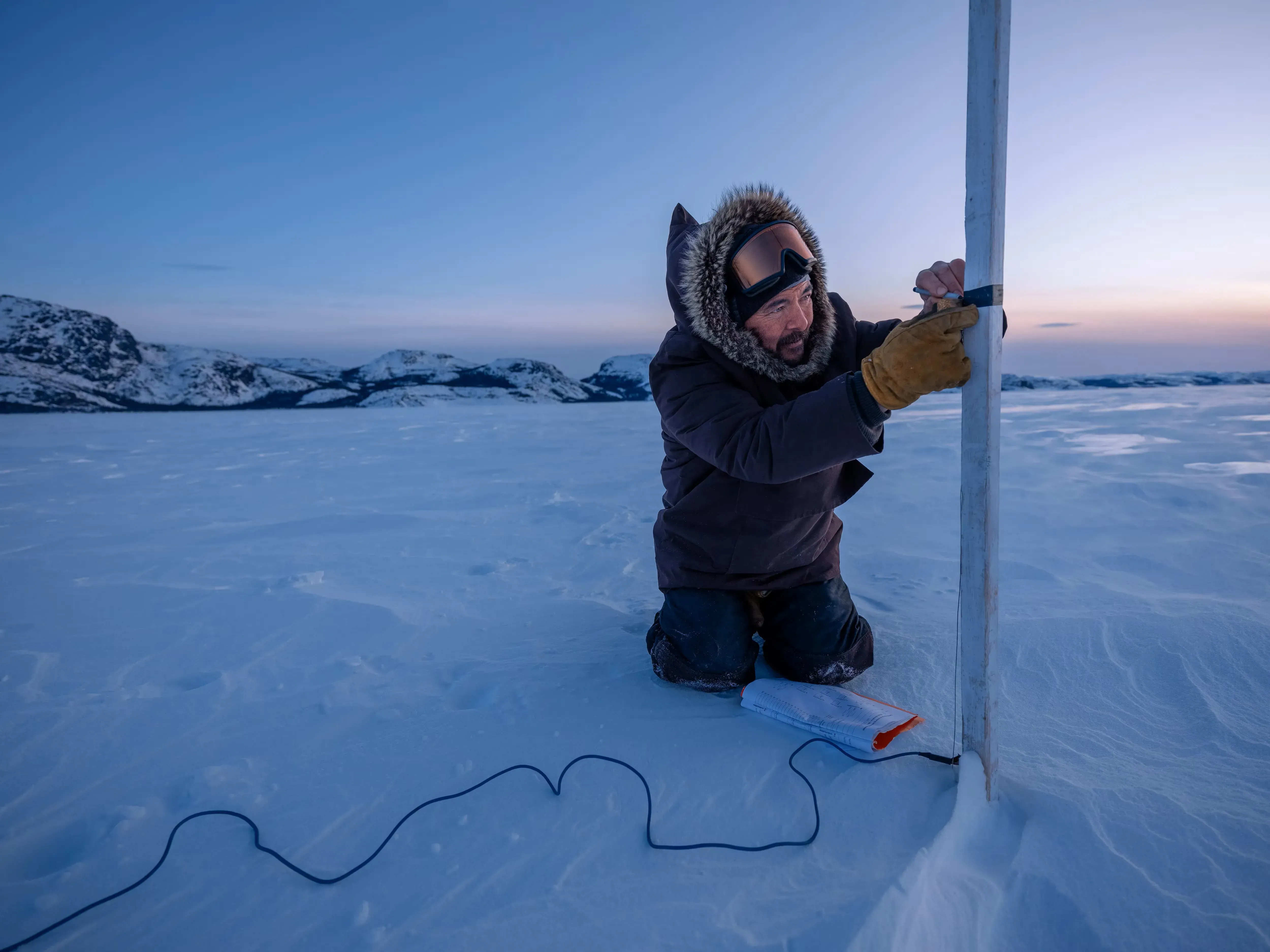
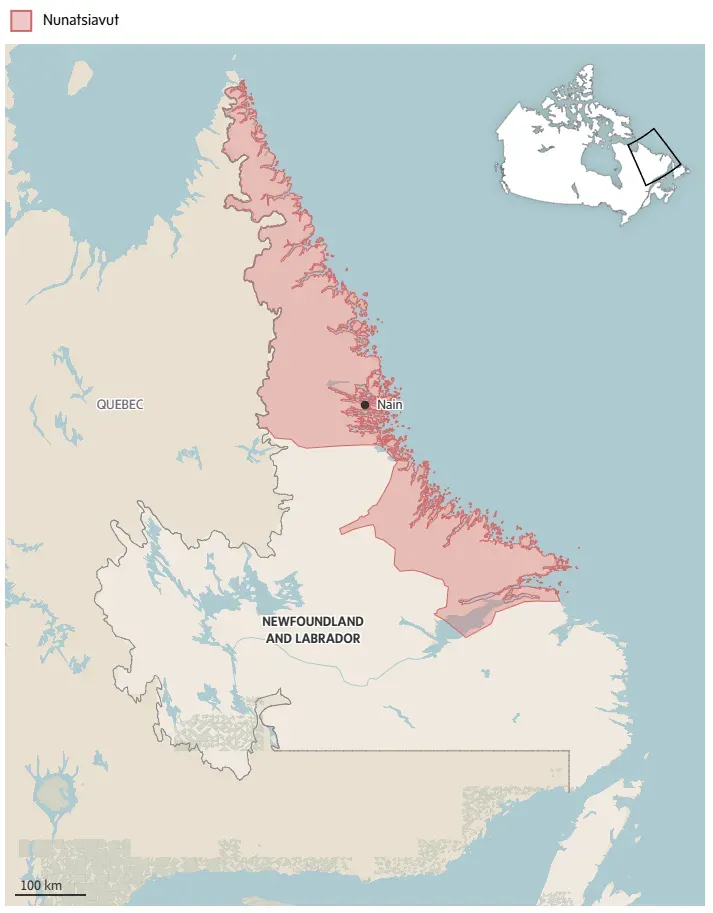
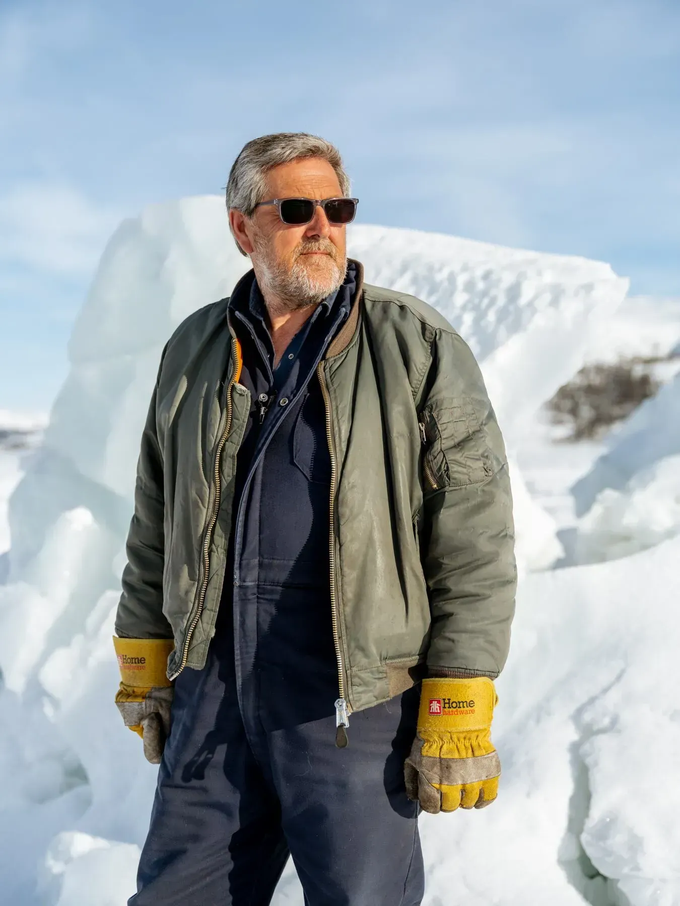
On a 17-below morning in late March, Inuk elder Ron Webb measures the thickness of a crucial ice highway on the Labrador Sea in Nunatsiavut, the sprawling, self-governing Inuit region of northeastern Newfoundland and Labrador.
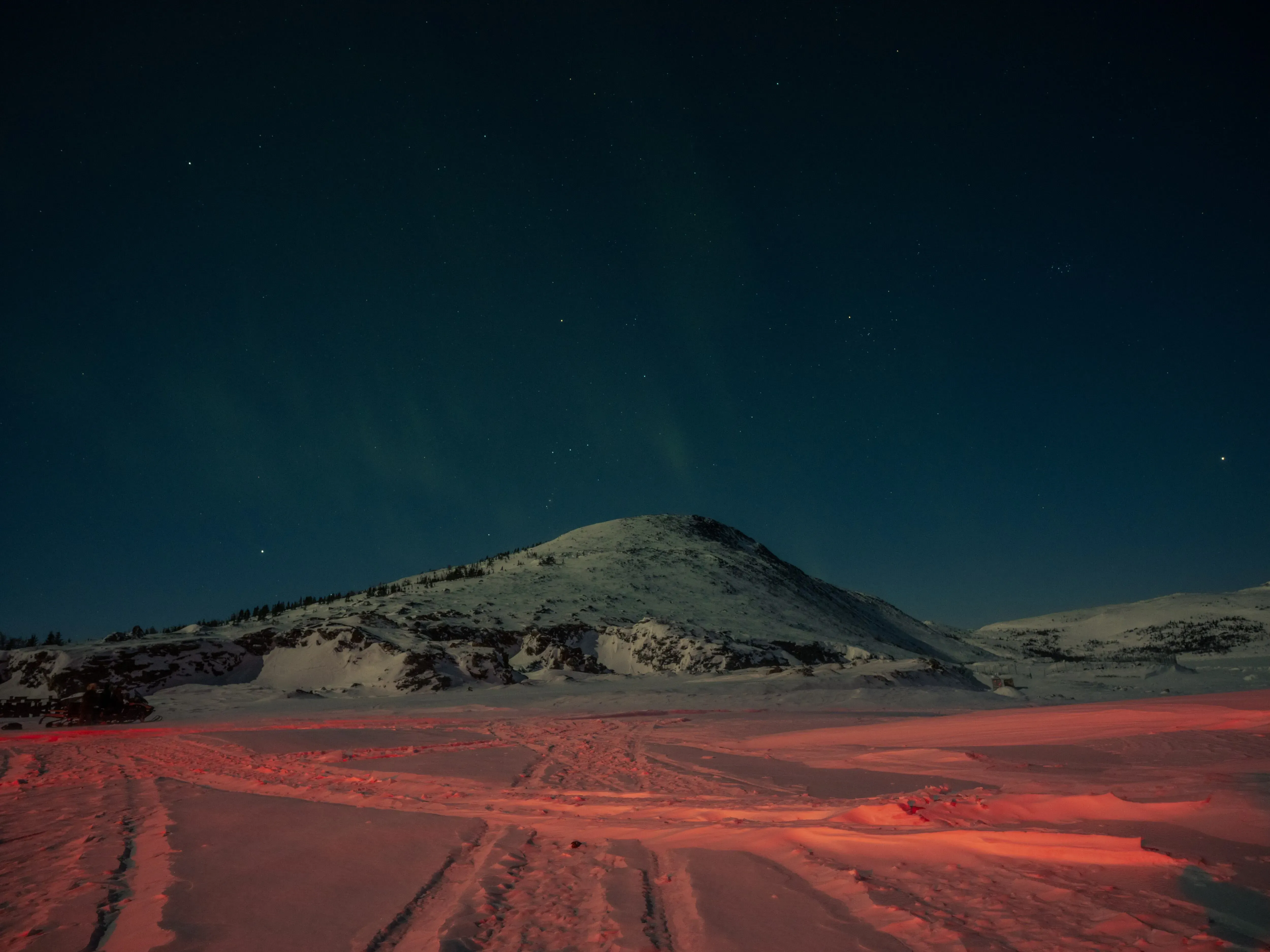
The white swath of sea ice is as layered with snow as the white sky is thick with cloud, interrupted by the dark patches of land that are the far-flung islands and coastlines in this remote part of the Atlantic Ocean.
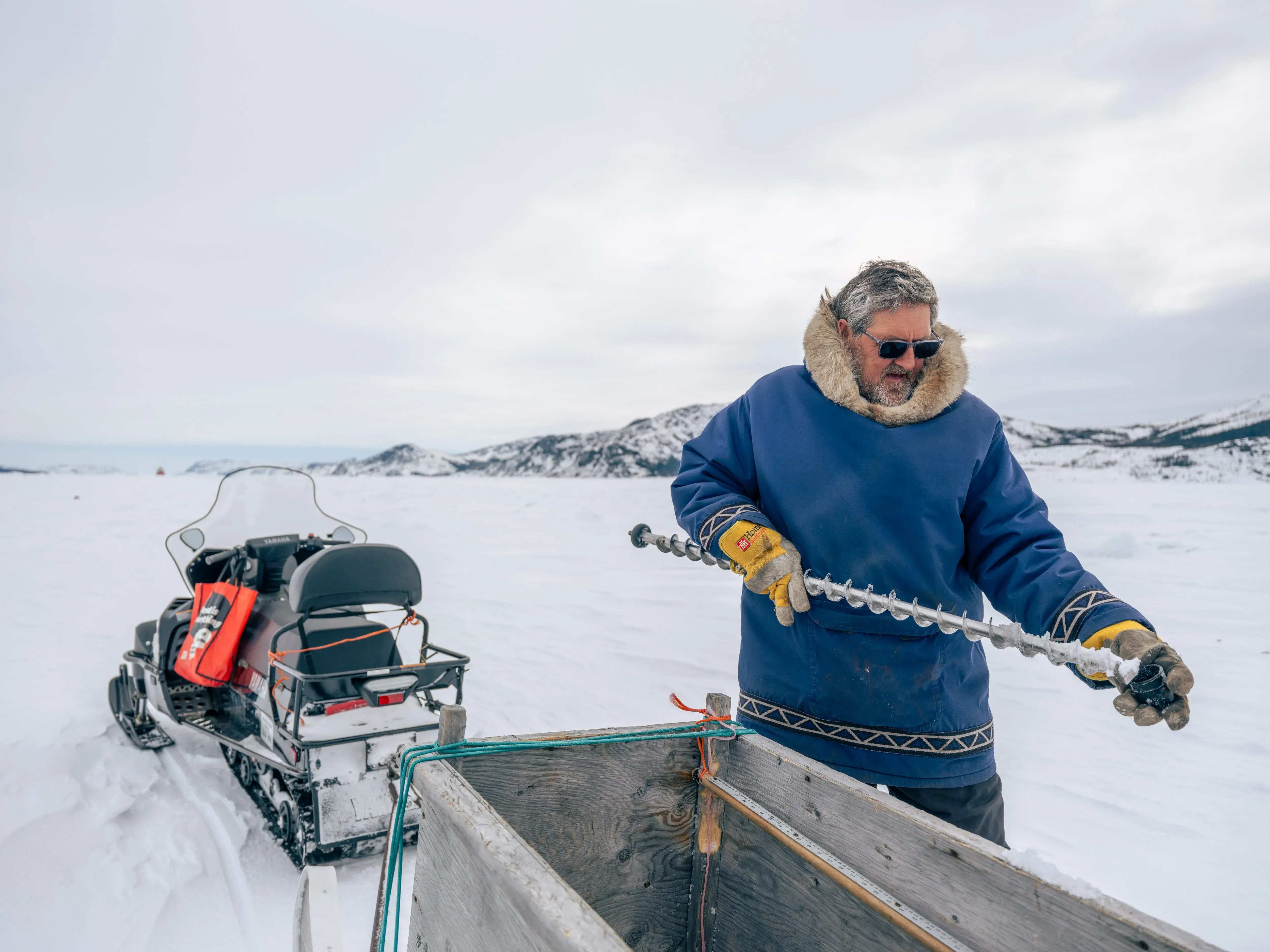
Using an auger to drill a hole, a yardstick to measure the ice and a notebook to log the findings, Mr. Webb collects the same data in a dozen locations, repeating the exercise weekly from winter freeze-up until the spring thaw.

Having become both scientist and steward of the sea ice, the 67-year-old’s decades of observations and logbooks tell a story of decline.
“Every measurement is a reminder of what we’re losing,” Mr. Webb says, his voice heavy with concern.
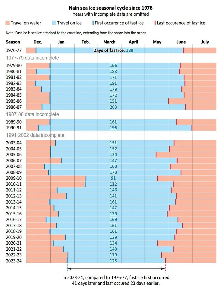
Today’s log is the latest to illustrate an undeniable truth: The sea ice is weakening at an alarming pace in Canada’s Far North because of climate change.
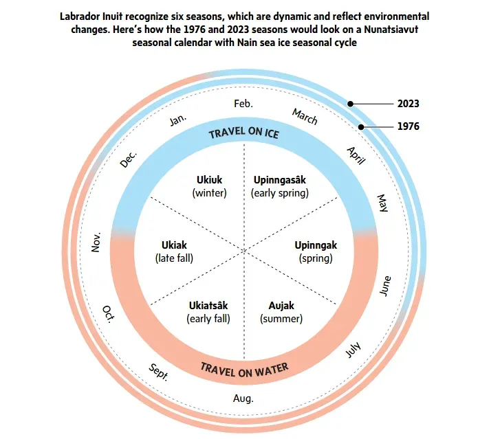
Labrador Inuit recognize six seasons, defined by environmental changes. Sea ice once marked four of them, from late fall (ukiak) in mid-November to spring (upinngak) in mid-June. Now, it only spans two, from winter (ukiuk) in late January to early spring (uppinngasâk) at the beginning of May.
More difficult to quantify is how the weaker sea ice isolates and stifles already-remote fly-in communities, restricting access to essential goods and services, and limiting traditions on the ice such as hunting, fishing and travelling off the grid.
It has social and cultural effects, too: Less time spent on the ice with others means less time steeped in local language. In Mr. Webb’s community of Nain, the northernmost and largest on the Labrador coast with a population of 1,200, Labrador Inuit have more than four dozen Inuttitut terms for sea ice.
Whereas traditionally Inuit elders and knowledge keepers gauge sea ice for travel safety using a harpoon, now they are adopting modern tools and technology, such as measuring sticks, ice sensors, satellite imagery and weather stations, into their practices. This blend of traditional knowledge and contemporary approaches is a critical strategy for adapting in a world that is changing beneath their feet.
Adaptation is not new to Inuit, with their five-millennia-long history of nomadic lifestyle, and resettlement by church, state and trade interests this past century. But amid unprecedented climate shifts, which are disproportionately affecting the coastlines in Canada’s Far North, Labrador Inuit communities are taking matters into their own hands.
“We don’t have a choice but to adapt. We have to find other ways to do things,” Mr. Webb says.
Over the past two decades, the sea ice in Nunatsiavut has persistently weakened, alongside record-breaking air and ocean temperatures. Add to that two coastal threats: The Northwest Atlantic ocean is a known global hot spot, while in the Arctic ocean an influx of warmer Atlantic waters called “Atlantification” is speeding up sea ice melt.
“This region is warming four times faster than the rest of the planet. That’s Arctic amplification, and Nunatsiavut is not immune to it,” says Eric Oliver, an Inuk oceanographer at Dalhousie University with roots in Rigolet, the southernmost community in Nunatsiavut.
While most of Nunatsiavut sits below the 60th parallel north, its sub-Arctic location adjacent to the cold Labrador current means the region has an Arctic-like climate, Mr. Oliver says.
Nunatsiavut is even more susceptible to sea ice loss than the Arctic, says Adrienne Tivy, a specialist with the Canadian Ice Service at Environment and Climate Change Canada (ECCC).
“The rate of thinning of seasonal sea ice in Nunatsiavut is comparable to the Arctic, but because Nunatsiavut has thinner ice cover than the Arctic, the impact is greater,” Ms. Tivy says.
As Mr. Webb documents the changing conditions, he works alongside Mr. Oliver to track ice formation, snow coverage and the effects on traditional lifeways. Each observation in Nunatsiavut’s five coastal and island communities is a vital piece of knowledge in a larger puzzle, one that reveals how climate change is altering their very existence.
According to the Intergovernmental Panel on Climate Change, human migration is the greatest single impact of climate change. For Inuit, the upheaval is more subtle, yet just as unsettling, Mr. Oliver says.
“Sea ice is a connector of people. When it forms, it provides this highway that allows people to connect across huge distances that the open ocean, with its waves, currents and tides, is so much harder to navigate,” he says.
“The only way I can explain it is we’re landlocked,” Mr. Webb says of a shorter sea ice season.
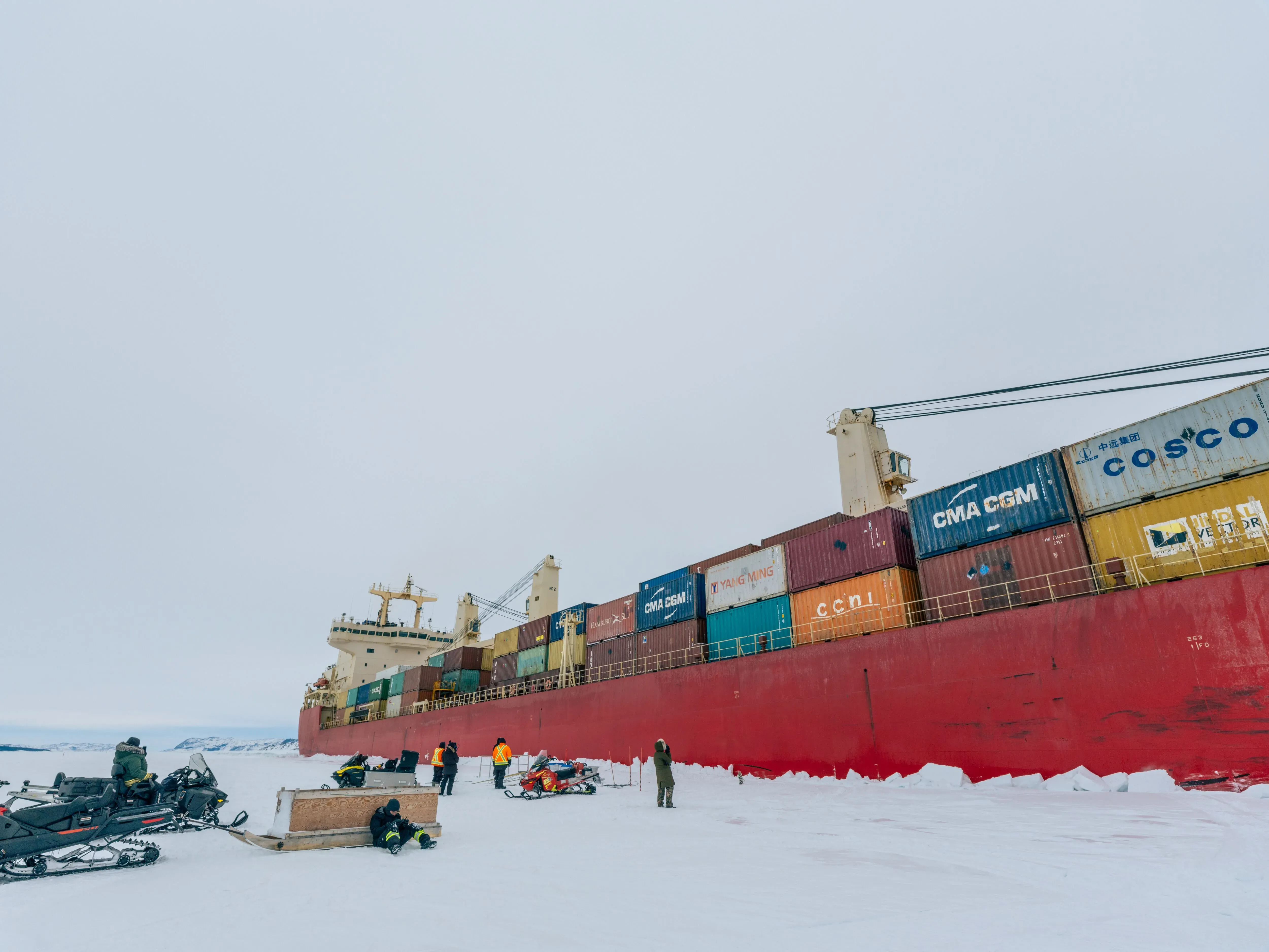
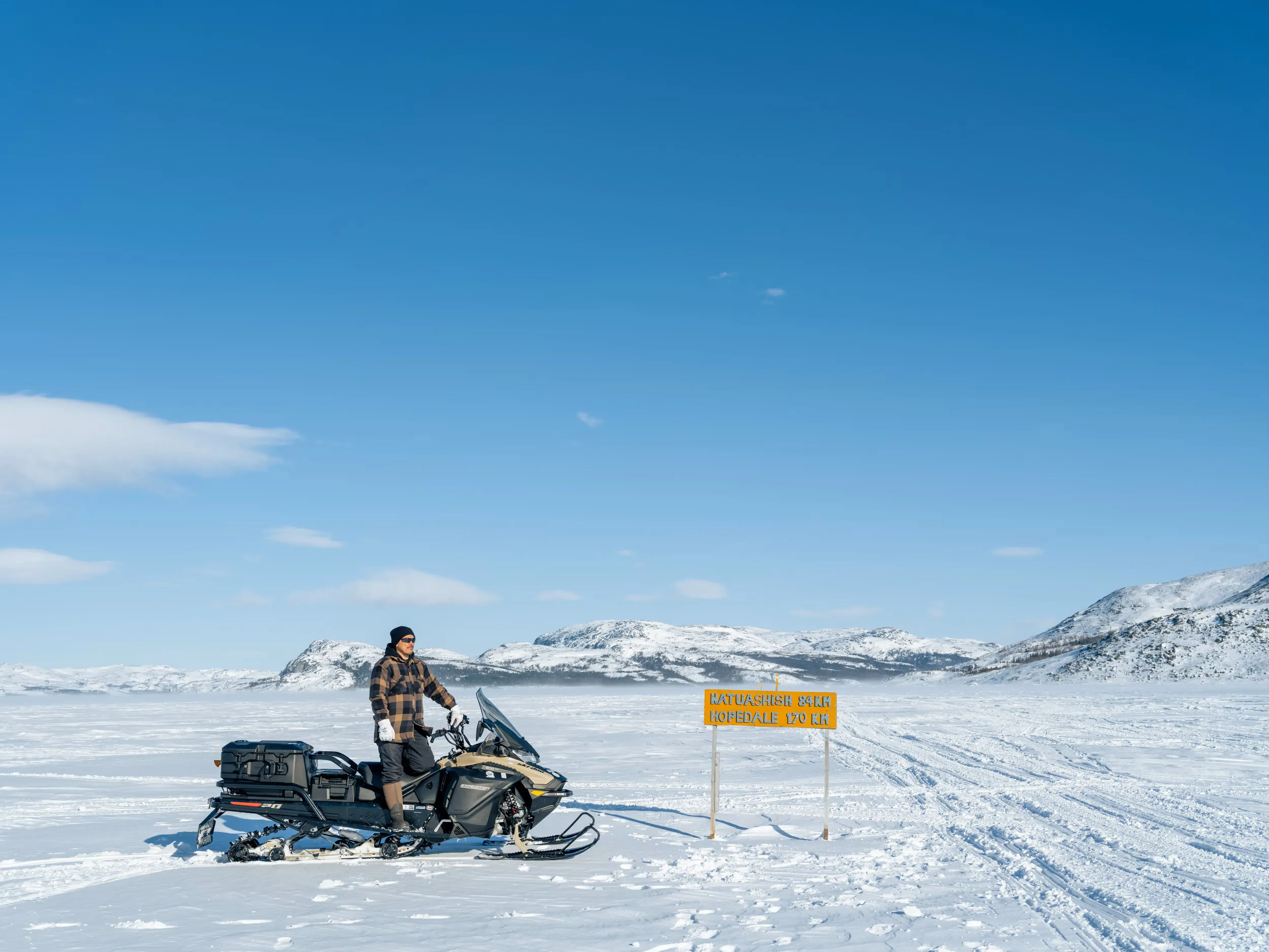
On the crucial ice highway where Mr. Webb is logging measurements, a 620-foot icebreaker, Umiak I, breaks the ice every month on the “ship track” to and from servicing the Voisey’s Bay nickel mine. The 70-kilometre-long east-to-west track severs the main ice highway connecting Nain, in the north, to the communities on the Labrador coast — the Innu community of Natuashish and the Inuit communities of Hopedale, Makkovik, Postville and Rigolet.
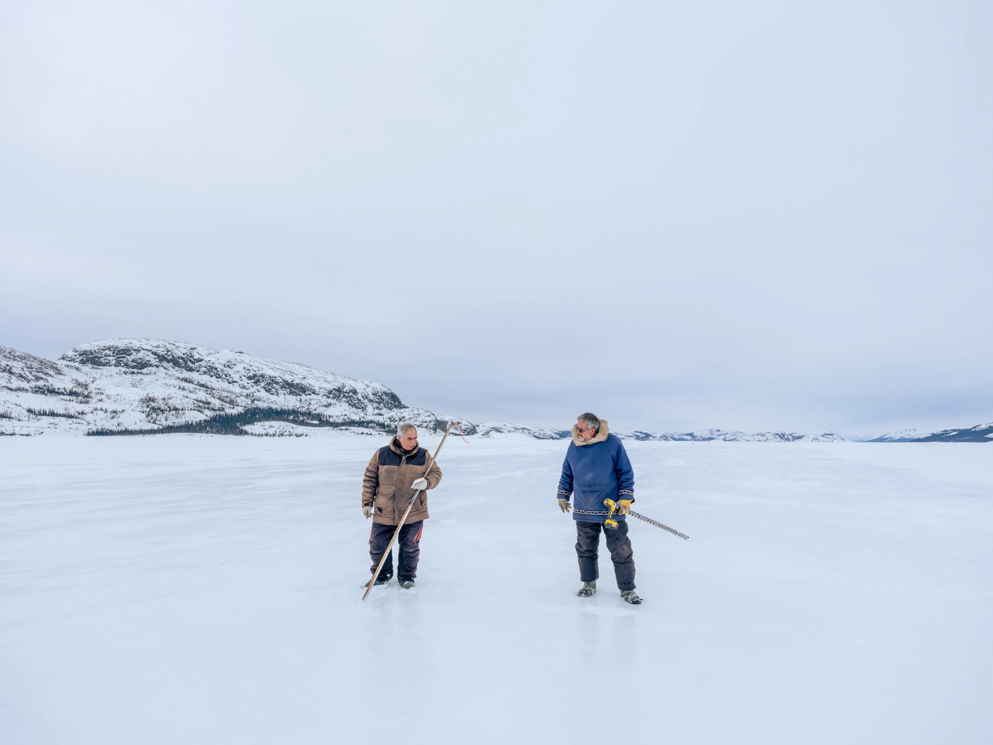
“It would be like breaking the 401 every month,” says Inuk sea ice expert and knowledge keeper Joey Angnatok, referencing the Ontario highway.
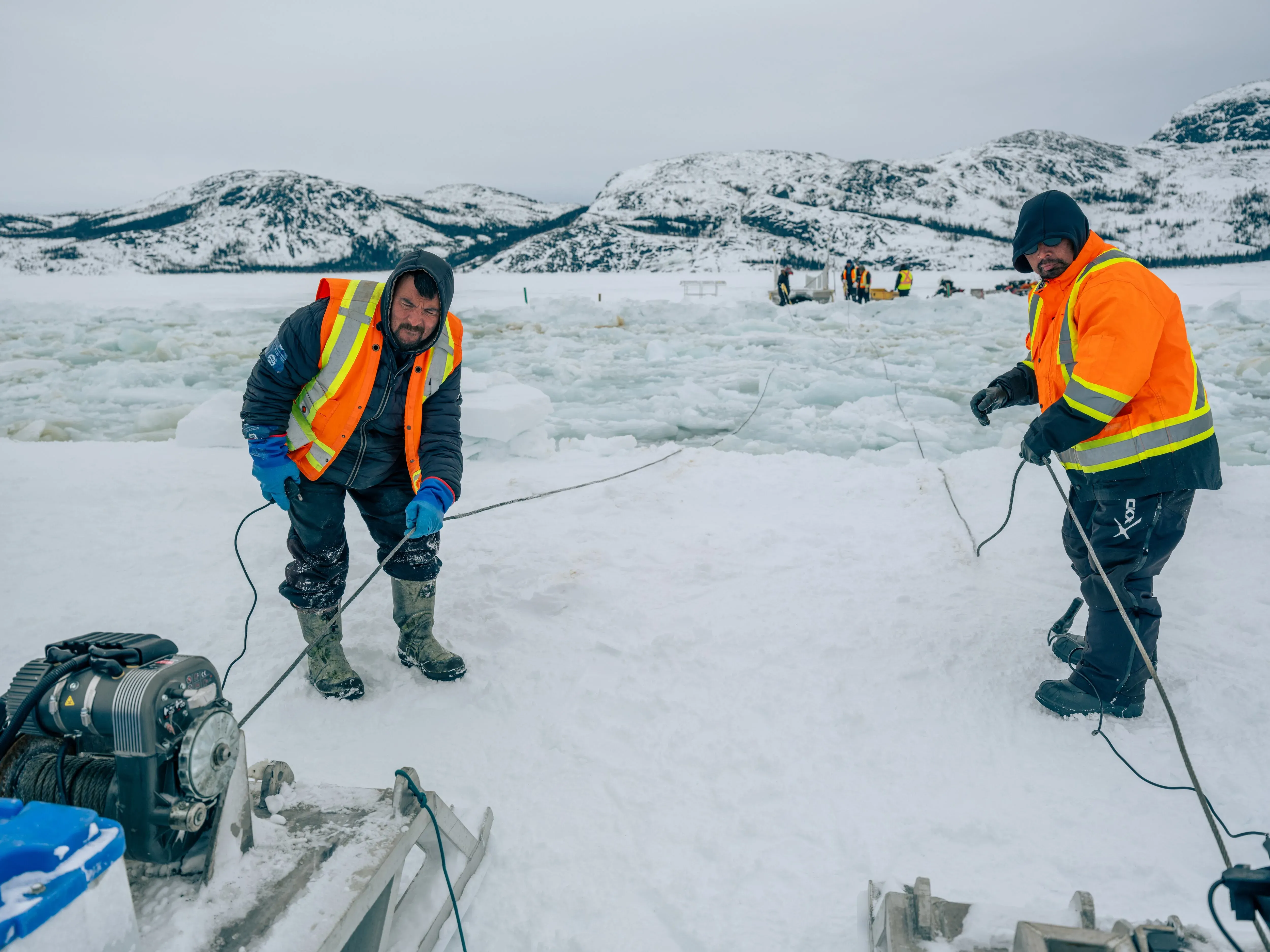
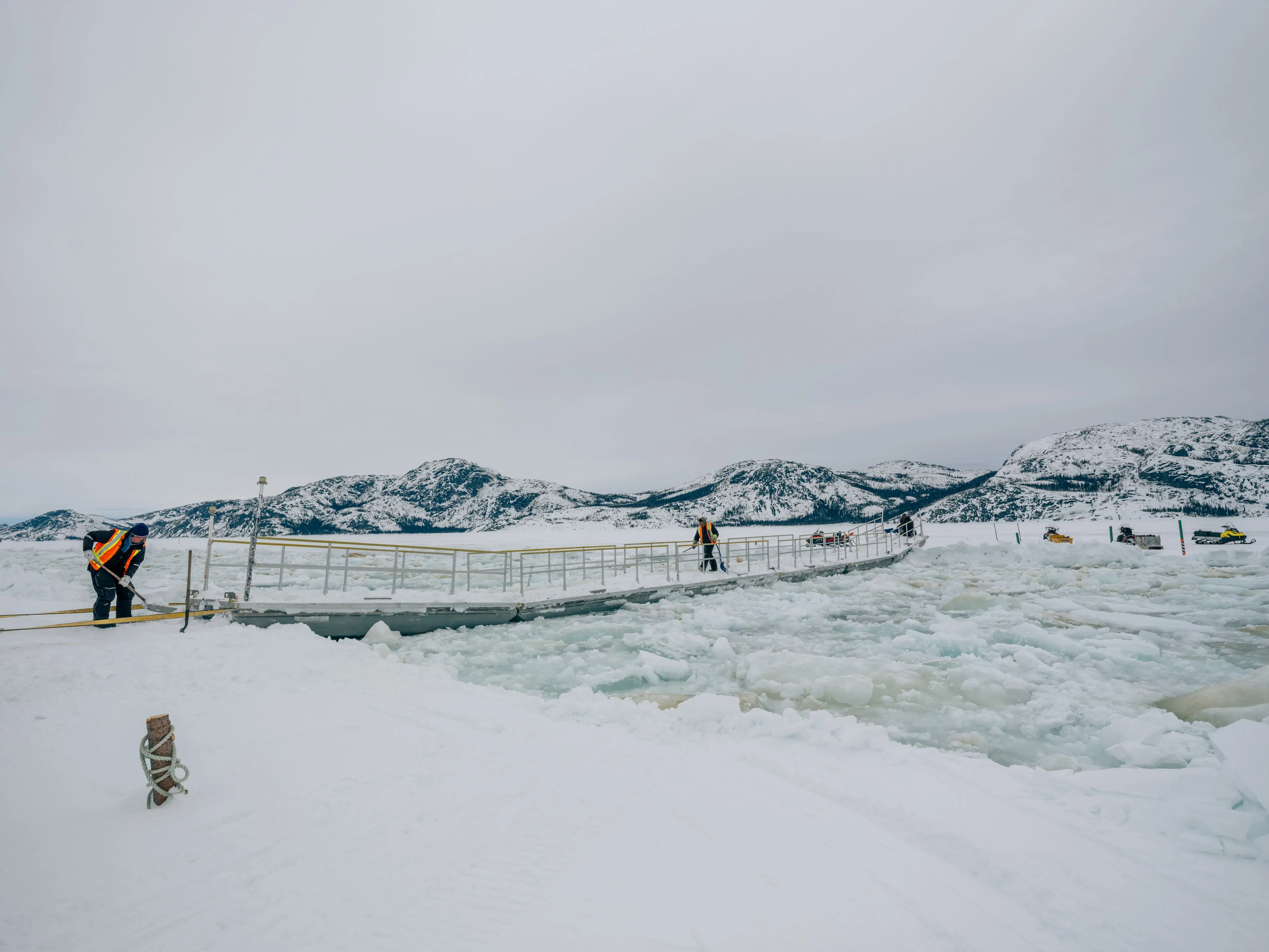
Carrying on a practice that Mr. Webb started 20 years ago, when the elder helped design the bridges over the ship track, Mr. Angnatok leads an all-Inuk team installing 100-foot metal pontoon bridges — one closer to the sina (floe edge in Inuttitut), the other west, toward the nickel mine — which are removed and reset when the ship passes.
“The pontoons are a necessity. Without them, travellers and communities would be cut off from entering or leaving Nain. Sometimes you can cross the ship track, but with the way climate is now, I wouldn’t trust not using the pontoons,” says John Winters, an Inuit research co-ordinator at Dalhousie University living in Hopedale.
Speaking in Nain at the end of March, Mr. Winters had just crossed over the bridge, with plans to do so again when returning home, a 170-km snowmobile ride. At 30 years old, Mr. Winters is already weary of what he calls “drastic changes” in the sea ice.
“You can’t predict how each season will go or even when the season is going to start,” Mr. Winters says, adding that unpredictable weather patterns are, in turn, disrupting traditional sea ice routes.
“The routes have been passed down from generations, but as time went on, with climate change, and as ice formation changed, it changed the routes as well,” he says.
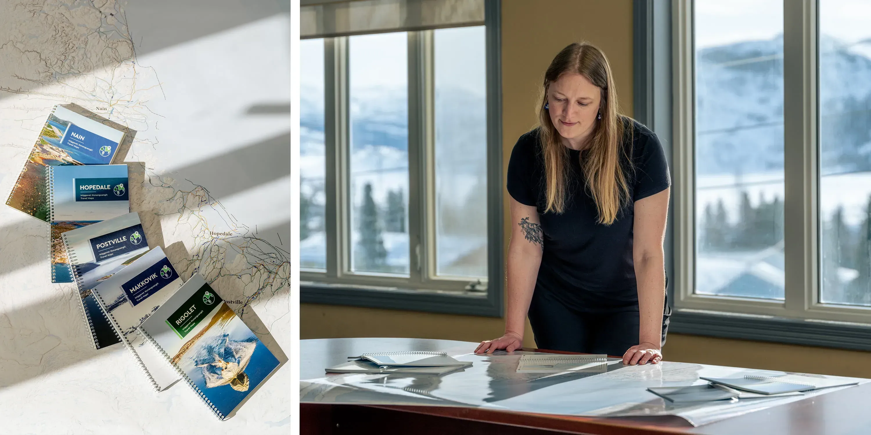
To capture these changes, Mr. Winters assisted in a “participatory mapping” project, spearheaded by Mr. Oliver and Dalhousie University doctoral candidate Breanna Bishop, to develop Nunatsiavut’s first-ever ice travel map booklets. Released last year, the maps — one for each of Nunatsiavut’s communities and available in English and Inuttitut — are another tradition-meets-modern-methods for supporting safer sea ice travel. More than that, the approach recognizes Inuit sovereignty on the ice, land and waterways.
“The mapping is inviting knowledgeable individuals — elders and other community knowledge holders — into the room to map features and areas that they deem important. It’s tied into decolonizing previous mapping policies that worked to remove Indigenous occupation from the land,” Ms. Bishop says.
“For a very long time, people didn’t expect Indigenous groups to be able to read maps, let alone make them. And it turns out, Inuit have made prolific contributions to mapping the Arctic environment.”
The Nain map includes travel routes 200-km north to Hebron, the former Moravian Church’s mission station and once the northernmost European settlement in Labrador. The Moravians had already removed Labrador Inuit from their northern lands in the early-18th century, resettling them to Hebron. In 1959, the Newfoundland government removed Inuit again, relocating residents from Hebron to coastal communities farther south. For many elders, retracing routes to Hebron is retracing the path home, Ms. Bishop says.
“It’s more than mapping the ice environment. It’s mapping people’s homelands,” she says.
The maps also show the extensive radius in which Inuit live, Mr. Oliver says. “It’s not just a dot on a map and then there’s another dot on the map 500-km away. The footprint on the land that people in communities have, the area that they actually use and occupy is significant.”
With no cell coverage on the ice outside of Nain and along the northern Labrador coast, a physical map is practical, too. Even if travellers have access to a satellite phone or Global Positioning System (GPS), these devices are inadequate for safe sea ice travel.
“A GPS can’t tell you there’s a hole in the ice,” Mr. Webb says.
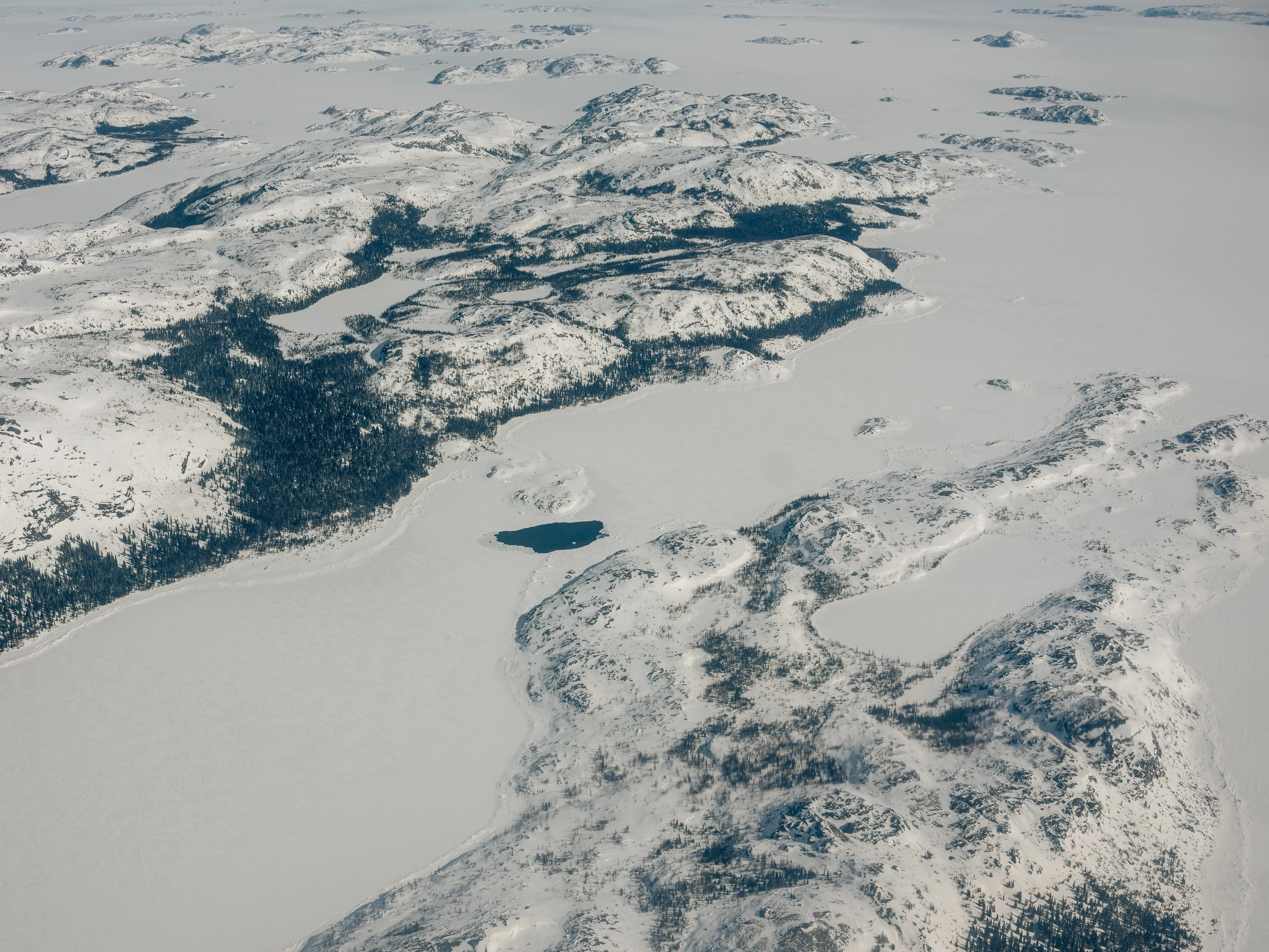
Permanently open areas of water surrounded by ice — called polynyas or what locals refer to as rattles — are commonplace in this region and becoming more prevalent.
“There’s always been big rattles here because of the tides and the shallow areas, but what we’re seeing now with climate change, the ice isn’t as thick as it used to be, so we’re either seeing new rattles become more visible, or ice that may not be considered rattled to be considerably thinner,” says Rex Holwell, the Nain operations manager for SmartICE (Sea Ice Monitoring and Information Services).
The non-profit’s seasonal maps provide the locations of known rattles. In the Nain area alone, there are 20, with another dozen to the south, and 11 more to the north in Okak Bay.
Nain elder Katie Winters says the maps could be lifesaving.
“A couple of lives were lost a few years back. If these maps were around, then I think they would have saved their lives,” Ms. Winters says, recalling a 2006 spring evening when two men, travelling together on a snowmobile north of Nain, fell through a rattle. The accident claimed the lives of 19-year-old Howard Lampe and 44-year-old Jacko Jarause.
Chelsea Saugârsuk, a cousin of the two late men, remembers how that news shook her sense of security. As climate change has deepened its hold on the North, Ms. Saugârsuk says she grieves a connection to life as she once knew it.
“For us Inuit, we feel so deeply connected to the land, and we see the land as a part of us. When we see all these drastic changes, and we’re trying to grasp all these changes, then you’re mourning the past of how we used to live,” Ms. Saugârsuk says.
SmartICE was founded in Nain in 2009 to help residents contend with these changes, particularly following a bad winter when rain and warmer-than-usual temperatures led to a below-normal sea ice season.
“The problem with what people were encountering is that they couldn’t use their traditional knowledge — what they were taught for generations on how to read the ice — because it was conditions that they’d never seen before,” Mr. Holwell says.
The same way Canadians check local weather daily, residents in Nain — as well as 35 communities across the Canadian Arctic — examine local sea ice maps. In addition to rattles, the weekly maps capture the ice edge, areas of moving ice, and the latest snow and sea ice thickness on ice highways.
“I look at them as an operational product, like the Meteorological Service of Canada puts out a weather forecast every day, we’re doing operational products in the community, for the community,” says Katherine Wilson, SmartICE’s knowledge co-production director.
Integrating Indigenous and local knowledge of sea ice with data-driven technology, including remote monitoring and satellite mapping, is what SmartICE does, says Ms. Wilson, who trains SmartICE Inuit co-ordinators to interpret and annotate satellite imagery using local knowledge and language.
Among SmartICE’s main technologies are its SmartBUOY, a three-metre-long stationary sensor, vertically positioned in the ice to collect air, snow, ice and water temperatures and communicate that data daily to satellites, informing a temperature profile that determines ice thickness. SmartKAMUTIK, a sled-mounted sensor, provides real-time snow and ice thickness measurements via a smartscreen mounted to the operator’s snowmobile.
How sea ice travel information is shared — on community Facebook groups and the Indigenous social-media platform SIKU — is as much a part of SmartICE’s innovation as the information itself, Mr. Oliver says, calling it a modern adaptation of traditional Inuit knowledge sharing.
“When someone comes back from a hunting trip, from a cabin or a fishing trip, one of the main things they do is speak with their family, speak with their friends, speak with other community members and share their knowledge, share their observations about what the conditions are,” he says. Social media amplifies that sharing — reaching a broader audience faster, complemented with photographs and maps.
But a shorter sea ice season means less time spent learning from elders and knowledge holders, steeped in tradition and culture. That’s a barrier for youth who want to reclaim their Inuit lifeways, Ms. Winters says.
“A lot of young people today are more interested in learning our language than before, because back then, our parents weren’t allowed or able to use their language. And that language was being lost,” she says.
A local sea ice terminology book launched in Nain last year aims to preserve the local Inuttitut language. The Sikusiutet sea ice terminology was produced by SmartICE’s Nain community management committee — a volunteer group of elders and knowledge holders who call themselves Sikusiutet, Inuttitut for “people who live on the sea ice.” Ms. Winters worked with the committee to translate, in English and Inuttitut, the book’s more than four dozen sea ice terms and definitions, which detail conditions from freeze-up until spring thaw and provide reference photos.
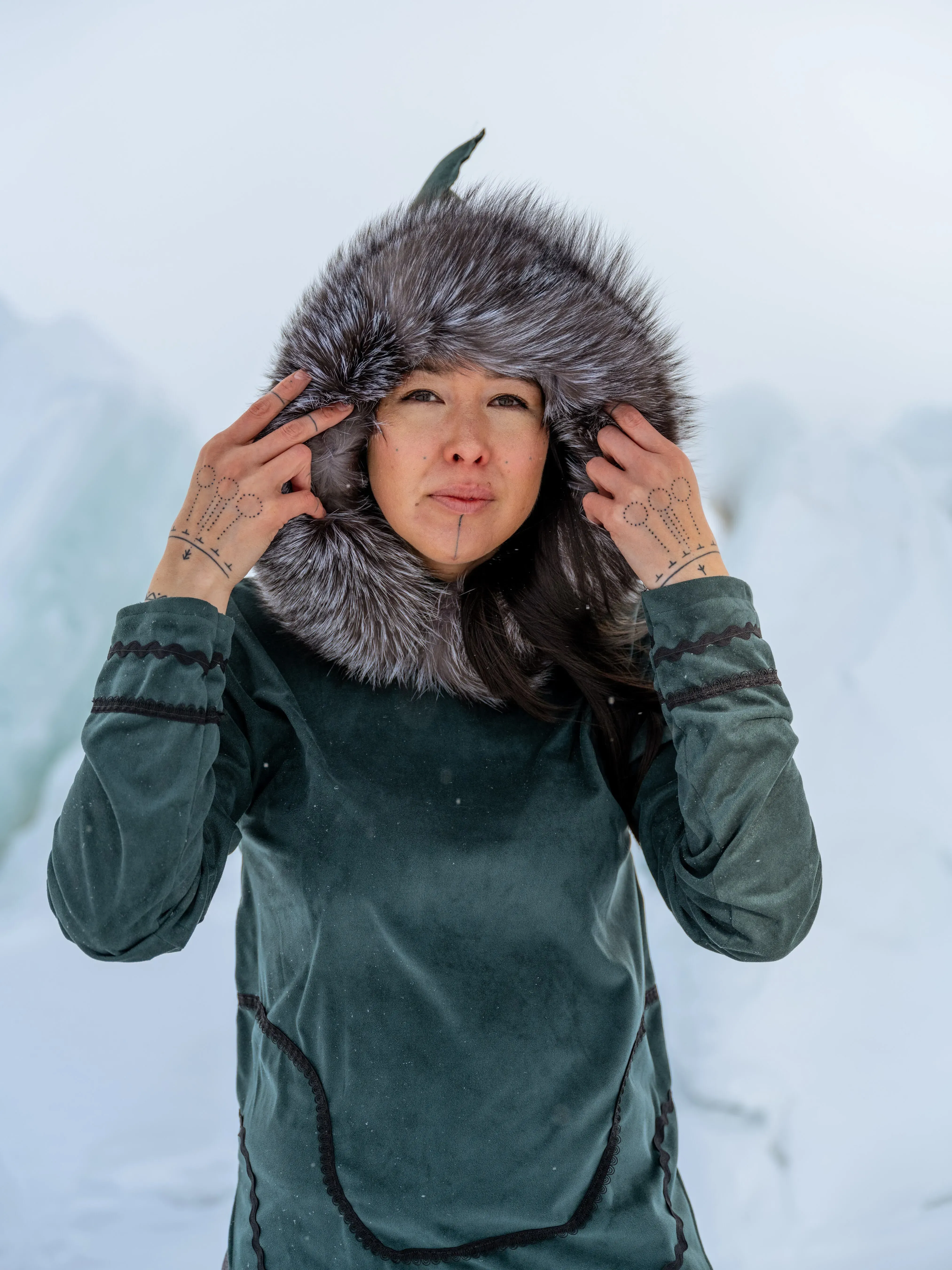
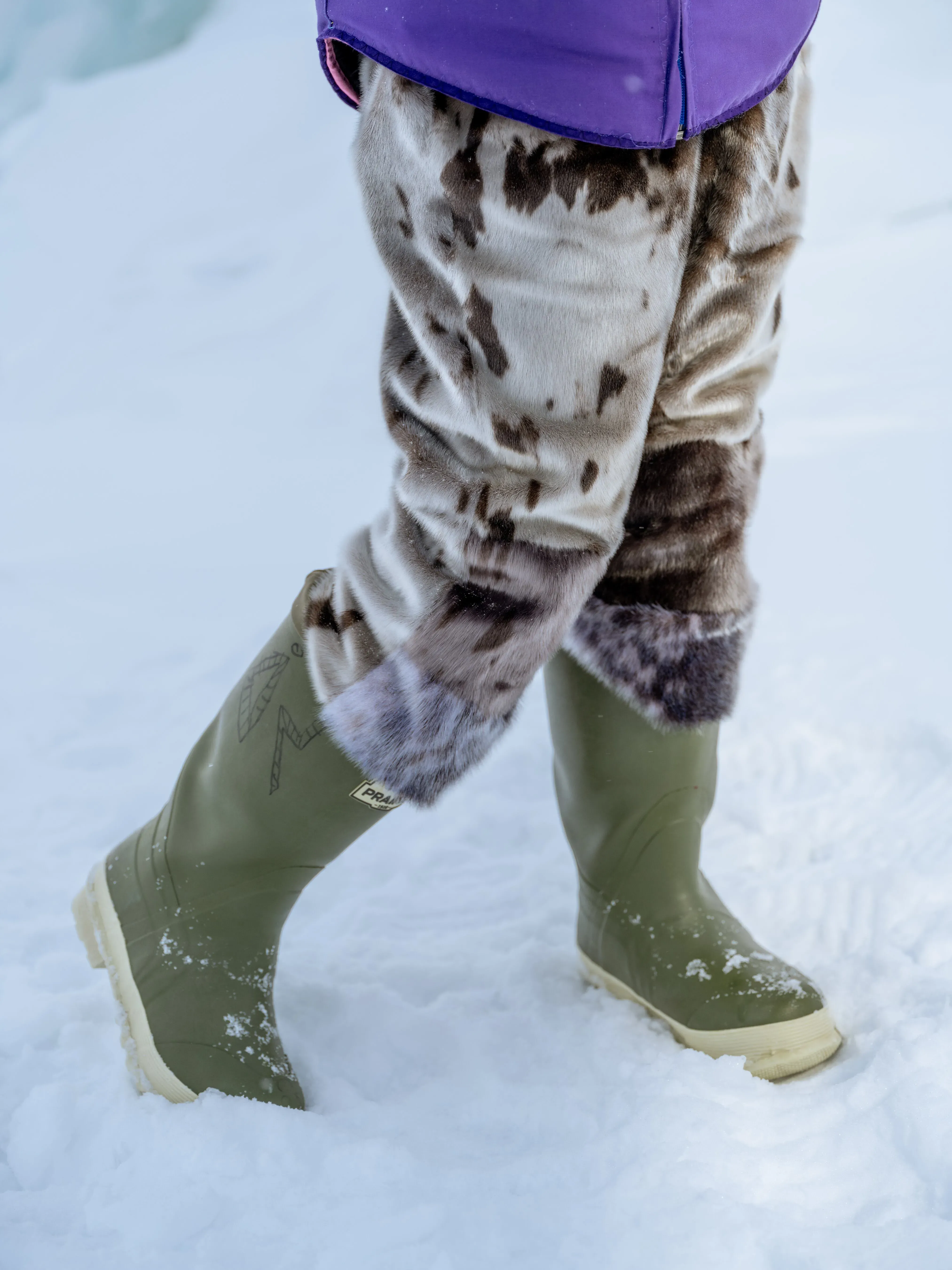
Another example of the cultural loss, says 11-year-old Aaju Lightfoot of Makkovik, is less time wearing traditional garments such as atigik (parkas) or kamik (sealskin boots).
“Atigik we would wear almost all winter. But now, because of climate change, it’s getting hotter. And for wearing kamik, we need it cold and dry,” Aaju says.
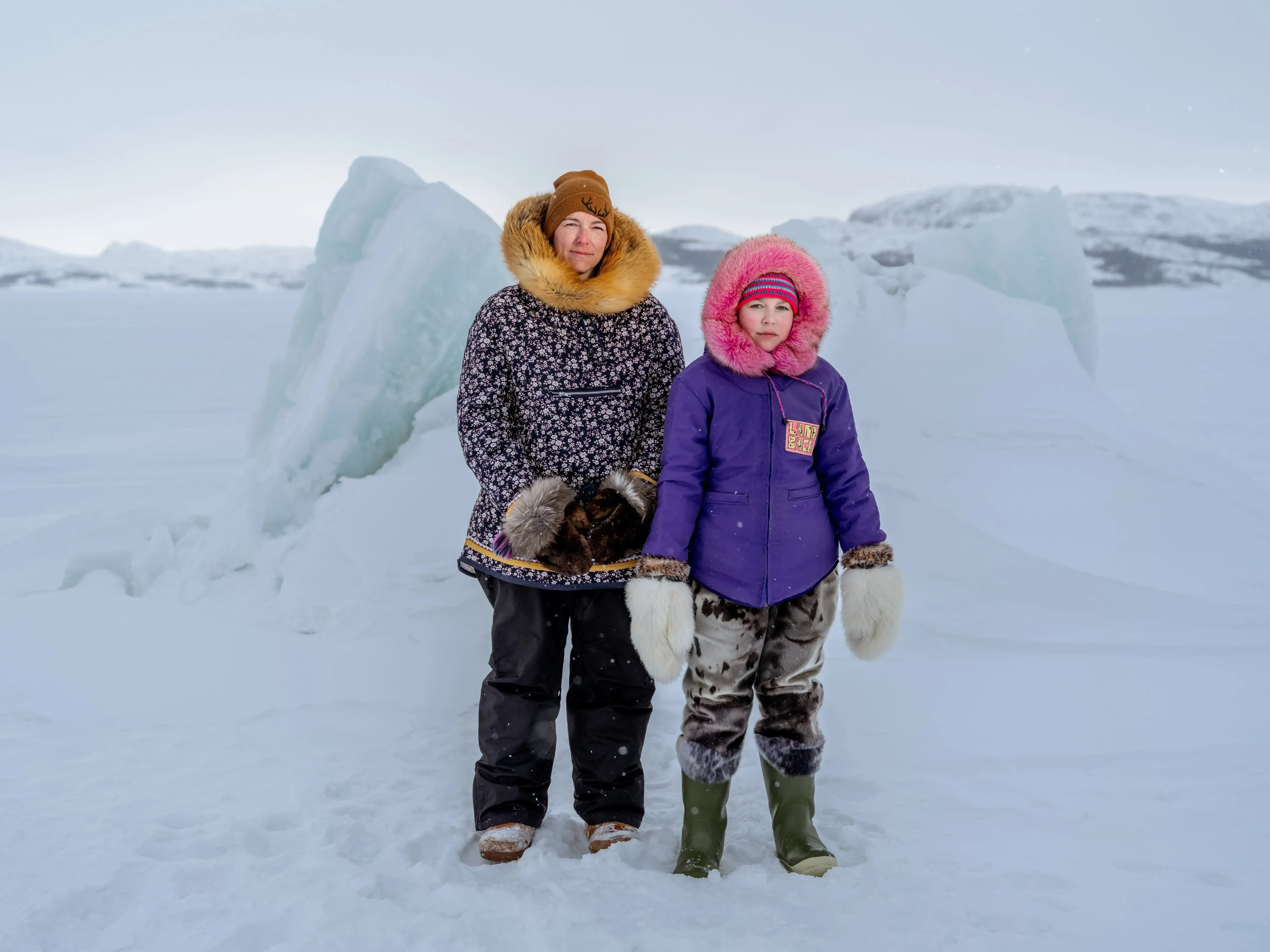
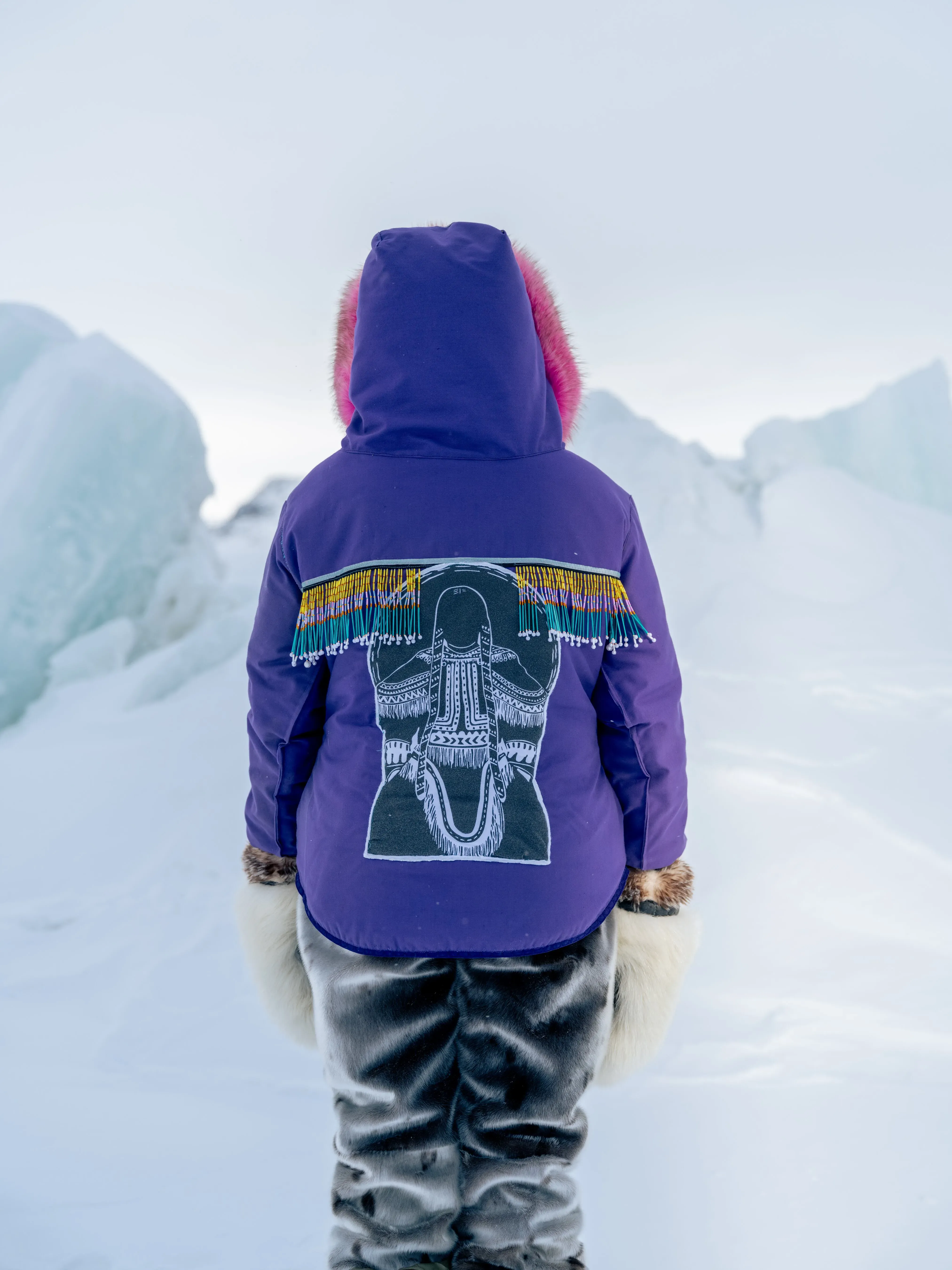
Each garment carries the stories of its creation, from hunting on the land, to preparing the furs, to sewing the needlework.
“It’s hard to talk about, like all the trauma we’ve been through, because not being able to wear traditional clothes, it’s impacting our culture and residential schools already did that,” Aaju says.
For Aaju’s mother, TJ Lightfoot, hearing how climate change has affected her child’s connection to Inuit tradition and culture, especially their ability to play, hunt and camp on the sea ice, is devastating.
“As a parent, that’s heartbreaking. As an Indigenous parent, knowing that there are risks with everyday normal activities that shouldn’t be special, that should just be the way that we’re living, that’s really hard to hear because my child’s childhood is not the same as ours or our grandparents‘,” Ms. Lightfoot says.
These emotions run raw particularly in remote, fly-in communities, she says, explaining that weather on the coast often puts flights in holding patterns.
A big reason for that is a lack of weather coverage.
Two-thirds of Canada’s landmass isn’t covered by weather radar systems, which forecast short-term severe weather such as thunderstorms, tornadoes, hail, extreme rain and ice storms.
“That includes nearly all of Canada’s most remote communities. It’s over 90 per cent of the communities that are fly-in communities and those are predominantly Indigenous communities,” says Robert Way, an environmental change researcher of Inuit and settler descent at Queen’s University.
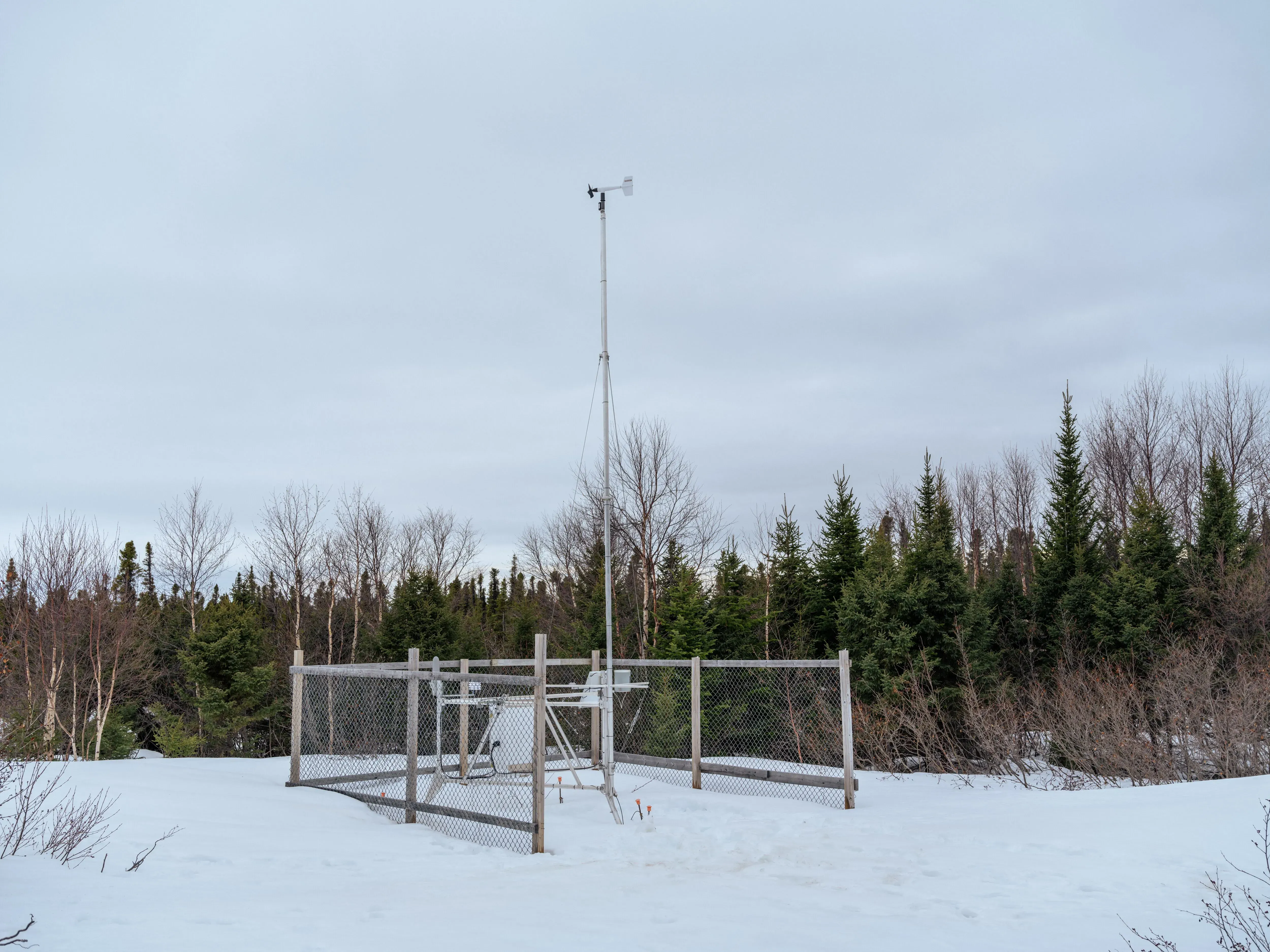
Some northern communities have ground-based weather stations, often at airports, that are operated by ECCC and offer basic information such as air temperature, precipitation and wind speeds.
Others have no federal weather coverage at all. Mr. Way’s team works with those communities to install and maintain community-led weather stations, putting real-time weather information into the hands of local residents.The stations are deployed in Postville and Rigolet, as well as along important travel routes outside of Nunatsiavut in Labrador.
Sikuliak, the sea ice that’s strong enough to walk on, is over a month or more away across Nunatsiavut, Mr. Webb says, speaking on the phone from his home in Nain in late November.
“Looks like it will be late getting ice again,” he says, blaming the “too warm weather” causing the ice to melt too soon.
What is lasting, Mr. Webb says, is how Inuit have seamlessly integrated their rich heritage with modern approaches.
“We won’t stop now. It’s what we’ve done for thousands of years.”
Reporting by Jenn Thornhill Verma; Photography and video by Johnny C.Y. Lam; Digital presentation by Mackenzie Lad; Photo editing by Clare Vander Meersch; Video editing by Melissa Tait; Graphics by Murat Yükselir.