Story
 March 29, 2020
How Tribes and Other Partners in Southeast Oklahoma Are Preparing for the Next Big Drought
Country:

Project
The Moving Meridian
How do farmers and rural towns in the Western United States reimagine their lives and businesses as...


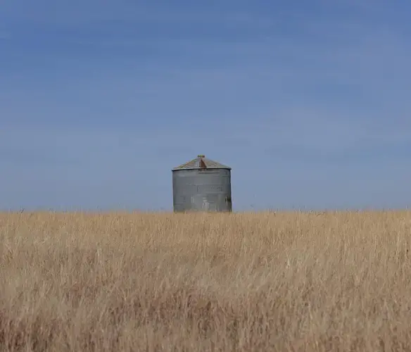
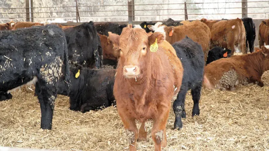
Southeastern Oklahoma averages at least 40 inches of rain per year, so its agricultural industry focuses primarily on livestock and timber. But an extended drought in 2011 and 2012 cost Oklahoma’s farmers and ranchers more than $2 billion in losses statewide.
A citizen of the Choctaw Nation, Billy Smallwood is a fifth-generation rancher and hay baler who has a cow-calf operation in Pushmataha County. He says that year, he made almost no hay.
“You know, a hay baler doesn’t like to buy hay, but we had to buy hay,” he remembers.
Smallwood says farmers and ranchers know they can’t control the weather, but that doesn’t make it easy to get through the tough times. There wasn’t much he could do about it.
“Because it doesn’t matter how many acres of ground you got. When the Good Lord don’t rain on you, it can’t produce,” he says. “And so you just have to make judgments that try to get the most out of what you’ve got.”
In response to the extended drought, the Chickasaw Nation, Choctaw Nation and other area partners began developing a drought mitigation plan for the Arbuckle-Simpson Aquifer in 2015. That aquifer is the principal source of water for about 150,000 people across southeastern Oklahoma. For some communities, it is the only potable water source.
“In Oklahoma, we’re used to drought,” says Kara Berst, the undersecretary of outreach and services for the Chickasaw Nation’s Department of Commerce. “Our agriculture folks depend on water for their industry. And so we’re kinda used to knowing there’ll be impacts here on our state.”
The collaborators included the City of Ada, the Nature Conservancy, the Oklahoma Water Resources Board, the National Park Service, East Central University and the Oklahoma Department of Environmental Quality. Berst says maintaining the aquifer, and executing any drought plan, will require everyone’s participation.
“We tried to reach out and get the most input that we could because we do believe that is the best way to get an effective plan,” she says. “If we just sat in a room by ourselves and put something on paper, when we take it out to the real world, it might not actually work.”
They came up with a multi-step plan, based on levels of alerts. For the plan to be activated, a trigger threshold has to be met based on a month’s worth of data for at least one of five hydrologic factors: the water level at Arbuckle Lake, the aquifer level at the U.S. Geological Survey’s monitoring well in rural Pontotoc County, Antelope Springs’ spring flow, the Blue River’s streamflow near Connerville in Johnston County and the Palmer Drought Severity Index. On the flip side, any decision to lift the drought plan is also based on a month’s worth of data.
Responses are based on how many triggers are set off. For example, if just one is tripped, then it is considered an alert. Area residents would be asked to hold off on washing their cars or watering their lawns. Area farmers would be asked to reduce their potable water use by one-fourth.
“We may say, if the temperature is 100 degrees, do you really need to wash your car today?” Berst says. “Just little things that will add up to make a huge overall impact.”
If all five triggers are set off, ranchers would be encouraged to move their livestock to an area with more water. For other residents, alert-level restrictions like the car wash ban would become mandatory in order to reduce water use by 40 percent.
“We have a lot of customers and a lot of employees,” Berst says of the Chickasaw Nation, “even small steps added together can make a huge difference on how much water we use.”
Oklahoma’s statewide rainfall varies greatly from the dry region of the panhandle to much wetter areas in the east and, especially, southeast. The 100th meridian cuts through Oklahoma along the border with the Texas panhandle. That line of longitude is what 19th-century naturalist John Wesley Powell suggested marked the separation of the wet, green east from the dry, brown west.
Modern researchers looking at aridity across the Great Plains have found those conditions have moved east, closer to the 96th meridian. But they’ve also gained a better understanding of the myriad weather patterns that contribute to the region’s precipitation.
The eastern section of Oklahoma, for example, looks very different from the middle of the state and the panhandle, in part because of the Ozark Plateau, the Ouachita Mountains and the Arbuckle Mountains. The landforms influence agricultural uses of the area, with most of Oklahoma’s cash crops grown elsewhere.
Still, as Oklahomans saw in 2011-2012, anomalous weather events such as drought can impact everyone and hit almost anywhere.
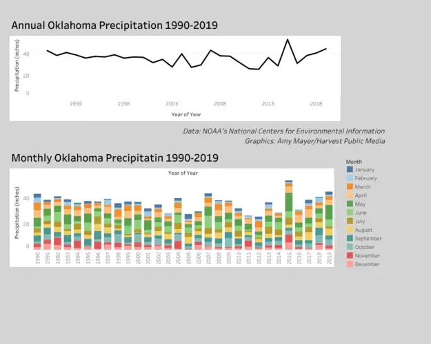
To date, the drought mitigation plan has not been enacted or revised since it was formally launched in 2017. According to data from the Oklahoma Mesonet, the region’s precipitation totals were above average in both 2018 and 2019. Monthly rainfall totals for January and February 2020 were also more than an inch above average for several communities in the plan’s area, including Ada, Sulphur and Tishomingo.
The wet years have provided time for more discussion and preparation. The drought mitigation plan has prompted additional research on water reuse, climate modeling and the impact of temperature shifts on water bodies in the region. It has also prompted research about alternative water sources, such as pipeline connections, for communities that currently rely on a single source should that one source start to dry up.
“We want to put into place all the measures we can now so that it’s only a matter of flipping a switch,” Berst says, “when and if that occurs.”
Meanwhile, area ranchers and farmers, including Smallwood, are also using that additional time and moisture to bolster their own drought plans. Smallwood says the 2011-2012 drought was tough, but it taught him valuable lessons.
“When the opportunity arises, you’d better get your hay baled or your ground worked or whatever you’re trying to do because you never know how your seasons are going to change,” he says.