Come with us as we explore Cape Cod to better understand what climate change is doing here, what it...


For the complete interactive presentation, visit The Boston Globe's website.
These bridges span much more than a canal.
To traverse the Sagamore, from the north, or the Bourne, from the west, is to cross the boundary between work and play. As the last girder shrinks in the rearview mirror, the road opens onto the pine-fringed mid-Cape expressway. Already those knotted neck muscles are beginning to soften and uncoil.
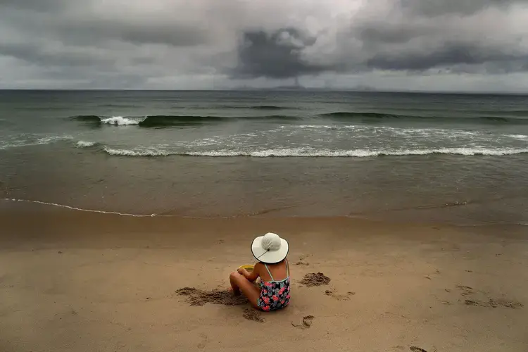
The beaches we love — Marconi, Cahoon Hollow, Nauset, to name three — are still miles away. But the worst of the dreaded Cape traffic is behind us now. We are in a postcard land that evokes a particular memory, a four-word poem, for anyone who has had the good fortune to experience it: Summer on the Cape.

But this is no vacation. The Cape we love is at risk now. Cape Cod is perched on a stretch of ocean warming faster than nearly any in the world. And as much as we might wish it away, as hard as we try to ignore it, the effects of climate change here are already visible, tangible, measurable, disturbing.
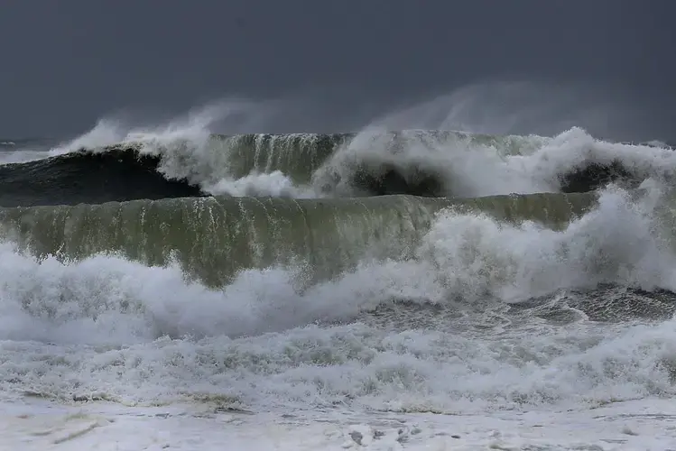
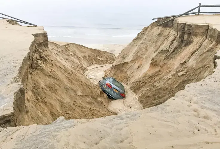
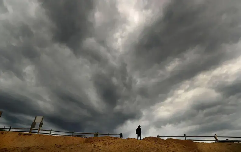
Perfect summers have grown hotter and muggier. Storms arrive violently, and more often. Occasionally, nature sends up an even more ostentatious flare: A historic home vanishes. The earth opens up and swallows a Honda Civic. A seasoned fisherman on the waters off Provincetown peers over starboard and spies an unmistakable shock of electric green: mahi-mahi, visiting from the tropics.
Along Old King’s Highway, the route the Wampanoag once wore into the earth, the blooming summer hydrangeas and bustling ice cream stands look familiar and timeless. But if we are going to preserve this precious place, and this world, we must learn to look for warnings we would prefer to ignore. The marsh, the birds, the forest, the food: So much is changing, shifting, or washing away.
People here like to say that the only thing constant about the Cape is change, and indeed the sands left behind by an ice age that ended 18,000 years ago have always eroded and reshaped the shoreline. But what human-caused climate change has already wrought here is not the same old uncertainty. It is loss.
And so, winding past the bay on which kids could once, before the water warmed, spend every winter ice skating, we criss-cross the Cape in search of what is slipping away. This is not a travelogue of the troubling future, or a preview of dire warnings that somehow go unheeded. It is about what we can already see happening, right now, on America’s playground. It is about what we will lose if we don’t look, harder than ever, at what global inaction will cost.
The Cape is fundamentally a peaceful place. For generations, we have talked about joy and family and the restorative power of open ocean and unspoiled sand.
But talk to the people who live and work here, who study emerging threats to the place they’ve always known, and you will hear them use different words: Higher ground. Breach. Retreat.
Today they speak the language of war.
Hidden in the Waves
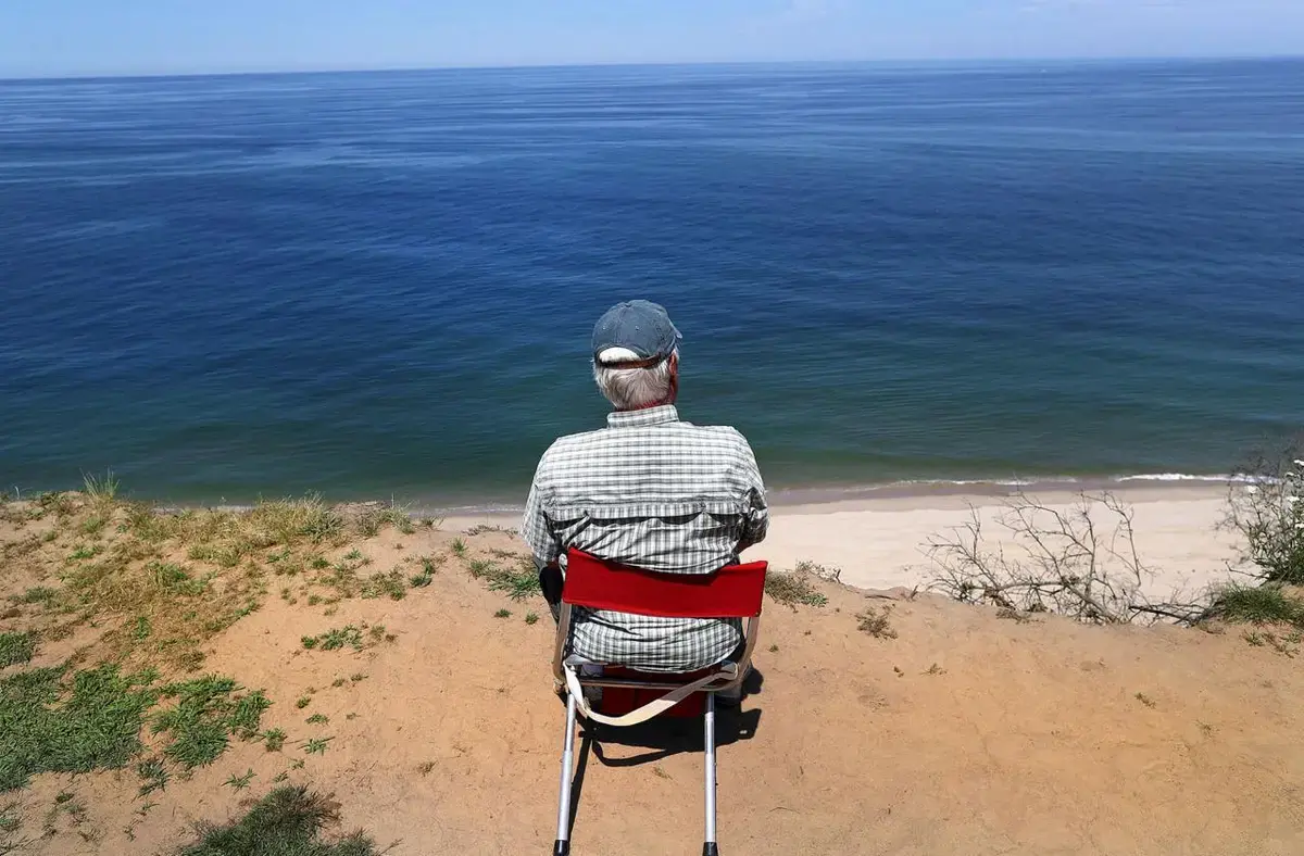
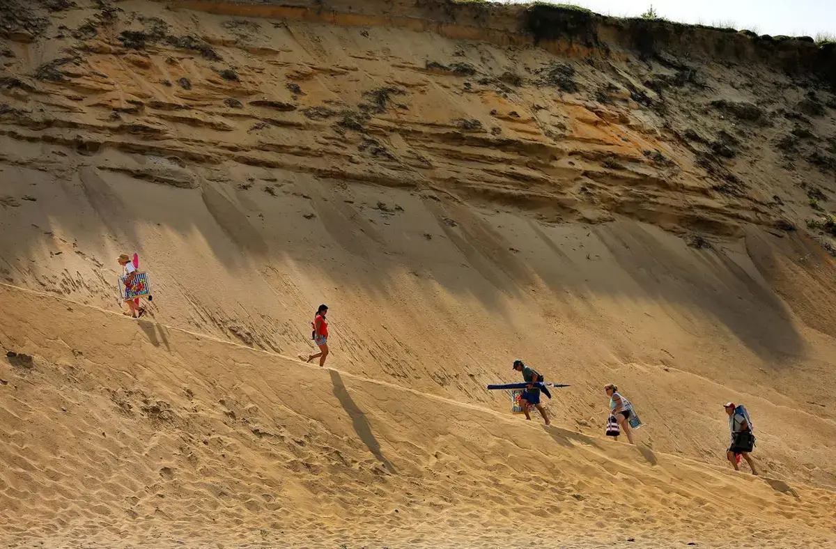
From Dave Spang’s perch high atop a sandy cliff in Truro, the vast ocean wriggles and writhes almost imperceptibly beneath a cloudless sky. More than 100 feet below Spang’s red folding chair, seals bob in the surf. Gentle waves tickle the edge of the desolate beach.
Staring out at the sea, Spang records the same careful measurements he has made three times a week, every week, for 15 years. Hidden somewhere in all his notes on water and time is a window into the forces that have hastened the erosion of the Outer Cape’s shoreline, claiming yard upon yard of this very cliff. It is a threat that is both imminent and largely unseen.
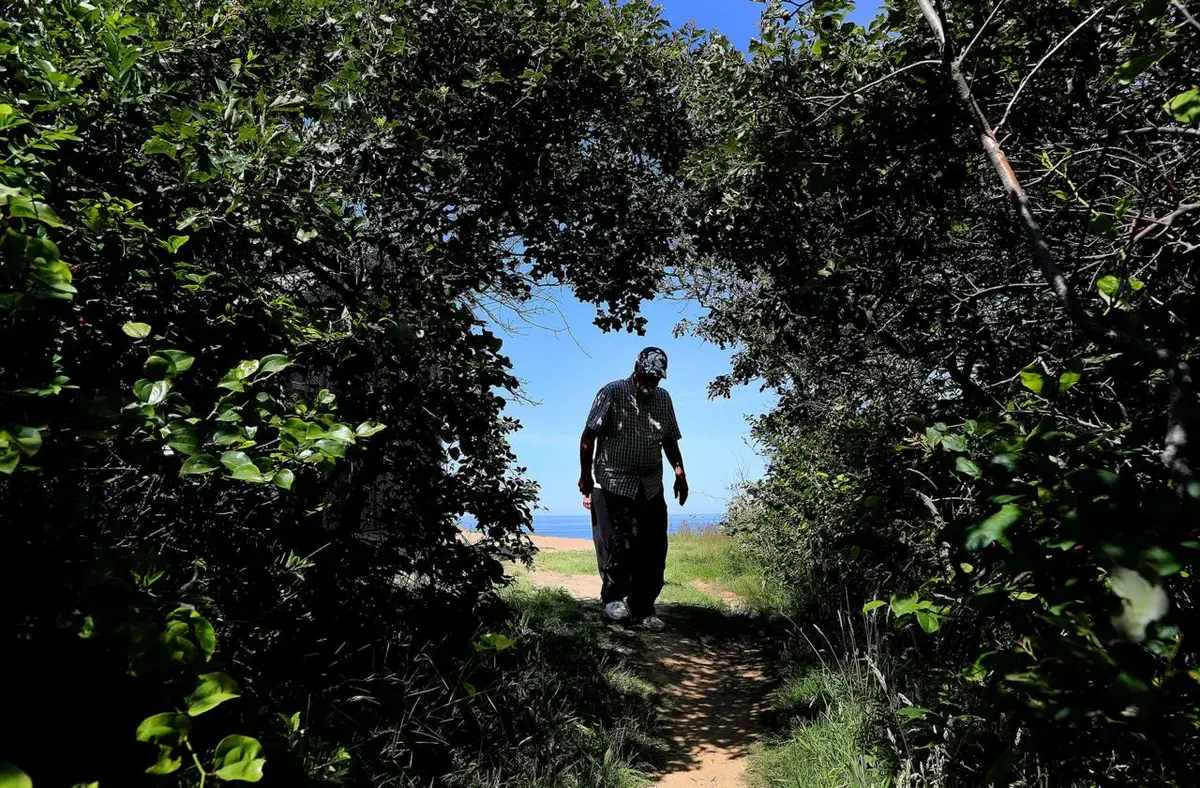
Spang and his wife, Gwen, bear witness. They park near the overgrown ballfield where the old Air Force base’s North Truro Blue Sox once played; they walk along the barbed-wire fencing and abandoned barracks and down a narrowing series of overgrown roads and dirt paths until Spang, still tall and sturdy at 81, stoops under a natural trellis of vines and brush and emerges into this small clearing at the end of the earth.
A shack about the size of a garden shed sits a few yards back from the edge, its windows boarded up year-round to discourage vandals.
From the shack, Spang retrieves his chair. Then, his left hand steadying his right before him like a marksman holding a pistol, he watches one wave pass his thumb and then counts the seconds until the next one does the same. He estimates their height. He gauges the angle at which they approach the shore.
In the roughly 15 years Spang has been volunteering to do this work, the sheer edge has lost about 50 feet. Several times — sometimes more than once a year — Spang has to jack up the shed, slide rollers under it, and shove it back a few feet so it doesn’t fall onto the beach far below.
Surrounded by the sea, the sands that shape the Cape have always shifted. Nearly 50 years ago, long before he began to count the waves, Spang helped pull the body of an 11-year-old boy from the sand on nearby Longnook Beach after a cliff collapse.
But something is different now. The ocean is rising faster than it has in thousands of years. The waves that eat at this shore are different now, too. They hit with more force, the result of a little-known phenomenon that Spang is helping to reveal.
During the Cold War, this air base was America’s first line of defense against the threat of Soviet bombers. Airmen stood at the ready, manning a state-of-the-art radar station to detect a potential nuclear attack that might have ushered in the end of the world.
Today, Dave Spang closes one eye and stares at the sea beyond his thumb, detecting a new kind of threat.
What does he see?
To fully understand the complex forces that now threaten Cape Cod, chronicling 15 years worth of waves will not be nearly enough. To make any sense of the present and peer into the future, you have to look deep into the past.
Since the last of the ancient glaciers that covered the northern half of North America receded and left Cape Cod protruding from the coastline, erosion has been the Cape’s geologic birthright. Engorged by melting ice, the Atlantic Ocean flooded the areas we now call the Gulf of Maine and Cape Cod Bay. Then, the sea rose slowly and steadily for thousands of years. The modern world had emerged from the mass of receding ice, and all that water was reshaping it.
But since the middle of the 19th century, the warming of the Earth due to climate change has caused sea levels to rise much faster, almost four times as fast. As a result, erosion on the Cape has accelerated to a geologic sprint.
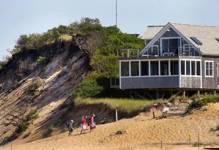
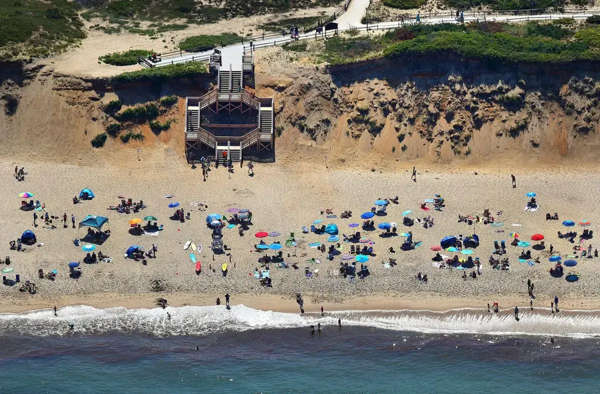
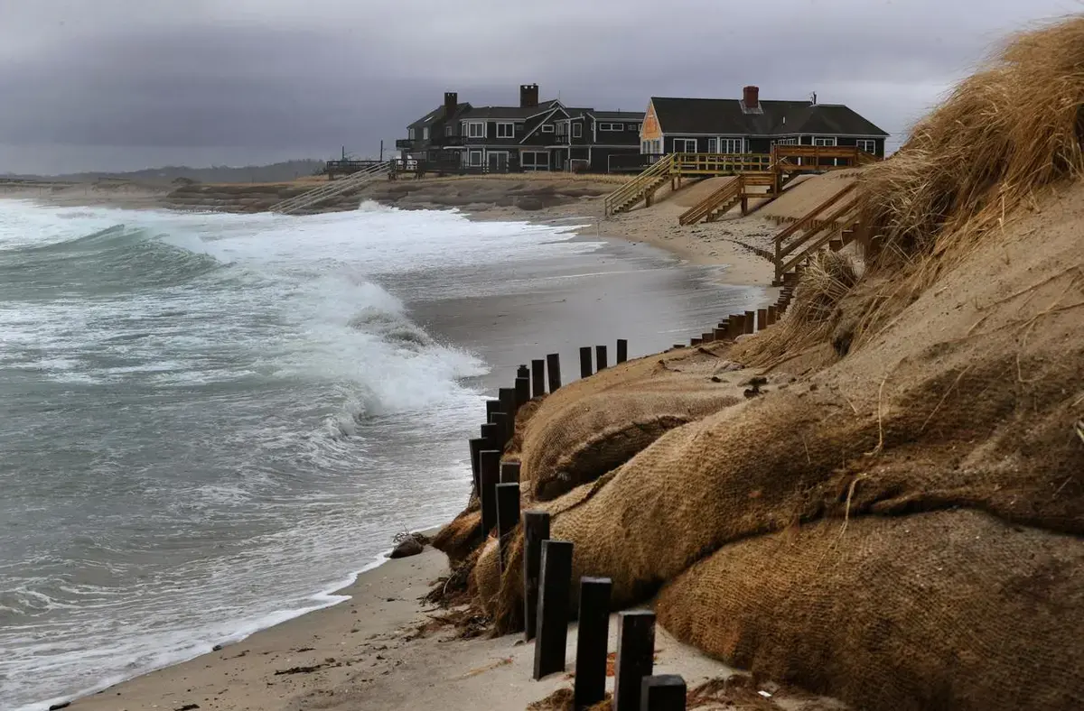
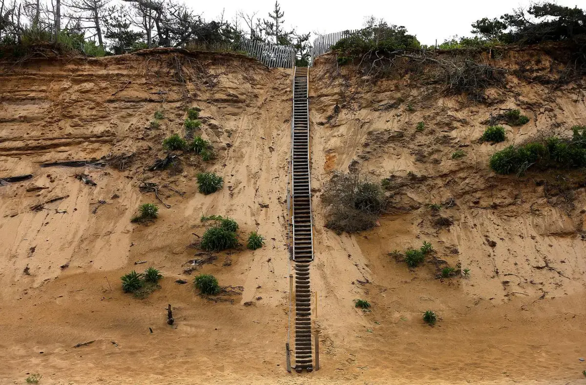
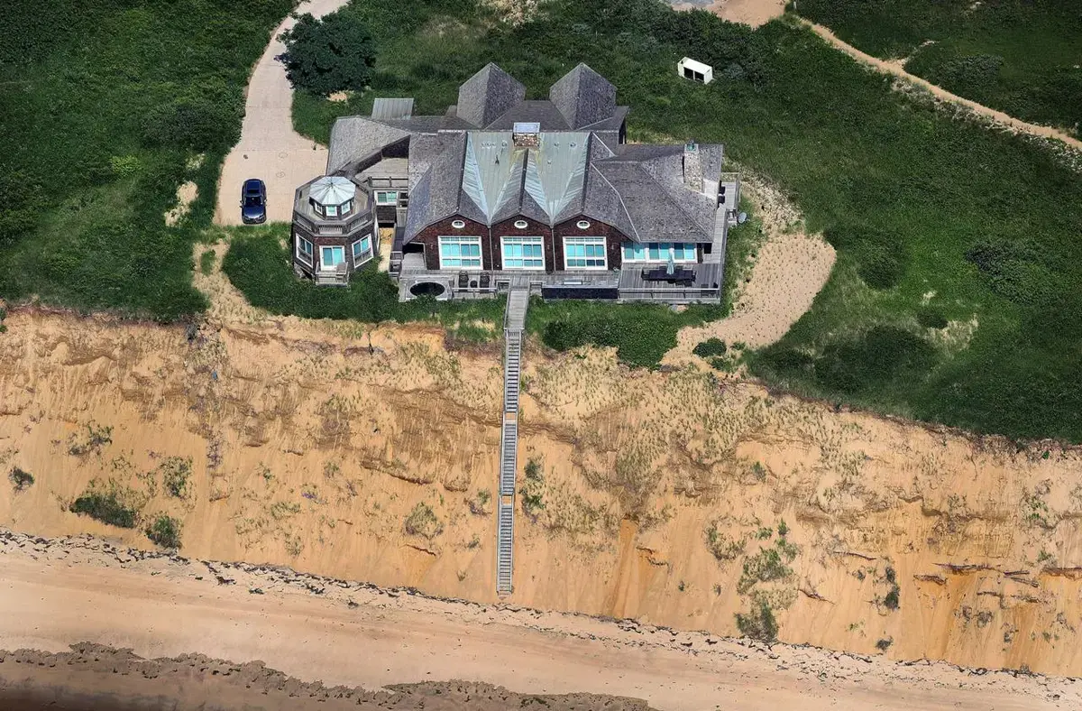
Today, the beaches on the Outer Cape lose an average of about 3 feet of shoreline a year as increasingly powerful waves slice away sand from the dunes and bluffs.
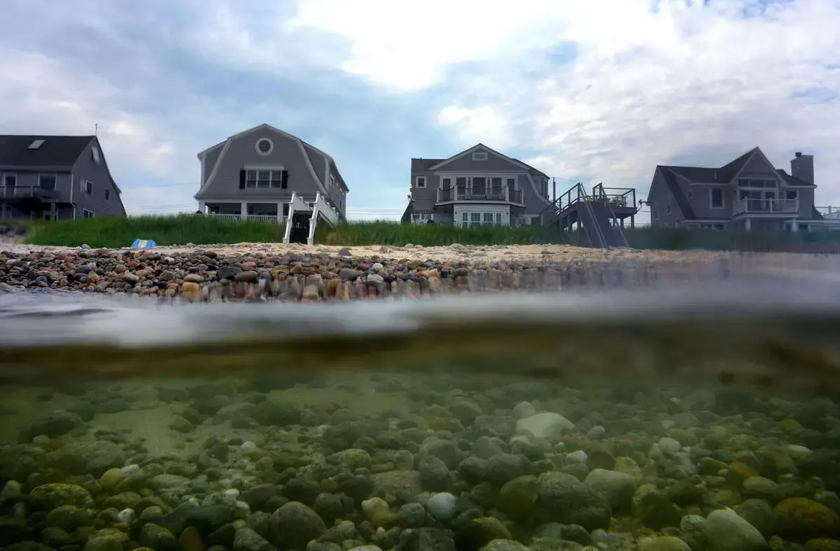
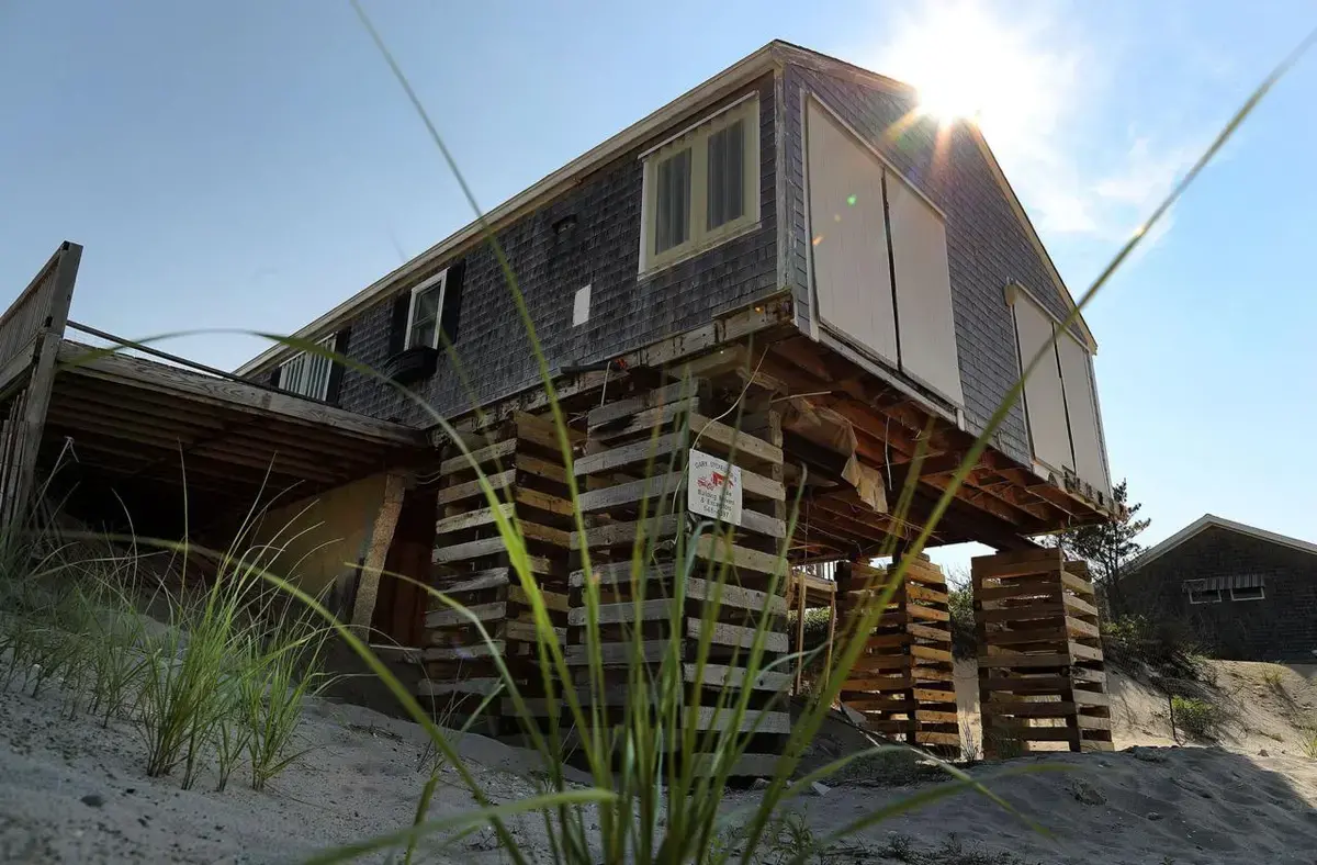
Buildings erected far from the water’s edge a generation ago now find themselves in harm’s way. Every summer, homes along the cliffs in Truro and Wellfleet are painstakingly lifted and moved inland. About a mile north of the cliff where Spang counts the waves is Highland Light, a historic Truro lighthouse whose whole purpose was to advise navigators of their proximity to land; it had to be moved more than 400 feet inland in 1996.
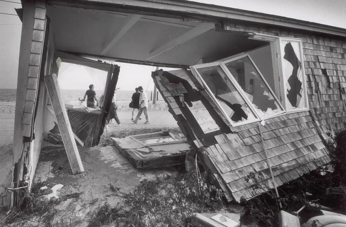
Some homeowners have nowhere to retreat. In Truro, a ramshackle old home on Ballston Beach was in the Moore/Musnuff family for over a century. It was long a subject for artists seeking to capture the Cape’s essence; Edward Hopper took a stab at it during his travels here. Wandering the galleries in Provincetown, the family would often spot renderings of their home.
John Musnuff spent his summers here, as a child playing on the beach and, eventually, as a father tinkering in the shed out back. Truro is the New Jersey real estate appraiser’s second hometown; the weather-beaten old house was like a second home.
But erosion was taking its toll. In recent years, winter storms have breached the dunes so often at Ballston Beach that the sand is now leveled, leaving a flattened, refuse-strewn alien beachscape at the head of the Pamet River. That breach in the dunes left the Moore/Musnuff home vulnerable not just from the east, but the north.
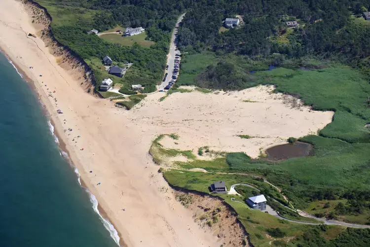
By 2018, one corner of the house was suspended in mid-air. There was so little land left that retreat — the term people here reluctantly use to describe moving inland, away from the ocean — was not much of an option. By the time the home was demolished in 2018, it was teetering on a shabby patch of dune barely bigger than its own footprint.
“It was a hard thing to watch,” Musnuff said. But a lifetime of summers on the Cape was worth the heartache, he said.
“It’s a marvelous place to be. All you’ve got to do is see it.”
Since the 1950s, the clam shack nestled in the dunes of Nauset Beach in Orleans had been the place to go. The weathered old building wore a long stretch of sand and beachgrass like a rumpled apron. There was plenty of space for a dozen or so forest green picnic tables and matching umbrellas, offering a little shade and a place to enjoy an extra thick milkshake before plunging back into the surf.
Liam’s was a place steeped in childhood memories: racing through the sand, bathing suit still dripping from the sea, exchanging a few dollars for a plate of whole belly fried clams piled on a soft roll and a tangle of crisp, golden onion rings.
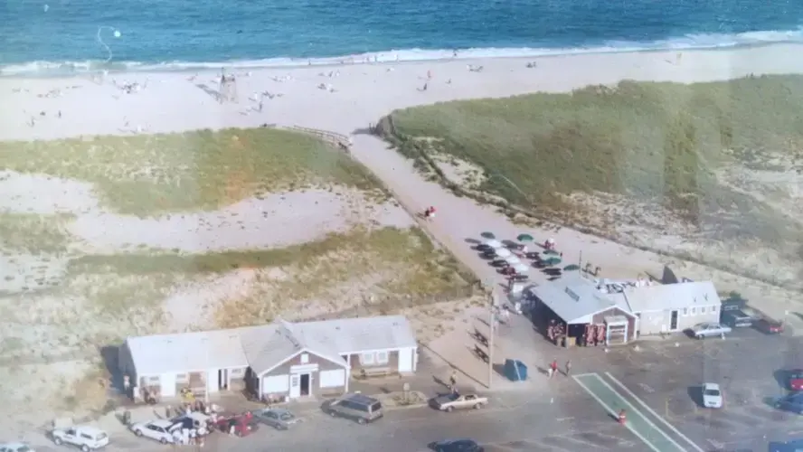
John Ohman was 41 years old when he took over the lease of what had been called Philbrick’s and renamed it for his newborn son. Ohman had already run two successful seafood restaurants in Dennis while his wife ran a third — Kate’s, which still stands along Paine’s Creek in Brewster. Soon, Liam’s outshone all of them, and Ohman was its face. Cheerful and chatty — “my wife says I can talk 20 minutes to a wrong number” — he greeted customers and rang the register, too busy to correct the visitors who assumed he was Liam.
And the notion that the water was creeping ever closer to the building? The sea was so far away it barely crossed his mind.
By the time Liam was 10, the boy was working at the restaurant that bore his name, standing on a milk crate behind the counter. Before he turned 20, he was in charge of the ice cream line, making milkshakes faster than anyone. On a busy day, when Liam’s would sell hundreds of shakes, Liam had all nine spindles going at once.
But the ocean’s advance had become impossible to ignore. The sand that stood between Liam’s and the sea was shrinking. At school, Liam had learned about the ways that climate change was hastening erosion and intensifying winter storms that can cut away beach and dune in a few hours. At work, he could see it in action.
John Ohman saw it, too.
“It caused me sleepless nights,” he said. “You always knew that you were at the mercy of Mother Nature there.”
By 2017, John and Liam Ohman had heard from experts that they had perhaps 10 years before waves consumed the 80 feet of beach between the building and the sea. A decade might have gotten John to retirement. It might have been enough time to plan Liam’s orderly retreat.
Then, on a Friday in March 2018, a nor’easter moved in.
Storms batter the Cape every winter, and Ohman didn’t give it much thought. Liam’s was closed for the season, and Ohman was keeping an eye on things by occasionally checking a town webcam trained on the beach.
“It was a normal Friday,” he said. “Everything seemed fine.”
But by Saturday, the storm had worsened. Waves at Nauset Beach swelled to over 20 feet high. While Ohman was picking up his younger son in Hyannis, the phone rang. It was a reporter from the Cape Cod Times.
“Have you been out to Liam’s?” Ohman recalled the reporter asking.
Ohman said that he hadn’t.
“Well you better get here,” the reporter said. “And fast.”
Ohman rushed to the beach. He watched the waves as they approached the dunes, surging closer and closer. Each swell seemed perfectly designed to slice away the sand that stood between Liam’s and the sea.
The old building withstood the storm, but its position was precarious. Ohman, halfway through a 10-year lease, hoped the town might move the building back, retreating to the inland side of the parking lot. Some experts agreed that would work for awhile.
But the town opted to tear it down, and three weeks after the storm, an excavator arrived to finish what the ocean had started. It clawed at the roof and walls, filling dumpsters with debris. A few signs and menus were visible in the wreckage: Salad rolls. Seafood baskets. Curly fries.
John and Liam Ohman had not been back since. The idea was painful, and they still harbor hard feelings toward the town. But on a windy Tuesday in June, they pulled up in John’s red pickup, LIAMS on the license plate.
Together, they paced off the path through the dunes, zeroing in on the specific places they’d spent so many hours working here, side by side. At the top of the dune, near the bench where the line for milkshakes used to form, they took a photo together.
The tide was low. The waves were calm. The ocean felt very far away.
The Cape can seem as thick with scientists as ice cream stands. From its southwestern tip in Woods Hole — a world center for environmental science — to the sprawling National Seashore, researchers come to study nature’s wonders and warning signs.
Few are better known here than Graham Giese, who 43 years ago co-founded the Center for Coastal Studies in Provincetown.
Eighty-seven years old, with a tangle of white hair that spends a lot of time stuffed into a faded ballcap, Giese has a way of explaining geological concepts as if he is puzzling out how these things work for the first time with you, waving his long arms excitedly and telling you what a smart question you just asked. (It wasn’t.)
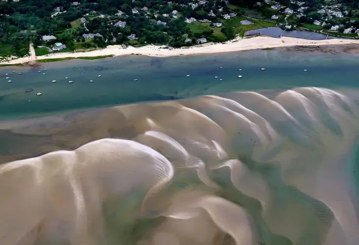
Erosion is deceptively complex. Energy from waves shifts sediment in every direction, often all at once, and if you could stand on the ocean floor and see each grain of sand with perfect clarity, it might look like a blizzard. But over time, patterns emerge. Waves carve away sand from the dunes and bluffs, the earth receding in a way that’s almost imperceptible until one day your restaurant is in danger or your house is about to fall off a cliff.
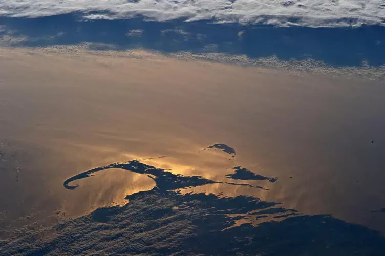
Giese, who has studied the charts and maps drawn by men who stalked these shores long before satellites orbited overhead, understands these patterns as well as anyone. In the 1960s, he was part of a team of scientists who proposed that the geologic origin of Provincetown’s signature hook was tied to Georges Bank, a vast plateau under the sea 60 miles off the Cape’s southeast coast.
Along the Outer Cape, eroding sand from beaches and dunes is distributed by waves coming from two directions: The waves that roll in off the Gulf of Maine push sand south, while swells arriving from the open ocean off the southeast coast push sand north.
Ocean waves are much more powerful than anything that wind in the gulf can produce, but their strength has long been blunted by Georges Bank, which acts as a sort of invisible breakwater.
Once water began to creep over Georges Bank 6,000 years ago, waves began to push sand north until it collected at the Cape’s now-familiar northern tip. It was a slow, steady process, undisturbed by human intervention.
The water over Georges Bank deepened only imperceptibly at first. But it is a massive force today.
The rising seas allow more powerful waves to pass over it relatively unimpeded, overpowering what had been a delicate balance with the waves that arrive from the gulf.
The result, Giese and others discovered, is that erosion rates on the Outer Cape are now nearly double what they had been for thousands of years. And the same phenomenon of water propelling sand that helped build the Cape we know has been almost weaponized by sea level rise, prematurely dooming places like Liam’s.
Wave after wave, the submergence of Georges Bank is revealed in the water. You can see it if you look closely, and for a very long time.
It is visible with special clarity if you are Dave Spang.
“Right now,” Spang says, reading the surf’s fingerprint of height, angle, and interval, “these swells are coming in from the open ocean.”
As his wife, Gwen, peers out to sea through a pair of binoculars, Spang retreats into the shack and records the day’s data in a thick three-ring binder, just as he’s done again and again before.
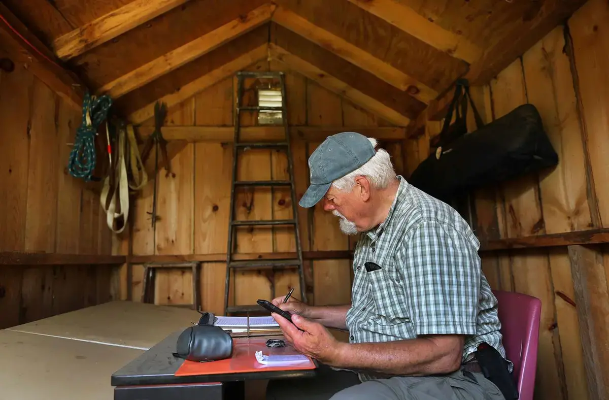


Every few months, he enters the data into a laptop charged by solar panels on the shed. About twice a year, he walks the laptop back to civilization and uploads the data where scientists like Giese can use it to study a massive global crisis.
As they make their way back along the trail they’ve walked countless times, the Spangs talk about the way climate change is shaping, altering, and threatening the Cape; it is a conversation that slips too easily into fatalism. Gwen Spang says she is glad to have lived her life already, so she won’t have to see what comes next.
A Winged Ambassador
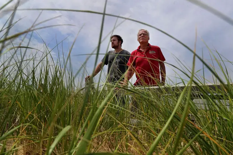
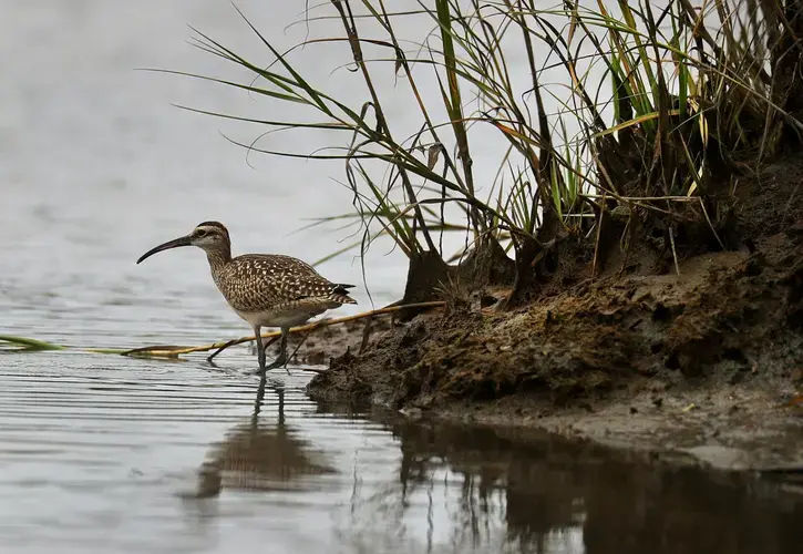
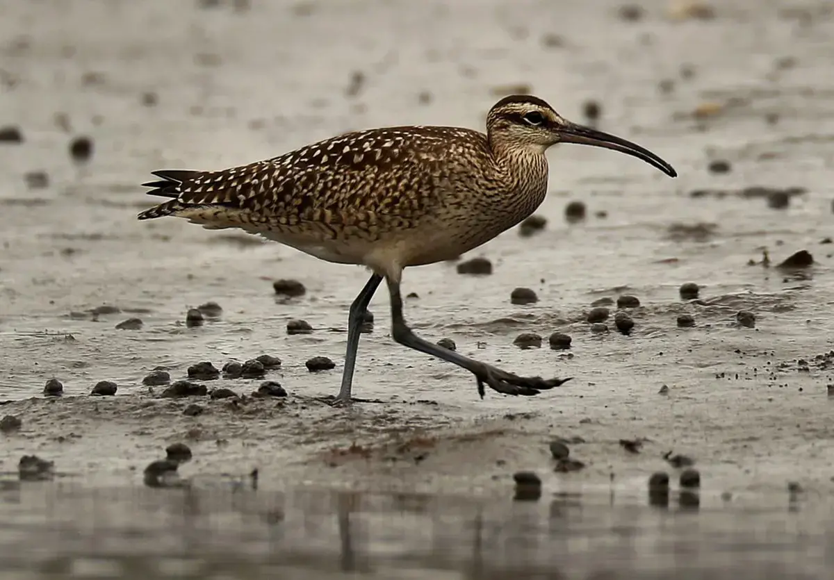
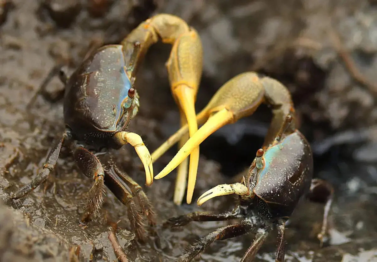
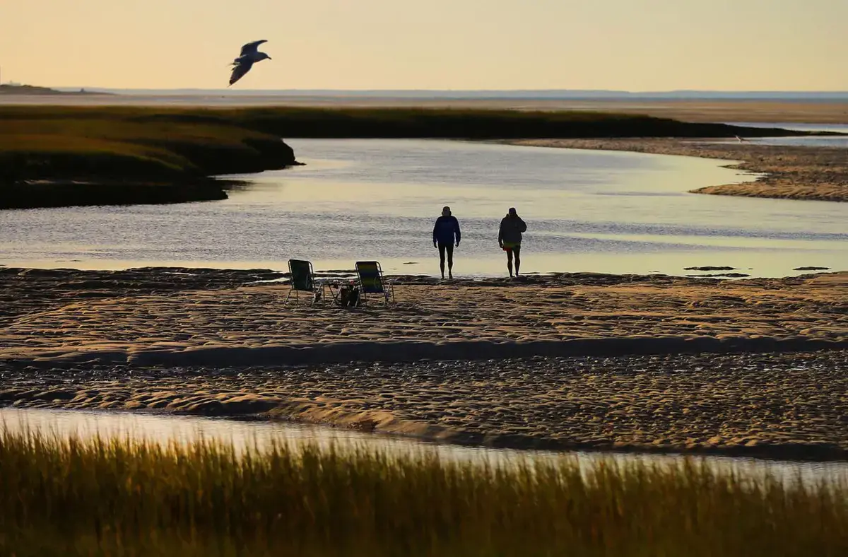
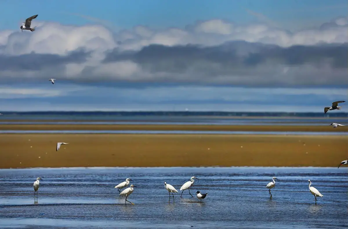
The elegant shorebird, with its curved needle beak, racing stripe above the eye, and the long legs of a wader, picked its way through Loagy Bay salt marsh in Wellfleet, plucking fiddler crabs from their finger-thick burrows in the mud.
It was a whimbrel, a seasonal Cape visitor with a story to tell, and Brad Winn was watching.
Winn steered his kayak behind the tall reeds a year ago this month and waited, perfectly still. His trap was set; all that was left to do was wait.
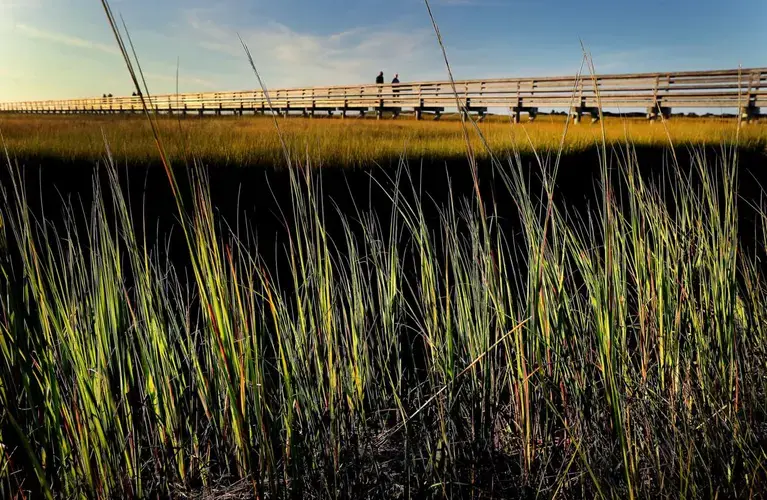
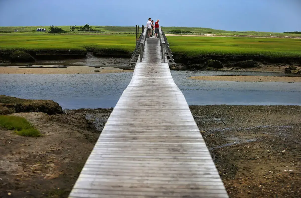
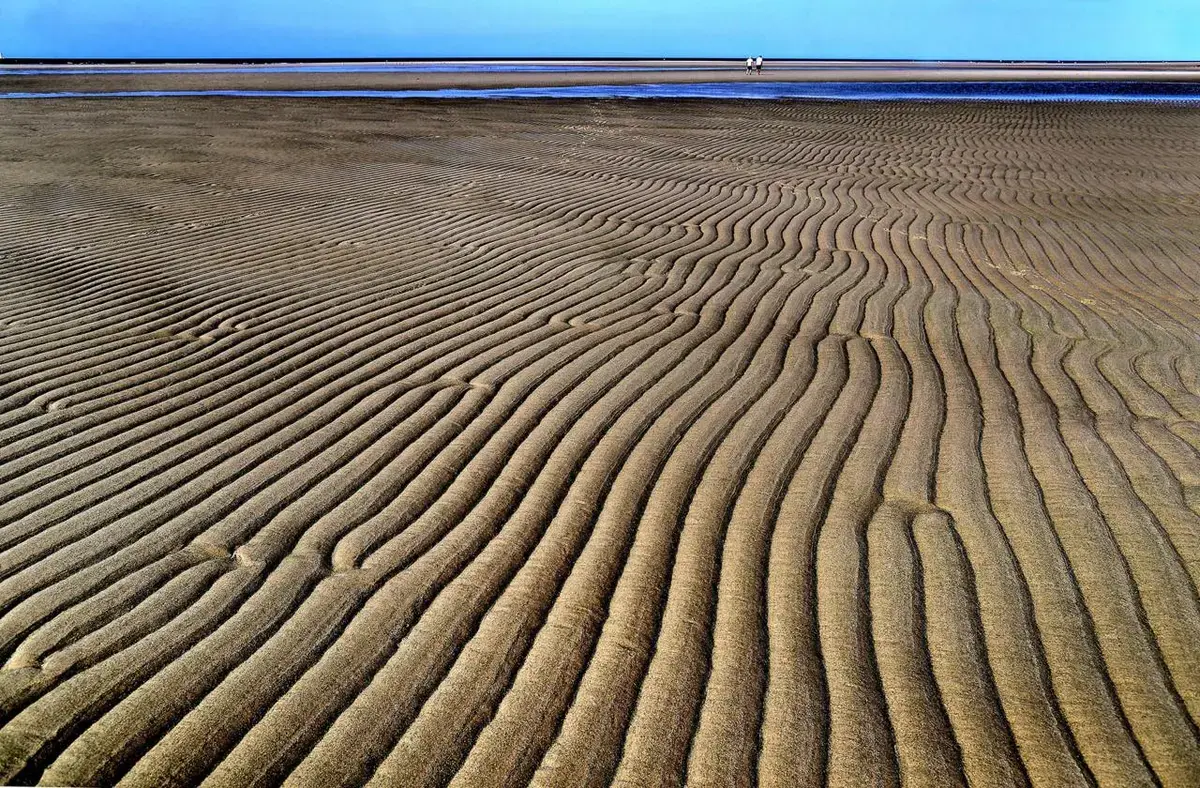
Salt marshes exude a particular stillness, but up close they are a hive of activity, and this one is no different. Tidal waters rush in and out from Cape Cod Bay under a single lane bridge, filling and draining the scores of serpentine creeks. At low tide, damp cordgrass dotted with horseshoe crab shells stretches for hundreds of yards in every direction. Soft breezes touch off cascading ripples of action in the water, the grass, the birds.
Marshes are home to their own complex ecology, each organism and element interacting in delicate balance. Their importance extends far beyond the cordgrass, to life both on land and under the sea. At a level that can be difficult to see, everything is interconnected.
But those lifelines are breaking. It takes thousands of years for a salt marsh like this one to arrange itself, growing slowly taller and moving gradually inland.
Now they are beginning to vanish under the rising sea, taking with them — among many things — what draws the whimbrels here.
Winn, director of shorebird habitat management at Manomet, an environmental nonprofit in Plymouth, had learned a lot by watching these birds — their migration, their habitat, their food, and the places they roost and mate.
By watching them so closely, Winn and his colleagues can catch a glimpse of nearly everything that is so important about this place, and everything that is at risk. The information they collect will help other scientists at Manomet and around the world try to preserve these precious places.
“This bird,“ Winn said. “is an ambassador for the health of a larger system.”
For whimbrels, these marshes are an important annual stop along a migration that traverses the globe; for people, the marsh is at least as critical — even if we never set foot in one.
Finally, the bird stepped into Winn’s trap. A small loop of filament snagged its slender leg — and Winn pounced, whisking the bird out of the marsh and into the back seat of his car, where he and colleague Alan Kneidel measured him, banded him, and used teflon ribbons to affix a tiny, solar-powered transmitter to the bird’s hip bone. Its antenna can send location data back to Manomet about once a day.
The researchers named the whimbrel Ahanu — a word common in some Native American languages that means “he laughs.”
Winn and his team would spend the next year waiting patiently, as scientists must, watching as Ahanu winged across the hemisphere, and wondering whether he’d return.
Beyond the birders, few in the human horde that descends each year on the Cape come for the marshes — Great Marsh in Barnstable, the Sippewissett in Falmouth, Nauset in Eastham, and so many others. But the marshes are no less important for being overlooked.
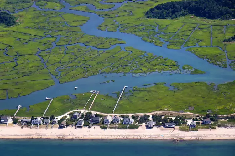
Many of the sport fish we catch and eat spend their early lives here, where baitfish and shellfish are plentiful. The marshes filter pollutants that would otherwise seep into the sea. They serve as a buffer when storms roll in, protecting homes built along the uplands. And they are a remarkably effective check on the forces driving climate change, trapping carbon that would otherwise enter the atmosphere 55 times more efficiently than tropical rainforest, according to Mass Audubon.
But these wetlands can no longer keep pace with the water. They grow atop vast beds of decomposing plant matter — carbon they’ve sequestered for centuries. But the process is slow, and the marshes can no longer grow taller fast enough to stay above the rising sea. At the same time, too many houses, yards, and entire neighborhoods on the Cape block the marshes’ inland march.
The result is that the area known as the low marsh, covered and uncovered by the tides, is slipping further and further underwater. Land that is now high marsh — rarely submerged, home to many plant and animal species — is converting itself into low marsh.
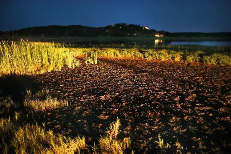
Already, the ecosystems here are showing symptoms of other stresses — carefully balanced connections thrown off kilter. In Wellfleet, at the mouth of the Herring River, swaths of cordgrass growing along the waters’ edge are missing large patches, denuded down to the bare earth like craters. These bald spots in what should be a thriving wetland ecosystem are the work of nocturnal purple marsh crabs, which feast on the soft grasses overnight.
Marsh crabs are native to the Cape, but in recent years their populations have multiplied. Today, their numbers are about 10 times normal. Scientists suspect the purple marsh crab boom may be caused by a decline in the crab’s predators, including Atlantic cod and striped bass — species whose decline on the Cape has been hastened by climate change.
The result is a destructive feedback loop — one change causing another and another that in turn reinforces and deepens the first. Weakened by the crabs eating away the plants that help bind the soil, sections of marsh could easily collapse into the water in a single storm — 2,000 years of growth gone in a day.
As the sea continues to rise, the smaller marsh that remains will not capture carbon as well as it had; it will not protect the uplands from storm tides as well, or be as bountiful a nursery for young fish. And the loop will begin again.
“The changes are subtle. It becomes obvious when you look at aerial photography over time,” said Stephen Smith, a plant ecologist with the Cape Cod National Seashore who studies the marsh. “Essentially there will be a lot less or even no vegetation.”
From the air, Loagy Bay must look like a buffet to a passing whimbrel. They are late summer Cape Codders, and for about a month, they spend their days feasting on fiddler crabs in the salt marshes and their nights roosting on sandbars far from predators. Once they’ve eaten their fill — enough to nearly double their body weight — they make the long-distance flight to their South American winter homes in a single shot.
Whimbrels make good subjects for researchers like Winn. They are large for shorebirds, more than a foot long, and sturdy enough to fly thousands of miles at a clip. That makes them representative of some 50 species of shorebirds that spend at least some of their year in the United States. And these remarkable creatures, it turns out, can tell us an awful lot about the health of our coasts. Here, the whimbrel’s success or failure is tied to the complex ecology of the Cape.


“We’re limited in what we can see in the world — in what we can interpret and understand,” said Winn. “But with birds, the tie-in is very direct.”
Year-in and year-out, whimbrels make the same stops along their migratory path up and down the Western Hemisphere, each location suited to the bird’s particular needs: Brazilian mangroves; wetlands south of Freeport, Texas; the breeding grounds in Canada’s Northwest Territories; the marshes of Hudson Bay and Wellfleet.
This is the path Ahanu traveled, and to see it on a map of the world is almost unbelievable, Winn said.
Ahanu will see more of the world than most people ever do, and Winn has tagged along on that journey since the day the bird was flapping around in the back seat of his car.
Ahanu’s journey — and his species’ survival — depends on the health of the environment at each of his carefully selected landing spots. Everything is connected, not just on the Cape but around the world.
Every year, Ahanu writes those connections across the sky.
There are other storytellers winging the Cape skies, feeding off its bounty, and occasionally wandering into a scientist’s snare.
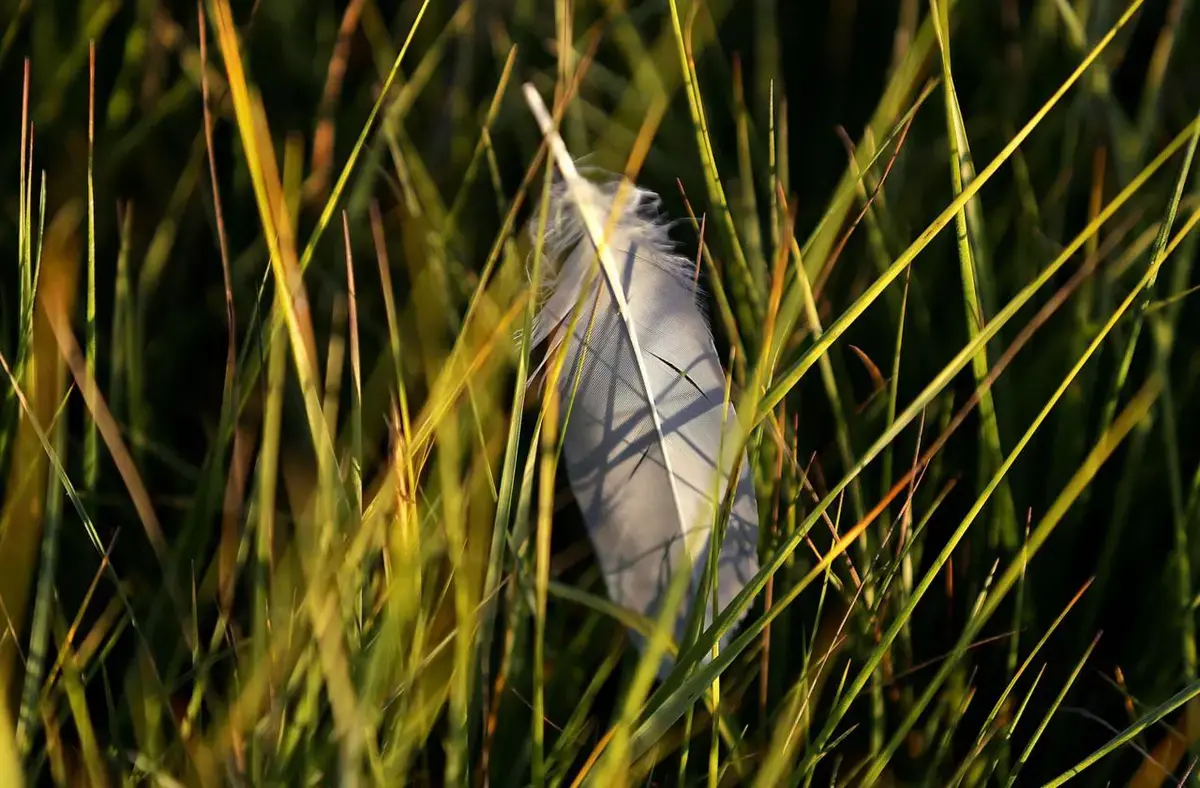
Consider the yellow-shafted northern flicker, a woodpecker common on the Cape. In museum collections from decades ago, the birds’ flight feathers are consistently yellow. But these days, many yellow-shafted flickers’ signature feathers are turning orange or even red.
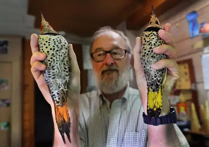
Ornithologists assumed this was due to cross-breeding with the red-shafted flicker, a subspecies more often found west of the Rocky Mountains. But recent research points in another direction entirely: As non-native plants have proliferated in a warming New England, the yellow-shafted flickers are now feasting on the berries of invasive honeysuckle bushes that only arrived in the Northeast once the climate warmed.
The flickers’ feathers are easy to see, but some of the most severe consequences of climate change for landbirds can be much harder to spot. At Manomet, the environmental nonprofit where Winn studies whimbrels, data show blue jays returning to the region earlier over the last several decades as the world warms, from a median arrival date of May 16 in the 1970s to May 5 between 2010 and 2015. It is a subtle shift in migration patterns that can have devastating consequences.
“There comes a point at which you have a complete ecological mismatch,” said Trevor Lloyd-Evans, director of Manomet’s landbird conservation program. Birds arrive at times when the insects they eat are in short supply; birds breed too late and can’t find food for their young.
“The stage we’re at now is that instead of maybe raising four young, they’re raising perhaps three young,” Lloyd-Evans said. Overall landbird bandings at Manomet are down 50 percent since 1970, a trend conservation efforts have thankfully leveled off.
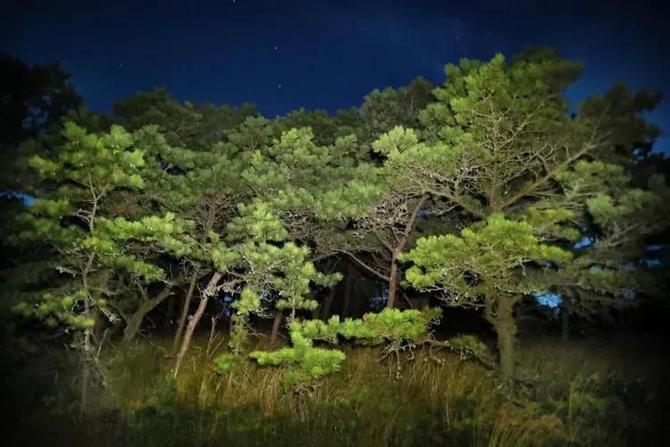
To experience the difference in a place like Wellfleet, where the pitch pine and oak forests once echoed with the familiar whistle of wood thrushes, you have to look not just up into the branches and the blue sky beyond, but back into the past.
Only then will you realize that these woods are quieter by half.
One year after trapping the visiting whimbrel, Winn was waiting on Ahanu again. It was getting late in the season: Would the far-flung wayfarer return?
“The bird will make the judgment,” he said, “if birds do that.”
If Ahanu did not return, it would not necessarily mean much about the Cape. You can only learn so much from a single bird’s path. But it would be a disappointment — and maybe a worrisome hint.
Then, one day in August, Ahanu took flight.
The tracking information showed him launching from Hudson Bay and flying over the coast of Nova Scotia, out over the open ocean. But just as he appeared to curve ever so slightly south, the signal stopped.
The tracker strapped to Ahanu’s hip communicates with a satellite that only receives signals when it’s in the right position — five hours of data, then about a day off-line. So Winn and his team waited, sitting in suspense, as a whimbrel and a satellite, both high overhead, traversed the globe.
Finally, it was time: Winn fired up his computer and had a hit: Ahanu had arrived in Massachusetts, but he’d flown right past the Cape. He hooked around and passed back over Martha’s Vineyard, finally alighting on the Monomoy National Wildlife Refuge on the Cape’s southeastern tip.
Sunday dawned. The sun was not up yet when Winn first checked his screen. Ahanu’s path on the map ended in the place they had all hoped it would: Loagy Bay, the same marsh where Winn first glimpsed the bird. By dawn the next day, Winn was there in his kayak. It took only a few minutes to spot Ahanu, a bright green flag strapped to his bony leg, the antenna that told his story protruding just beyond his tail feathers.


There is still a place for birds like Ahanu on the Cape. His travels here are in part a testament to the important conservation work being done on the Cape, Winn said — the refuge in Monomoy where he spends his nights and the Mass Audubon-owned marsh in Wellfleet where he eats all day.
It is not too late to save the marsh. But imagine, if you can, a day when the whimbrels and other shorebirds stop arriving at the Cape.
One day, a migratory bird like Ahanu, soaring 1,000 feet above the sea, will look down in search of the marshy margins and sandy spits that made his globetrotting life possible and see only water.
And he will fly right by.
"Once They're Gone"
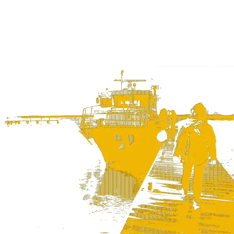
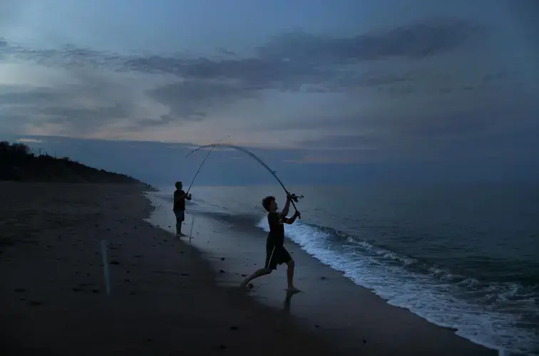
Erick Scherer made his living at night.
Kneeling against the railing of his specially outfitted aluminum boat, powerful halogen lamps trained on the water, Scherer plunged his sharp-tined steel rake into the shallows along Cape Cod’s shores again and again.
He turned the rake in a big circle at low tide, combing the bottom of a rivulet between two sandbars and hauling up with each pass dozens of wriggling, silver fish called sand lances. Striped bass followed him wherever he went, gobbling the fish that slipped off Scherer’s rake.
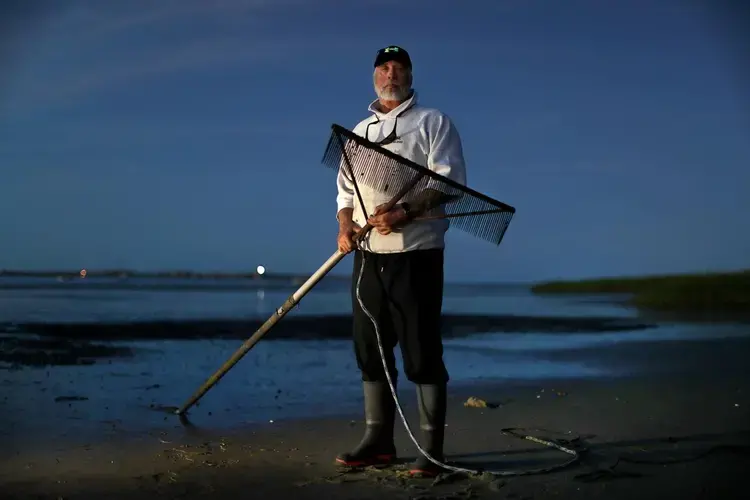
The sand lance is lunch for all manner of marine life, and some birds, too. But they also make perfect bait, and fetched Scherer about $5 a pound at shops around the Cape. On a good night, the four-hour shift that low tide allowed would yield several hundred pounds of sand lances.
Scherer named his one-man business for both the fish he caught and the hours he toiled, when most of the world rested: Sandman.
The work was exhausting. The rake weighed over 100 pounds, and he’d comb the sand with it 1,000 times a night, wrecking his shoulders, elbows and hands. But it paid well enough for Scherer to spend $80,000 for his boat, a truck and the rest of his equipment. It didn’t make Scherer rich, but it put food on the table.
Then, one summer about 10 years ago, the sand lances got hard to find. His typical catch was cut in half. Then it was a third. Scherer kept trying, but the rakes weren’t turning up fish anymore — certainly not in big enough numbers to make a living.
“I had to get rid of the boat, I had to get rid of the truck,” Scherer said. Sandman “kind of died a horrible death at the end.”
Scherer wondered if it was his fault: Had he and the other two sand lance specialists who frequented the shores taken too many? Maybe it was just a dry spell for a species — still found flitting around the waters off the Cape today — that is notoriously boom-and-bust.
The limited sand lance research that exists cannot fully explain Scherer’s experience. But scientists, who say these tiny fish deserve a lot more study, believe they are vulnerable to the changing climate.
Ten years later, Scherer wonders if what he saw was actually a warning — a sign that the sea was in trouble.
Erick Scherer was on to something.
Whatever happened to the sand lances, the warming world is wreaking havoc on ocean ecosystems, touching off a cascade of disruptions that are rippling across species. And in the waters closest to the Cape, the effects have been disturbing and profound.
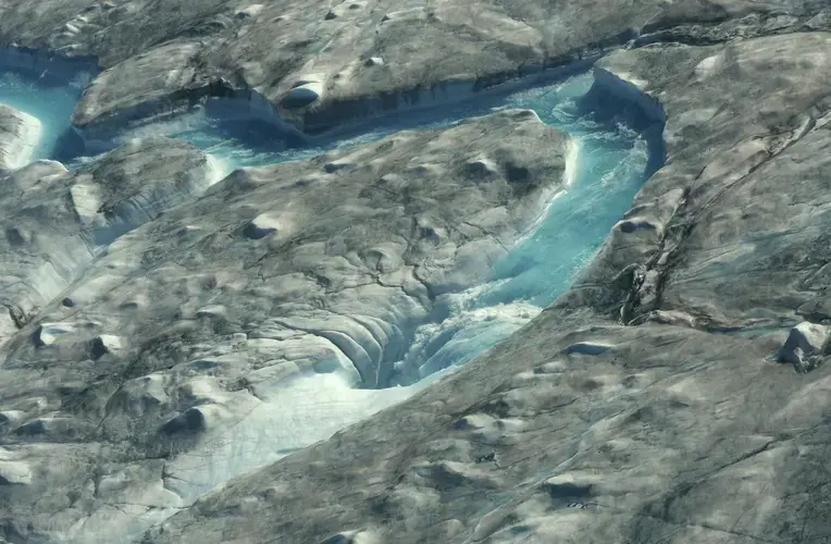
Melting arctic ice is pumping fresh water into the ocean around Greenland and weakening an ancient current that pulses cold water down the East Coast. With that cold water spigot turned down, a surge of warm water that travels north from the tropics is increasingly encroaching on the Gulf of Maine, the basin of the Atlantic whose southern boundary is marked by the Cape.
For thousands of years, this frigid, 36,000-square-mile bathtub was home to countless cold-water creatures. But in recent years, it has been warming faster than 99 percent of the world’s oceans. Species that are able, including lobsters, are seeking more hospitable waters, touching off a great undersea migration. But those that cannot move or adapt must suffer through marine heat waves and contend with an unfamiliar ocean that is also more acidic and, because warmer water holds less gas, less oxygenated — trends whose consequences scientists are only beginning to understand.
The effects within food chains and delicate ecosystems are enduring and destructive, their tentacles touching lives and livelihoods on land. Lobsters, once abundant in Buzzards Bay, are now largely gone there but are being caught in the colder, deeper waters off the Outer Cape and north well into Canadian waters. Those that remain nearby tend to be smaller and more often suffer gruesome shell disease. Ocean quahogs are declining near the Cape and increasing to the north, both because of warming and ocean acidification. Bay scallops are all but gone along the Cape, the eelgrass where they spend their early lives disappearing under rising seas and being devoured by invasive crabs.
And cod, the New England staple for which the Cape is named, are struggling to recover from decades of overfishing in water that is now too warm and too oxygen-depleted for the iconic fish to rebound to their former abundance.
Meanwhile, species such as black sea bass, longfin inshore squid, and summer flounder, once rare this far north, have arrived in abundance. Commercial and recreational fishermen alike say that more and more often they see tropical oddities. In 2013, an amateur angler cast a line into the Cape Cod Canal and reeled in a sailfish.
The unmistakable smell of food hot from the fryer greets you in the parking lot. Picnic tables, pump dispensers unleashing slicks of ketchup and tartar sauce, a line to order stretching out onto the gravel: This is the familiar summer afternoon scene at Cobies clam shack, right on the Cape Cod Rail Trail in Brewster. But it could be almost anywhere on the Cape.
A late lunch here is one of the purest joys of a summer day off, and a rite of vacationers.
Built and popularized around the notion that the nearby seas’ bounty was best enjoyed fresh, places like Cobies still make an effort to keep things local when they can, seeking nearby fresh seafood at a price customers will tolerate.
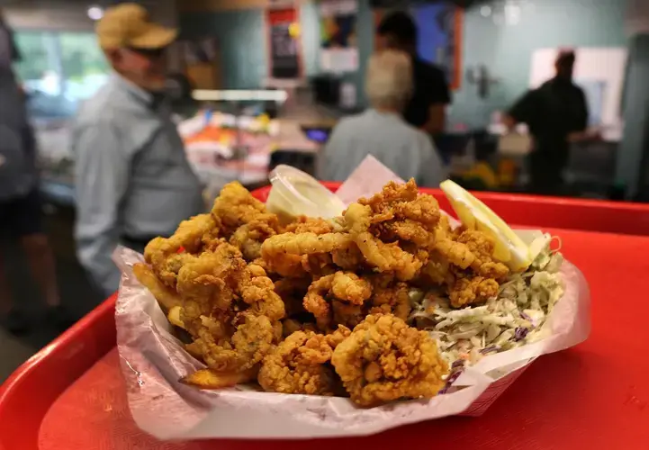
But that is increasingly impossible. At clam shacks all over the Cape, the clams come in buckets from Maryland or even all the way from Washington state. If the fish-and-chips fillet is cod or haddock, it could have come from as far north as Canada. And depending on the season, a lot of the lobster consumed on the Cape has made its way down from Maine.
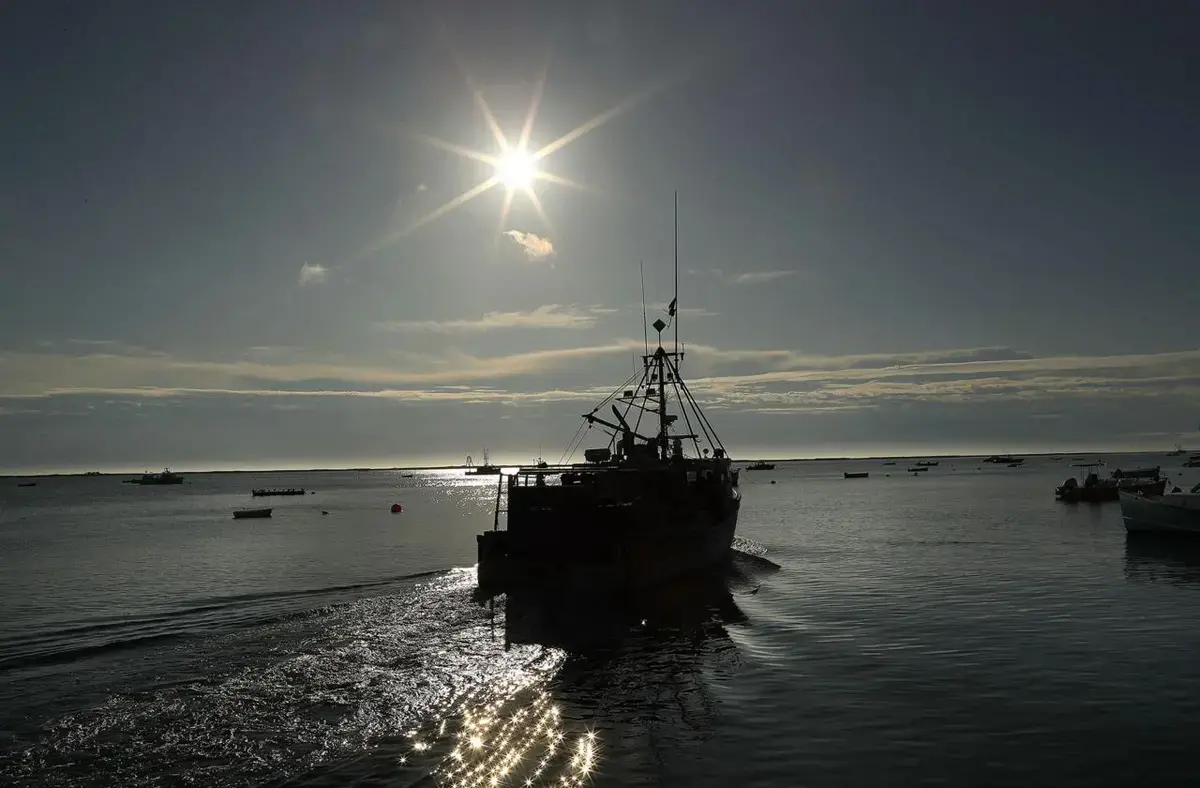
That familiar menu is almost an anachronism now, and the fishing fleet that once caught it is changing and shrinking.
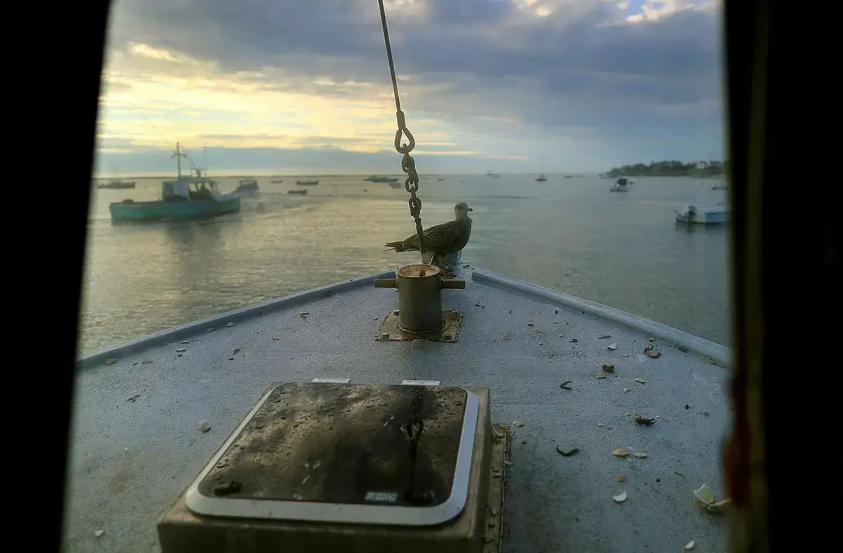
One of the dwindling number of commercial fishermen who remains, Eric Hesse, was out on the water in Wychmere Harbor one recent day, troubleshooting a balky autopilot on one of his fishing boats, the Tenacious II.
Long ago, when this perfect circle of seawater in Harwich Port, on the Cape’s southern coast, was called Salt Pond, people held horse races around it. When a channel was finally cut and dredged through to Nantucket Sound in 1887, commercial fishing began to take hold.

Today, the working fish pier is flanked by sprawling manses packed in like herring, their dark green lawns mowed into patterns of diamonds or stripes.
Thirty-five years ago, Hesse would have had an expert nearby to diagnose and repair a problem with the ship’s hydraulics. Now, many in those specialty trades have moved off the Cape or into new careers, just like so many of the fishermen Hesse knew.
Hesse, like the other captains, used to spend winters reeling in great hauls of cod. Hundreds of years ago the first were so abundant that fishermen told tall tales of walking across the Atlantic on their backs. But their populations were pummeled by overfishing.
By the time regulators strictly limited cod fishing, climate change had made recovery much harder. The water around the Cape — already at the southern limit of the cod’s range — was getting warmer. Particularly sensitive to changes in temperature and oxygen levels in their early lives, the cod have been slow to rebound.
With the fish went the fishermen.
“There’s just a handful of commercial guys left — people that actually fish for their whole living,” Hesse said.
Fishing was less a job than a lifestyle then, passed between generations like an inheritance. But Hesse’s two sons are in their early 20s, and one is working for a big software company, the other is in school, pre-med.
Hesse keeps at it, though now he fishes for haddock and harpoons tuna. He fills in some of the gaps in both time and income working with scientific research organizations studying sharks, or deploying gear for Woods Hole Oceanographic Institution researchers monitoring climate change. Many other former fishermen have ended up in trades serving another industry, one that’s thriving on the Cape — construction of houses.


Few fishermen, if any, would suggest climate change alone upended their livelihood. But warming seas and resultant change in fish populations have undeniably changed the course of the Cape’s fleets, not always in expected ways.
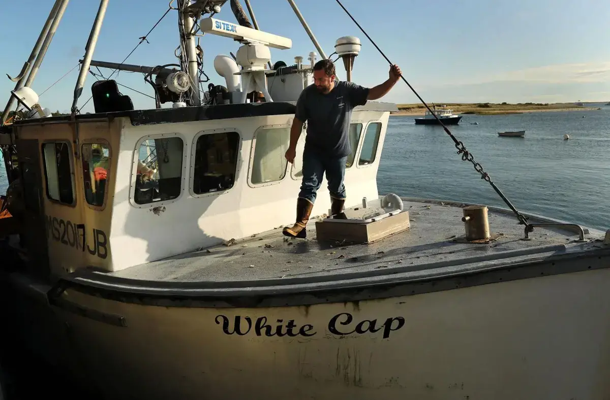
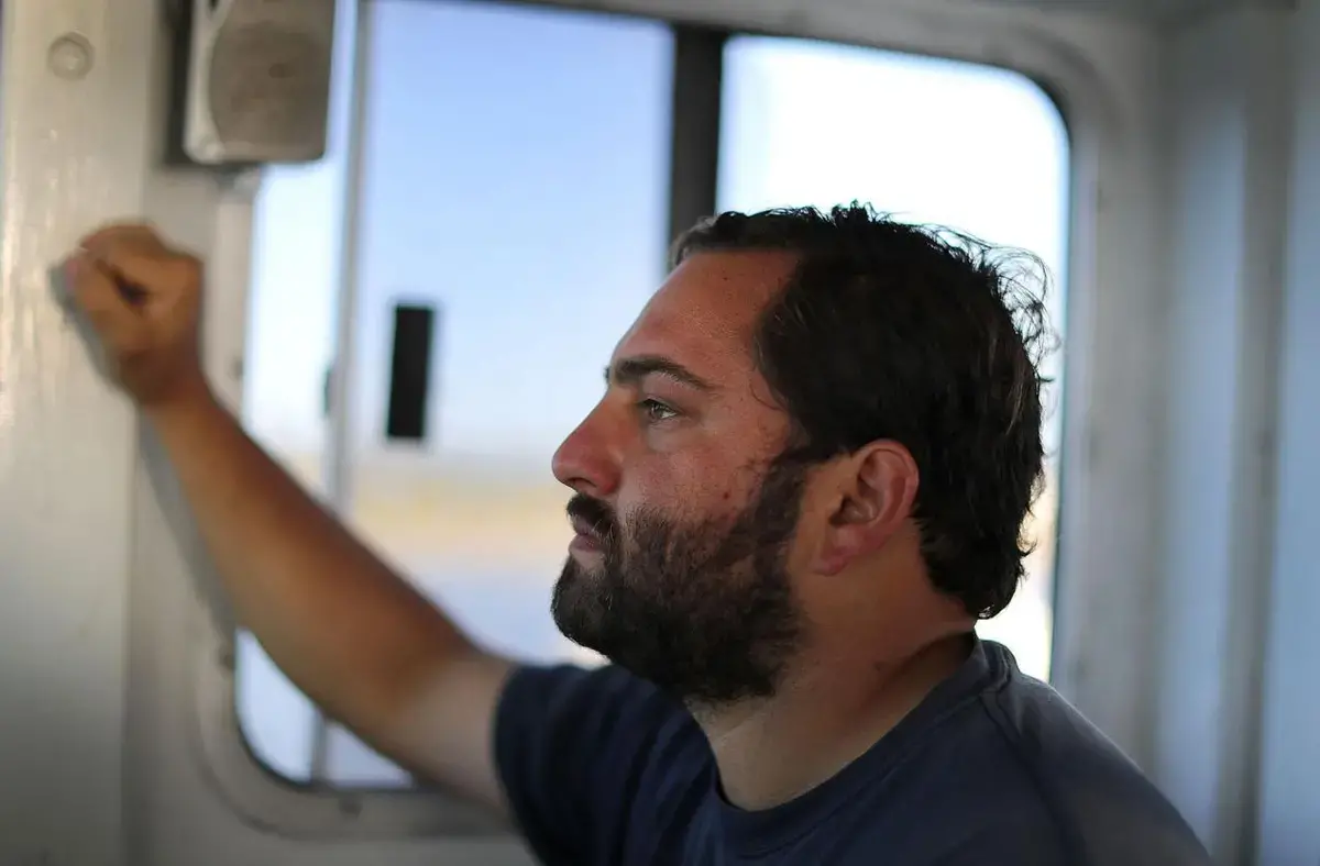
Jared Bennett, a 29-year-old Chatham fisherman, is as rare as a blue lobster on the Cape: a young commercial fisherman on his own boat, at the start of what he hopes will be a long career.
Bennett is bringing in big catches of something that Cape fishermen once tossed back in disgust: a species of small shark called spiny dogfish.
Dogfish, common around the world, have always lived near the Cape. But, uncommonly resilient and adaptable to changes in their habitat, their populations have soared in recent years. Swimming in aggressive packs of thousands, they’re a bane of haddock fishermen like Hesse. Leave your long lines in too long, and you’ll haul up the lips and skeletal remains of hooked haddock ravaged by dogfish.
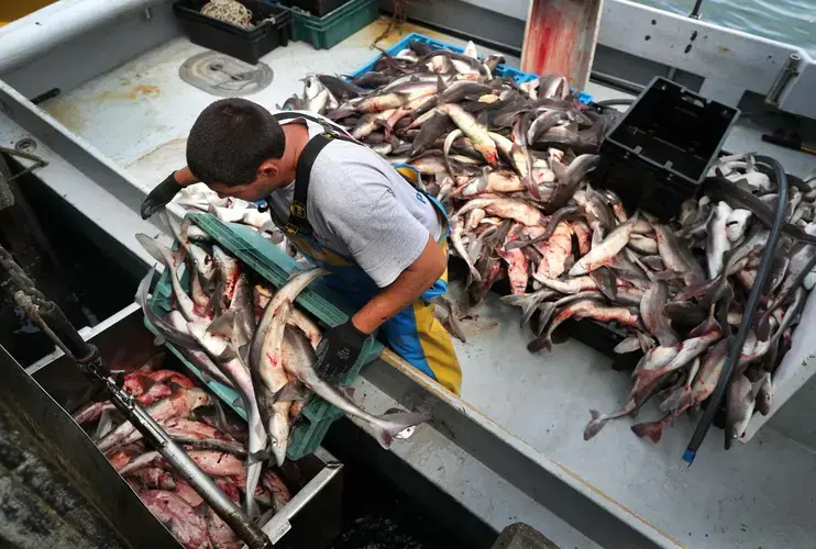
Dogfish fetch a fraction of the price that more prized fish would bring — paying fisherman something closer to 20 cents a pound than two dollars or more for cod. But at Chatham’s famous fish pier, commercial boats returning from sea now line up with huge catches. Last month alone, Massachusetts fisherman landed over a million pounds of dogfish.
Cape fishing marketers have tried to sell restaurants and a skeptical public on the unfamiliar and unfortunately named species that people devour overseas. One effort included a possible rebranding — a new name to appeal to consumers, perhaps especially visitors to these shores: Cape shark.
“They’re here,” Bennett said, matter-of-factly. “So we’re going to catch them.”
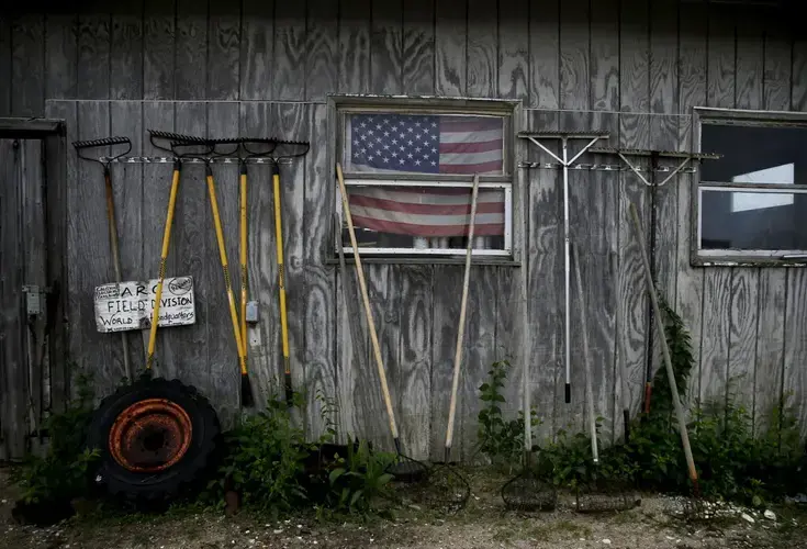
There is one oceanic delicacy that you can be sure emerged from local waters: raw oysters. A dozen Wellfleets is still a dozen Wellfleets.
But if you’ve ordered a dozen raw oysters on the Cape in recent years, it’s quite likely that they were hatched and nursed in a low-slung cluster of buildings and tidal pools at the end of a dirt road on the shore in Dennis.
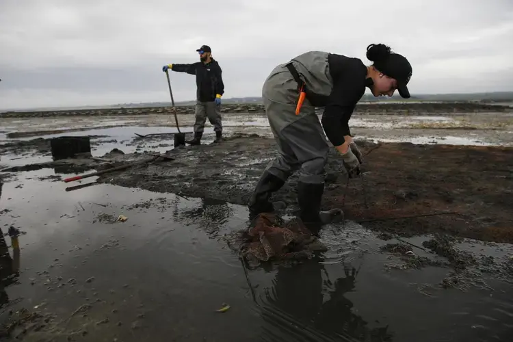
For about 50 years, this has been the home of the Aquacultural Research Corporation’s hatchery. Digging a pail full of quahogs from the shallows might feel like unearthing nature’s bounty, but these days it’s a near certainty that those clams, too, came from A.R.C. Towns purchase them from the organization in mesh bags and seed the sand with shells not much bigger than a pea.
A.R.C. is critical to the present and future of the shellfish industry here. It supplies about 80 percent of the seed for clam and oyster farmers on the Cape. But the steady flow of briny bivalves emerging from the facility behind Chapin Beach belies the reality for this vulnerable species.
In the wild, “shellfish populations are at 1 percent of historic levels along Cape Cod,” said Rob Doane, the former chief executive of A.R.C. who left the company this month.
“Commercial fishing boats used to be able to steam out for half an hour and get a full boat of wild quahogs. Now it’s to the point that it’s not even economical to go out and try to find them,” said Rick Sawyer, A.R.C.’s president. Some of their disappearance is due to overfishing, but because of the changing climate, native shellfish cannot replenish themselves.
“Once they’re gone, they’re gone,” Doane said, “no different than what we’ve done to the cod or the lobster.”
Warmer water, shifting seasons, dangerous algae blooms caused by storm runoff: All pose serious risks to shellfish, even here. On rare occasions, problems in water quality can slip past A.R.C.’s testing. In March, an algae bloom clogged filters, resulting in the death of 20 to 30 percent of an oyster spawn.
One morning in early June, A.R.C.’s staff went to their farm in Barnstable to retrieve 200,000 quahogs about as big around as a dime, ready to sell as seed to another farm. But more than two-thirds were gone, likely the result of changing seasonal patterns.
“When a quahog goes dormant, it’s set for the winter. But what we’ve been seeing the last few winters is that it will go dormant, and then we’ll get a spike in temperature and they’ll wake up,” Doane said. Once they awaken in water that isn’t warm enough to support the algae they eat, the clams can’t sustain themselves. Their tiny shells open and drift away.
“In the fall, they were beautiful, healthy quahogs,” Doane said. “Three or four months later, here we are.”

That makes the future of the shellfish industry a little murky on Cape Cod, where Dave Fontaine and the other shuckers at the Beachcomber in Wellfleet will bang through 1,200 or so oysters a day.
For now, Doane said, most of the oysters on raw bars on the Cape are local; shellfish destined for the fryer are usually trucked in from the Chesapeake Bay.
When A.R.C. was founded 60 years ago, aquaculture was envisioned as a way to create cheap protein to help solve world hunger.
Today, Massachusetts shellfish — what’s left of them — are too valuable to shuck and fry.
Fortify and Retreat
On a summer afternoon, vacationers fill the parking lot nestled between the dunes at Chapin Beach in Dennis. They unload beach chairs and plunge umbrellas into powdery sand, their children splashing across acres of bayside shallows and sandbars exposed by low tide.
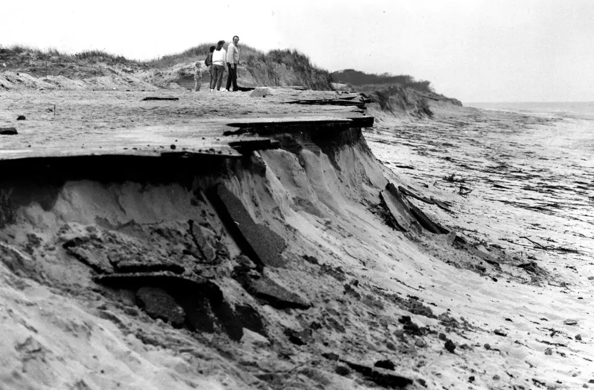
Unless they’ve seen what winter brings, they would not realize that the road they traveled to get here was so close to ruin. The only clues along Dr. Bottero Road are a handful of highway-orange construction barrels and a web of cracks in the asphalt — remnants of winter storms that erode the earth right out from under the roadway, the blacktop cracking and collapsing.
“It just sticks right out there and says, ‘Erode me. Hit me with your waves,’” said Karen Johnson, natural resources director for the town of Dennis. “We go into every winter saying, ‘Is Dr. Bottero going to make it?’” Often, it doesn’t. Over the course of Johnson’s nine years on the job, Chapin Beach has lost about 30 feet to erosion.
There are places like this all over the Cape — homes, streets, whole neighborhoods — that exist perilously close to catastrophe. And in every town, there are people like Johnson working to save them.
Confoundingly, the threats are not just the storms and rising seas and increased rates of erosion brought by climate change, but the human reaction to it. Along the bay west of Chapin Beach, each new stone sea wall or rocky protrusion jutting into the ocean helps to preserve one piece of property by collecting eroding sand. But each one also prevents that sand from traveling to the beach downstream. The solution in one place exacerbates the problem in another.
The projects proceed, property by property, pushing the problem downstream, each preserving a small part of the Cape by ruining it, just a little bit, until there’s no beach left.
“I don’t know what Cape Cod is without beaches,” said Andrew Gottlieb, director of the Association to Preserve Cape Cod. “Living on a Cape without beaches is kind of an unimaginable thing. Why would you do that?”
This shortsightedness about climate change is hardly unique to the Cape. It is a global failing of unmistakable consequence, here and almost everywhere.


Nothing about preserving the essence of the Cape will be easy. The sandy shores of the Cape’s coastline are inherently malleable, shifting in response to storms and sea level rise. The roads and neighborhoods and buildings? Not so much.
In all, about 20 percent of the Cape is now within the special flood hazard area designated by the Federal Emergency Management Agency. That represents more than $29 billion in property, including over 1,500 historic structures.
The state, local Cape governments, and conservation groups have all poured time and money into protecting the coastline and the environment from the effects of climate change. Millions of dollars in grants, working groups packed with national experts, and voluminous, detailed reports have made Massachusetts a national leader in the field.
One recent example: Through its Resilient Cape Cod project, funded by a $780,000 grant from the National Oceanic and Atmospheric Administration, the Cape Cod Commission, the regional planning and regulatory agency on the Cape, has identified dozens of strategies to protect the Cape’s coasts from the rising seas and major storms. These include open space requirements that allow natural land to migrate inland; building dunes and marshes and something called living shorelines, which combine such minor hard barriers as low rock walls with natural wetlands; incentives to help homeowners move their houses out of harm’s way — a process known as retreat.
But getting through to the public and persuading property owners to take heed has proved to be difficult.
“People are resistant to that ‘retreat’ word,” said Kristy Senatori, the commission’s executive director. “They prefer to fortify instead. They prefer the short-term solutions like putting sand on a beach.”


So much is threatened here that some 8,000 homes were added to the flood plain in 2014, the last time the federal government updated its maps. Flood-proofing homes can be both complicated and expensive, said Shannon Jarbeau, a flood plain manager who works with communities all over the Cape to enforce building codes that help drive down flood insurance rates, which now average about $2,000 a year.
Such costs are sure to accelerate a trend which already threatens something that makes the Cape special, compared to its island neighbors — economic diversity, the working class and the well-to-do mingling where sand meets sea.
“There’s a significant potential,” Jarbeau said, “for gentrification of the coast.”
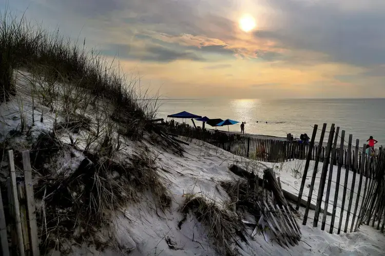
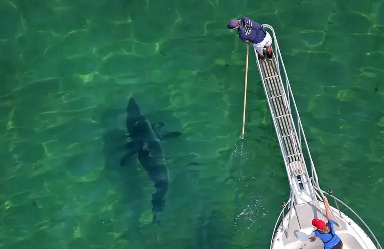
One day in June, a cement mixer rolled into the parking lot at Herring Cove Beach in Provincetown, preparing to pour a pad for a new emergency phone: Dial in case of sharks.
The presence of great white sharks in the waters around the Cape, lured by a booming seal population, has fundamentally changed the way people interact with the beaches here. Walk onto any public beach on the Cape and you’ll pass a menacing sign warning that something deadly could be lurking not too far off shore.
But the more existential danger is the water itself.
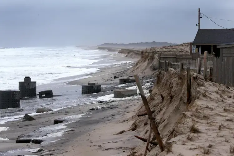
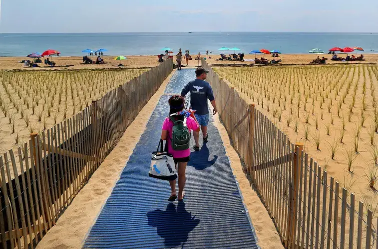
Along Herring Cove, a patchwork of flimsy wooden fencing bigger than a football field extends down the beach here, designed to catch sand and encourage a dune system to rebuild. Native grasses are planted in perfect rows like crops. A new, freshly paved parking lot is behind the fledgling dunes.
As the sea rises and erosion does its steady work, this is what retreat looks like: A new parking lot, built about 200 feet inland from the old. A bath house built on pilings so it can be scooped up and moved again in a few decades.
Dunes were coaxed back to life. The effort cost about $3 million and is decidedly temporary, said Mark Adams, a coastal geographer at the National Seashore.
There were other options, none of them perfect. A rock wall might have lasted a bit longer, but pretty soon you’d lose the beach. The ocean does not negotiate. A few feet out in the shallows, a cockeyed concrete piling protrudes from the water: This used to be a road. A seal bobbed by as if out for a stroll.
The strategic retreat at Herring Cove is a model for how things could go elsewhere on the Cape and around the world, said Adams. It does minimal damage to the surrounding area, preserves public access to a place people love. It also leaves decisions about what to do when the water threatens the parking lot again to the next generation of residents.
Like so much around here, it won’t last.
When the Big One Comes
To lay eyes upon what happened in Provincetown two winters ago — and to glimpse what will surely happen again — begin in the basement of Jerry Swartz’s Commercial Street liquor store, where the water crashed through a bulkhead door and filled the basement.
Today, the dried detritus of January 2018’s storm still lines the pipes that criss-cross overhead in the darkened stockroom. A single sea gull feather the length of a toddler’s finger is wedged in a fitting at the bottom of the stairs.
“I was in the Coast Guard. I’ve seen what water can do to the hull of a ship. But this was something else,” Swartz said. “We’ve had trickles … but never enough that the water came down the stairwell.”
The water rushed down Commercial Street, crashing into the art galleries and bars, bed & breakfasts that are packed densely into the town’s tourist center.
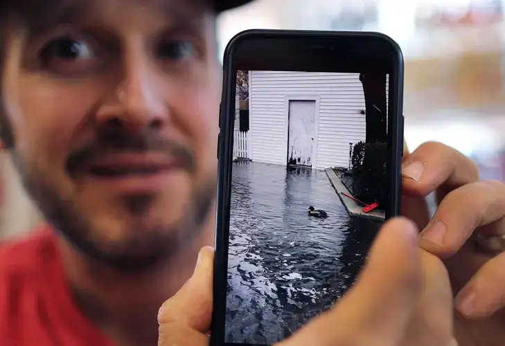
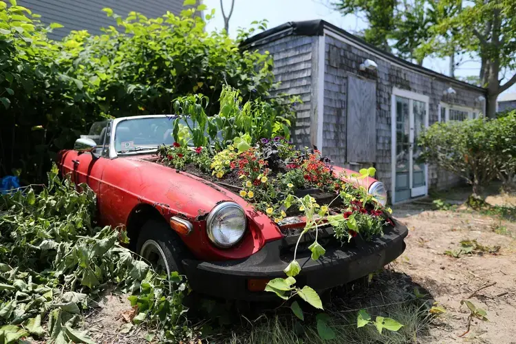
The January storm badly damaged Julie Heller’s art gallery on the beach, her iconic sign — the word ART spelled out with seaweed — protruding incongruously from the flood waters. The handmade windows and doors buckled.
“It had never flooded there, ever,” Heller said. “I didn’t have business insurance because it had never flooded, and it was off season.”
Today, weeds grow up and through her husband’s old Alfa Romeo, still parked in the sand. And all those paintings are in storage.
Nearby, the old Unitarian Universalist Meeting House, built in 1826 on the far side of Commercial Street from the ocean had seemed secure. But flood pathways can be counter-intuitive: When the water arrived, it came first from the back door, which faces away from the beach.
Even after the storm, the water stubbornly refused to recede. When someone hoisted up the bulkhead in the boiler room behind the downstairs hall, they found tiny fish swimming just below the floor.
The problems didn’t stop when the water receded. One day, the pastor, Kate Wilkinson, spotted tiny hills of sawdust under the old wooden benches in the lobby. Powder post beetles that had been dormant in the wood for years or decades had begun gnawing their way out.
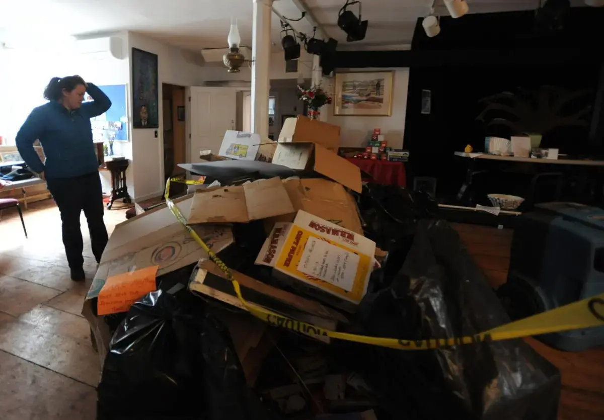


“My entire job changed,” said the Rev. Wilkinson. “I was still a minister but I was also a project manager.” Some days she wore a respirator mask to church.
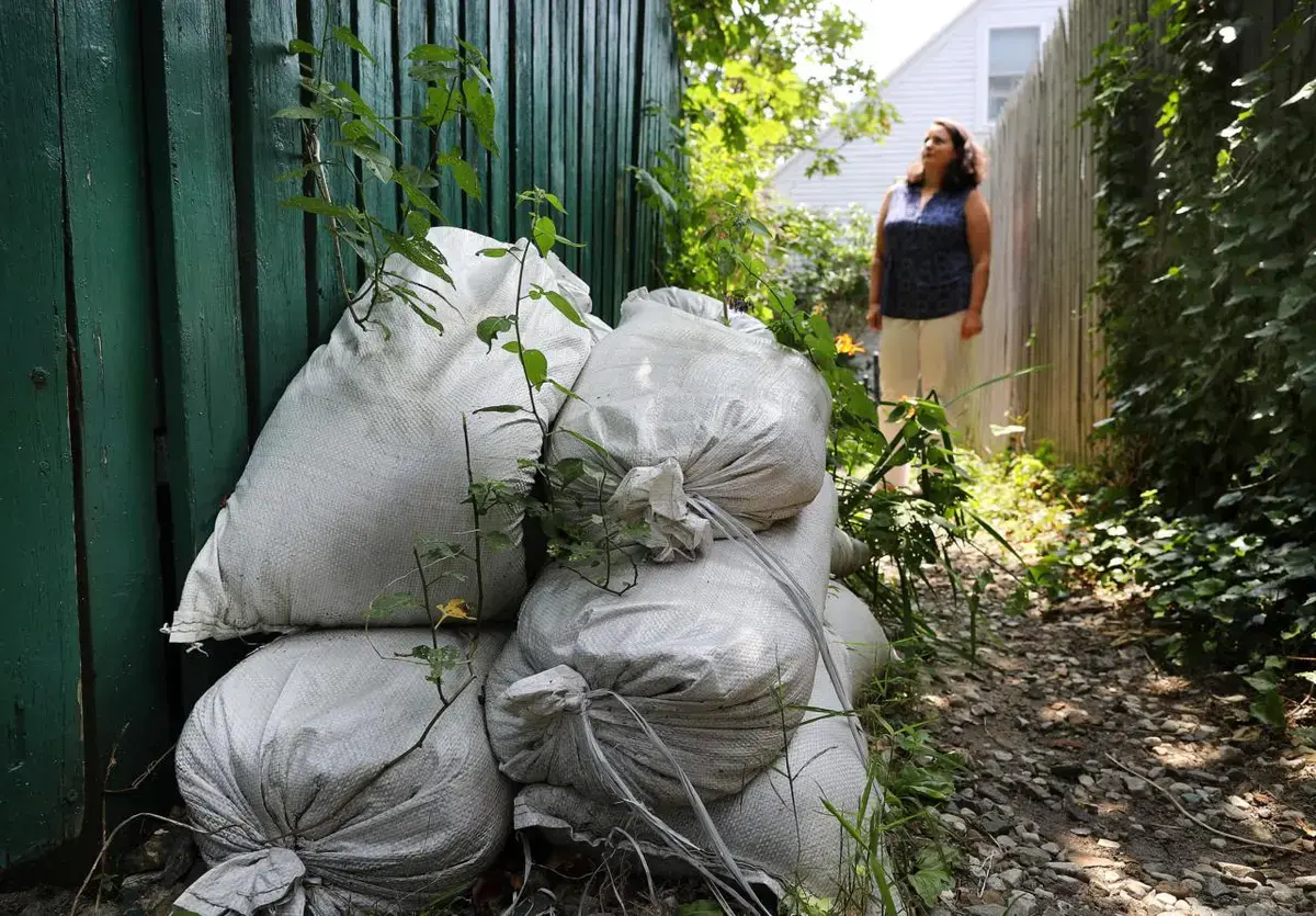
The town had spent years preparing for flooding like this, using a state grant to study risks and mapping vulnerable areas. And it has redoubled its efforts in the two years since. To shore up the path that flood waters followed in 2018, the town is planning to build a large dune at the end of Gosnold Street, where Heller’s gallery still sits. The necessary preparations are physical, but they’re also psychological and financial: Plan, protect, and insure.
But the reality is that there’s only so much to be done. In the case of the grand old meeting house, there’s nowhere to move: Downtown Provincetown is densely packed. Elevating a massive, nearly 200-year-old building listed in the National Register of Historic Places — one of more than 500 such structures in the flood plain in Provincetown — would be an iffy undertaking, and a very costly one.

And then Wilkinson asked an unpleasant question — one that the next storm, or the one after that, may make impossible to ignore.
“How important is it to raise a building if the town is not going to be here?” she said.
This is the notion that some on the Cape are not quite ready to confront.
“If there is a hurricane that takes out a lot of the Cape, what does that mean for Cape Cod?” wondered Heather McElroy, natural resources program manager at the Cape Cod Commission. “Maybe it means elevating structures. It means building more densely in more appropriate areas that are actually out of the flood plain. That’s all longer term, and the community isn’t there yet.”
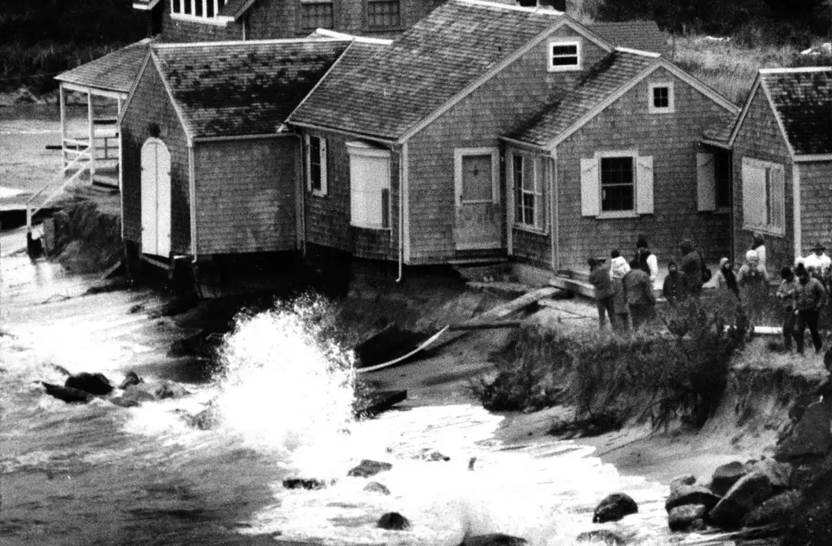
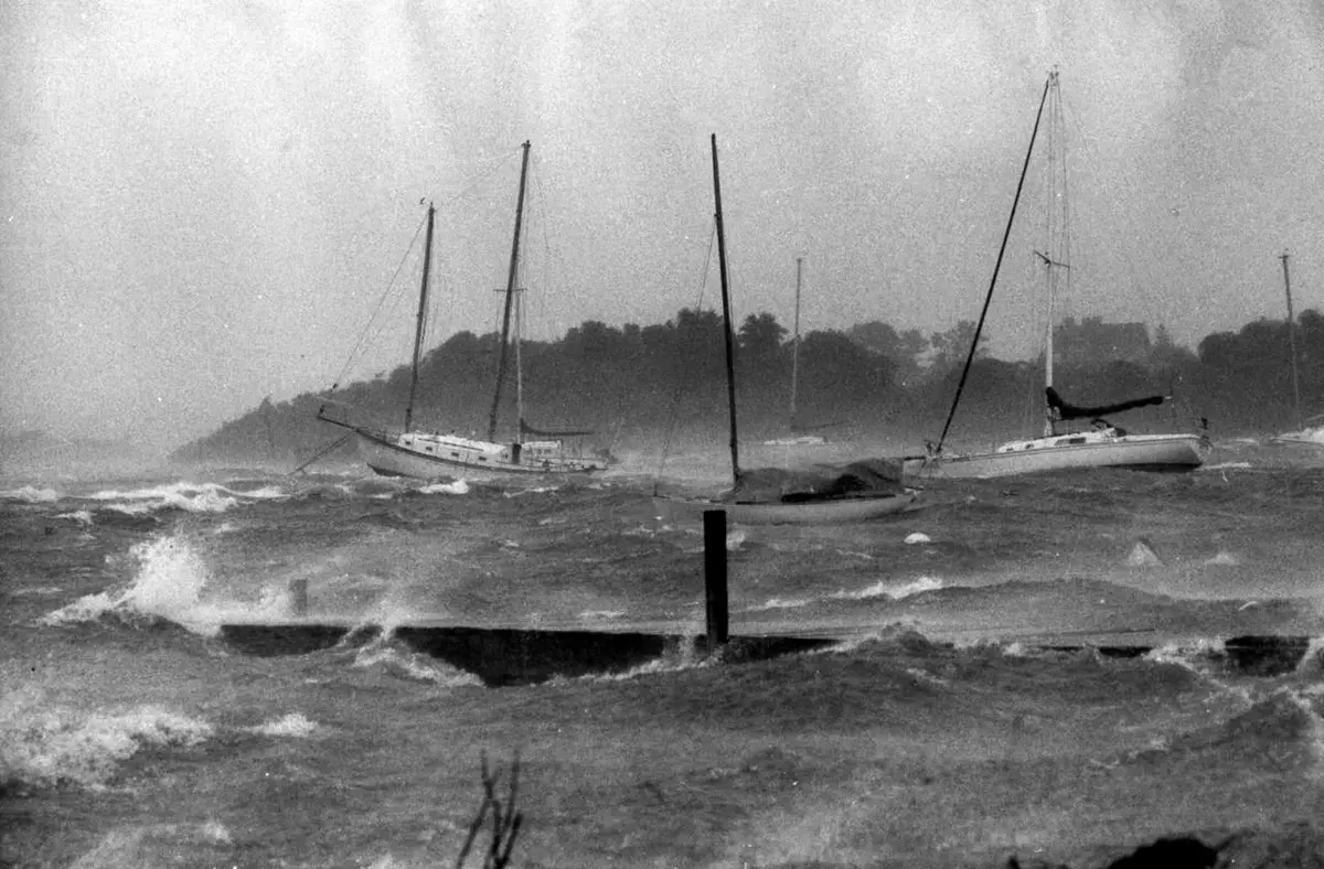
The 2018 storms in January and March were in some ways an unwelcome reminder of that reality. They flooded homes in the Little Beach neighborhood in Chatham and trapped drivers on Route 6A in West Barnstable. The Bass Hole boardwalk in Yarmouth Port was destroyed. In Sandwich, deep water pooled in front of the police and fire stations and slashed away the foundation of homes on Salt Marsh Road that still are uninhabitable.
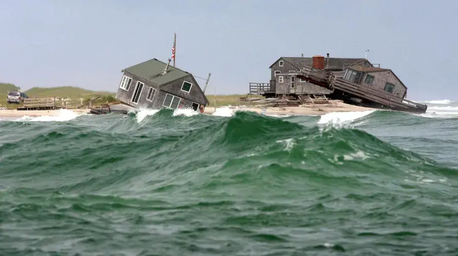
But those storms? The ones that claimed Liam’s and soaked Provincetown? That destroyed houses on the bay and on Ballston Beach? That flooded out coastal roads all over the Cape and stranded low-lying homeowners for days?
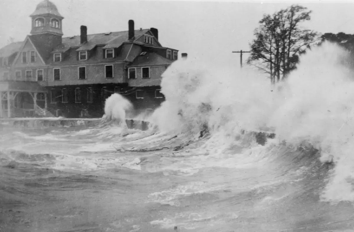
By historical standards, those nor’easters would be nothing compared to an honest-to-God hurricane. In 1991, Hurricane Bob brought a storm surge of nearly 12 feet to Buzzards Bay and knocked out power to the whole Cape.
And even Bob does not compare to the Great New England Hurricane of 1938.
That pushed 15 feet of storm surge into Bourne and Wareham. Much of the western edge of the Cape was under several feet of water.
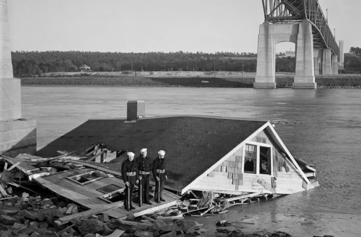


The devastation a storm like that would bring today is difficult to picture. But from a cluttered office at the Woods Hole Oceanographic Institution, Jeff Donnelly and his team of researchers are using a computer simulation to help us see it.
In the 81 years since the 1938 storm, the sea level here has risen about a foot, Donnelly said, and is now rising faster than it has in thousands of years. And the land has changed at least as much. The Cape was a different place then — the canal bridges had opened just three years earlier. The population was a fifth of what it is now. Thousands of homes and other buildings have been erected in the intervening decades, many perilously close to the coast.
Donnelly and his team are working to turn their storm surge calculations into images of today’s Cape. When complete, we will be able to see what would happen here if one of the major weather events of the last 400 years were to strike again, the water flowing over and through today’s landscape, following complex and sometimes counter-intuitive pathways inland.
If the storm of 1938 churned north toward the Cape today, its strong right arm pummeling Buzzards Bay, evacuations would be ordered. The 11-mile backup at the Sagamore Bridge that preceded Bob would be at least that bad. Those who waited too long to abandon the Outer Cape would find the Orleans Rotary and dozens of other evacuation routes flooded as the eye of the storm passed over Long Island.
The 1938 storm arrived as a Category 3 hurricane, pummeling the Cape with powerful winds. It killed 564 people, injured three times that many, and destroyed almost 9,000 homes. And today, there is much more at risk.
Buzzards Bay would act like a funnel, driving storm surge higher until the sea swallowed such places as New Silver Beach and the houses that line its streets. Surf Drive in Falmouth, where runners stampede during the famous Falmouth Road Race every August, would be submerged, the underground sewer line spilling into the open ocean. The Woods Hole dock, which hundreds of scientists like Donnelly use to study precisely this problem, would be obliterated.
When the Cape Cod Commission prepared what it called a “Multi-Hazard Mitigation Plan” in 2010, the dozens of state and local officials and scientists studying the impact of a potential major hurricane dared not even guess at the scope of what might be destroyed. The plan found some 20 percent of the Cape, 70 square miles, could be inundated during a hurricane. That includes dozens of critical facilities, including hospitals, utilities, government facilities.
And the storm itself would just be the beginning. Its surge would affect the shoreline after the storm passed, washing roads and leaving streets impassable. Wells from which people draw drinking water would be inundated, brackish water pouring into kitchen sinks. Electricity could be out for weeks or months.
Recovery would take years and the cost in dollars and time would be incalculable. The Cape would never be the same.
Donnelly’s calculus relies on data from the storms the Cape has known. But climate change is changing storms themselves, potentially increasing their frequency and intensity and even changing the patterns of their movement, said Jennifer Francis, a senior scientist at Woods Hole Research Center in Falmouth.
A warmer atmosphere holds more water vapor, providing more fuel for storms like those that hit in 2018.
“That really is the battery that storms draw their energy from,” Francis said.
A storm that started its northward journey under the same meteorological conditions as the great hurricane of 1938 would likely arrive even more powerful and destructive. And such devastating events will likely happen more often.
Meanwhile, the rapid warming of the arctic has caused a considerable slowing trend in the jetstream, Francis explained, causing weather that would have otherwise moved more rapidly north to get stuck in place, its destructive power lingering.
Jutting out into this corner of the North Atlantic, built on a pile of sand and rock, the Cape was vulnerable long before people began walking its beaches. Still, something is different now. The last hundred or so years of human activity have ratcheted up that risk, fueling storms even as we build more and more in this perfect place in their path. It is not hypothetical. It has happened before and it will happen again.
But that is difficult to see, and harder to believe, until the water arrives at the back door.
Thousands of Years
To see what is happening on this bit of sand sticking out into the ocean, you have to know where to look. But that’s not all. You also have to know how to look. When to look. You have to see past and present, thousands of years all at once.
“I’ve been here all my life, and I’ve seen pristine and that’s not what we have now,” said Chuckie Green, the natural resources director for the Mashpee Wampanoag tribe.
Green grew up swimming in Santuit Pond, back before cyanobacteria turned it murky and green, unsafe for people and their pets. He used to fish here, then eat the fish. Popponesset Bay was overflowing with oysters. Sweet grass that the tribe used for ceremonial and medicinal purposes still grew thick in the high marsh.
“It was a great place to live, I’ll tell you what,” Green said.
Today, storms and sea tear up the marsh and the shore and the sweetgrass. The winter moths feast on the white oaks from which the tribe once picked acorns to supplement the corn harvest. The red cedars down by the ocean are disappearing.
“The worst thing is I get to see it right out my window,” Green said.
But seeing it — really seeing it, the way Green can — is the only way to save it.
“That’s why I do what I do,” said Green, 65. “I have grandchildren. I would like to preserve a little portion of what I had. I can’t preserve it all.”
Maybe we can’t, either. All those cars keep coming across those grand old bridges, trailing plumes of climate-warming emissions and transporting visitors eager for the wonders of the Cape but reluctant to confront what is happening.
But for so many of the people who live here — the people who’ve learned how to see what’s being lost — this is an occasion for fear, but not for fatalism. It is not an excuse to do nothing; it is a reason to do more.
The waves crash like they always do, but they are not the same. They come from the open ocean now. Families play on beaches that look like they always have, but the sand is not the same, either. The birds, the bugs, the marsh; the forest, the fish, the food: They’re still here, and worth saving, even if they’re different.
If we can still see it, we can still save it. But only if we look.