Lesson Plan August 31, 2015
Lesson Plan: Illustrating Cholera Outbreaks in Manhattan and Haiti
Country:
Grades:
Questions for “Contagion in New York City: 1832”
- What is cholera?
- What are the symptoms of cholera?
- How is cholera spread?
- Why was New York City susceptible to cholera in the 19th century?
- What challenges did the city face in containing cholera?
- How did the city eventually overcome the outbreak?
Questions for “Mapping Cholera: A Tale of Two Cities”
- What two locations are being compared as part of the project?
- What was the origin of cholera?
- How does cholera spread? How does the author use technology to represent this?
- What facilitated cholera’s rise in Manhattan?
- What human factors led to creating an environment that supported cholera growth?
- How many people were dying daily at the height of the cholera epidemic in Manhattan?
- How did cholera end up in Port Au Prince, Haiti?
- How did cholera spread in Haiti?
- What environmental factors led to the spread of cholera in Haiti?
- What human factors contributed to the spread of cholera in Haiti?
- How did the New York City change its water system to prevent future spread of cholera?
- How does the author conclude the project? Why do you think the author made that choice?
Informing the World About Cholera: Analyzing how an author unfolds an analysis comparing cholera outbreaks in Manhattan and Haiti
Objective:
Students will be able to analyze the purpose of the "Mapping Cholera" project, and how an author uses language and media to structure its accompanying articles, in order to create an instructional resource
Warm-up:
1. Brainstorm: Quickly jot down a list of health problems that your community is currently facing. Next to each health problem, write an example of what that health concern looks like. Be prepared to share with a partner or with the class.
2. Today's lesson will examine the project "Cholera: A Tale of Two Cities" by international journalist Sonia Shah. The project examines a major health concern that the world has faced for over a century. Read the first paragraph of the project's introduction below.
"Nearly two centuries separate the two devastating epidemics—one began four years ago this month and the other in the summer of 1832—but they are otherwise strikingly similar, and the parallels offer some lessons for public health officials today."
Now answer the following and prepare to discuss your responses with the class:
- So far, what do you know this project will be about?
- What questions do you still have about this project?
3. Now read the second paragraph of the introduction:
"A novel infectious agent, cholera, is introduced into an island population living in crowded and unsanitary conditions, killing thousands. The recent epidemic, of course, occurred on the impoverished island nation of Haiti. The earlier one unfolded 2,400 kilometers north, on the island of Manhattan."
4. Answer the following and prepare to share your responses with the class:
- What new information did you get about the project?
- Were any of your questions answered?
- What new questions do you have about the project?
5. With a partner, or as a full class, consider the following:
- Why do you think author wrote the introduction to the project in this order?
- What would be the impact if the paragraphs were switched, or if one paragraph was eliminated?
- What might be the purpose of this project? What evidence from the introduction supports your idea?
Introducing the Lesson:
Today we will be looking at articles from international journalist Sonia Shah's project "Cholera: A Tale of Two Cities" to analyze how the author has chosen to structure the pieces, and for what purpose. As you explore the resources below, use the questions to analyze the author's purpose for the project, and how the author uses language and media to achieve her purpose.
- By the end of class, our goal will be to use tools we've learned from Shah's project to come up with a plan to inform an audience about a public health concern in our community.
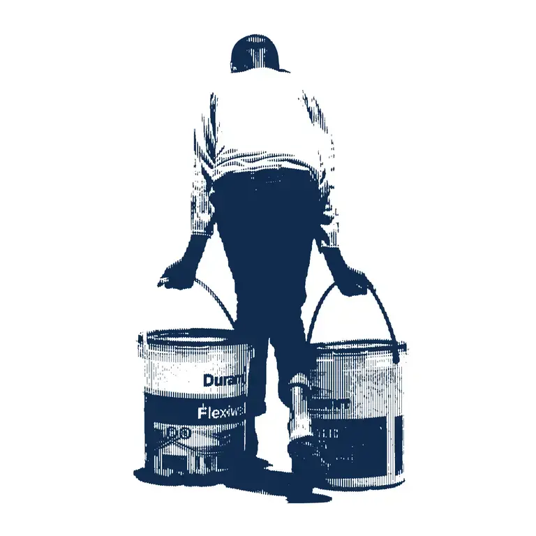
Introducing Resource 1: "Contagion in New York City: 1832"
Read the following article and answer the accompanying questions.
As you read, track the order that author Shah unfolds information. Consider the following:
- What images were most vivid in the article?
- How was the article structured and what is the impact?
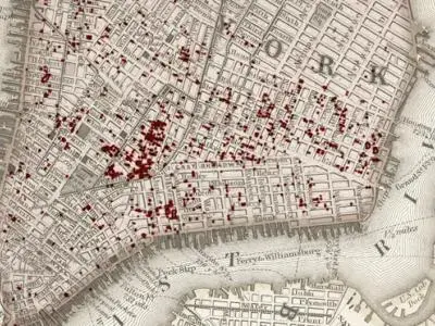
Introducing Resource 2: "Mapping Cholera: A Tale of Two Cities"
Review the following resource (map and text) and answer the accompanying questions.
As you read, consider the following:
- How is the map structured?
- When are images used/not used?
- What is the order of the information?
- What do you think is the author's purpose for this resource?
- How do the structure and use of visuals contribute to achieving the author's purpose?
Conclusion:
1. Consider the following and be prepared to share your responses with a partner, or with the class:
- What do you think is the author's purpose for creating these materials?
- How did the author order and present information to achieve that purpose?
- Do you think that one resource was more or less successful than the other at achieving that purpose?
2. Final task: Refer back to the brainstorm from your warm up. Select one of the health challenges you face in your community and create an outline for a resource that you could use to inform your community about the issue. Use the "Mapping Cholera: A Tale of Two Cities" project as a reference. Your outline should clearly articulate what issue you plan to address and how. It should include what information you want to present and how. In your outline, reference when you will use text, images and video.
Optional Extension Activity:
Create a resource for your own community that engages them in the issue of cholera's spread in Haiti. Consider the following as your create your resource:
- What elements could you use from Shah's project that would help inform and impassion your community?
- What additional information and resources might you need to get your community engaged?
- What is your ultimate goal for the resource? What do you want your community to feel/think about/do as a result of engaging with your resource?
In the following lesson, students analyze the impacts of Cholera outbreaks in Manhattan and Haiti by exploring Sonia Shah's "Mapping Cholera" map. Additionally, students brainstorm health concerns in their own communities, analyze the author's purpose for creating the map and create plans for their own publicity campaigns informing community members of current community health concerns.
Note: In addition to independent investigation of the attached resources, this lesson includes warm-up and reflection exercises that are designed to be facilitated in small groups or by the instructor.
CCSS.ELA-Literacy.RI.9-10.3
Analyze how the author unfolds an analysis or series of ideas or events, including the order in which the points are made, how they are introduced and developed, and the connections that are drawn between them.