Story
 September 1, 2020
Big Problems for Smallest Great Lake: More Precipitation, Warmer Temperatures and Controversial Regulation Plan Upend Life Along Lake Ontario
Country:


Climate change is not only causing a crisis for our oceans and coasts, but it is also having a...


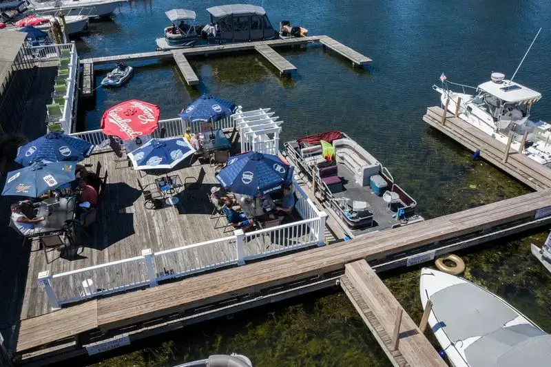
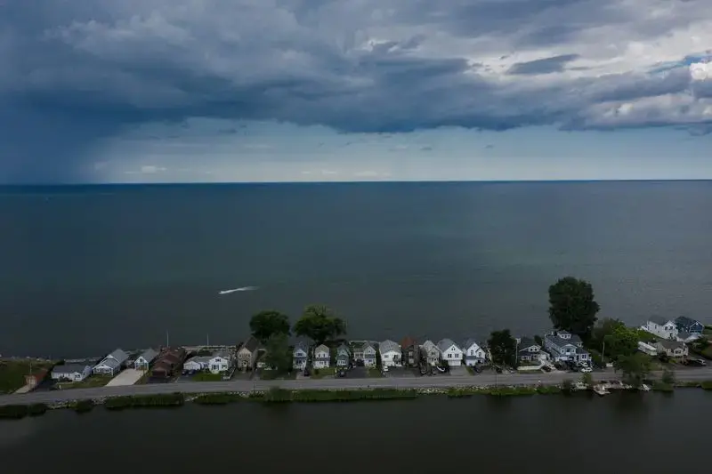


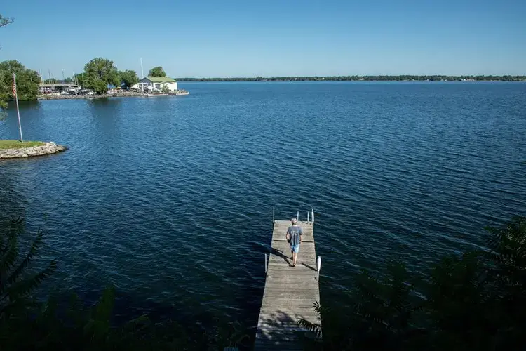
SODUS POINT, N.Y. — On Mother’s Day three years ago, Tom Frank was at his bayside restaurant, Captain Jack’s Good Time Tavern, when a brimming Lake Ontario surged onto the back patio.
Water spilled across the wooden deck, a sun-soaked spot popular with beachgoers and boaters, taking aim at the kitchen and the bar.

“All of a sudden, water’s coming through the floors, through the walls, flooding the restaurant,” Frank said. “You’re fighting to survive.”
Frank’s restaurant was one of many businesses and homes that suffered flood damage in Sodus Point, an upstate New York town of about 900 on Lake Ontario’s southern shore, two hours northeast of Buffalo. From Captain Jack’s and the vacation homes on Greig Street to the town’s wide sandy beach, few areas escaped the damage that storms and a surging lake caused throughout the spring and summer of 2017.
Two years later, the lake swelled again to historically high levels, following another period of heavy rains and — in the eyes of many — exacerbated by a new international regulation plan. The double-barreled floods caused millions of dollars of damage, leaving businesses, homes and parkland soaked, eroded and destroyed.
Flooding is the most conspicuous example of how a changing climate is having a profound effect on Lake Ontario. Drenching rains, wet winters, warmer air and water temperature, less ice cover and more runoff throughout the entire Great Lakes basin, scientists say, have formed a meteorological cocktail that has contributed to unprecedented lake levels, flood-producing storms and the degradation of the shoreline, both natural and developed.
More variability in conditions over shorter periods of time is pushing Lake Ontario — and all of the Great Lakes — as high as ever recorded in wet years, conditions that arrived only a few years after water levels were extremely low.
“This is going to be the new normal,” said Charles Driscoll, a professor of environmental systems and civic and environmental engineering at Syracuse University.
In a special report on climate change, the Tribune is visiting each Great Lake to discover how coastal communities are adapting to a warming world.
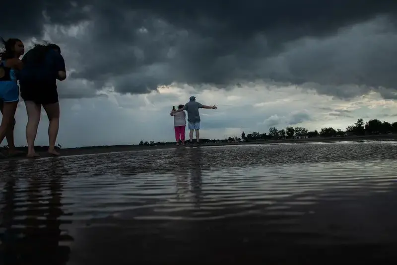
To the residents and business owners along the Lake Ontario shore, the last few years have been maddening and nerve-wracking. Restaurants and shops along the New York shoreline have been forced to close. Homeowners have paid thousands of dollars to dry out swamped basements, install shoreline barriers and raise the foundations of their houses. The coronavirus pandemic, and the ripple of economic consequences, has only added to the challenges.
After the Mother’s Day deluge, Frank and his family went into crisis mode, bringing in 15 pumps, buying plywood to raise the floor and sealing cracks in the walls. They reopened the next day. The flooding throughout 2017 cost Frank’s business $400,000, he said. Two years later, when Sodus Point was once again swamped with high water, Frank said his business suffered a $300,000 loss.
Frank and his staff have soldiered onward. The regulars and tourists returned to Captain Jack’s. But the lake was changed. The back deck of the restaurant, where families, fishermen and motorcyclists watch the boats in the harbor as they savor fried fish, pizza, scallops and an ample selection of draft beer, is now at risk daily.
“The shoreline can’t take another ’19,” Frank said. “It just can’t.”
Frank recalled recent summer afternoons when the waitstaff needed to issue warnings to the guests whenever a big wave caused by the wake of a boat sent water streaming across the deck.
“Lift your feet!” Frank and the others yelled, and patrons kindly obliged, pulling their legs up a few inches while water washed across the patio. Then they gingerly set their feet back on the soggy surface and continued their meals.
Help or hindrance
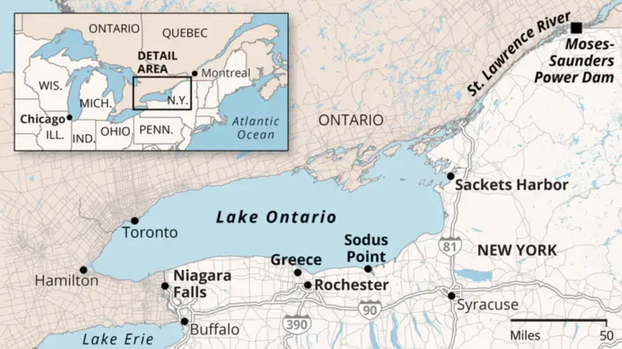
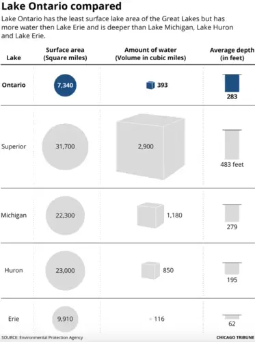
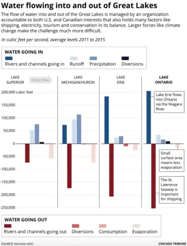
The smallest of the Great Lakes by surface area, Lake Ontario, straddling the international border between the United States and Canada, is facing a cascade of threats. Some, like high water levels, have become common refrains throughout the Great Lakes. But Lake Ontario — which holds nearly four times the volume as Lake Erie because it is much deeper — is unique among its sister lakes. It serves as the gateway to the St. Lawrence River — and the Atlantic Ocean beyond — and its coast is home to Canada’s largest city, Toronto. The lake also is affected by human regulation more intensely and directly than the other lakes to the west.
That regulation, designed to balance the lake’s role as host to international commerce, coastal cities, tourist towns and natural habitats ranging from rocky shoals, sandy dunes and marshland, plays an outsize role in Lake Ontario’s health and its future.
The International Joint Commission, a binational organization founded a century ago by the governments of the United States and Canada, cooperatively manages lake and river systems of the borderlands.
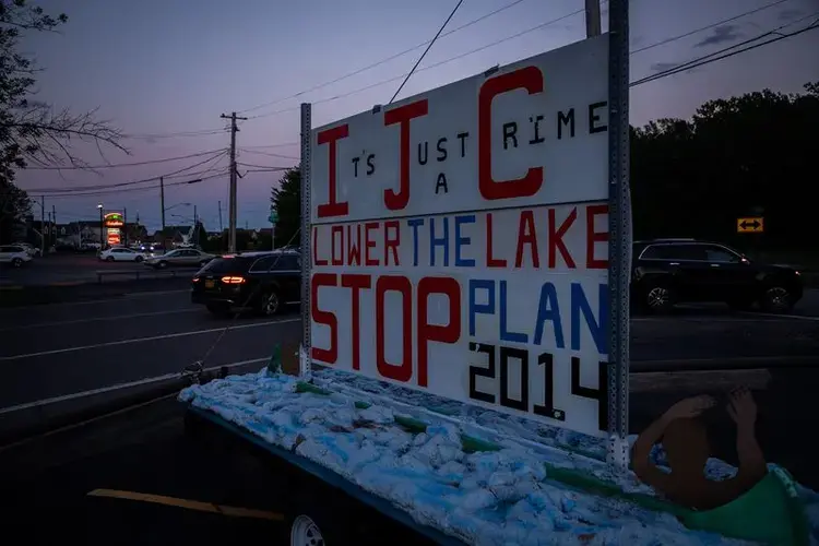
In the wake of the devastating coastal flooding, the IJC has come under fire for the implementation and then deviation from a new Great Lakes management plan, known as Plan 2014. The IJC says its goal is to protect against extreme water levels, restore wetlands and prepare for climate change.
Critics, including the New York state government, small town mayors and shoreline residents, say the plan contributed and worsened the damaging floods of 2017 and 2019.
“It’s our belief that the IJC completely ignored us in the development of Plan 2014,” said Dave McDowell, mayor of Sodus Point and member of the group Save Our Sodus. “Because what we told them was going to happen was exactly what happened.”
A major component of Plan 2014, which went into effect in 2016, sets forth parameters for regulating the outflow from the Moses-Saunders Dam on the St. Lawrence River, located about 75 miles southwest of Montreal. The dam, which straddles the U.S.-Canada border and provides hydroelectric power to both countries, is used to regulate water levels in the St. Lawrence River and Lake Ontario upstream, while providing a navigable waterway for ships traveling to and from the Atlantic Ocean.
Plan 2014 sets out a series of trigger levels — both high and low water — in which IJC regulators will change the amount of water released or blocked at Moses-Saunders.
McDowell said he believes the trigger levels are set too high. At the upper limits, “it’s too late,” he said, and the shoreline flooding in upstate New York towns like Sodus Point will be, in his estimation, inevitable.
Frank, the restaurant owner, said he doesn’t understand regulators’ decisions, or even why the rules of lake management needed to change.
“Why? To ruin everyone’s livelihood?” Frank asks.

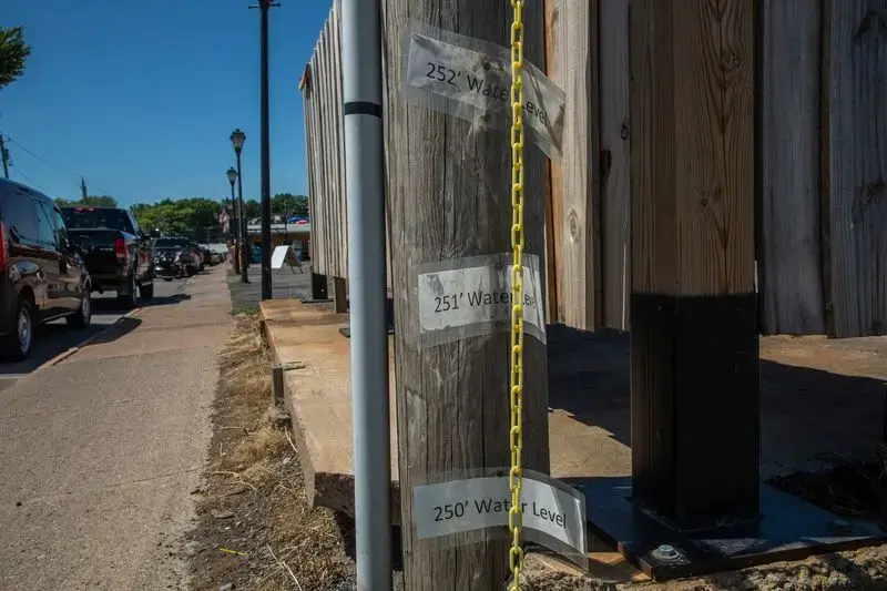
In communities along the shore, most people know the lake level numbers like they do their address or phone number: 242 feet, 246, 247, 249. They know what section of road floods at each level, how high to build docks, when the breakwater will disappear, how much beach will be gone.
So for homeowners and business operators up and down the picturesque coastline, it’s hard to reconcile that two of the worst floods in recent memory — and for many long-timers, any memory — came on the heels of the new lake levels management plan.
George Smith, whose family members settled the town of Sackets Harbor on the lake’s eastern shore, where he has now returned to live, remembers when the marina and the boat slips at the town square park were all underwater in the early 1970s as well.
“High water’s not unusual,” Smith said.
But this time it’s different.
“Follow the money,” Smith said, believing that the IJC’s decisions regarding regulation tie directly to the sway of the shipping industry. But he also said that Canada has not done its part, failing to manage the flow of the Ottawa River and prioritizing the politically powerful Montreal region at the expense of the small towns and open space along Lake Ontario’s southern shore.
He’s not alone. From Greece, Oswego and Sodus Bay in the central shore, to Sackets Harbor and Cape Vincent at the eastern end, the yards in the shoreline communities are dotted with signs criticizing Plan 2014 and the IJC.
New York state, in a lawsuit the attorney general filed against the IJC in October 2019, argues the commission failed to provide remedy for shoreline property owners and “prioritized commercial shipping interests, causing large-scale injury and damage to the state.” In a federal report, officials with the New York Department of Environmental Conservation also said the IJC did not adequately balance environmental restoration goals with the needs of property owners.
IJC disputes the allegations in the lawsuit.
In a public webinar in early July, the IJC provided updates on their work and plans for the future.
Jane Corwin, the IJC’s U.S. commissioner and chair, said the region has experienced unprecedented wet conditions over the past several years and the IJC has authorized changes to Plan 2014 in order to reduce Lake Ontario levels.
“The last few years have been very difficult for all of us in the Great Lakes basin,” said Corwin, a former Republican member of the New York State Assembly. She said the commission is testing deviation levels and the plan’s limits, and also is listening to all stakeholders from both the U.S. and Canada when making future decisions.
“We also know that the outflow regulation will be unable to maintain water levels within the desired ranges when extreme weather conditions occur,” Corwin said. “We, the people of the Great Lakes-St. Lawrence River basin, have to learn to cope with the full range of conditions.”

‘The big driver'
Driscoll, the Syracuse professor, said the IJC is not the problem.
“Climate change is the big driver,” Driscoll said.
“To blame the IJC is just a ridiculous situation because we’ve had three (very wet years) and these are very clearly documented in the record and in the scientific research,” Driscoll said. “The IJC took the long-term view. … It’s a very challenging task they have.”
Driscoll said he believes a detailed analysis of the records shows where most of the blame should be directed.
“It’s the weather,” Driscoll said. The best way forward, he said, is to “de-harden” surfaces, support wetland coastline buffers and fund natural-based solutions.
Three main factors, Driscoll said, contributed to the floods and shoreline erosion two of the previous three years: high Lake Ontario water levels heading into autumn, the quantity of precipitation throughout the entire Great Lakes basin during the winters and, more specifically, the quantity of precipitation in the Lake Ontario basin during the spring.
But climate change is not the only factor. As humans build more along the shores, and as coastline cities and suburbs expand, more of the water running into the Great Lakes basin will find its way to the region’s rivers and streams and into the lakes.
“It’s not only precipitation that’s doing this, it’s the development as well,” Driscoll said.
“There are things that we can do in terms of smart development to at least try to mitigate the situation,” Driscoll said. “Why not understand the problem we have and deal with it in a natural way?”
Basil Seggos, the commissioner of the New York Department of Environmental Conservation, said the federal government has failed to acknowledge the environmental issues facing Lake Ontario and the other Great Lakes.
“The economy and the environment are interrelated, inextricably so,” Seggos said.
That connection, he said, is lost on some of the politicians in Washington.
“The Trump administration,” Seggos said, “has pulled the rug out very powerfully” on a number of environmental and climate regulations and policies.
Climate change, and the cascade of issues it causes, he said, is real.
“It’s irrefutable that we have a massive problem on our hands,” Seggos said. “And it’s not going to go away.”
‘You keep going’
This year the weather pendulum has swung back the other way, with much of upstate New York under drought conditions and Lake Ontario’s water level noticeably lower than 2019, when the lake reached its all-time high in June. But monthly levels are still consistently above average this year, and upstate New Yorkers are looking to the west, where the near-record Lake Michigan water levels are already weighing on their minds. Since the Great Lakes are all connected, the water of the west will eventually make its way into Lake Ontario.
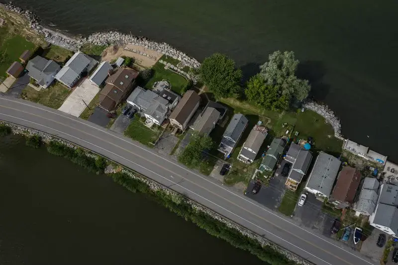
Nancy Sullivan, edging her front lawn along the pathway that leads to her front porch in the Edgemere area of Greece, N.Y., has been on the front lines of water level and shoreline changes.
“You bet your booty I had damage,” Sullivan said. She lost two decks and several trees in her yard. Her basement flooded, multiple times. Now she keeps nothing on the basement floor. “It’s cost me a fortune.”

With the road in front of her house flooded for weeks, Sullivan said she went through multiple pairs of rubber boots.
“It’s just a mess,” Sullivan said. “But you keep going.”
The high waters, flooding and the damage it delivered has had long-lasting ramifications. Sullivan once had a small beach on her lakefront property and a dock. Both are now gone.
“At this time in August, I should have a beach,” Sullivan said.
Sullivan, a retired accountant, calls herself a Lake Ontario “lifer.” The house has been in her family for three generations, and she has lived there for more than 40 years.
“Never saw anything like it, never,” Sullivan said of 2017 and 2019.
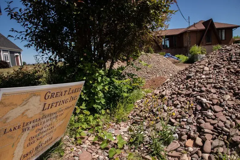
Scores of homeowners like Sullivan have shelled out thousands to bail out flooded basements or even raise their foundations to avoid future flooding. The state of New York and the Federal Emergency Management Agency also have provided millions for stormwater projects, shoreline rehabilitation efforts and sewer upgrades.
About 125 miles to the east, then north up the coast in the quiet town of Sackets Harbor, flooding, property damage, dents in tourist visits and shoreline erosion have taken a toll on residents. But more than the financial repercussions, Mayor Eric Constance said, has been the emotional effects: business owners forced to close, residents wondering if they can pay their mortgage, townspeople worrying about what the future holds.
“I’d say they’re nervous,” Constance said. Now, he said, residents — and potential buyers — are conditioned to consider what the lake may have in store for them in the coming years.
“It’s in the back of your mind: Can this be flooded?” Constance said. “To us, that became the new norm, to protect your property.”
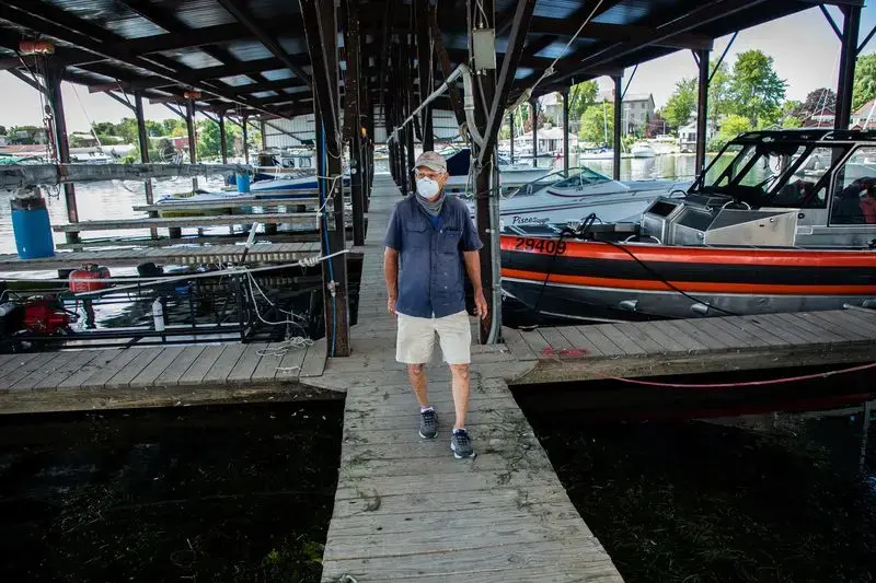
High water, and now the coronavirus, have scuttled many plans. At Navy Point Marine, which caters to boaters and sailors who use the historic harbor as the launching spot for lake access, including the popular two- to five-hour journey along the eastern Lake Ontario shoreline to Kingston, Ontario, the docks aren’t as busy these days.
Co-owner Peter Leubner said in 2017, he was forced to shut down the power to the marina as waves crashed into the docks, boats slips, service road and offices. Navy Point Marine lost 35 boat slips. With the average yearly rental about $4,000 a year, the cost of the floods and storms rose quickly.
“There were water boils up through everywhere,” Leubner said. “Pumps were useless.”
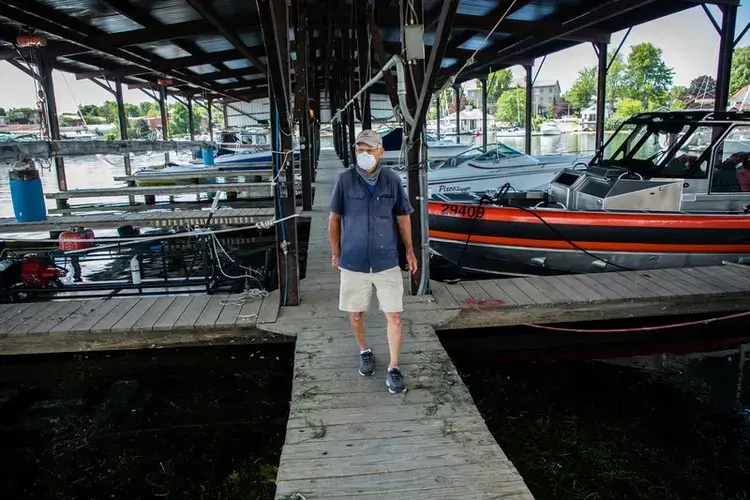
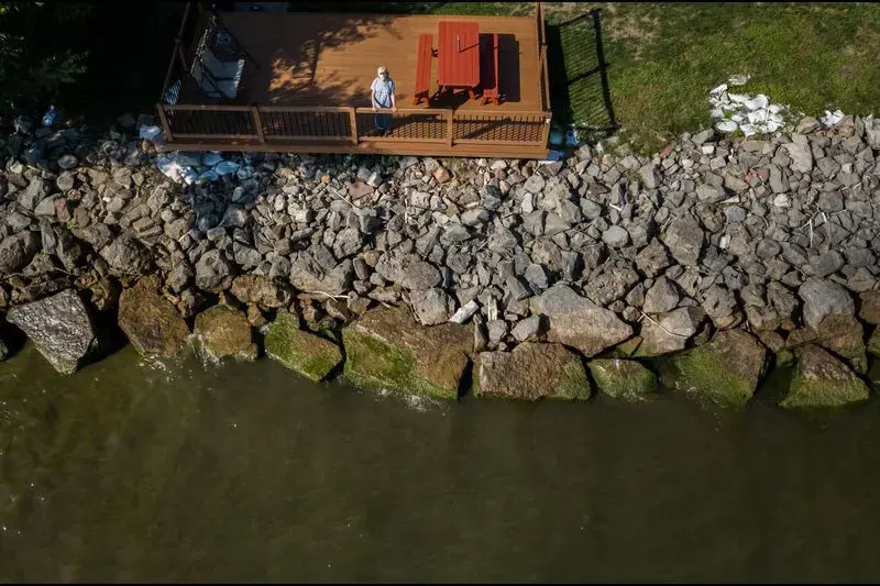
Leubner and the staff dealt with flooded facilities. Boots were required work attire. The discoloration of the support column at the covered marina, inches higher than the base of the wooden walkway and the docks, is lingering proof of the lake level’s role.
For each of the flood years, Leubner said, his business went $150,000 to $170,000 in the red.
Leubner was looking forward to a drier, calmer 2020. Then the pandemic arrived, closing the border with Canada and leading other American customers to alter their plans for the boating season.
“We can’t go there and they can’t come here,” Leubner said about the usual popular boat travel across the international border.
The government finance programs, Leubner said, aren’t exactly practical. He and his business partners would need to spend $400,000 to get $200,000 back, and with the losses of the last few years, that’s not feasible. Real change to the marina, and others along the shores of the lake, Leubner said, will take millions in investment.
“Look at the last four years,” Constance said. “If it’s not one tragedy, it’s another.”
Many masters
Bill Reilich, the commissioner of Greece and a former New York state assemblyman who recently was added to the IJC’s Lake Ontario-St. Lawrence River Board, said the IJC needs to do a better job of managing lake levels. Plan 2014, he said, was designed to allow for higher highs, but also lower lows.
“Well, all we’ve seen so far are higher highs,” Reilich said.
As high water and storm surges again battered the coastline in the spring of 2019, the IJC deviated from the plan, but in many ways it was too late. Plus, Reilich said, “It’s not as simple as letting water out.”
“It’s not like we can flip a switch tomorrow,” Reilich said about high levels. “It’s not like it’s going to be gone.”
Still, Reilich said that since his priority is to protect both shoreline residents and the natural shoreline ecosystems, more balance is needed. Shipping and hydropower and the more populated regions of Canada, especially the Montreal region, should not take priority over the rest of the coastline, many on the New York coast say.
Such a balance, Reilich acknowledged, is far from simple.
The IJC and the river board, he said, are “trying to please about six masters, right?”
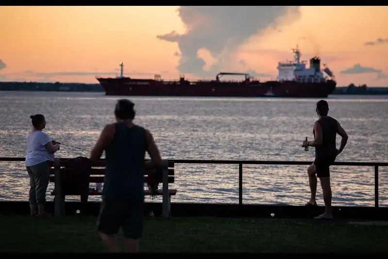
About 150 million tons of cargo, valued at $15 billion, move annually through the Great Lakes on commercial ships, according to the Lake Carriers’ Association’s 2019 State of the Lakes report and a study commissioned by the Great Lakes Seaway Partnership. U.S. flag ships, the association says, move between 80 and 90 million tons. The shipping industry says the commerce supported 238,000 jobs and $35 billion in economic activity in 2017. Iron ore is by far the most-shipped material (46 million tons) on the lakes, followed by limestone (22 million tons), according to lake carrier statistics.

Jim Weakley, president of the Lake Carriers’ Association, made up of the owners and operators of U.S. cargo ships that are licensed for Great Lakes travel, said he is sympathetic to shoreline residents and business owners. He said ships do all they can to minimize the damage that ship traffic causes to coastal areas, from slowing down in high water, avoiding passing other ships to prevent too much water displacement and avoiding travel close to the shore when possible.
But Weakley said that most of his members’ traffic is centered in the other four Great Lakes, not Lake Ontario, where Canadian and foreign flag ship traffic dominates. He expressed frustration that U.S. ships are lumped in with Canadian vessels and framed the issue as more of a schism between Canadian business interests and the United States.
“We do everything we can to reduce the impact on the shore, the shoreline businesses and the homeowners,” Weakley said. “I get very frustrated when we are painted as the greedy shipowners.”
The port in Montreal on the St. Lawrence River handles more than 40 million metric tons of cargo each year and is a major hub of commerce for eastern Canada, with direct connections to more than 140 countries.
On the Canadian side of the lake, Jolanta Kowalski, spokeswoman for the Ontario Ministry of Natural Resources and Forestry, said in an emailed response that the province provides funding for the maintenance of existing infrastructure, such as dams, dikes, shorelines and channels, that are critical to public safety, and flooding and erosion minimization.
Earlier this year the province released a plan that will examine existing flood data, make predictions under a changing climate and review flood-proofing recommendations.
‘Saying no’
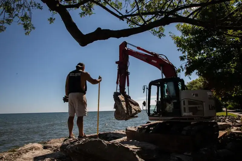
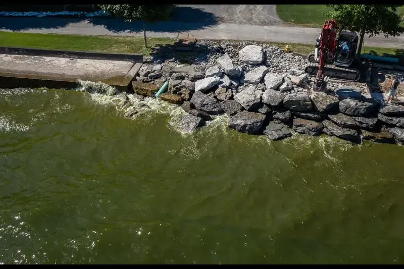
Seggos, the environmental commissioner, stood atop the recently completed gravel, stone and grass berm near Buck Pond in Greece, a short walk from Edgemere Drive and the houses that line the shoreline of Lake Ontario. The berm, meant to protect residents while at the same time fitting into the marshland habitat, is one of a bevy of projects funded under New York state’s REDI project in response to the lakeshore flooding.
The New York DEC’s goal, Seggos said, is to fund projects that strike a balance between protecting residents and businesses, and preserving the coastline and near-shore natural environments.
In 2017, the area where Seggos stood was underwater for 100 days. On a beautiful, clear late July day, it is easy to forget the neighborhood, and the natural areas to the south and west, were inundated by storm surges in previous years.
In conjunction with the DEC’s initiatives, the town of Greece, which has 8 miles of Lake Ontario shoreline, 98% of which is residential, has permanently installed a series of underground pumps and pipes to help deal with anticipated future flooding. In the flood years, with water slamming into the shore from both the lake and the ponds to the south overflowing, the temporary pumps the town brought in had a hard time keeping up.
From the Niagara River in the west to the Moses-Saunders dam on the St. Lawrence in the northeast, New York is spending $300 million on 135 shoreline-related projects. The DEC received more than 500 proposals for projects, Seggos said, and ultimately whittled that down based on engineering, environmental and economic factors.

Some homeowners have been frustrated with various government agencies rejecting their applications for shoreline projects. Others don’t want FEMA to reclassify their properties into the floodplain or floodway because of the insurance ramifications and have paid to install giant boulders along the shore.
Seggos said he knows the shoreline is a ”very emotional issue” for those whose home or livelihood is tied to the lake. But he said that hard infrastructure projects, such as sea walls, “are not a sustainable approach” going forward. Such projects have the potential to cause more damage in the long term, especially if they are done piecemeal, with one homeowner here and there completing work, leaving others to bear the brunt of future storms and high water.
“Look, I’m sympathetic,” Seggos said, when asked to respond to residents who expressed frustration at the DEC’s priorities. “Edgemere is a very challenging example.”
Still, he said, the best approach is a “more comprehensive, wholesale approach rather than strengthening one-offs.”
“Our role is to protect the environment and also to open up economic opportunity for the state,” Seggos said. That means “saying no to some projects that will cause damage to the environment and neighbors.”
Despite all of the damage and headaches, Sullivan, who lives a few minutes from where Seggos outlined the new flood-control measures, isn’t going anywhere. She loves the water, monitoring the minks as they dart into the shoreline rocks, welcoming herons to her yard.
“I still get up in the morning and it’s a gorgeous sunrise,” Sullivan said. “Absolutely stunning. And I get gorgeous sunsets too. I never blame it on the lake. The lake can’t help it. It’s the people controlling it. I love the lake.
“It’s a man-made-caused mess,” she said.
Her freshly edged lawn looked crisp and clean. Beyond the path leading to the house, Lake Ontario shimmered in the summer sun, waves licking the shore.