Story
 December 6, 2022
‘Ticking Ecological Time Bombs’: Thousands of Sunken WWII Ships Rusting at Bottom of Pacific
Country:

This detritus of war has been rusting, leaching, poisoning, and exploding in the lands and seas of...
Earthquakes, storm surges and other natural disasters could mean environmental catastrophe if oil and other hazardous material spill out.
Soon after the Solomon Islands was rocked by a 7.0 magnitude earthquake on Nov. 22, oil began lapping onto Guadalcanal’s sleepy northwestern shores.
The suspected source? A World War II shipwreck.
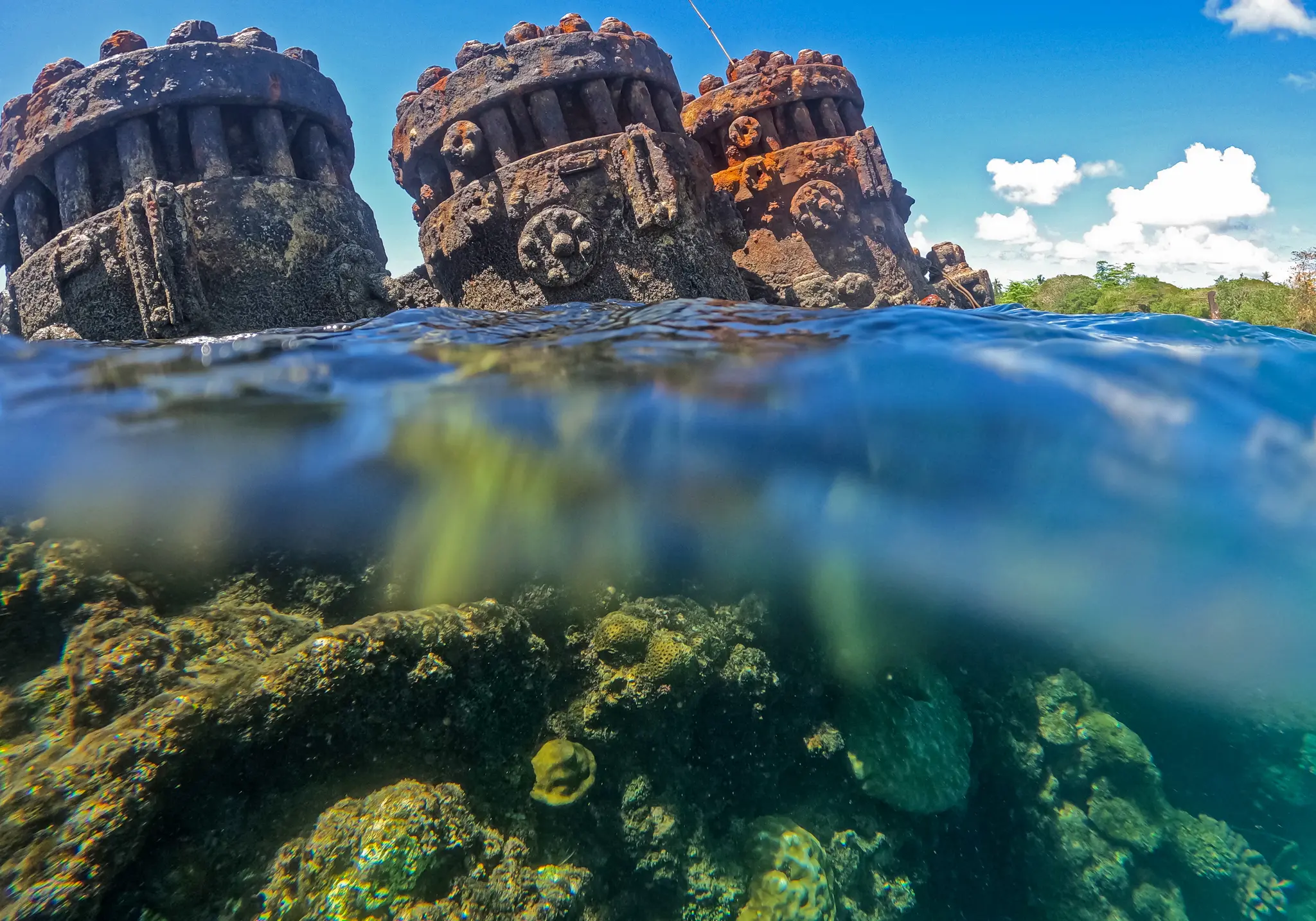
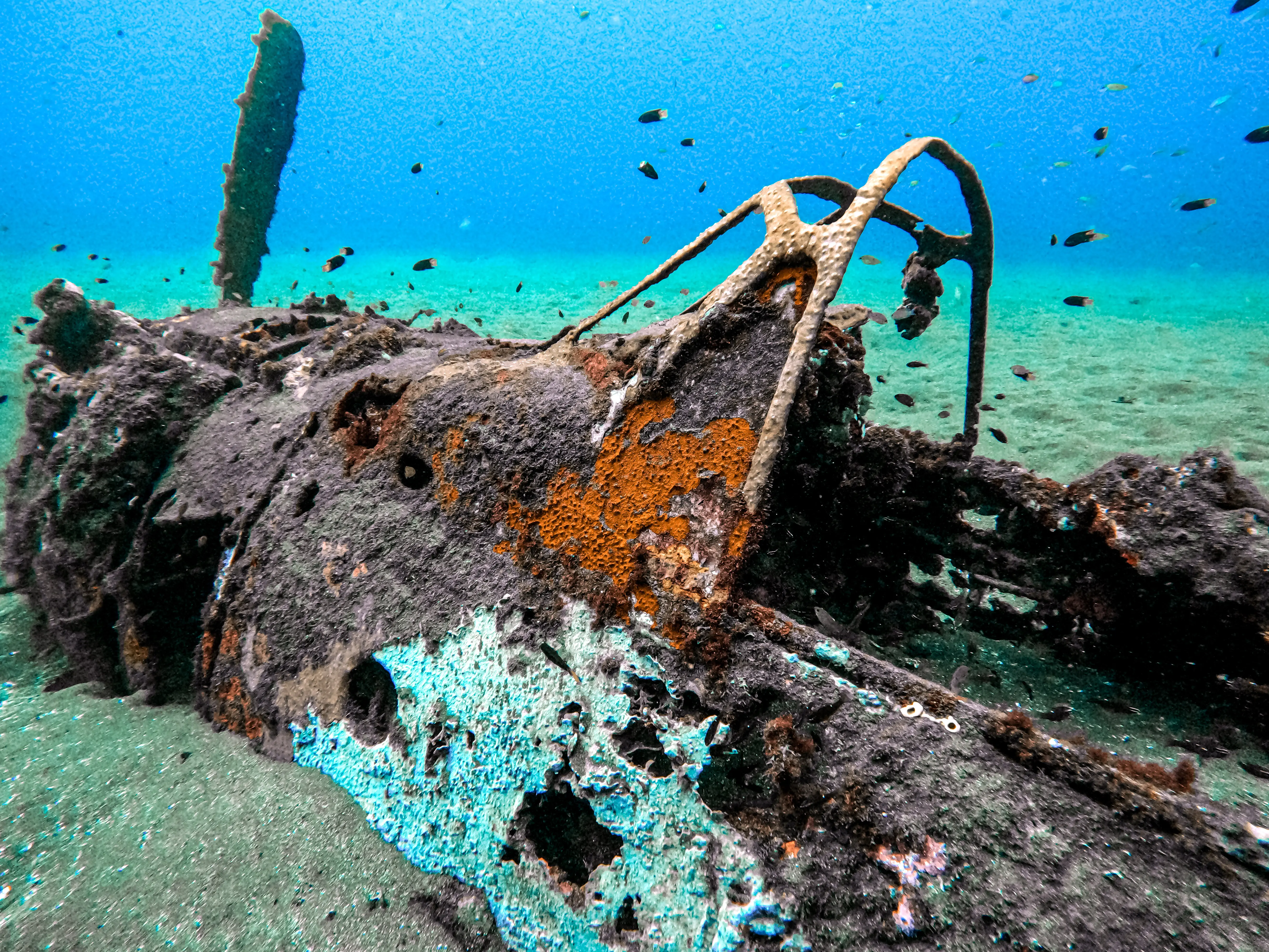
More than 3,800 ships were sunk during World War II across the Pacific, each now holding the potential for catastrophic environmental fallout.
Many of these shipwrecks contain a potentially devastating threat: Thousands of tons of oil and an unknown quantity of bombs and chemical weapons.
Decades of decay combined with seismic activity and increasingly uncertain weather events has already ruptured some shipwrecks’ weakening fuel tanks and hulls, sending thousands of gallons of oil into the sea.
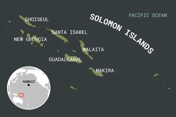
The problem is a big one for the Solomon Islands. The offshore area north of Guadalcanal is called Iron Bottom Sound, named after the 1,450 airplanes and 111 shipwrecks on its floor, more than half a mile down.
Oil and fuel spills can destroy the reefs and ecosystems fundamental to Pacific Island economies, food systems and protection from the ever-increasing threat of climate change and sea level rise. Climate change is also causing more unpredictable and severe storms and changing sea conditions. The marine ecosystems that underpin life in the Pacific are already being compromised.
Pacific island nations and territories have long been warning about the impacts of climate change, calling for action globally as they already face its myriad effects.
Now, the increasing danger from shipwrecks and other World War II debris that is hidden beneath their waters is only adding to the peril they find themselves in.
Out Of Sight But Everywhere
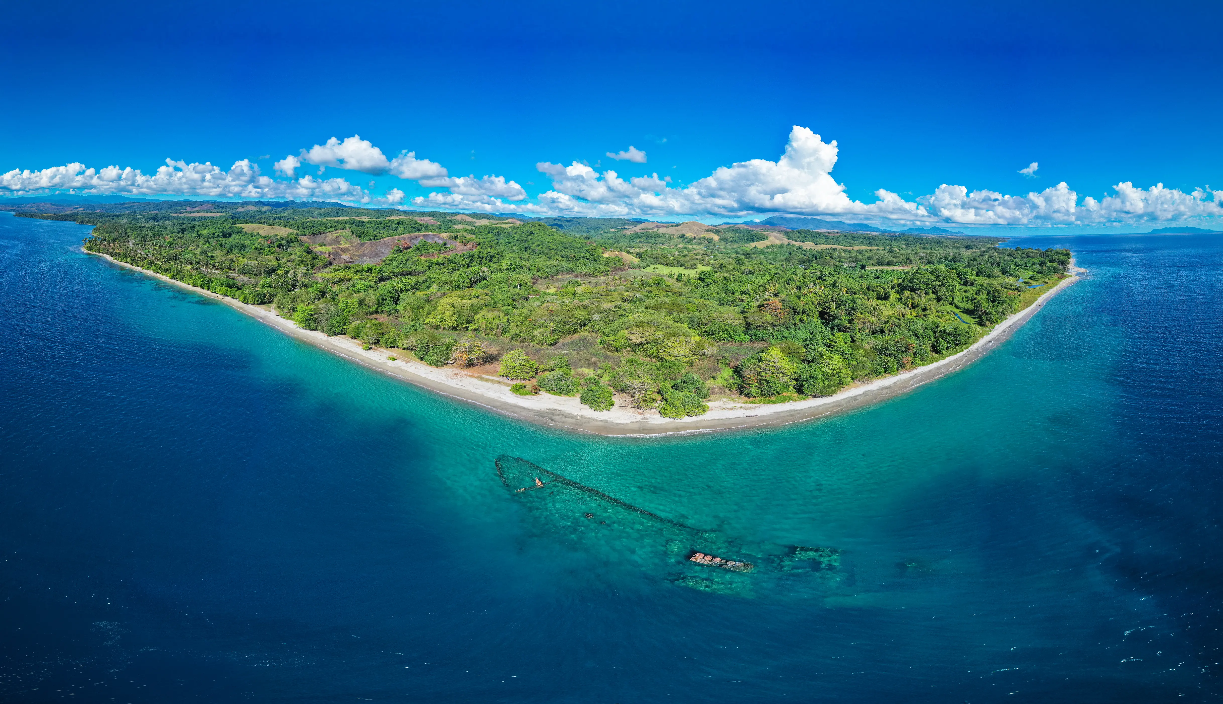
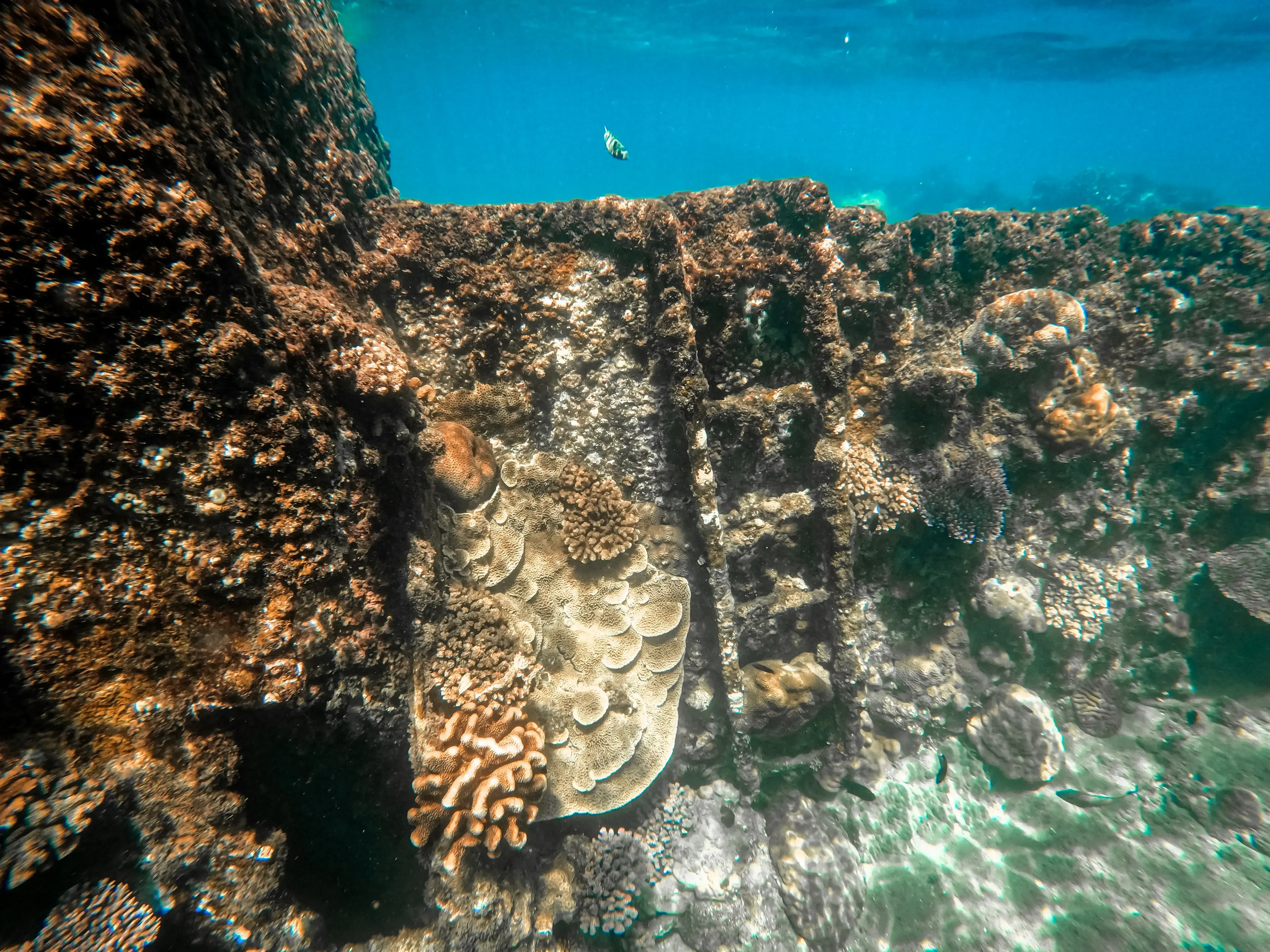
An iron sarcophagus is all that is left of the Kashi Maru, a Japanese merchant ship lying in the midnight-blue waters of Mbaeroko Bay. Corals adorn the steel hull, which has become a haven for marine life and a pilgrimage for scuba divers.
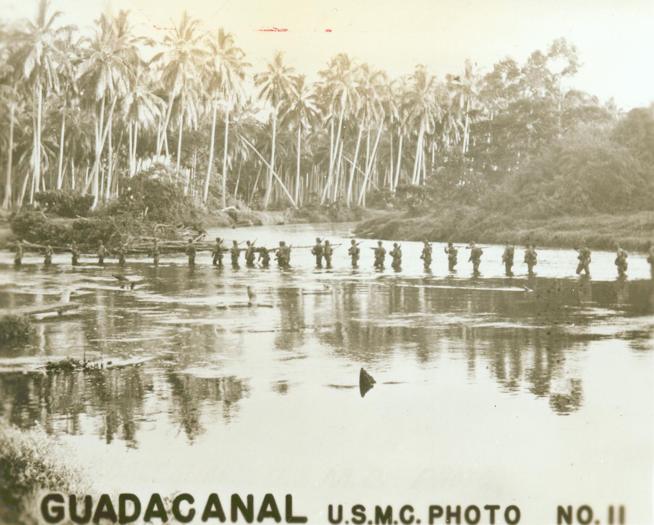
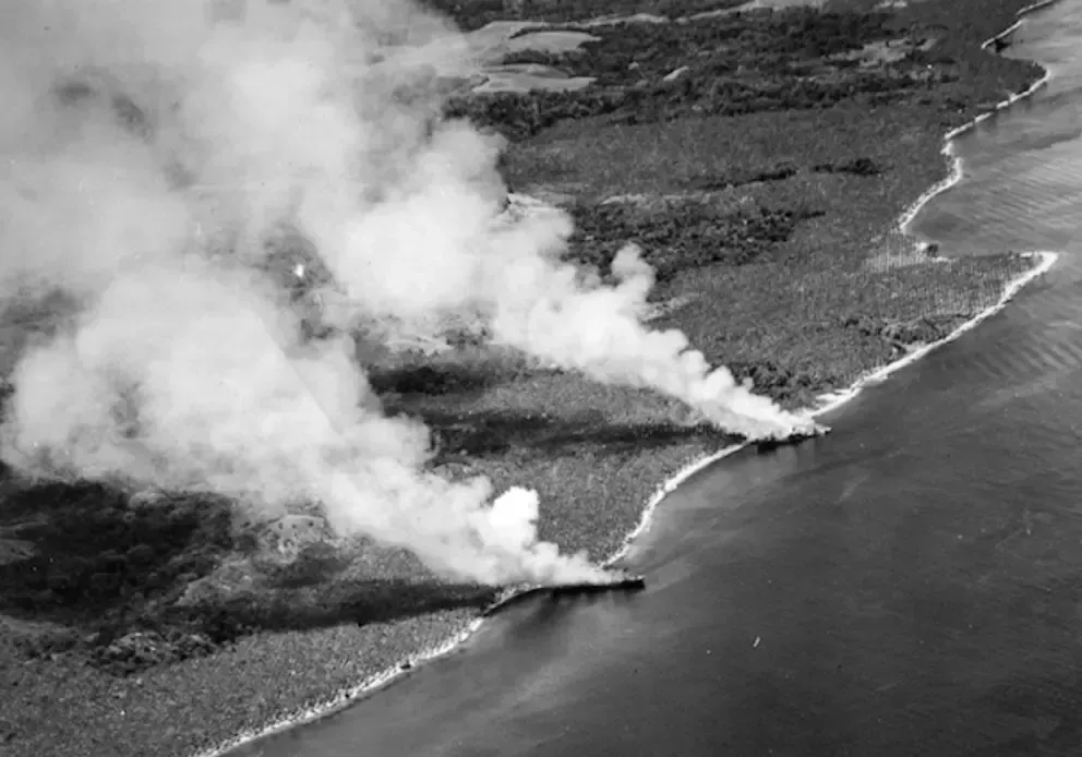
U.S. forces sank the 654-ton ship during WWII, in the bloody campaign for the Solomon Islands, as fighting migrated westward to the island of New Georgia in 1943.
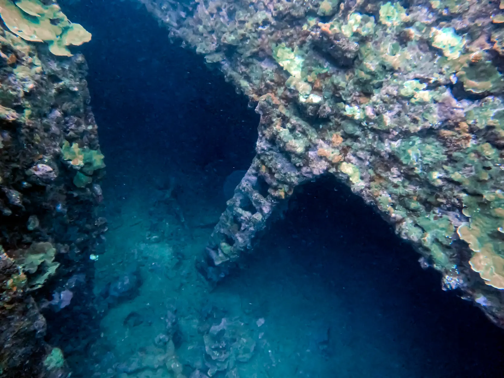
The Kashi Maru’s crew had been furtively unloading cargo from the 172-foot ship, and had attempted to camouflage it under a thicket of native greenery.
From above, the ship appeared to be just another island among the more than 900 that comprise the South Pacific nation. But Indigenous Solomon Islander scouts alerted the Allies to the mysterious new island in Mbaeroko Bay. Their call ushered a flurry of strafing B-25 bombers and Naval Corsair fighters that blew a hole in the minelayer’s hull, sinking it yards off the sands of northern New Georgia.
The histories that have been written and recorded about the war have informed much of the recent research into the thousands of potentially polluting wrecks across the Pacific.
The Australian nonprofit Major Projects Foundation has categorized 471 ships across the Western Pacific as high priority, requiring further investigation.
Fifty-three of those wrecks are deemed the most problematic, most dense in the Federated States of Micronesia, followed by the Marshall Islands and the Solomon Islands.
Nineteen high priority ships are believed to be in the shallow waters of Chuuk Lagoon, in the Federated States of Micronesia, making it the most disaster prone area in the Pacific. The Marshall Islands has 12, while the Solomon Islands has 10.
MPF is now focusing its work on Chuuk Lagoon, working with the FSM and Japanese governments to contain the risk of shipwrecks rupturing in the highly contaminated area.
Most of the sunken ships throughout the Pacific are invisible, with little known about their condition or potential environmentally damaging payloads housed within them.
But Canadian cartographer Paul Heersink’s eight-year effort to map the resting places of WWII ships has contributed significantly to illustrating the breadth of the issue worldwide.
His research has pinpointed 15,000 shipwrecks across the globe in a map accounting for the more than 550,000 servicemen killed and 43 million tons of iron sunk during WWII. But 4,500 sunken ships remain unaccounted for because records on them are limited, Heersink says.
The project was born out of his interest in naval history and a passion for mapping. But it’s become an almost indispensable tool for those trying to address problem shipwrecks across the globe – especially in the Pacific.
Several groups wanting to help extract the toxic material from these ships have approached Heersink to discuss his findings.
A History Of Danger
The threat of oil spills was highlighted in the Pacific region in 2001, when a tropical storm disturbed the resting place of the USS Mississinewa, an oil tanker sunk by a WWII Japanese suicide torpedo in the Federated States of Micronesia.
About 400 miles southwest of Guam, lying in Ulithi Atoll, the tanker leaked up to 24,000 gallons over the course of 60 days from 130 feet below the surface, before being plugged and eventually drained of its oil.
The generally accepted rule for the rate of corrosion is 0.1 millimeters per year and can be up to 0.2 millimeters. Wartime ships’ hulls were typically 25 millimeters thick, which could leave a ship sunk in 1942 more than 30% weaker by now.
But not all ships went down in the same manner, especially during battle. They could have been sunk by torpedo, scuttled intentionally or torn in half during battle, landing on the seafloor in different ways.
Matt Carter of the Major Projects Foundation has dubbed the shipwrecks “ticking ecological time bombs.”
Still, the timeline is uncertain: The way ships were sunk, what depth they lie at, how much exposure to the sun they face, and whether they have been disturbed all influences risk, Carter says.
“The actual corrosion rate of a given wreck varies enormously,” Carter said in an email. “We cannot accurately predict (the) release of oil/pollutants without direct assessment of individual wrecks.”
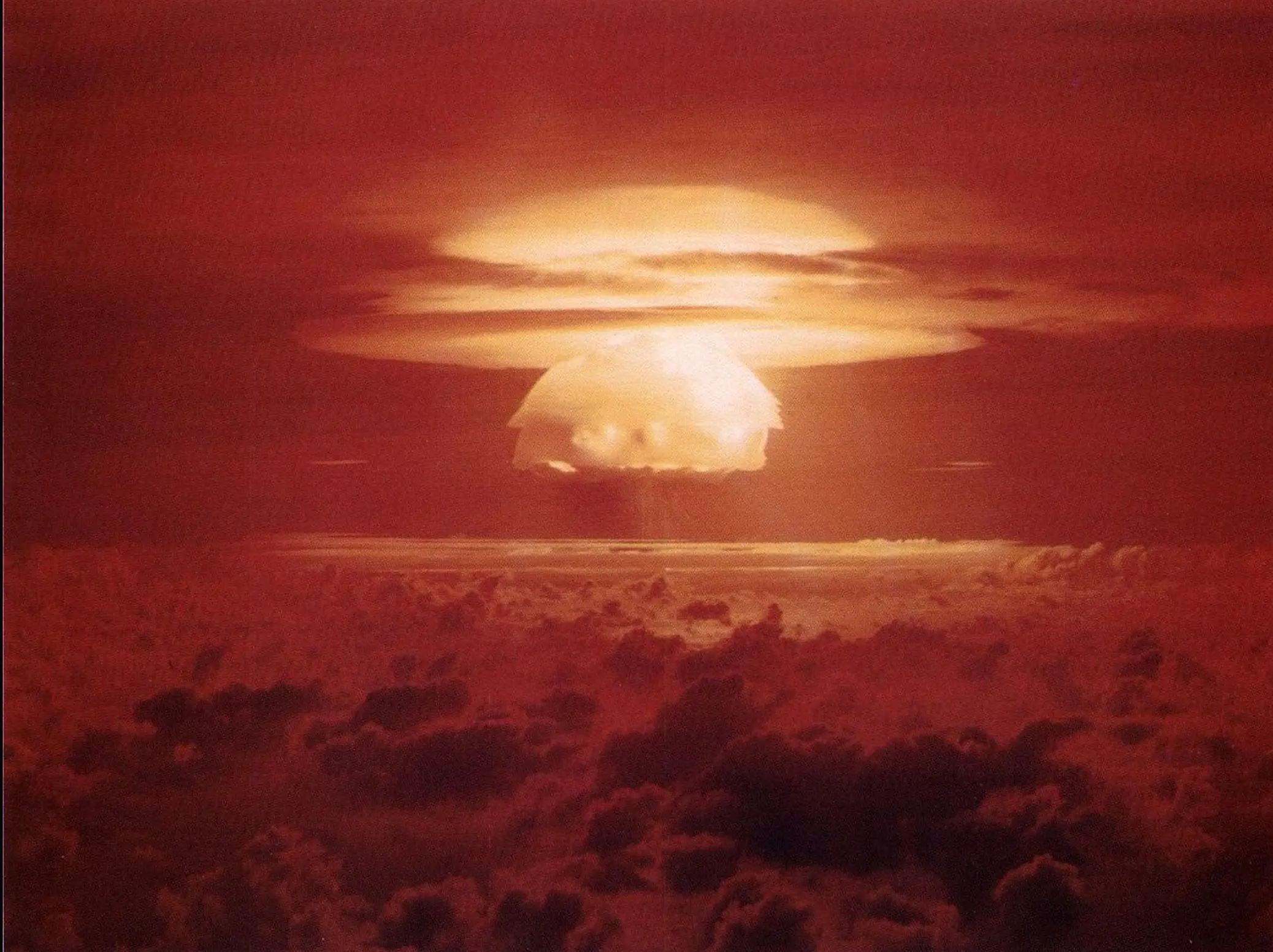
In 2021, MPF and a satellite mapping outfit called CGG found more than 6 miles of oil slick in Bikini Atoll in the Marshall Islands leaking from ships destroyed during nuclear testing in 1946.
More recently, a WWII ship was found to be polluting North Sea waters, influencing the ecosystems around the wreck.
For the Solomon Islands, despite the density of shipwrecks, a majority lie at depths of more than 1,600 feet below sea level – Iron Bottom Sound’s depths average 2,000 feet.
The Solomon Islands archipelago, which straddles the seismically active Pacific tectonic plate, is prone to earthquakes. And while November’s 7.0 magnitude quake and suspected spill was local villagers’ first sighting of oil, many Solomon Islanders are familiar with spills.
There are still many shipwrecks in shallower waters that might pose a risk.
An Expensive Problem
Dealing with a potential polluting wreck requires myriad considerations and comes at a hefty cost.
The almost three-year process of remediation and eventual salvage of oil from the 25,000-ton USS Mississinewa in the FSM cost $6 million. A spill from the S.S. Jacob Luckenbach which was built for the war but sank off the coast of San Francisco in 1953 cost about $19 million in 2002.
The National Oceanic and Atmospheric Administration is a key scientific adviser for government agencies, U.S. territories and Micronesian states, such as Palau, Marshall Islands and the FSM. Its work includes a country-wide assessment of shipwrecks in U.S. waters, of which there are approximately 20,000.
The Emergency Response Division conducts regular spill forecasting and prioritizes shipwrecks on the basis of risk – there are three shipwrecks of concern in Hawaiian waters, for instance.
Emergency Response Division regional operations supervisor Doug Helton says the office forecasts international spills, detecting oil and predicting its future movements from space, helping in countries such as Peru, Mauritius and Sri Lanka.
“With most pollution response, you don’t have the luxury of deciding when to do it,” Helton says. “But with some of these sorts of vessels, you try to figure out what’s the best time of year, with the most favorable to salvage conditions.”
For the USS Mississinewa, the conditions were hardly ideal, because the ship rolled over when it sank, full of a fresh load of fuel and oil.
But other cases might be easier to anticipate, for remediation at a time that’s less intrusive on marine and avian life, for example.
“There are a lot of things to keep in mind. One of them is that most of these wrecks are historic artifacts, many of them are war graves,” Helton says. “So you typically approach them with a little bit of caution, making sure you don’t make things worse.”
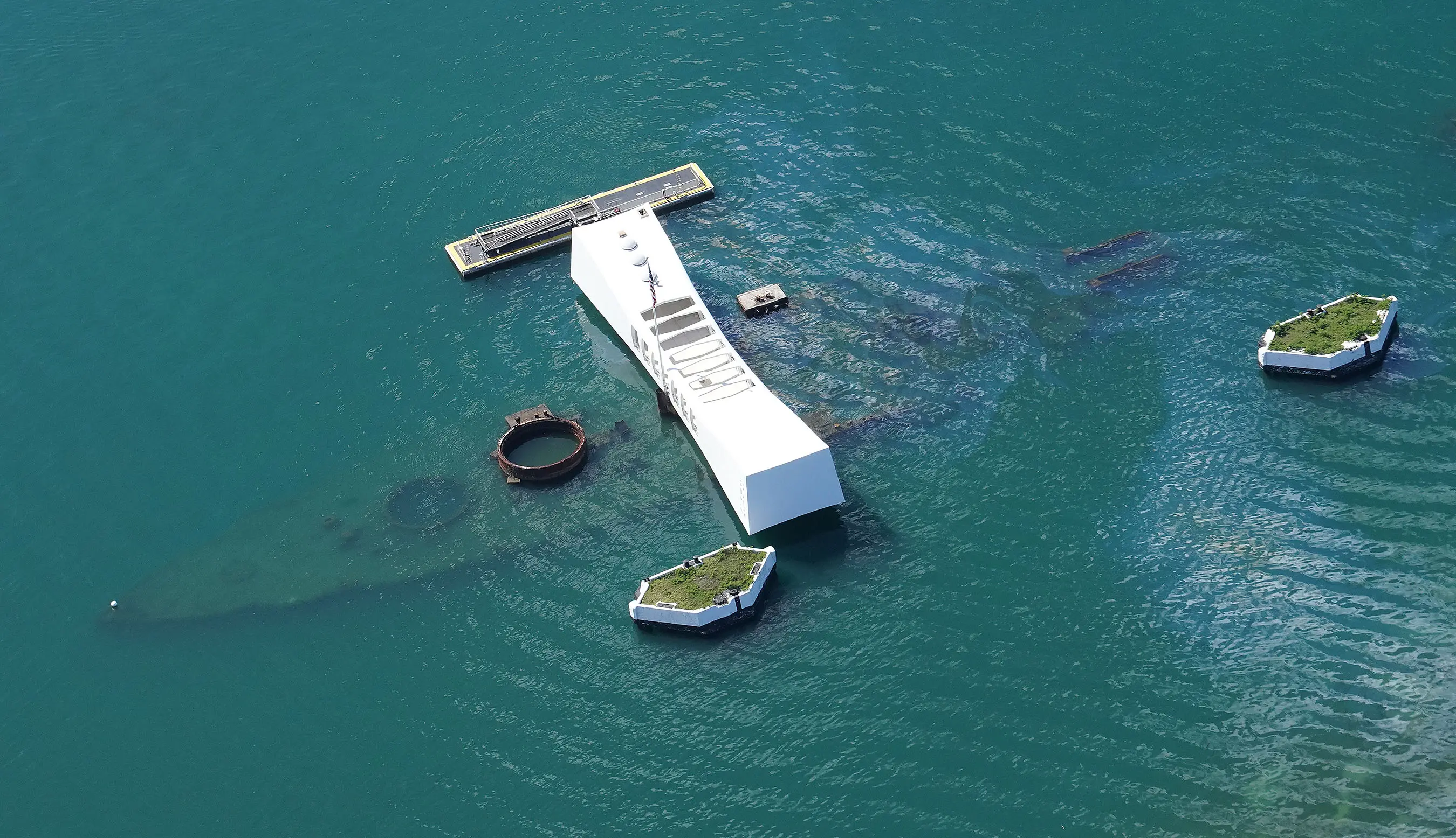
The USS Arizona in Pearl Harbor is one example of a war grave. The ship, sunk in the 1941 attacks, has leaked somewhere between 14,000 and 64,000 gallons of oil since it was destroyed.
Federal authorities have continued to let the oil leak, despite the Department of Defense finding the oil was “particularly harmful” in 2008. It’s been estimated that the leak will continue for the next 500 years, at nine quarts per day.
Ships in international waters are generally protected by their flag countries and are considered war graves that cannot be disturbed.
But the catastrophic potential has left scientists in agreement: The ships stay, but the dangerous material needs to go.
Islanders Need More Information
The Solomon Islands’ environmental ministry is used to fielding reports of oil seeping from around the country, not just from ships but also airplanes and post-World War II dump sites scattered across the archipelago’s waters.
Approximately half a billion pounds of U.S. military paraphernalia was in the Solomon Islands in August 1945, as WWII was ending. In the greater Pacific, it is estimated the total weight of military presence was almost 20 billion pounds, according to reports from the National Archives and Records Administration.
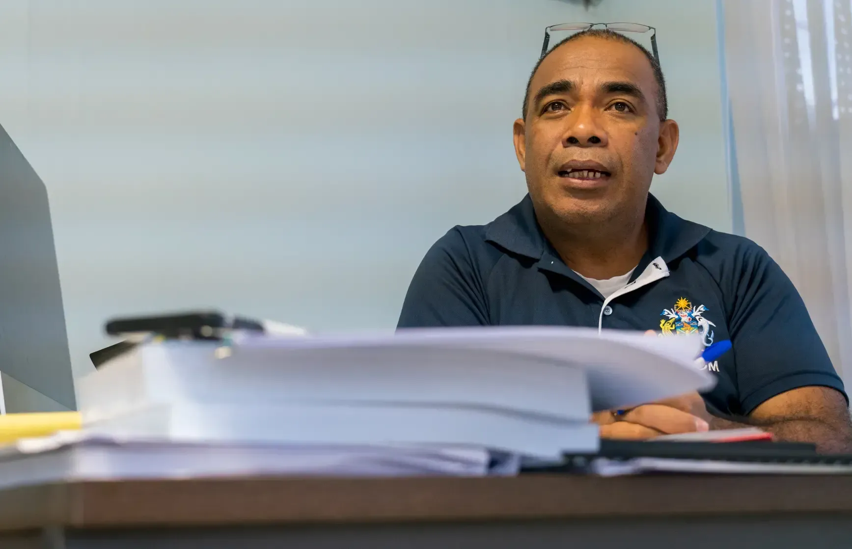
The issue of dumpsites is both on land and sea, according to Melchior Mataki, permanent secretary for the Solomon Islands Ministry of Environment, Climate Change, Disaster Management and Meteorology.
In 1987, 115 shells of mustard gas were discovered in the coastal lands and waters of the Russell Islands – where Mataki grew up – in the central region of the Solomon Islands.
U.S. forces disposed of the bombs in Johnson Atoll in the early 1990s, but there have since been reports about more mustard gas and other chemical weapons, such as white phosphorous.
The problem persists in the Solomons but still can be ignored or unknown to many residents, according to Mataki, including fishermen who recover unexploded ordnance and use the contents to make explosives that help for fishing, an illegal but common practice.
“It’s the unknowns that are really dangerous for us,” Mataki says. “So it’s important that we give attention to that.”
And considering the risk of oil spills is only fully known once fully assessed, the Solomon Islands is in need of open and frank conversation about what the Japanese and the Allied navies were carrying during the war.
But diplomatic conversations have been stilted and sporadic, Mataki says, as reports of oils slicking the country’s waters have so far been met with lethargy and uneasiness, on the part of Japan.
“I think this is where we would need both the American authorities as well as the Japanese authorities to be open with us,” he says.