Story
![]() February 5, 2014
February 5, 2014
Corridors to Survival: Charting a Path to Combat Climate Change in the Tropics
Country:

Project
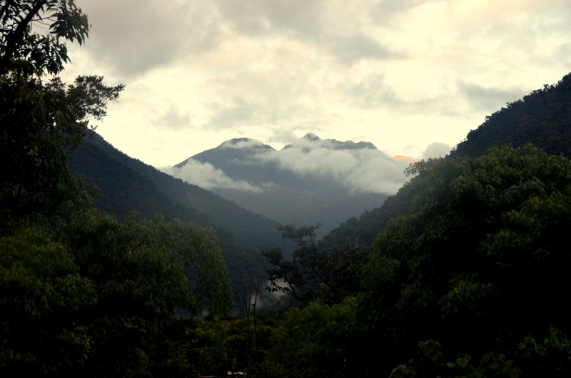
Peru: Race in the Rain Forest
In the most biologically diverse place on earth, rising temperatures are causing trees and plants to...

The concept of habitat corridors in conservation has been around for a while. It's a topic at global climate talks and an issue for NGOs eager to create pathways for survival between protected areas.
For all the talk, there hasn't been much research to help execute a plan. A team of scientists at Woods Hole Research Center in Falmouth, Mass., has stepped into this scientific vacuum in the tropics. Using newly available, high-resolution data sets of vegetation carbon stocks gleaned from satellite sensors, they mapped more than 16,000 corridors through areas of highest carbon-catching biomass between 5,600 protected areas in the tropics.
"To my knowledge, there hasn't been anything done on this scale before," Patrick Jantz, a postdoctoral fellow at Woods Hole told me in a recent interview. "It hasn't been done explicitly to integrate protected areas with surrounding ecosystems. That's because, until now, we haven't had the high-quality (satellite) data on carbon stocks."
The Woods Hole findings by Jantz and co-authors Scott Goetz and Nadine Laporte were published along with a series of maps from the Brazilian Amazon, Africa and Southeast Asia in the journal Nature Climate Change on Jan. 26.
"In the paper, we go beyond identifying areas of high carbon stocks and try to prioritize corridors in terms of biodiversity benefits and vulnerability to deforestation," Goetz, a Wood Holes senior scientist, told me. "That work we could only do in the Brazilian Amazon because that's where we have the data sets."
Jantz and Goetz were candid in acknowledging the relatively narrow focus of their research, and its limitations as well. But a fundamental goal, they said, was providing some tangible impetus for tropical countries to figure out how best to leverage the UN policy called REDD, or reducing emissions through deforestation and degradation. That's where measurable conservation efforts that impact climate change could become eligible to foreign investors – countries or corporations – seeking carbon offsets.
In an accompanying commentary in Nature Climate Change, Australian ecologist Oscar Venter applauded the Woods Hole research noting that it recommends "investing in corridors between protected areas that traverse locations (1) high in vegetation carbon stock, (2) rich in species, and (3) with a low value for other economic opportunities thus minimizing conflict with competing land uses."
Benefits of Remote-Sensing Data
I ran the Woods Hole findings by several tropical biologists I covered last summer in southern Peru, who are members of the Andes Biodiversity and Ecosystem Research Group. They specialize in how tropical forests are responding to climate change and the great need for public policy to promote effective conservation.
"The study helps demonstrate that we can potentially use the wealth of data being generated from remote sensing and land-use models to purposely and intelligently design protected areas to simultaneously maximize their value along multiple axes of conservation," wrote Ken Feeley, a tropical biologist Florida International University, in an email exchange.
Greg Goldsmith, a postdoctoral research associate at Oxford University in England, responded: "Historically, we've made decisions either based on conserving, for example, a jaguar habitat or preserving forests for their carbon. Now we have a method to try to do both of these things at the same time. Effective conservation is complex, and computers can help."
From my vantage point, here's the central significance of the Woods Hole research and why it merits a serious look, more data collection and ultimately, broader, more precise corridor-mapping strategies.
Migrate or Die
Roping off and conserving large swaths of tropical forests around the world is critical in the battle against global warming. These forests, with their lung-like virtues, absorb and store tons of greenhouse gas emissions annually. They also cycle massive amounts of water that generate clouds that produce worldwide weather patterns, which helps to regulate global temperatures.
But the reality of rising temperatures in our warmest climates is that tropical forests must move to survive, as I reported here last September. As Feeley, Goldsmith and their Andes research colleagues have established, tree and plant migration in species reproduction is vital to the survival of tropical forests (which is vital to the survival of the planet). These species exist in narrow temperature ranges; if they don't move, they face dieback or extinction from a climate that is rapidly becoming inhospitable where they stand.
As tropical forests migrate, of course, the enormous biodiversity they harbor – plants, birds, animals, and insects, or all the things that make a forest a forest – must be able to migrate as well. This is the appeal of habitat corridors. It recognizes that preserved areas fixed in place are bound to degrade if they can't move. The Woods Hole maps are trying to say: if you choose these particular paths, you get the double benefit of some species-migration potential along with vegetation-covered land that can assist in sequestering carbon emissions. Right this way, please.
"Corridors for climate mitigation and for species migration don't necessary go hand in hand," said Jantz of Woods Hole, "but they will align in many cases, especially where vegetation carbon stocks cross broad climatic gradients that connect lowland and highland habitats."
Barriers and Limitations
All this sounds good in theory, and it is a credible start to advancing the corridor-habitat discussion. But there are more than a few barriers and limitations.
Some Woods Hole-recommended corridors, for example, cross private lands that won't likely be made available for conservation, posing a challenge to the scale necessary to make an impact. Some corridors connect such dissimilar habits – a savanna habitat, for example, connecting to a forest through a swamp – that species migration is unlikely. And while connecting lowland and highland habits is crucial, as the research notes, there is a lack of protected highland areas in the tropics.
That said, it seems possible that the Woods Hole corridor maps could become quickly useful to NGOs such at the World Wildlife Fund and Amazon Conservation Association that are already working on corridor initiatives in the Amazon basin. Could the maps provide the basis that such NGOs need to hash out land-use policies with national governments working on climate-mitigation agreements? That's the hope. The Woods Hole findings will be presented at the next round global climate talks in Lima, Peru, in December.
"Given the available data, our initial focus is on integrated climate mitigation and preservation," Jantz said. "Longer term, species will have to move with temperatures and precipitation. We don't include those factors this time."
Goetz, at Woods Hole, added, "That's where we want to go with the next phase of the project. We want to integrate animal tracking data to see the needs of forest species. We know there are ways of integrating climate information and the effects of climate patterns. We hope to capture additional co-benefits in future research."